地理信息系统 专业外语试卷1
地理信息系统试题与答案
地理信息系统试题与答案一、单选题1. 地理信息系统(GIS)是指通过特定的技术手段和方法将地理空间数据与非空间数据相结合,进行地理信息的采集、存储、管理、分析、处理和展示的综合性信息系统。
GIS最主要的特点是()。
A. 数据形态来自实测或调查B. 多种数据形态的相互关联C. 具有地理定位与时空关联能力D. 具有分析与决策支持功能答案:C2. 在地理信息系统中,地图投影的作用是()。
A. 在平面上以真实比例显示地图B. 将地球表面的曲线投影到平面上C. 使地图在比例尺上能直接测量D. 改变地图样式和颜色答案:B3. GIS数据库中的地理实体指的是()。
A. 地球的自然地理要素B. 数据表中的某一列C. 数据库中存储的地理现象D. GIS软件的主要功能答案:C二、判断题根据以下描述,判断其正误并说明理由。
1. 使用地理信息系统可以对地理空间数据进行可视化分析,但无法实现多源数据的集成和共享。
答案:错误理由:地理信息系统具有多种数据形态的相互关联能力,可以将来自不同数据源的数据进行集成和共享。
2. 地理坐标系统的主要作用是为了保证地图图形的形状和大小的准确性。
答案:正确理由:地理坐标系统可以将地球上的点映射到平面上,保证地图的形状和大小的准确性。
三、简答题1. 请简要描述地理信息系统在城市规划中的应用。
答案:地理信息系统在城市规划中扮演着重要的角色。
它可以通过采集、存储和分析各种城市要素的空间数据,例如土地利用、建筑分布、交通网络等,从而帮助规划者更好地了解城市的现状和发展趋势。
基于地理信息系统的空间分析功能,规划者可以进行城市发展预测、环境评估、交通规划等工作,进一步优化城市规划方案,提高规划决策的科学性和可行性。
2. 请简述地理信息系统在资源管理中的应用。
答案:地理信息系统在资源管理中具有广泛的应用。
资源管理涉及到对各类地理空间资源的监测、评估、分析和优化利用。
地理信息系统可以通过采集和整合地理空间数据,如土地利用、水资源、矿产资源等,帮助资源管理部门实时监测资源状况,评估资源质量和开发潜力,进而制定合理的资源管理政策和措施。
地理信息系统试题和答案
地理信息系统试题和答案试题一1. 什么是地理信息系统(GIS)?2. 列举并解释GIS的主要组成部分。
3. GIS在哪些领域有应用?4. 请简要描述GIS在城市规划中的作用。
答案一1. 地理信息系统(GIS)是一种用于捕捉、存储、管理、分析和展示地理数据的计算机系统。
2. GIS的主要组成部分包括硬件、软件、数据和人员。
硬件包括计算机、显示器、打印机等设备;软件包括用于数据处理和分析的GIS软件;数据包括地理数据和属性数据;人员包括GIS专业人员和操作人员。
3. GIS在地理学、环境科学、城市规划、农业、地质学、交通等领域有广泛的应用。
4. 在城市规划中,GIS可以用于地理数据的收集和分析,辅助决策制定和规划设计。
它可以帮助规划人员分析城市区域的地理特征、人口分布、交通状况等,从而制定更科学合理的城市规划方案。
试题二1. 什么是地理坐标系统?2. 列举并解释常用的地理坐标系统。
3. 请简要描述经纬度坐标系统的原理和应用。
4. 什么是投影坐标系统?为什么在地图制作中需要使用投影坐标系统?答案二1. 地理坐标系统是一种用于确定地球上任意位置的坐标系统。
2. 常用的地理坐标系统包括经纬度坐标系统、UTM坐标系统、高斯-克吕格坐标系统等。
经纬度坐标系统以地球的赤道为基准,使用经度和纬度来确定位置;UTM坐标系统将地球划分为若干个区域,使用东北方向的偏移量来确定位置;高斯-克吕格坐标系统通过数学模型将地球表面投影到一个平面上,使用坐标值来确定位置。
3. 经纬度坐标系统的原理是以地球的赤道和子午线为基准,通过测量经度和纬度来确定地球上的任意位置。
它被广泛应用于航海、导航、地图制作等领域。
4. 投影坐标系统是将地球表面投影到一个平面上的数学模型。
在地图制作中,由于地球是一个球体,无法完全展示在平面上,所以需要使用投影坐标系统将地球表面投影到地图上。
这样可以更方便地进行地图测量、比例缩放和数据分析。
地理信息系统试题及答案【范本模板】
“地理信息系统原理”课程考试试题一参考答案一、名词解释1。
地理信息系统的定义是由两个部分组成的。
一方面,地理信息系统是一门学科,是描述、存储、分析和输出空间信息的理论和方法的一门新兴的交叉学科;另一方面,地理信息系统是一个技术系统,是以地理空间数据库为基础,采用地理模型分析方法,适时提供多种空间的和动态的地理信息,为地理研究和地理决策服务的计算机技术系统。
2.TIN 即不规则三角网(Triangulated Irregular Network),是一种表示数字高程模型的方法. TIN 模型根据区域有限个点集将区域划分为相连的三角面网络,区域中任意点落在三角面的顶点、边上或三角形内。
如果点不在顶点上,该点的高程值通常通过线性插值的方法得到.3.元数据是关于数据的描述性数据信息,它应尽可能多地反映数据集自身的特征规律,以便于用户对数据集的准确、高效与充分的开发与利用。
元数据的内容包括对数据集的描述、对数据质量的描述、对数据处理信息的说明、对数据转换方法的描述、对数据库的更新、集成等的说明。
4。
信息是向人们或机器提供关于现实世界新的事实的知识,是数据、消息中所包含的意义,它不随载体的物理设备形式的改变而改变。
二、简答题1。
地理信息系统的组成。
一个完整的 GIS 主要由四个部分构成,即计算机硬件系统、计算机软件系统、地理数据(或空间数据)和系统管理操作人员.其核心部分是计算机系统(软件和硬件),空间数据反映 GIS 的地理内容,而管理人员和用户则决定系统的工作方式和信息表示方式。
(1)计算机硬件系统:是计算机系统中的实际物理装置的总称,是 GIS 的物理外壳。
包括输入/输出设备、中央处理单元、存储器等,向提供信息、保存数据、返回信息给用户。
(2)计算机软件系统:计算机软件系统是指必需的各种程序.对于 GIS 应用而言,通常包括:计算机系统软件、地理信息系统软件和其他支持软件、应用分析程序。
(3)系统开发、管理和使用人员:完善的地理信息系统项目应包括负责系统设计和执行的项目经理、信息管理的技术人员、系统用户化的应用工程师以及最终运行系统的用户。
地理信息系统基础试卷4套

地理信息系统基础试卷4套地理信息系统基础试卷4套地理信息系统基础试卷1一、名词解释(每个5分,共20分)(英文名词要写出中英文全称)1 GIS GEOGRAPHICAL INFORMATION SYSTEM,一方面,地理信息系统是一门学科,是描述、存储、分析和输出空间信息的理论和方法的一门新兴的交叉学科;另一方面,地理信息系统是一个技术系统,是以地理空间数据库(Geospatial Database)为基础,采用地理模型分析方法,适时提供多种空间的和动态的地理信息,为地理研究和地理决策服务的计算机技术系统。
2 RS REMOTE SENSING,遥感是一种远离目标,利用传感器采集从目标反射或辐射的电磁波信息而判定、测量并分析目标性质的技术。
接收从目标中反射或辐射的电磁波的装置叫遥感器,搭载遥感器的移动体叫遥感平台。
3空间数据模型空间数据模型就是对空间客体进行描述和表达的数学手段,使之能反映客体的某些结构特性和行为功能。
4缓冲区答:缓冲区就是地理空间目标的一种影响范围或服务范围。
二、简答题(1、2必答,3、4选1道。
每题10分,共30分)1 GIS有哪些主要的功能(10)答:GIS是由计算机硬件、软件和不同的方法组成的系统,该系统设计支持空间数据的采集、管理、处理、分析、建模和显示,以便解决复杂的规划和管理问题。
(5分)GIS具有数据采集与编辑、数据存储与管理、数据处理与变换、空间分析与统计、产品制作与显示等功能。
(5分)2 ARCVIEW能实现哪些空间分析,并指出在哪个模块中可以实现(10)答:ARCVIEW能实现的空间分析有:距离量算,用"measure"即可实现临近、邻接,用"select by theme"模块实现。
(2分)缓冲区:地理要素的影响范围,用"create buffers"模块实现。
(2分)空间叠加:多要素相关分析,用"geoprocessing"模块实现。
地理信息系统考试试题
地理信息系统考试试题一、选择题1. 地理信息系统(GIS)是指______。
A. 一种地理学研究方法B. 一种计算机软件C. 一种用于收集、存储、处理、分析和抽象地理信息的系统D. 一种传统地图2. GIS技术最早起源于______。
A. 二战时期B. 冷战时期C. 工业革命时期D. 文艺复兴时期3. 下列地图投影中,不常用于大规模制图的是______。
A. 经纬网投影B. 米勒投影C. 正轴等角投影D. 兰勃托等积投影4. GIS数据模型包括______。
A. 点线面数据模型B. 网格数据模型C. 地理关系数据模型D. 以上都是5. 下列软件中,不属于专业的GIS软件是______。
A. ArcGISB. AutoCADC. QGISD. ERDAS二、填空题6. GIS中的底图通常采用______格式储存。
7. 矢量数据中的最小要素是______。
8. ______是用来代表地理空间要素的重要属性之间的关系的数据模型。
9. 颜色模式中,RGB代表______。
10. ______是GIS中的数据输入设备之一。
三、简答题11. 什么是地理信息系统?简述其发展历程。
12. GIS数据的分类及特点有哪些?13. 什么是地理数据模型?简述常见的地理数据模型。
14. 什么是地图投影?简要介绍常见的地图投影类型及其应用领域。
15. 请简述遥感影像在GIS中的应用。
四、计算题16. 若已知地图比例尺为1:50000,实地距离为2500米,求地图距离。
17. 设有一GIS数据集包括10个建筑物矢量要素,每个建筑物的属性数据包括建筑物类型、建筑面积和建筑年代等,求该数据集的记录数。
五、应用题18. 某市规划了一处公园,其周围分布有道路、湖泊和建筑物等要素。
请利用GIS软件绘制公园的周边环境地图,并进行空间分析,提出合理的规划建议。
以上为地理信息系统考试试题,请按要求完成答题。
地理信息系统试题及答案
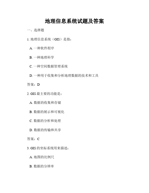
地理信息系统试题及答案一、选择题1. 地理信息系统(GIS)是指:A. 一种软件程序B. 一种地理科学C. 一种空间数据管理系统D. 一种用于收集和分析地理数据的技术和工具答案:D2. GIS最主要的功能是:A. 数据的收集和存储B. 数据的展示和可视化C. 数据的分析和处理D. 数据的传输和共享答案:C3. GIS的坐标系统用来描述:A. 地图的比例尺B. 数据的分辨率C. 地理位置的准确度D. 图层的渲染效果答案:C4. GIS中的矢量数据是通过什么方式进行存储的?A. 栅格B. 坐标系C. 地图投影D. 点、线、面答案:D5. 进行GIS分析时,下列哪种操作用来合并不同图层的属性数据?A. 叠置操作B. 缓冲操作C. 裁剪操作D. 清理操作答案:A二、填空题1. GIS中的栅格数据由若干个像素(pixel)组成,每个像素包含了__________。
答案:数值或分类信息2. 在地图投影中,保角投影主要用于解决__________问题。
答案:形状失真3. 高程数据主要用于表示地表的__________。
答案:海拔或地形4. 地理信息系统中的空间分析主要包括__________和__________两个方面。
答案:地理定位、地理测量5. GIS中的元数据用于描述数据的__________、__________和__________等属性信息。
答案:来源、格式、准确度三、简答题1. 请简要说明地理信息系统(GIS)在城市规划中的应用。
答案:GIS在城市规划中的应用非常广泛。
它可以用于收集和管理城市的各类空间数据,如土地利用、交通网络、人口分布等。
通过数据的可视化和分析处理,可以帮助规划者更全面、准确地了解城市的发展现状和趋势。
同时,GIS还可以进行多种分析,如可达性分析、环境评价等,为规划决策提供科学依据。
2. 请简要说明GIS在环境保护中的应用。
答案:GIS在环境保护中发挥着重要作用。
它可以用于监测和评估环境污染,通过数据的收集和分析,及时发现和预测环境问题的发生。
地理信息系统专业英语

1.Where does the word Geomatics come from? GEODESY+GEOINFORMATICS =GEOMATICS or GEO –for earth and –MATICS for mathematical or GEO- for Geoscience and –MATICS for informatics. It has been said that geomatics is many things to many people . The term geomatics emerged first in Canada and as an academic discipline; it has been introduced worldwide in a number of institutes of higher education during the past few years, mostly by renaming what was previously called “geodesy” or “surveying”, and by-adding a number of computer science- and/ or GIS-oriented courses.地质这个词在哪里地质从何而来?大地测量+教育或地理=地球,地球和-双语对照查看数学或地理-双语对照查看地质灾害与信息学。
有人说地球对于许多人来说意味许多东西。
地球这个词作为学术纪律第一次出现在加拿大; 在过去几年中,现已引进大量的在全球高等教育学院,大多数是被重命名以前被称为“大地测量”或“测量”,双语对照查看,许多计算机科学,和/或GIS-导向课程。
2.Data acquisition techniques include field surveying, global positioningsystem (GPS), satellite positioning, and remotely sensed imagery obtained through aerial photography and satellite imagery. It also includes the acquisition of database material scanned from older maps and plans and data collected by related agencies.数据采集技术包括野外调查、全球定位系统(GPS)、卫星定位、遥感图像得到,通过空中摄影和卫星图像。
地理信息系统 专业外语试卷1
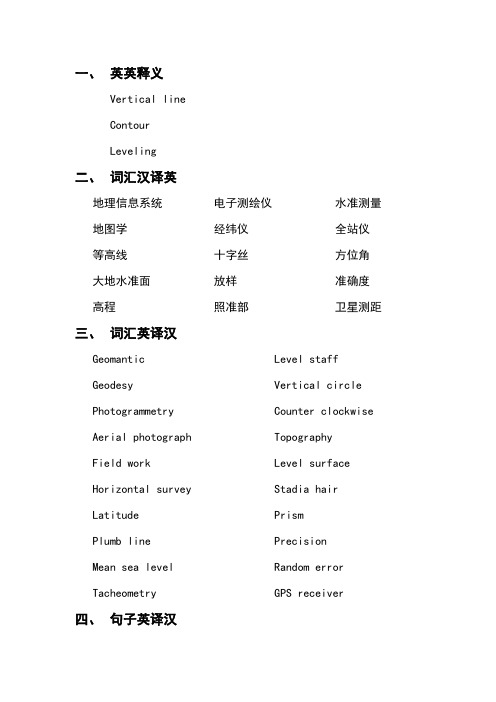
一、英英释义Vertical lineContourLeveling二、词汇汉译英地理信息系统地图学等高线大地水准面高程电子测绘仪经纬仪十字丝放样照准部水准测量全站仪方位角准确度卫星测距三、词汇英译汉Geomantic Geodesy Photogrammetry Aerial photograph Field work Horizontal survey LatitudePlumb lineMean sea level Tacheometry Level staff Vertical circle Counter clockwise TopographyLevel surface Stadia hairPrismPrecision Random errorGPS receiver四、句子英译汉1.It is processed and manipulated with state-of-the-artinformation technology using computer software and hardware.2.It has applications in all disciplines which depend onspatial data.3.Once the positions and attributes of geographic entities(实体) have been digitized and stored in computer memory, they are available for use by a wide variety of users.nd surveys are the oldest type of survey and have beenperformed since earliest recoded history.5.Construction surveys are made for purposes of locatingstructures and providing required elevation points during their construction.6.To judge the exact horizontal line, we should move tapeup and down along the plump line and we will find the changes of reading in the tape.7.If the distance is longer than the length of tape, thenwe can divide the distance into several segments and get the total distance by plus each segment together.8.Since different tapes have different starts of zero ofthe tapes, it is important to judge where the zero of thetape begins.9.Vertical Line is a line that follows the direction ofgravity as indicated by a plumb line.10. A spirit level is used to fix the line of sight of thetelescope.11.Random Errors are introduced into each measurementmainly because of human and instrument imperfections aswell as uncertainties in determining the effects of the environment on measurements.12.If a quantity is measured several times and the valuesobtained are very close to each other,the precision is said to be high.13.The GPS receiver on the ground is the unknown point,and must compute its position based on the informationit receives from the satellites.14.When the two spheres intersect,a circle is formed,so it must be somewhere on that circle.15.In addition,both the L1 and L2 GPS signals would bemade available to civil users and a new civil signalwould be authorized.五、段落英译汉1.The science and technology of acquiring, storing,processing, managing, analyzing and presenting geographically referred information (geo-spatial data).This broad term applies both to science and technology, and integrates the following more specific disciplines and technologies including surveying and mapping, geodesy, satellite positioning, photogrammetry, remote sensing, geographic information system(GIS), land management, computer systems, environmental visualization and computer graphics.2.A horizontal angle is the angle formed in a horizontalplane by two intersecting vertical planes, or a horizontal angle between two lines is the angle between the projections of the lines onto a horizontal plane. For example, observations to different elevation points B and C from A will give the horizontal angle ÐBAC which is the angle between the projections of two lines (AB and AC) onto the horizontal plane. It follows that, although the points observed are at different elevations, it is always the horizontal angle and not the space angle that is measured. The horizontal angle is used primarily to obtain relative direction to a survey control point, or to topographic detail points, or to points to be set out.3.The first step in measuring the distance between the GPSreceiver and a satellite requires measuring the time it takes for the signal to travel from the satellite to the receiver. Once the receiver knows how much time haselapsed, the travel time of the signal multiplies thespeed of light (because the satellite signals travel at the speed of light, approximately 186,000 miles persecond) to compute the distance. Distance measurements to four satellites are require to compute a 3-dimensional (latitude, longitude and altitude) position.六、扩展试题Explain the process about this question that how does the GPS receiver located itself with four satellite.答案一、1.A line that follows the direction of gravity as indicatedby a plumb line;2.An imaginary line on the ground with all points at thesame elevation above or below a specified referencesurface;3.The process of finding elevations of points or theirdifference in elevation.二、Geographic information system;Cartography;Contour;Geoid;Elevation;Electronic distance measurement instrument; Theodolite/transit;Cross-hair/reticle; Set out/lay off; Upper plate; Leveling;Total station; Azimuth; Accuracy;Satellite ranging.三、测绘学,地理信息学;大地测量学;摄影测量;航片;外业;平面测量;纬度;铅垂线;平均海水面;视距测量法;水准尺;垂直度盘;逆时针;地形,地势;水准面;视距丝;棱镜;精度;随机误差;GPS接收机。
- 1、下载文档前请自行甄别文档内容的完整性,平台不提供额外的编辑、内容补充、找答案等附加服务。
- 2、"仅部分预览"的文档,不可在线预览部分如存在完整性等问题,可反馈申请退款(可完整预览的文档不适用该条件!)。
- 3、如文档侵犯您的权益,请联系客服反馈,我们会尽快为您处理(人工客服工作时间:9:00-18:30)。
一、英英释义∙Vertical line∙Contour∙Leveling 二、词汇汉译英地理信息系统地图学等高线大地水准面高程电子测绘仪经纬仪十字丝放样照准部水准测量全站仪方位角准确度卫星测距三、词汇英译汉Geomantic Geodesy Photogrammetry Aerial photograph Field work Horizontal survey LatitudePlumb line Mean sea level Tacheometry Level staff Vertical circle Counter clockwise Topography Level surface Stadia hair Prism Precision Random error GPS receiver四、句子英译汉1.It is processed and manipulated with state-of-the-art informationtechnology using computer software and hardware.2.It has applications in all disciplines which depend on spatial data.3.Once the positions and attributes of geographic entities(实体)have been digitized and stored in computer memory, they are available for use by a wide variety of users.nd surveys are the oldest type of survey and have beenperformed since earliest recoded history.5.Construction surveys are made for purposes of locating structuresand providing required elevation points during their construction.6.To judge the exact horizontal line, we should move tape up anddown along the plump line and we will find the changes of reading in the tape.7.If the distance is longer than the length of tape, then we can dividethe distance into several segments and get the total distance by plus each segment together.8.Since different tapes have different starts of zero of the tapes, it isimportant to judge where the zero of the tape begins.9.Vertical Line is a line that follows the direction of gravity asindicated by a plumb line.10.A spirit level is used to fix the line of sight of the telescope.11.Random Errors are introduced into each measurement mainlybecause of human and instrument imperfections as well asuncertainties in determining the effects of the environment onmeasurements.12.If a quantity is measured several times and the values obtained arevery close to each other,the precision is said to be high.13.The GPS receiver on the ground is the unknown point,and mustcompute its position based on the information it receives from thesatellites.14.When the two spheres intersect,a circle is formed,so it must besomewhere on that circle.15.In addition,both the L1 and L2 GPS signals would be madeavailable to civil users and a new civil 10.23MHZ signal would beauthorized.五、段落英译汉1.The science and technology of acquiring, storing, processing,managing, analyzing and presenting geographically referredinformation (geo-spatial data). This broad term applies both toscience and technology, and integrates the following more specificdisciplines and technologies including surveying and mapping,geodesy, satellite positioning, photogrammetry, remote sensing,geographic information system(GIS), land management, computersystems, environmental visualization and computer graphics.2. A horizontal angle is the angle formed in a horizontal plane by twointersecting vertical planes, or a horizontal angle between twolines is the angle between the projections of the lines onto ahorizontal plane. For example, observations to different elevationpoints B and C from A will give the horizontal angle ÐBAC which isthe angle between the projections of two lines (AB and AC) ontothe horizontal plane. It follows that, although the points observedare at different elevations, it is always the horizontal angle and notthe space angle that is measured. The horizontal angle is usedprimarily to obtain relative direction to a survey control point, orto topographic detail points, or to points to be set out.3.The first step in measuring the distance between the GPS receiverand a satellite requires measuring the time it takes for the signalto travel from the satellite to the receiver. Once the receiver knowshow much time has elapsed, the travel time of the signal multipliesthe speed of light (because the satellite signals travel at the speedof light, approximately 186,000 miles per second) to compute thedistance. Distance measurements to four satellites are require tocompute a 3-dimensional (latitude, longitude and altitude)position.六、扩展试题Explain the process about this question that how does the GPSreceiver located itself with four satellite.答案一、1. A line that follows the direction of gravity as indicated by a plumbline;2.An imaginary line on the ground with all points at the sameelevation above or below a specified reference surface;3.The process of finding elevations of points or their difference inelevation.二、Geographic information system; Cartography;Contour;Geoid;Elevation;Electronic distance measurement instrument;Theodolite/transit;Cross-hair/reticle; Set out/lay off; Upper plate; Leveling;Total station; Azimuth; Accuracy; Satellite ranging.三、测绘学,地理信息学;大地测量学;摄影测量;航片;外业;平面测量;纬度;铅垂线;平均海水面;视距测量法;水准尺;垂直度盘;逆时针;地形,地势;水准面;视距丝;棱镜;精度;随机误差;GPS接收机。
