GPS Note
手机的note是什么意思

手机的note是什么意思手机已经成为我们日常生活中不可或缺的工具之一。
它不仅仅是一种能够用来打电话和发送短信的设备,同时还拥有其他多种功能,例如相机、游戏、社交媒体等。
而在手机的功能中,note(备忘)是一项非常重要的功能之一。
在本文中,我们将探讨手机的note的意思以及它为我们的生活带来的好处。
手机上的note是指我们可以利用手机软件或者应用来创建和管理备忘录的功能。
它允许我们在手机上记录和保存日常生活中的重要事项、想法、提醒事项等。
与传统的纸质笔记相比,手机的note提供了更加便捷和灵活的方式来记录、查看和编辑我们的备忘内容。
手机note的优点之一是方便性。
我们不再需要携带纸和笔来记录重要的事项,只需打开手机上的note应用程序即可随时随地进行备忘。
而且,我们还可以根据需要在备忘录中添加文字、图片、语音或者视频等多种形式的内容,以更加直观和详细的方式记录信息。
其次,手机note的另一个好处是灵活性。
通过手机的note功能,我们可以轻松地对备忘录进行编辑、删除、移动或者重新排列。
这意味着我们可以根据需要将备忘内容进行组织和分类,以便更好地管理和查找。
此外,一些note应用程序还提供了便捷的搜索功能,让我们可以快速找到特定的备忘录或相关信息。
手机note还可以帮助我们提高工作效率和时间管理能力。
我们可以使用note来记录会议的要点、工作任务的详细说明或者待办事项的清单。
这样,我们不会忘记重要的工作事项,也可以更好地组织和安排自己的时间。
而且,一些note应用程序还支持设置提醒功能,可以在预定时间提醒我们完成某项任务或者参加某项活动。
此外,手机note还可以作为创意和灵感的来源。
我们可以随时利用手机note记录下突如其来的灵感、创意或者想法。
这样,即使在没有纸和笔的情况下,我们也能够迅速捕捉住这些灵感,并在之后进行进一步的思考和处理。
总的来说,手机的note是指手机上的备忘录功能,它提供了一种方便、灵活和高效的方式来管理和查看我们的备忘内容。
AuCon GPS-Repeater AS47 48说明书

GPS-Repeater AS47 CSManual3.7English LanguageManual for AuCon GPS-Repeater AS47/486.Release/10.10/3.6All rights reserved.©passing on and copying only with acclaim from AuCon. AuCon/Inh.W.FinkGleissachweg9D-85774Unterföhring bei MünchenPrinted in Germany.Index1.General2.Safety3.Installation3.1.Installation in a building1.Installation of outdoor antennaying of cables3.Installation of sending antenna4.Delivery contents5.Architecture6.Datasheet AS477.Datasheet AS488.Glossary and imprint1.General:AS-47/48is a L1-Signal GPS-Repeater with two antennas for real-time GPS-datareceiving in buildings.The system consists of a High-Gain GPS-antenna for outdoor,a precisely amplifier with a helix-typ GPS-sending antenna and an integrated electronic power regulator.This enables all kinds of L1-band GPS-systems to receive an goodsignal indoor.The repeated signal could be used for system test,initialisation,and product demonstartion.The input signal power at the receiving antenna is approximately 130dBm (spreading over 2MHz),so the desired signal is below the thermal noise floor.Please read this manual before installing and working with the system.For any questions please contact the technical support from aucon by Email:*************2.SafetyThis product is conform to the EU-standarts.Please note the advices below before working.Symbols used in the description:∙ This system should only be used by the configuration from the manufacturer.∙ Before turning on the system please always check the voltage.∙ Due to current regulatory considerations,GPS repeater kits are available for work inshielded environment.Please ask your federal offices if you have any questions about regulations about in your country.∙ Please not that electrostatic discharge could damage your system,so only workunder ED-proved conditions.∙ Please also install the system in a dryenvironment.Please refer to the manual!This note is veryimportant!Please note.3.Installation3.1Installation in a buildingThe GPS-Repeater AS47/48consits of a receiving gps antenna which has to be located outdoors on the roof of a building,a special HF-cable with configured length and a sending gps antenna for distributing the signal indoor.The amplifier is integrated in the antenna and works with230V AC,or7,5to9Volts,depending on your countrys power supply.Scheme for GPS-Repeatersystems AS47/AS48:3.1.1Installation of outdoor antennaBefore installing the gps outdoor antenna please check the quality of gps signal on different days,so that you could be sure to receive a good signal on this location.You should only use an location with bright view to the sky.Please note that the outdoor antenna should not be installed in sight to thesending antenna because of interferences.This interferences could shutdown the hole system.The GPS outdoor antenna(white)should be mounted on a flatsurface on the top of a roof,or if mounting on a roof is notpossible,it could be mounted on a facade(holder availableoptional).Pull the cable through the holder of antenna,before mounting.Then bolt the connector of cable together to the antenna.Mount the antenna on the metal stand.Mount the metal stand on a flat surface.3.1.2Laying of cablesIf you install the cable,please note that there should be no strain on the cable.The cables should be mounted in a cable channel or with clamps.Ensure also that the cables have a bending radius which is big enough.A big,heavy cable with a big diameter (like f.e.AIRCOM Plus or ECOFLEX10/15)should not give a compressive load to other parts of the system like splitter(see below).So tighen the cables on the connectors to the splitters that the compressive load is minimized.Use the right cables depending on the scheme of your spezial configuredgps repeater system,do not exchange the specific cables.Ensure that theholes for the cables are big enough because the connetcors are mostlybigger than the cables.Example:Connecting an Aircom Plus cable to an GPS splitterby TNC-connector.Tighen the connectors only by hand,do not use a spanner.If you install the system on a building which has no lightening protection yet,we also offer a lightening protection to be installed into the cable by connectors.Please use UV-protection for the part of cable which is mounted directly outside the building with a free view to the sky,to protect the cover from aging.Bending radius of HF-cables in comparison:Nr Typ of cable Diameter in mm B-Radius1RG58/U5,0025mm2Aircell55,0025mm3Aircell77,3025mm4Ecoflex1010,2040mm5Ecoflex10H10,2040mm6Aircom Plus10,3055mm7Ecoflex15H15,0055mm8H-1555,5035mm9RG214-XL10,8050mm10CFD2004,9525mm11CFD2406,1030mm12CFD40010,3050mm3.1.3Installation of sending antenna:Locate and mount the repeater antenna with it s cylinder facing against the celing or against the testing bench.Note that the signal could be attenuated easily because of the high frequency.Only your hand in front of the repeater can attenuate the gps signal clearly.You can use a small conduit for mounting the repater on a balk(see picture)or you can also use metal bracket holder.Example in a hangar:Installation site:Please see the important notes on the additional flyer which is added to every gps repeater set.Radiating characteristics:Vertical(in sending direction)Horizontal(vertical to sending direction)bei80°bei40°bei0°Note for mounting indoor:Do not mount the sending antenna(repeater)behind a heating system or something like that.Do not mount the antennas in a direct circle to WLAN or GSM-Repeaters.Connection to the power supply:Use the power supply for 230V AC which is standart in european countries.If you need to adapt the system to your countries power supply only use 7,5to 9V DC to power up the sending e an ON/OFF Switch to power up the system and shut-off the system if you do not need it.Please note that the repeater antenna is only for indoor mounting.Activation and general conditions:Please ask your federal offices if you have any questions about regulations about gps repeaters in your country.For prejudice only the customer is liable for.The GPS-Repeatersystem needs several minutes to send with full transmitting power.If not enough transmitting power is reached after severeal minutes please check the installation of the outdoor antenna if there is free sight to the sky.Also check the indoor antenna of the right adjustment to the gps testing bench in the room.Also check the connetcors of the cable.The sending antenna should not be mounted in sight to the outdoorantenna.4.Delivery Content of AS47/481x GPS-outdoor antenna white(IP66)1x metal stand for antenna1x GPS-Repeater AS-47or AS-481x40m cable Typ RG58with connector TNC and SMA(depending on your requirement)1x Power supply230V for gps repeater1x ManualSome Optional acessoires:GPS-splitter1in2/1in4/1in8GPS-Attenuator/GPS-AmplifierRack-Mount Splitter1in18/36GPS-Antennas for L1/L2/L5/GLONASS5.Scheme of the GPS-RepeatersystemSignal Level Structure of GPS-Repeater AS-47Minimal Signal power for a modern GPS-Receivers(like SIRF 3)is about –155dBm.Please note that the cable length and cable kind on the respective system is tuned on.Therefore it may not be extended or shortened.If you need a bigger cable length between outdoor antenna and indoor antenna you should contact us.Then we could offer to you our special HF cables with especially low damping values,e.g.,after MIL specification,stiffly or highly adaptably or for special outdoor suitability.Then with it bigger lengths can be also bridged without loss in signal strength or signal quality.S i g n a l L e v e l i n (d B m )ReRadiating range (m)GPS Nominal Level (outdoor)1250Repeater Signal Level1506.Technical Specification of the AS47RR-GPS-SystemSpecificationExternal Antenna Electrical Specifications,TA=25o C(Cable=40m)Description Parameter Min Typ Max Units Frequency L1band 1.575GHz Bandwidth50MHz Amp Gain28dB Noise Figure 1.3dB Output SWR 2.0:1ratio DC Input 4.5 5.5Vdc Reradiating Antenna System Electrical Specification,TA=25o CDescription Parameter Min Typ Max Units Frequency L1band 1.575GHz Bandwidth20MHz Impedance50ohm Gain30dB Noise Figure 2.0dB Output SWR 1.6:1ratio Element Helix typePolarization RHCPRF Out at1dB gaincompression-2.0dBmDC Input+6+30Vdc Consumption55mA ReRadiating Range:10-12mHousing of the outdoor antenna is Polycarbonat waterresistent by IP66.Operating temperature:-30°bis85°COperating humidity:95%7.Technical Specification of the AS48RR-GPS-SystemSpecificationsExternal Antenna Electrical Specifications,TA=25o C(Cable=40m)Description Parameter Min Typ Max Units Frequency L1band 1.575GHz Bandwidth50MHz Gain27dB Noise Figure 1.3dB Output SWR 2.0:1ratio Connectortyp TNCDC Input 4.5 5.5Vdc Dimensions Dia.:113x74mm Weight237gRe-Radiating Antenna System Electrical Specification,TA=25o CDescription Parameter Min Typ Max Units Frequency L1band 1.575GHz Bandwidth20MHz Impedance50ohm Gain--dB Noise Figure 2.0dB Output SWR 1.6:1ratio Element Helix typePolarization RHCPRF Out at1dB gaincompression-2.0dBmConnectortyp SMADC Input+6+30Vdc Consumption55@7,5V mA Dimensions37(L)x35(W)x71(H)mm Weight48gReRadiating Range:30mHousing of the outdoor antenna is Polycarbonat waterresistent by IP66.Operating temperature:-30°bis85°COperating humidity:95%8.Glossary and ImprintGPS-Repeater a reradiating system which receives gps signal outdoor,amplifies and sends the signal to a testing bench indoorInterferenz In physics,interference is the addition(superposition)of two ormore waves that result in a new wave pattern.ShortcutsGLONASS russian satellite navigation system,GLO balnaya NA vigationayaS putnikova S istema in short GLONASSIGS I nternational G PS-S ervice– ConformityThis product was tested by AuCon and meets the requirements of the R&TTE Directive 1999/5/EWG:07KFE007949-A-01.The hole text you can get from aucon.Identification:Limitation of guaranteeFor accuracy of this manual AuCon could not guarantee.For any mistakes or comments please contact us.ImprintThe information contained in this manual and data can be changed without previous announcement.Without explicit written permission of the AuCon no part of these documents may be multiplicated for some purposes or be transferred no matter,in which manner or with which means,electronically or mechanically this happens. TrademarkAuCon®is a trademark of AuCon Automotive Consulting.。
NEO-6M-GPS模块说明手册

UBLOX-6M-GPS模块说明手册UBLOX-6M-GPS模块说明手册 (1)一.模块介绍 (2)二、模块参数 (2)1.电压 (2)2.温度 (2)3.引脚说明以及电气连接 (2)4.波特率 (3)5.特性参数 (3)三、模块尺寸 (4)四、模块调试和GPS数据解析 (5)一.模块介绍BLOX6M GPS模块,具有高灵敏度、低功耗、小型化、其极高追踪灵敏度大大扩大了其定位的覆盖面,在普通GPS接收模块不能定位的地方,如狭窄都市天空下、密集的丛林环境,UBLOX6M都能高精度定位。
模块的高灵敏度、小静态漂移、低功耗及轻巧的体积,非常适用于车载、手持设备如PDA,车辆监控、手机、摄像机及其他移动定位系统的应用,是GPS产品应用的最佳选择。
二、模块参数1.电压输入电压: 3.3-5.5V功耗正常模式:50mA省电模式:30mA2.温度工作温度-40°Cto+85°C存储温度-55°Cto+100°C3.引脚说明以及电气连接模块引脚1VCC电源脚输入3.3-5.5V2GND电源地3RXD模块串口接收脚--接单片机串口TXD发送4TXD模块串口发送脚--接单片机串口RXD接收5PPS时钟脉冲输出脚模块PPS脚接了红色LED灯常亮:正常工作,但未定位闪烁:定位成功4.波特率模块默认的波特率是96005.特性参数模块自带陶瓷天线,另外有IPEX接口可以连接其他有源天线模块增加了射频放大电路,有利于加快搜星模块自带可充电后备电池,可以掉电保持星历数据模块兼容3.3V/5V电平,方便连接各种单片机系统三、模块尺寸长宽:37.4x26.2四、模块调试和GPS数据解析1.首先用一条microusb线将模块和电脑连接,然后找到资料里面的usb驱动文件,安装完毕后在设备管理器会看到如下图所示,出现一个虚拟串口2.打开资料里面的多功能调试助手,选择gps定位3.定位必须在室外空旷地进行,否则无法定位成功,陶瓷天线面向天空。
三星M8800实现GPS定位导航教程

【大硕原创】谁说小八不能定位导航?三星M8800实现GPS定位导航教程【大硕原创】三星M8800实现GPS定位导航教程(追加edenpang大侠撰写的一些使用经验)入手三星m8800之初并没有太在意小八是否有GPS定位导航的功能,被他吸引完全是高质量的摄影功能和不算太高的价格(当然不是指行货)。
然而,当把小八其他功能都挖掘的差不多的时候,网上关于小八是否有GPS模块以及是否能定位导航之争不由不让人心里痒痒,不管怎么说有GPS总是件令人愉悦的事情。
M8800原机自带了一个像垃圾一样的Google地图,其并非GPS导航,而是通过测算手机周边信号发射基站的位置来推断手机大致处于什么位置,这种定位非常不准确,而且由于每次都要在线下载地图,使得流量大增,因此Google地图可谓鸡肋中的鸡肋。
那么,M8800是否真的只能实用这种垃圾地图呢?关键在于小八有没有真正意义上的GPS模块。
事实证明,小八是有GPS模块的,这个证明的过程繁杂,在此不叙。
那么接下来就是如何通过软件实现小八的导航功能。
市面上流行的手机导航软件基本上只支持智能手机,对小八这个非智能手机来说丝毫没有可能用的上。
然而,上帝是眷顾众生滴,于是“乐图”出现了。
乐图的定位是利用软件提供地图读取,然后通过手机蓝牙与外置GPS模块连接,使得原本不具备GPS功能的手机享受这一功能。
不过由于乐图支持java,使得M8800也分享了能够使用GPS定位导航的快感。
这里有必要插叙一段,由于三星手机系统封闭,在最初的时候M8800使用乐图软件时不能读取记忆卡里的离线地图包,使得实用性大打折扣。
乐图论坛的管理员alvin注意到这一情况,经过反复测试、修改终于使m8800能够完美运行乐图导航软件并顺利读取记忆卡里的离线地图,直接为大家省了很多流量钱啊,在此谢谢alvin和乐图团队!我会一直支持乐图的!好,继续正题,首先下载m8800专用版的乐图软件(附件里有),装入手机(小八如何安装软件不在此文叙述之列,如有疑问请上网上自搜)。
GPS_NMEA-0813协议详解

GPS NMEA-0183协议详解NMEA协议是为了在不同的GPS(全球定位系统)导航设备中建立统一的BTCM(海事无线电技术委员会)标准,由美国国家海洋电子协会(NMEA-The National Marine Electronics Associa-tion)制定的一套通讯协议。
GPS接收机根据NMEA-0183协议的标准规范,将位置、速度等信息通过串口传送到PC机、PDA等设备。
NMEA-0183协议是GPS接收机应当遵守的标准协议,也是目前GPS接收机上使用最广泛的协议,大多数常见的GPS接收机、GPS数据处理软件、导航软件都遵守或者至少兼容这个协议。
NMEA-0183协议定义的语句非常多,但是常用的或者说兼容性最广的语句只有$GPGGA、$GPGSA、$GPGSV、$GPRMC、$GPVTG、$GPGLL、$GPZDA等。
下面给出这些常用NMEA-0183语句的字段定义。
协议帧总说明:该协议采用ASCII码,其串行通信默认参数为:波特率=4800bps,数据位=8bit,开始位=1bit,停止位=1bit,无奇偶校验。
帧格式形如:$aaccc,ddd,ddd,…,ddd*hh<CR><LF>1、“$”——帧命令起始位2、aaccc——地址域,前两位为识别符,后三位为语句名3、ddd…ddd——数据4、“*”——校验和前缀5、hh——校验和(check sum),$与*之间所有字符ASCII码的校验和(各字节做异或运算,得到校验和后,再转换16进制格式的ASCII字符。
)6、<CR><LF>——CR(Carriage Return)+ LF(Line Feed)帧结束,回车和换行GPGGAGPS固定数据输出语句,这是一帧GPS定位的主要数据,也是使用最广的数据。
$GPGGA,<1>,<2>,<3>,<4>,<5>,<6>,<7>,<8>,<9>,<10>,<11>,<12>,<13>,<14>*<15><CR><LF><1> UTC时间,格式为hhmmss.sss。
手机型号的note是什么意思有什么特别的含义

⼿机型号的note是什么意思有什么特别的含义
现在⼿机的型号可以说是五花⼋门,什么max,什么pro,什么note。
最常见的还是note,红⽶note,三星note等等,很多⼿机都喜欢⽤note代表型号,那么⼿机型号上带的note到底是什么意思呢?note是什么意思呢?有什么特别的含义吗?我们现在就⼀起来了解⼀下吧。
note是什么意思
note本⾝就是笔记本的意思,所以三星的note是带有笔记本功能的⼿机,就是所有的note⼿机都有⼀⽀笔,打开⾃带的s note(就是备忘录)可以⽤笔记录、修改等,就像随⾝带的笔记本⼀样⽅便。
⼀般来说,⼿机型号命名为note就是这个意思了呢。
哈哈,不知道⼩编今天带来的这个解释,有没有帮助你解决⼼中的疑问呢?希望对⼤家有帮助。
CUAV NEO 3 GNSS导航模块使用手册说明书

感谢您选择CUAV NEO 3 GNSS导航模块。
请在使用前仔细阅读本手册,在手册指导下进行操作,不规范的操作可能会导致无法挽回的后果。
*本说明书为印刷品,不保证时效,可能会由于固件或产品更新而进行修改,修改内容不再另行公告,更多内容请访问CUAV文档中心,产品功能GPS定位功能,提供准确的地理定位信息。
电子罗盘功能,提供准确的航向和姿态信息。
状态显示功能,提供环形RGB状态灯显示功能。
警报提醒功能,提供硬件状态的声音提示功能。
安全保护功能,提供物理按键解锁保护功能。
连接方法卫星接收器 RGB状态灯 电子罗盘 蜂鸣器安全开关卫星系统增强系统并发器数量工作频段水平精度速度精度NEO M9NNCP5623CIST8310无源蜂鸣器物理按键北斗、伽利略、格洛纳斯、GPS SBAS:WAAS,EGNOS,MSAS QZSS:L1s(SAIF)其它:RTCM3.34GPS:L1C/A格洛纳斯:L10F北斗:B1I伽利略:E1B/C2.0M(高至0.7m)0.05m/s类别参数更新速率捕获速度最大卫星数量灵敏度接口协议接口类型支持的飞控类型滤波防电磁/射频干扰固件类型固件升级25Hz(Max)冷启动 24S再次捕获: 2S辅助启动: 2s32颗+追踪&导航-167dBm冷启动-148dBm热启动-148dBm重新捕获-160dBm UART+I2C+IOGHR-10V-SCUAV系列飞控 . Pixhawk系列(蜂鸣器不工作)SAW+LAN+SAWEMI+RFI Ardupilot/PX4可对GNSS进行固件升级NEO3主机 X1 NEO3支架 X1配件清单产品认证产品已通过CE安全认证产品已通过FCC认证雷迅创新已通过ISO 9001质量管理体系认证输入电压温度尺寸重量5V-10-70℃60*60*16MM 33g注意事项-请仔细阅读产品的使用说明书;-请正确安装支架位置;-请不要暴力损坏产品;相关资料产品使用教程,请访问官方文档中心:Thank you for choosing the CUAV NEO 3 GNSS navigation module. Please read this manual carefully before use and operate under the guidance of the manual. Irregular operation may lead to irreparable consequences.This manual is printed and does not guarantee the validity period. It may be modified due to firmware or product updates. The modification content will not be announced separately. For more information, please visit CUAV documentation center:Provides geographic positioning information.Provides accurate heading and attitude information.Ring RGB status light display Voice prompt for hardware statusProvides physical key unlock protection.Features Head orientationGPS status lightConnection methodGNSS receiver RGB driver Compass Buzzer Safety switch GNSS GNSS Augmentation SystemNumber of concurrent GNSS Frequency bandHorizontal accuracy NEO M9NNCP5623CIST8310 Passive buzzer Physical button Beidou、Galileo、 GLONASS、 GPS SBAS:WAAS,EGNOS,MSAS QZSS:L1s(SAIF) Other:RTCM3.34GPS:L1C/A GLONASS:L10F Beidou:B1I Galileo:E1B/C2.0MSpecificationsSpeed accuracy Nav. update rate AcquisitionNumber of satellites(MAX) SensitivityProtocolPort Type Supported flight controllerUpgrade firmware Wave filteringAnti-Electromagnetic/radio frequency interference 0.05m/s25Hz(Max)Cold start:24SHot start:2SAided start:2s32+Tracking and nav-167dBmCold start Hot star-148dBm Reacquisition -160dBmUART+IO+I2CGHR-10V-SCUAV series, Pixahwk series (the buzzer does not work)SupportSAW+LAN+SAWEMI+RFINEO 3 module X1NEO 3 stand X1Packing List Product certificationFirmware type Operating VoltageOperating temperature Size Weight Ardupilot/PX45V -10-70℃60*60*16MM33g Product has passed CE safety certification Product has passed FCC certificationCUAV has passed ISO 9001 quality management system certificationNotes-Please read the manual before use;-Please install the bracket position correctly;-Please do not damage the product violently; Related informationVisit the official documentation center for more turorial: 。
MT600 4G GPS车辆追踪器用户手册说明书
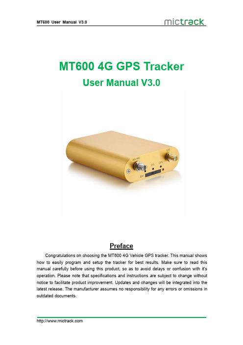
MT6004G GPS TrackerUser Manual V3.0PrefaceCongratulations on choosing the MT6004G Vehicle GPS tracker.This manual shows how to easily program and setup the tracker for best results.Make sure to read this manual carefully before using this product,so as to avoid delays or confusion with it’s operation.Please note that specifications and instructions are subject to change without notice to facilitate product improvement.Updates and changes will be integrated into the latest release.The manufacturer assumes no responsibility for any errors or omissions in outdated documents.Contents1.Overview (1)2.Application (1)3.Specifications (1)4.MT600and Accessories (2)5.Unit Diagram (3)6.Installation (3)6.1SIM Card installation (3)6.2LED Indications (4)6.2.1CHG-Charge indicator(RED) (4)6.2.2SYS-System indicator(BLUE) (4)6.2.3GPS-GPS indicator(GREEN) (4)6.3Device Button Instruction (4)6.4Install4G&GPS Antenna (5)6.5Connection of supplied wiring loom (5)6.6Install the SOS switch(optional) (6)7.Setup and Configuration (6)7.1Setting Authorized Mobile Phone Numbers (6)7.2Deleting authorized number (6)7.3Changing the Admin password (6)7.4Instant Location Request(used to receive unit location via SMS) (6)7.5SOS Alarm(optional) (7)7.6Round Geo-fence(Setting of size and shape of Geo-Fence) (7)7.6.1Enable the Round Geo-fence (7)7.6.2Disable the Round Geo-fence (7)7.7Remote cut off fuel and ignition(optional) (7)7.8External power cut off alarm (7)7.9Towing alarm (7)7.10Low battery Alarm(internal backup battery) (8)7.11Over-Speed alarm(Alerts that the unit is exceeding a preset speed) (8)7.12Set time zone (8)7.13Set APN(Access Point Name) (8)7.14Set Tracking Server IP and PORT (8)7.15Set GPRS Upload Interval Time (8)7.15.1ACC ON(Upload default status is AUTO) (8)7.15.2Vehicle Towed Alarm(vehicle moves whilst ACC is turned OFF) (9)7.15.3ACC OFF&Vehicle Stationary(Upload status is AUTOLOW) (9)7.16SMS Response ON/OFF (9)7.17Unit Phone Calling Control(useful for SIM Card data cost saving) (9)8.App&PC Tracking platform (10)8.1Active the device ID number (10)8.2App install&Login (10)8.3PC login (10)9.Troubleshooting (11)1.OverviewThe MT600is the latest technology4G GPS tracker,fully supporting4G LTE mobile networks.This device can be used locate,track and monitor any remote target via SMS, PC Computer or Mobile APP.It is commonly used to track and locate individual vehicles, motorbikes or boats,and is a valuable tool for enhanced fleet management.The user also can remotely cut off Fuel/Ignition and check the historical route travelled and other vehicle data.The MT600has an excellent track record for stable performance and possesses a wide variety of features.2.Application●4G LTE network support(fallback to3G/2G network)●Real-time tracking●Vehicle trip history and mileage data on web server●SOS alarm reporting(optional)●ACC switch status report●Geo-Fence alarm and reporting●External power cut off alarm●Remote cut off fuel/ignition(optional)●Vehicle towing/Movement alarm●Over-Speed alarm and reporting●Backup battery low power alarm●Power saving/sleep mode●Compatible with most of third party platform●Open protocol3.Specifications4.MT600and Accessories5.Unit Diagram6.Installation6.1SIM Card installation1.Get ready a Standard size SIM Card with10-15MB data a month.2.Insert the SIM card into the SIM card plastic tray.3.Ensure the SIM card has metal contacts facing up(Diagram#1).4.Gently slide the SIM Tray into the SIM Slot(Diagram#2).Note:●The device only supports Standard Size SIM card;●To remove SIM card,use paperclip to press the SIM card pop-out button to eject theSIM card tray.●Make sure insert the sim card first and then connect the external12V power.Diagram #1Diagram #26.2LED Indications6.2.1CHG-Charge indicator (RED )StatusDescription Constant ONNo SIM Card (or)No Network Reception OFFVehicle Parked –ACC Power OFF Quick flash Normal Working Mode6.2.3GPS-GPS indicator (GREEN )6.3Device Button InstructionButton Description StatusDescriptionConstant ONCurrently Charging OFF Charging Complete or sufficient battery.(Note:LED will no light if backup battery is not low power.)StatusDescription OFFGPS /Satellites Unavailable –Out of Range Quick flash GPS/Satellite Locked –Normal ModePowerON/OFF ●Insert the SIM trayto POWER ON the unit;Take out SIM tray to POWER OFF the unit ●Connect the external power to POWER ON;Disconnect thepowerto POWER OFF6.4Install 4G &GPS Antenna●Connect the 4G Antenna firmly to "3G/4G"Socket ●Connect the GPS Antenna firmly to “GPS”socket6.5Connection of supplied wiring loomWhen installing the device,please connect supplied wiring loom as follows:(or contact us for help)●Red :Connect to constant 12V Car Battery(+)●Black:Connect to Earth(Chassis)Car battery(-)●Green:Connect to ACC switched12V Power●Yellow:Connect to red wire of supplied SOS switch●White:Connect to Relay terminal(85)●Pink:Connect to Relay terminal(86)Note:Relay is optional for remote fuel/ignition shut-off.6.6Install the SOS switch(optional)●Red:connect to Yellow wire from supplied wiring loom●Black:connect to Earth(Chassis)Car battery(-)Note:installation Video:https://bit.ly/mt600-install7.Setup and ConfigurationNote:When sending SMS command to the unit,do NOT use spaces or symbols not listed below.[brackets and+are for instructional use only]*and#are valid command parameters.7.1Setting Authorized Mobile Phone NumbersSMS Command format:mobile number+password+[command parameter]Note:Command Parameter here is the sequence of the mobile numberi.e.[1=Admin]or[2=SOS call number]For example:*134****2330*0000*1**Unit Reply:SET USER NUMBER1OK.Note:●The defaulted password is0000.●It can authorize up to3phone numbers.7.2Deleting authorized numberSMS Command format:password+number+[command parameter]Note:Command Parameter here is the sequence of the mobile numberi.e.[1=Admin]or[2=SOS call number]For example:**0000*1**Unit Reply:DELETE USER NUMBER1OK.7.3Changing the Admin passwordSMS Command format:777+new password+old passwordFor example:77712340000Unit Reply:SET USER PASSWORD OK.7.4Instant Location Request(used to receive unit location via SMS)SMS Command format:666+passwordFor example:6660000When sent,this command will result in a Unit Reply SMS as follows:ID:865662000409210Date:05:36:5911/11/2016Fix:A State:SMS/maps?q=+22.63146%2c+114.03701Note:This link can to be opened on any Smart Phone to reveal the Google Maps Location of the unit at the time of request7.5SOS Alarm(optional)When the SOS button is pressed for3seconds,the unit will automatically send it’s location to authorized phone number via SMS,and also upload location data to the Web Tracking Platform server along with the status description“SOS”7.6Round Geo-fence(Setting of size and shape of Geo-Fence)SMS Command format:005+password+R+[Command Parameter]Note:Command Parameter here is fence diameter in KM[0.1~999.9]For example:0050000R1.0Unit Reply:SET ROUND GEO-FENCE:ON7.6.1Enable the Round Geo-fenceSMS Command format:211+passwordFor example:2110000Unit Reply:SET ROUND GEO-FENCE:ON.7.6.2Disable the Round Geo-fenceSMS Command format:210+passwordFor example:2100000Unit Reply:SET ROUND GEO-FENCE:OFF.7.7Remote cut off fuel and ignition(optional)To remotely Cut-Off fuel or powerSMS Command format:940+passwordFor example:9400000Unit Reply:SET OILWAY DISCONNECT.To remotely Resume fuel or powerSMS Command format:941+passwordFor example:9410000Unit Reply:SET OILWAY RECOVERY CONNECT.Note:The default setting for the Cut-Off feature is OFF7.8External power cut off alarmIf the external power to the unit is disconnected,[i.e.unit tampering or vehicle battery removal]the unit will call the authorized phone numbers,and then send location data to the authorized phone number and upload location data to the Web Tracking Platform server along with the status description“DEF”7.9Towing alarmIf the vehicle was be moved or towed when ACC is turned OFF,it will SMS locationdata to the authorized phone number,and upload location data to the Web Tracking Platform server along with the status description“TOWED”7.10Low battery Alarm(internal backup battery)When the unit’s internal backup battery is low,it will SMS the authorized phone number,and upload location data to the Web Tracking Platform server along with the status description“BLP”7.11Over-Speed alarm(Alerts that the unit is exceeding a preset speed)SMS Command format:#122#user password#[Command Parameter]##Note:Command Parameter here is[Km/Hour]Example:#122#0000#100##Unit Reply:SET SPEED LIMIT:ONTo disable the Over-Speed AlarmSMS Command format:#122#0000#0##Note:Command Parameter here is[0=OFF]Unit Reply:SET SPEED LIMIT:OFF.Note:Speed is in KM/H,Maximum setting=[999].7.12Set time zoneSMS Command format:896+password+[+/-]HH:MMNote:Command Parameter here is[Plus or Minus GMT]&[Hours/Minutes]For example:8960000+10:00Reply:SET TIME ZONE:+08:00Note:The default is Greenwich Time(UTC).[i.e.Melbourne Australia=+10:00]7.13Set APN(Access Point Name)SMS Command format1:#803#password#APN##For example:#803#0000#telstra.internet##SMS Command format2:#803#password#APN#APN user name#APN password## For example:#803#0000#CMNET#INTERNET#INTERNET##Reply:SET GPRS APN OK.Note:Please CALL your SIM Card provider to get the correct APN info.7.14Set Tracking Server IP and PORTSMS Command format:#804#password#IP address(or domain)#port##Example:#804#0000#112.95.164.248#7700##Reply:SET SERVER IP AND PORT OK.7.15Set GPRS Upload Interval TimeThis sets how often[in seconds]the unit sends location data back to the Tracking Platform whilst the ACC is switched on.This will affect accuracy and data usage.7.15.1ACC ON(Upload default status is AUTO)SMS Command format:#805#password#interval time#[command parameter]##Note:Command Parameter here[1=ON]&[0=OFF]For example:#805#0000#10#1##Unit Reply:SET GPS PERIODIC UPLOAD ON.Note:interval time maximum[10,65535]secondsUnit Reply:SET GPS PERIODIC UPLOAD OFF.7.15.2Vehicle Towed Alarm(vehicle moves whilst ACC is turned OFF)SMS Command format:#809#password#interval time#[command parameter]##Note:Command Parameter here[1=ON]&[0=OFF]For example:#809#0000#10#1##Unit Reply:SET GPS TOWED UPLOAD ON.Note:interval time maximum[10,65535]secondsUnit Reply:SET GPS TOWED UPLOAD OFF.7.15.3ACC OFF&Vehicle Stationary(Upload status is AUTOLOW) [Periodic upload of vehicle status to the Web Tracking Platform server whilst ACC off –variable to save SIM data costs when parked for long periods and Power Saving] SMS Command format:#807#password#interval time##For example:#807#0000#2##Unit Reply:SET GPS POWER SAVING UPLOAD ON.Note:interval time maximum[2,1440]minutes[If interval time=0,it will stop upload] Unit Reply:SET GPS POWER SAVING UPLOAD OFF.7.16SMS Response ON/OFFTo turn SMS messages OFFSMS Command format:160+passwordFor example:1600000Unit Reply:SET SEND SMS:OFF.To turn SMS messages back ONSMS Command format:161+passwordFor example:1610000Unit Reply:SET SEND SMS:ON.Note:if you want to disable the SMS alerts,send16000007.17Unit Phone Calling Control(useful for SIM Card data cost saving)To turn OFF unit Calling Alerts(i.e.to save SIM data costs)SMS Command format:150+passwordFor example:1500000Unit Reply:SET VOICE CALL:OFFTo turn ON unit Calling AlertsSMS Command format:151+passwordFor example:1510000Unit Reply:SET VOICE CALL:ON\Note:if you want to disable the call alerts,send15000008.App&PC Tracking platform8.1Active the device ID number●Contact with your sales or distributor●If not please subscribe the server plan from official online shop:https:///shop/gps-tracking-platform-service8.2App install&Login●Search“Yi tracker”in Google Play or iOS store(or scan the following QR code)todownload the Mobile APP(not Yi tracker2);●Choose the”Login by Device No.,Input server ●Input your device’s ID number and password(default is123456)to login.8.3PC login●Web:,Choose“ID No.”●Input your device’s ID number and password(default is123456)to login●Watch the video:https://bit.ly/trackis9.TroubleshootingIssues Caused SolutionsSend SMS to the device but no reply 1>SIM Card have not active2>Card balance is not enoughPlease check the SIM cardstatus and try again.Text command format is wrongPlease check the commandformat againConnect network fail.Please check LED status andmake sure the networkconnect successful first.GPS platform shows logged off 1.Check the APN setting;2.Check IP and port3.Check network if matchGPS platform shows no location or the coast of Africa.Device indoor/garage Take it outside for a10-minute walk or drive,andits location should update.LED no light Backup battery is low power Please charge the device for30minutes at least.Any questions please do not hesitate to contact us:Add:706,United Building,Donghuan1st Road,Longhua District,Shenzhen,China518109 Tel:+86-755-28198746Web:Email:*****************。
- 1、下载文档前请自行甄别文档内容的完整性,平台不提供额外的编辑、内容补充、找答案等附加服务。
- 2、"仅部分预览"的文档,不可在线预览部分如存在完整性等问题,可反馈申请退款(可完整预览的文档不适用该条件!)。
- 3、如文档侵犯您的权益,请联系客服反馈,我们会尽快为您处理(人工客服工作时间:9:00-18:30)。
NMEA(National Marine Electronics Association ):美国国家海洋电子协会。
实际上应为NMEA 0183。
它是一套定义接收机输出的标准信息,有几种不同的格式,每种都是独立相关的ASCII格式,逗点隔开数据流,数据流长度从30-100字符不等,通常以每秒间隔选择输出,最常用的格式为"GGA",它包含了定位时间,纬度,经度,高度,定位所用的卫星数,DOP值,差分状态和校正时段等,其他的有速度,跟踪,日期等。
NMEA实际上已成为所有的GPS接收机和最通用的数据输出格式,同时它也被用于与GPS接收机接口的大多数的软件包里。
NMEA-0183协议定义的语句非常多,但是常用的或者说兼容性最广的语句只有$GPGGA、$GPGSA、$GPGSV、$GPRMC、$GPVTG、$GPGLL等。
下面给出这些常用NMEA-0183语句的字段定义解释。
最常用的有GPGGA和GPRMC,一般为GPGGA。
并以逗号隔开。
$GPGGA语句包括17个字段。
数据帧结构及各个字段释义如下:
$GPGGA,<1>,<2>,<3>,<4>,<5>,<6>,<7>,<8>,<9>,M,<10>,M,<11>,<12>*xx
$GPRMC语句包括15个字段。
数据帧结构及各个字段释义如下:$GPRMC,<1>,<2>,<3>,<4>,<5>,<6>,<7>,<8>,<9>,<10>,<11>,<12>*hh。