全球定位系统的介绍英文
GPS全球卫星定位导航系统

GPS地图
GPS地图是GPS中一个重要的组成部分,光有机器还不行,还得 有地图和软件支持,这样才能让GPS为我们引路,找地方。。。 既然有这么多地图,那肯定各有各的长处,听小生一一道来。 市场上的GPS地图资源主要有以下这些 凯立德:公司总部在深圳,地图主要优势在华南,尤其是 广东省及周边,信息点全,地图绘制较详细。 道道通:公司名叫瑞图万方,有十年的地图绘制经验,兴 趣点比较全面且较准确。 四维地图:主要应用于车载GPS(装在中控上的),一些 高端品牌也有使用,使用成本较高。 高德地图:地图测绘厂家的后来者,目前市场上使用该地 图的品牌不是很多。 灵图天行者:主要应用于智能手机,大家常见的多普达就 是用灵图的地图。
功能
GPS的实时监控功能: 在任意时刻通过发出指令查询运输工具 所在的地理位置(经度、纬度、速度等 信息)并在电子地图上直观地显示出来。
GPS的双向通讯功能
网络GPS的用户可使用GSM的话音功能与司 机进行通话或使用本系统安装在运输工具上的 移动设备的汉字液晶显示终端进行汉字消息收 发对话。 驾驶员通过按下相应的服务、动作键,将该 信息反馈到网络GPS,质量监督员可在网络 GPS工作站的显示屏上确认其工作的正确性, 了解并控制整个运输作业的准确性(发车时间、 到货时间、卸货时间、返回时间等等)。
GPS方案
为什么要像大家详细解说GPS方案,这是因为方案不 同,机器采用的硬件和价格有很大的差异! 国内市场 上主流的GPS大多采用三星或者掌微的方案。 一般来讲,采用三星方案的多为高端机器,用的是三 星的CPU(频率为400M赫兹),价格一般在2千元以上, 贵一些的甚至要四五千。掌微方案可谓是GPS市场的 推动者,使GPS进入广大车友的功臣。为何? 听我慢 慢道来,首先从成本上来说,三星的CPU性能是没得 说,但是价格不菲就注定了它竞争不过物美价廉的掌 微。目前,从性能上来说,掌微并不比三星落后,只 是采用的工艺不同,两者在各方面的表现各有长短, 三星的信号强度好,掌微的搜星速度快。目前市场上 采用三星方案的多为高端品牌,比如:神达、任我游, 价位一般在2000以上,贵的甚至要四五千。 用掌微方 案的就多了,价格一般1000-2500左右,以市场畅销品 牌为主。Biblioteka GPS的数据存储、分析功能
GPS简介科普
按用途划分
1.导航领域(陆海空导航,监控,调度) 2.授时领域(电力,天文,电讯„) 3.测姿领域(飞行器姿态测量) 4.精密定位领域 A.测绘(大地测量,控制测量,精密工程测量 ,变形监测,海洋测量,摄影测量„„) B.地球科学(地球动力学,地震监测,卫星遥 感,灾害监测,资源勘探„„) C.水利(大坝监测,滑坡监测) D.天文,气象,环境„„
•发送钟差改正参数 •发送电离层和对流层改正参数 •其他(监测核试验L3和军事用途L4)
3. GPS控制部分简介
- 5个监控站
24小时连续对每一颗卫星进行连续 跟踪观测,采集数据,用以预报轨道和改正时钟,并将数 据发送到主控站
- 1个主控站(MCS) 位于 Colorado Springs 附近 Falcon空军基地. MCS 对监测跟踪站传送来的数据进行 处理,计算每一颗卫星的星历和钟差等参数,将星历和 钟差等参数及控制指令传送到注入站。 MCS 也是唯一控 制卫星随机运动的地面站。 - 3个注入站 具有地面天线用来发送上载信息和 控制数据,当卫星经过注入站上空时,将星历和钟差等 参数及控制指令注入给每颗卫星。
- 消除接收机和卫星钟差 - 消除整周模糊度 - 允许探测周跳
(六)GPS精密定位有哪 些实现方法?
•静态测量
•实时动态测量RTK
•静态测量:
水平:
3mm + 0.5ppm x D
垂直: 6mm + 0.5ppm x D
• RTK •
平面 10MM+1ppm 高程 20mm+1ppm
RTK(Real Time kinematic) 概念
• 双差观测方程 pq pq pq • DD 12(ti)= (f/c) ρpq 12(ti)+ (f/c) δρ 12trop pq (f/c) δρ 12ion- N 12(t1) • 通过多个卫星,多个历元的观测,即可解算 两个观测站之间的 三维坐标差 及
gps定位原理和简单公式

GPS定位原理和简单公式全球定位系统(Global Positioning System)是美国第二代卫星导航系统。
是在子午仪卫星导航系统的基础上发展起来的,它采纳了子午仪系统的成功经验。
和子午仪系统一样,全球定位系统由空间部分、地面监控部分和用户接收机三大部分组成。
按目前的方案,全球定位系统的空间部分使用24颗高度约2.02万千米的卫星组成卫星星座。
21+3颗卫星均为近圆形轨道,运行周期约为11小时58分,分布在六个轨道面上(每轨道面四颗),轨道倾角为55度。
卫星的分布使得在全球的任何地方,任何时间都可观测到四颗以上的卫星,并能保持良好定位解算精度的几何图形(DOP)。
这就提供了在时间上连续的全球导航能力。
地面监控部分包括四个监控站、一个上行注入站和一个主控站。
监控站设有GPS用户接收机、原子钟、收集当地气象数据的传感器和进行数据初步处理的计算机。
监控站的主要任务是取得卫星观测数据并将这些数据传送至主控站。
主控站设在范登堡空军基地。
它对地面监控部实行全面控制。
主控站主要任务是收集各监控站对GPS卫星的全部观测数据,利用这些数据计算每颗GPS卫星的轨道和卫星钟改正值。
上行注入站也设在范登堡空军基地。
它的任务主要是在每颗卫星运行至上空时把这类导航数据及主控站的指令注入到卫星。
这种注入对每颗GPS卫星每天进行一次,并在卫星离开注入站作用范围之前进行最后的注入。
全球定位系统具有性能好、精度高、应用广的特点,是迄今最好的导航定位系统。
随着全球定位系统的不断改进,硬、软件的不断完善,应用领域正在不断地开拓,目前已遍及国民经济各种部门,并开始逐步深入人们的日常生活。
上述四个方程式中待测点坐标x、y、z 和Vto为未知参数,其中di=c△ti (i=1、2、3、4)。
di (i=1、2、3、4) 分别为卫星1、卫星2、卫星3、卫星4到接收机之间的距离。
△ti (i=1、2、3、4) 分别为卫星1、卫星2、卫星3、卫星4的信号到达接收机所经历的时间。
GPS导航定位原理以及定位解算算法

G P S导航定位原理以及定位解算算法TYYGROUP system office room 【TYYUA16H-TYY-TYYYUA8Q8-GPS导航定位原理以及定位解算算法全球定位系统(GPS)是英文Global Positioning System的字头缩写词的简称。
它的含义是利用导航卫星进行测时和测距,以构成全球定位系统。
它是由美国国防部主导开发的一套具有在海、陆、空进行全方位实时三维导航与定位能力的新一代卫星导航定位系统。
GPS用户部分的核心是GPS接收机。
其主要由基带信号处理和导航解算两部分组成。
其中基带信号处理部分主要包括对GPS卫星信号的二维搜索、捕获、跟踪、伪距计算、导航数据解码等工作。
导航解算部分主要包括根据导航数据中的星历参数实时进行各可视卫星位置计算;根据导航数据中各误差参数进行星钟误差、相对论效应误差、地球自转影响、信号传输误差(主要包括电离层实时传输误差及对流层实时传输误差)等各种实时误差的计算,并将其从伪距中消除;根据上述结果进行接收机PVT(位置、速度、时间)的解算;对各精度因子(DOP)进行实时计算和监测以确定定位解的精度。
本文中重点讨论GPS接收机的导航解算部分,基带信号处理部分可参看有关资料。
本文讨论的假设前提是GPS接收机已经对GPS卫星信号进行了有效捕获和跟踪,对伪距进行了计算,并对导航数据进行了解码工作。
1 地球坐标系简述要描述一个物体的位置必须要有相关联的坐标系,地球表面的GPS接收机的位置是相对于地球而言的。
因此,要描述GPS接收机的位置,需要采用固联于地球上随同地球转动的坐标系、即地球坐标系作为参照系。
地球坐标系有两种几何表达形式,即地球直角坐标系和地球大地坐标系。
地球直角坐标系的定义是:原点O与地球质心重合,Z轴指向地球北极,X轴指向地球赤道面与格林威治子午圈的交点(即0经度方向),Y轴在赤道平面里与XOZ 构成右手坐标系(即指向东经90度方向)。
6.2全球定位系统(GPS)

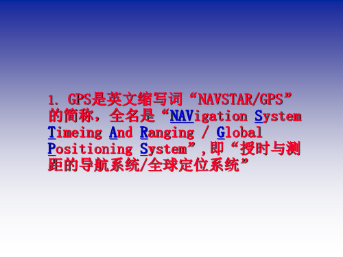
1、全球定位系统概述(1)GPS的概念及其发展GPS是英文缩写,其全名为Navigation System Timing and Raging/Global positioning System,即。
"授时与测距导航系统/全球定位系统".全球定位系统GPS,于1973年由美国政府组织研究,耗费巨资,历经约20年,于1993年全部建成。
该系统是伴随现代科学技术的迅速发展而建立起来的新一代精密卫星导航和定位系统,不仅具有全球性、全天候、连续的三维测速、导航、定位与授时能力,而且具有良好的抗干扰性和保密性。
该系统的研制成功已成为美国导航技术现代化的重要标志,被视为本世纪继阿波罗登月计划和航天飞机计划之后的又一重大科技成就。
全球定位系统的研制,最初主要用于军事目的。
如为陆海空三军提供实时、全天候和全球性的导航服务,并用于情报收集、核爆监测、应急通讯和爆破定位等方面,其作用已在1991年海湾战争中得到了证实。
以美国为首的多国部队所持有的17000台GPS接收机被认为是作战武器的效率倍增器,是赢得海湾战争胜利的重要技术条件之一。
随着GPS系统步入试验和实用阶段,其定位技术的高度自动化及所达到的高精度和巨大的潜力,引起了各国政府的普遍关注,同时引起了广大测量工作者的极大兴趣。
特别是近几年来,GPS定位技术,在应用基础研究、新应用领域开拓、软硬件开发等方面都取得了迅速发展。
目前,GPS精密定位技术已经广泛地渗透到了经济建设和科学技术的许多领域,尤其是在大地测量学及其相关学科领域,如地球动力学、海洋大地测量学、天文学、地球物理和资源勘探、航空与卫星遥感精密工程测量、变形监测、城市控制测量等方面的广泛应用,充分显示了这一卫星定位技术的高精度和高效益。
这预示测绘界将面临着一场意义深远的变革,从而使测绘领域步入一个崭新的时代。
在我国测绘行业,GPS的应用起步较晚,但发展速度很快。
测绘工作者们在GPS 应用基础研究和实用软件开发等方面取得了大量的成果;从而为GPS技术在我国全面推广提供了技术保证。
介绍gps作文 英语120字

介绍gps作文英语120字英文回答:GPS, which stands for Global Positioning System, is a technology that uses satellites to provide location and time information anywhere on Earth. It has become an essential tool in our daily lives, helping us navigate, track our fitness activities, and even locate lost pets.I remember a time when I was driving to a friend's house in a new city and got lost. Luckily, I had my GPS device with me, and it guided me to the right destination without any hassle. It was such a relief to have that technology at my fingertips.Another great thing about GPS is its accuracy. Whether I'm hiking in the mountains or sailing in the ocean, I can always rely on my GPS to pinpoint my exact location. It's like having a personal navigator with me wherever I go.中文回答:全球定位系统(GPS)是一种利用卫星在地球任何地方提供位置和时间信息的技术。
GNSS全球导航卫星系统
讲课人:51136364 2012年2月27日
目 录
一、GNSS(全球导航卫星系统)
1、 GNSS的概念 2、 GNSS包括的四大全球系统
GPS、GLONASS、Galileo、Compass
二、COMPASS(北斗卫星导航系统)
一 、GNSS(全球导航卫星系统)
3、北斗一代
自身特点 1.)"北斗"具有定位和通信双重作用,具备的短信通讯 功能就是GPS所不具备的。 2.)"北斗"定位精度20米左右。 3.)目前"北斗"终端价格已经趋于GPS终端价格。 4 . 4).采用接收终端不需铺设地面基站。 5.)灾难中心的船只一秒钟就可以发出信息 系统的四大功能 1短报文通信:北斗系统用户终端具有双向报文通信 短报文通信: 短报文通信 功能,用户可以一次传送40-60个汉字的短报文信息。 2 精密授时:北斗系统具有精密授时功能,可向用户 精密授时: 提供20ns-100ns时间同步精度。 3 定位精度:水平精度100米(1σ),设立标校站之后为 定位精度: 20米(类似差分状态)。工作频率:2491.75MHz。 4 系统容纳的最大用户数:每小时540000户。 系统容纳的最大用户数:
2000年10月31日 140E
2000年12月21日 80E
2003年5月25日 110.5E
4、北斗二代
《2006年中国航天白皮书》宣布将在未来5年启动五大航天工程 ,其中具有军事用途的第二代“北斗”卫星导航系统将在4年内完成 部署。二代“北斗”卫星系统部署完成后,中国将能对小目标发动精 准攻击,而美国也有媒体认为中国用北斗计划来压制美国卫星的军事 优势。随着我国综合国力的提升和卫星导航定位系统全面渗透普通人 的生活,还有科索沃战争和第二次海湾战争美国GPS制导高精度打击 武器的诱惑,构建一个类似GPS的全球卫星导航定位系统开始提上日 程,从2007年开始正式建设“北斗”卫星导航定位系统(“北斗二号 ”)。 “北斗”卫星导航定位系统需要发射35颗卫星,足足要比GPS多 出11颗。按照规划,“北斗”卫星导航定位系统将有5颗静止轨道卫 星和30颗非静止轨道卫星组成,采用“东方红”-3号卫星平台。30颗 非静止轨道卫星又细分为27颗中轨道(MEO)卫星和3颗倾斜同步 (IGSO)卫星组成,27颗MEO卫星平均分布在倾角55度的三个平面上, 轨道高度21500公里。“北斗“卫星导航定位系统将提供开放服务和 授权服务。开放服务在服务区免费提供定位,测速和授时服务,定位 精度为10米,授时精度为50纳秒,测速精度为0.2米/秒。授权服务则 是军事用途的马甲,将向授权用户提供更安全与更高精度的定位,测 速,授时服务,外加继承自北斗试验系统的通信服务功能。 2012年2月25日凌晨0时12分,西昌卫星发射中心用“长征三号丙 ”运载火箭,将第十一颗北斗导航卫星成功送入太空预定转移轨道。 此前,第一、第二颗“北斗二号”卫星分别于2007年4月和2009年4月 发射。卫星发射时间间隔越来越短,预示着“北斗二号”正在加速组 网。
gps的作用英语作文
gps的作用英语作文英文回答:GPS, or Global Positioning System, plays a crucial role in our daily lives. It is a navigation system that uses satellite signals to determine the exact location of a person or object on Earth. GPS has become an indispensable tool for various applications, ranging from navigation and transportation to tracking and mapping.One of the main uses of GPS is in navigation. Whether you are driving a car, riding a bike, or even walking, GPS can provide you with accurate directions to your desired destination. It eliminates the need for paper maps or asking for directions from strangers. For example, when I go on a road trip, I rely on my GPS to guide me todifferent cities and attractions. It not only tells me the fastest route but also provides real-time traffic updates, helping me avoid congested areas.GPS is also widely used in transportation systems. It enables vehicles to be tracked and monitored, ensuring efficient fleet management. For instance, delivery companies use GPS to keep track of their vehicles and optimize their delivery routes. This not only saves time and fuel but also improves customer satisfaction by providing accurate delivery estimates.Furthermore, GPS has revolutionized outdoor activities such as hiking, camping, and geocaching. With a GPS device or smartphone app, adventurers can navigate through unfamiliar terrains and find hidden treasures. I remember going on a hiking trip with my friends, and thanks to GPS, we were able to find our way back to the starting point without getting lost in the wilderness.In addition to navigation and transportation, GPS has numerous other applications. It is used in agriculture for precision farming, where farmers can precisely determine the areas that need fertilization or irrigation. GPS is also used in wildlife tracking to monitor the movement and behavior of animals. Moreover, it is used in emergencyresponse systems to locate and rescue individuals in distress.Overall, GPS has greatly enhanced our lives byproviding accurate navigation, improving transportation systems, and enabling various outdoor activities. It has become an essential tool that we rely on daily. Without GPS, we would be lost in more ways than one.中文回答:GPS,全球定位系统,在我们的日常生活中起着至关重要的作用。
全球定位系统英文作文模板
全球定位系统英文作文模板英文回答:The Global Positioning System (GPS) is a satellite-based navigation system made up of a network of 24satellites placed into orbit by the U.S. Department of Defense. GPS was originally intended for military use, but in the 1980s, the U.S. government made the system available for civilian use.GPS works by measuring the time it takes for signals to travel from the satellites to a receiver on the ground. The receiver uses this information to calculate its position, speed, and altitude. GPS receivers are used in a wide variety of applications, including navigation, surveying, and tracking.中文回答:全球定位系统(GPS)是由美国国防部放置在轨道上的 24 颗卫星组成的卫星导航系统。
GPS 最初是用于军事用途,但在 1980 年代,美国政府将该系统开放给平民使用。
GPS 的工作原理是测量信号从卫星传输到地面接收器所需的时间。
接收器利用这些信息来计算其位置、速度和高度。
GPS 接收器被广泛用于导航、测量和跟踪等多种应用中。
GPS是英文Global Positioning System
GPS是英文Global Positioning System(全球定位系统)的简称。
GPS起始于1958年美国军方的一个项目,1964年投入使用。
20世纪70年代,美国陆海空三军联合研制了新一代卫星定位系统GPS 。
主要目的是为陆海空三大领域提供实时、全天候和全球性的导航服务,并用于情报收集、核爆监测和应急通讯等一些军事目的,经过20余年的研究实验,耗资300亿美元,到1994年,全球覆盖率高达98%的24颗GPS卫星星座己布设完成。
在机械领域GPS则有另外一种含义:产品几何技术规范(Geometrical Product Specifications)-简称GPS。
另外一种解释为G/s(GB per s)GPS导航系统的基本原理是测量出已知位置的卫星到用户接收机之间的距离,然后综合多颗卫星的数据就可知道接收机的具体位置。
要达到这一目的,卫星的位置可以根据星载时钟所记录的时间在卫星星历中查出。
而用户到卫星的距离则通过记录卫星信号传播到用户所经历的时间,再将其乘以光速得到(由于大气层电离层的干扰,这一距离并不是用户与卫星之间的真实距离,而是伪距(PR):当GPS卫星正常工作时,会不断地用1和0二进制码元组成的伪随机码(简称伪码)发射导航电文。
GPS系统使用的伪码一共有两种,分别是民用的C/A码和军用的P(Y)码。
C/A码频率1.023MHz,重复周期一毫秒,码间距1微秒,相当于300m;P码频率10.23MHz,重复周期266.4天,码间距0.1微秒,相当于30m。
而Y码是在P码的基础上形成的,保密性能更佳。
导航电文包括卫星星历、工作状况、时钟改正、电离层时延修正、大气折射修正等信息。
它是从卫星信号中解调制出来,以50b/s调制在载频上发射的。
导航电文每个主帧中包含5个子帧每帧长6s。
前三帧各10个字码;每三十秒重复一次,每小时更新一次。
后两帧共15000b。
导航电文中的内容主要有遥测码、转换码、第1、2、3数据块,其中最重要的则为星历数据。
- 1、下载文档前请自行甄别文档内容的完整性,平台不提供额外的编辑、内容补充、找答案等附加服务。
- 2、"仅部分预览"的文档,不可在线预览部分如存在完整性等问题,可反馈申请退款(可完整预览的文档不适用该条件!)。
- 3、如文档侵犯您的权益,请联系客服反馈,我们会尽快为您处理(人工客服工作时间:9:00-18:30)。
Introduction to the Global Positioning SystemChapter One: What is GPS?The Global Positioning System (GPS) is a location system based on a constellation of about 24 satellites orbiting the earth at altitudes of approximately 11,000 miles. GPS was developed by the United States Department of Defense (DOD), for its tremendous application as a military locating utility. The DOD's investment in GPS is immense. Billions and billions of dollars have been invested in creating this technology for military uses. However, over the past several years, GPS has proven to be a useful tool in non-military mapping applications as well.GPS satellites are orbited high enough to avoid the problems associated with land based systems, yet can provide accurate positioning 24 hours a day, anywhere in the world. Uncorrected positions determined from GPS satellite signals produce accuracies in the range of 50 to 100 meters. When using a technique called differential correction, users can get positions accurate to within 5 meters or less.Today, many industries are leveraging off the DOD's massive undertaking. As GPS units are becoming smaller and less expensive, there are an expanding number of applications for GPS. In transportation applications, GPS assists pilots and drivers in pinpointing their locations and avoiding collisions. Farmers can use GPS to guide equipment and control accurate distribution of fertilizers and other chemicals. Also,GPS is used for providing accurate locations and as a navigation tool for hikers, hunters and boaters.Many would argue that GPS has found its greatest utility in the field of Geographic Information Systems (GIS). With some consideration for error, GPS can provide any point on earth with a unique address (its precise location). A GIS is basically a descriptive database of the earth (or a specific part of the earth). GPS tells you that you are at point X,Y,Z while GIS tells you that X,Y,Z is an oak tree, or a spot in a stream with a pH level of 5.4. GPS tells us the "where". GIS tells us the "what". GPS/GIS is reshaping the way we locate, organize, analyze and map our resources.Chapter Two: Trilateration - How GPS Determines a Location In a nutshell, GPS is based on satellite ranging - calculating the distances between the receiver and the position of 3 or more satellites (4 or more if elevation is desired) and then applying some good old mathematics. Assuming the positions of the satellites are known, the location of the receiver can be calculated by determining the distance from each of the satellites to the receiver. GPS takes these 3 or more known references and measured distances and "triangulates" an additional position.As an example, assume that I have asked you to find me at a stationary position based upon a few clues which I am willing to give you. First, I tell you that I am exactly 10 miles away from your house. You would know I am somewhere on the perimeter of a sphere that has an origin as your house and a radius of 10 miles. With this information alone, you would have a difficult time to find me since there are an infinite number of locations on the perimeter of that sphere.Second, I tell you that I am also exactly 12 miles away from the ABC Grocery Store. Now you can define a second sphere with its origin at the store and a radius of 12 miles. You know that I am located somewhere in the space where the perimeters of these two spheres intersect - but there are still many possibilities to define my location.Adding additional spheres will further reduce the number of possible locations. In fact, a third origin and distance (I tell you am 8 miles away from the City Clock) narrows my position down to just 2 points. By adding one more sphere, you can pinpoint my exact location. Actually, the 4th sphere may not be necessary. One of the possibilities may not make sense, and therefore can be eliminated.For example, if you know I am above sea level, you can reject a point that has negative elevation. Mathematics and computers allow us to determine the correct point with only 3 satellites.Based on this example, you can see that you need to know the following information in order to compute your position:A)What is the precise location of three or more known points (GPS satellites)?B) What is the distance between the known points and the position of the GPSreceiver?Chapter Three: How the Current Locations of GPS Satellites are Determined GPS satellites are orbiting the Earth at an altitude of 11,000 miles. The DOD can predict the paths of the satellites vs. time with great accuracy. Furthermore, the satellites can be periodically adjusted by huge land-based radar systems. Therefore, the orbits, and thus the locations of the satellites, are known in advance. Today's GPS receivers store this orbit information for all of the GPS satellites in which is known as an almanac. Think of the almanac as a "bus schedule" advising you where each satellite will be at a particular time. Each GPS satellite continually broadcasts the almanac. Your GPS receiver will automatically collect this information and store it for future reference.The Department of Defense constantly monitors the orbit of the satellites looking for deviations from predicted values. Any deviations (caused by natural atmospheric phenomenon such as gravity), are known as ephemeris errors. When ephemeris errors are determined to exist for a satellite, the errors are sent back up to that satellite, which in turn broadcasts the errors as part of the standard message, supplying this information to the GPS receivers.By using the information from the almanac in conjunction with the ephemeris error data, the position of a GPS satellite can be very precisely determined for a given time.Chapter Four: Computing the Distance Between Your Position and the GPS SatellitesGPS determines distance between a GPS satellite and a GPS receiver by measuring the amount of time it takes a radio signal (the GPS signal) to travel from the satellite to the receiver. Radio waves travel at the speed of light, which is about 186,000 miles per second. So, if the amount of time it takes for the signal to travel from the satellite to the receiver is known, the distance from the satellite to the receiver (distance = speed x time) can be determined. If the exact time that the signal was transmitted and the exact time it was received are known, the signal's travel timecan be determined.In order to do this, the satellites and the receivers use very accurate clocks which are synchronized so that they generate the same code at exactly the same time. The code received from the satellite can be compared with the code generated by the receiver. By comparing the codes, the time difference between which the satellite generated and the receiver generated can be determined. This interval is the travel time of the code. Multiplying this travel time, in seconds, by 186,000 miles per second gives the distance from the receiver position to the satellite..Chapter Five: Four (4) Satellites to give 3D positionIn the previous example, you saw that it took only 3 measurements to "triangulate" a 3D position. However, GPS needs a 4th satellite to provide a 3D position. Why?Three measurements can be used to locate a point, assuming that the GPS receiver and satellite clocks are precisely and continually synchronized, thereby allowing the distance calculations to be accurately determined. Unfortunately, it is impossible to synchronize these two clocks, since the clocks in GPS receivers are not as accurate as the very precise and expensive atomic clocks in the satellites. The GPS signal speed traveling from the satellite to the receiver is very fast, so if the two clocks are not synchronized, even if only a small part, the determined position data may be considerably distorted.The atomic clocks on aboard keep their time at a very high degree of accuracy. However, there will always be a slight variation in clock rates from satellite to satellite. Close monitoring of the clock of each satellite from the ground permits the control station to insert a message in the signal of each satellite which precisely describes the drift rate of that satellite's clock. The insertion of the drift rate effectively synchronizes all of the GPS satellite clocks.The same procedure cannot be applied to the clock in GPS receiver. Therefore, the fourth variable (in addition to x, y and z)time must be determined in order to calculate a precise location. Mathematically, to solve for four unknowns (x,y,z, and t), there must requir four equations. In determining GPS positions, the four equations arerepresented by signals from four different satellites.Chapter Six: The GPS Error BudgetThe GPS system has been designed to be as nearly accurate as possible. However, there are still errors. Added together, these errors can cause a deviation of +/- 50 -100 meters from the actual GPS receiver position. There are several sources for these errors, the most significant of which are discussed as bellows:Atmospheric ConditionThe ionosphere and troposphere both refract the GPS signals. This causes the speed of the GPS signal in the ionosphere and troposphere to be different from the speed of the GPS signal in space. Therefore, the distance calculated from "Signal Speed x Time" will be different from the portion of the GPS signal path that passes through the ionosphere and troposphere and for the portion that passes through space.As mentioned earlier, GPS signals contain information about ephemeris (orbital position) errors, and about the rate of clock drift for the broadcasting satellite. The data concerning ephemeris errors may not exactly model the true satellite motion or the exact rate of clock drift. Distortion of the signal by measurement noise can further increase positional error. The disparity in ephemeris data can introduce 1-5 meters of positional error, clock drift disparity can introduce 0-1.5 meters of positional error and measurement noise can introduce 0-10 meters of positional error.Ephemeris errors should not be confused with Selective Availability (SA), which is the intentional alteration of the time and ephemeris signal by the Department of Defense.GPS signal bouncing off a reflective surface prior to reaching the GPS receiver antenna is referred to as multipath. Because it is difficult to completely correct multipath error, even in high precision GPS units, multipath error is a serious concern to the GPS user.Chapter Seven: Measuring GPS AccuracyAs discussed above, there are several external sources which introduce errorsinto a GPS position. While the errors discussed above always affect accuracy, another major factor in determining positional accuracy is the alignment or geometry of the group of satellites (constellation) from which signals are being received. The geometry of the constellation is evaluated for several factors, all of which fall into the category of Dilution Of Precision, or DOP.DOP is an indicator of the quality of the geometry of the satellite constellation. computed position may be derrerent, depending on which satellites you use for the measurement. Different satellite geometries can magnify or reduce the errors in the budget described above. A greater angle between the satellites lowers the DOP, and provides a better measurement. A higher DOP indicates poor satellite geometry, and an inferior measurement configuration.Some GPS receivers can analyze the positions of the satellites available, based upon the almanac, and choose those satellites with the best geometry in order to make the DOP as low as possible. Another important GPS receiver feature is to be able to ignore or eliminate GPS readings with DOP values that exceed user-defined limits. Other GPS receivers may have the ability to use all of the satellites in view, thus minimizing the DOP as much as possible.。