七大洲四大洋英语讲课讲稿
七大洲四大洋英语

The USA, Mexico, and Canada are the three biggest countries in North America United States of America 华盛顿 Washington ['wɔʃiŋtən] United Mexican States ['meksikən] 墨西哥城 Mexico City ['meksikəu] Canada 渥太华 Ottawa ['ɔtəwə] 巴拿马 Republic of Panama [,pæ nə'mɑ:]巴拿马城 Panama 古巴 Republic of Cuba [‘kju:bə]哈瓦那 Havana hə’væ nə] 海地 Republic of Haiti ['heiti]太子港 Port-au-Prince [,pɔ:təu'prins]
Republic of
Europe
Europe (43个国家/1个地区)
北欧:芬兰、瑞典、挪威、冰岛、丹麦 法罗群岛(丹) 东欧:爱沙尼亚、拉脱维亚、立陶宛、白俄罗斯、俄罗斯、乌克兰、摩尔多瓦 中欧:波兰、捷克、斯洛伐克、匈牙利、德国、奥地利、瑞士、列支敦士登 西欧:英国、爱尔兰、荷兰、比利时、卢森堡、法国、摩纳哥 南欧:罗马尼亚、保加利亚、塞尔维亚、马其顿、阿尔巴尼亚、希腊、斯洛文尼亚、克罗地亚、波斯尼亚和墨塞哥维那 意大利、
Berlin [bə:'lin]
kingdom of Great Britain and Northern Ireland伦敦 London 爱尔兰 Ireland 都柏林 Dublin ['dʌblin] 丹麦 Kingdom of Denmark ['denma:k]哥本哈根 Copenhagen [,kəupən'heiɡən]
七大洲和四大洋课件

ห้องสมุดไป่ตู้
忆一忆
比一比
东半球
西半球
北极圈
南极圈
比一比:看谁又快又好地说出大洲间的分界线
巴拿马运河
苏伊士运河
乌拉尔山
乌拉尔河
大高加索山脉
土耳其海峡
白令海峡
画一画
三笔画世界――画简笔画识记七大洲和四大洋
赤道
北回归线
南回归线
南极圈
北极圈
0°
23.5°N
23.5°S
66.5°N
66.5°S
东半球
西半球
看谁最快说出图中数字表示的大洲名称
2
3
6
5
亚洲
欧洲
非洲
大洋洲
南极洲
北美洲
认识七大洲的大小和轮廓形状
亚非北南美,南极欧大洋
北宽南窄
看谁能准确说出七大洲的分布
东半球
西半球
◆主要位于东半球的大洲 :
◆主要位于西半球的大洲:
亚洲、欧洲、 非洲、大洋洲
北美洲、南美洲
比一比
来自亚洲的大熊猫
来自非洲的长颈鹿
来自北美洲的野牛
来自南美洲的羊驼
来自南极洲的企鹅
来自大洋洲的袋鼠
讲课人:丰南区第四中学 刘玉霞
第二章 陆地和海洋 第一节 大洲和大洋 七大洲和四大洋
人教版七年级上册
认识图中陆地的基本形态
认一认
大陆
半岛
岛屿
找出图中的大陆、岛屿、半岛、大洲
比一比
在空白图上,用简单的几何图形画出七大洲的轮廓,并标注出大洲与大洋的名称。(注意各大洲大致的纬度位置)
感谢您的到来
Thanks For Your Coming
七大洲四大洋英语

奥地利 Republic of Austria ['ɔstriə]维也纳 Vienna [vi'enə] 瑞士 Swiss Confederation 伯尔尼 Bern [bə:n]
西班牙 Kingdom of Spain [spein]马德里 Madrid [mə‘drid 葡萄牙 Portuguese Republic [,pɔ:tju’ɡi:z]里斯本Lisbon [‘lizbən]
意大利 Italian Republic [i‘tæ ljən]罗马 Rome [rəum]
希腊 Greece [he'lenik]雅典 Athens ['æ θənz]
Asia
Asia (48 countries,约占世界陆地总面积的29.4%,是世界第一大洲。人口32.29亿,约占世界总人口的60%,居世界第一位。 )
英国 United kingdom of Great Britain and Northern Ireland伦敦 London 爱尔兰 Ireland 都柏林 Dublin ['dʌblin]
丹麦 Kingdom of Denmark ['denma:k]哥本哈根 Copenhagen [,kəupən'heiɡən]
中欧:波兰、捷克、斯洛伐克、匈牙利、德国、奥地利、瑞士、列支敦士登
西欧:英国、爱尔兰、荷利亚、塞尔维亚、马其顿、阿尔巴尼亚、希腊、斯洛文尼亚、克罗地亚、波斯尼亚和墨塞哥维那 意大利、
梵蒂冈、圣马力诺、马耳他、西班牙、葡萄牙、安道尔
挪威 Kingdom of Norway ['nɔ:wei]奥斯路 Oslo ['ɔzləu
冰岛 Republic of Iceland 雷克雅未克 Reykjavik ['reikjəvik]
名师推荐小学英语 七大洲课件
USA C. USA, Spain, China D. Asia, North America,
Africa
20
10. Why is Africa the hottest continent?
A. It is near Florida B. It is cold C. The equator goes
9
Antarctica
• Antarctica is the coldest continent
• No people live in Antarctica, but some scientists visit to study the weather or animals there
• Many kinds of penguins live in Antarctica
• There are 47 countries in Europe
• People in Europe speak over 50 languages!
• The weather in Europe is similar to North America – cold in the north and warm in the south
• People there speak mostly Spanish
• The biggest country is Brazil, where people love to play soccer
• The Amazon rainforest is in South America
5
Europe
called Aborigines • Other people in Australia are
七大洲-四大洋.ppt

Mongolia [m??'ɡ?uli?] 乌兰巴托 Elggydggmgj
第一:太平洋
第二:大西洋 第三:印度洋 第四:北冰洋
大西洋:Atlantic Ocean 太平洋:Pacific Ocean 印度洋:Indian Ocean 北冰洋:Arctic Ocean
North America South America Oceania Antarctica
Earth rotation
16 世纪,西班牙的航海学家麦哲伦从大西洋经麦哲伦海峡进入太平洋并到达菲律宾,航行其间, 天气晴朗,风平浪静,于是也把这一海域不约而同地取名为“ 太平洋”。
太平洋Pacific [p?'sifik]占地球表面积的三分之一,是世界海洋面积的二分之一。 大西洋Atlantic [?t‘l? ntik]是世界第二大洋大西洋的海运特别发达,
中非:乍得、中非、喀麦隆、赤道几内亚、加蓬、刚果共和国(即:刚果(布))、刚果民主共和国(即:刚果(金))、圣
多美及普林西比 西非:毛里塔尼亚、西撒哈拉(注:未独立,详细请看:)、塞内加尔、冈比亚、马里、布基纳法索、几内亚、几内亚比绍、佛 得角、塞拉利昂、利比里亚、科特迪瓦、加纳、多哥、贝宁、尼日尔、加那利群岛(西)
东、西分别经苏伊士运河和巴拿马运河沟通印度洋和太平洋,其货运量约占世界货运总量的三分之二以上。
印度洋Indian Ocean [‘indi? 'ou??n] 第三大洋,石油丰富 北冰洋Arctic Ocean [‘a:ktik '?u??n] 最小,两大奇观。第一大奇观:一年中几乎一
半的时间,连续暗无天日,恰如漫漫长夜难见阳光;而另一半日子,则多为阳光普照,只有白昼而无黑夜。由 于这样,北冰洋上的一昼一夜,仿佛是一天而不是一年。此外,置身大洋中,常常可见北,天空的极光现象, 飘忽不定、变幻无穷、五彩缤纷,甚是艳丽。是北冰洋上第二大奇观。北冰洋又是四大洋中温度最低的寒带洋, 终年积雪,千里冰封,覆盖于洋面的坚实冰层足有 3~4米厚。每当这里的海水向南流进大西洋时,随时随处可 见一簇簇巨大的冰山随波飘浮,逐流而去,就像是一些可怕的庞然怪物,给人类的航运事业带来了一定的威胁
七大洲四大洋英语

Asia
Mongolia [mɔŋ'ɡəuliə]乌兰巴托 Elggydggmgj Democratic People's Republic of Korea [kə'riə]平壤 Pyongyang ['pjʌŋjɑ:ŋ] Republic of Korea 汉城 Seoul [səul] Japan 东京 Tokyo ['təukjəu] Republic of the Philippines [ 'filipi:nz]马尼拉 Manila [mə'nilə] Republic of Indonesia ['indəu'ni:zjə]雅加达 Jakarta [dʒə'kɑ:tə]
¾ of the Earth is covered in water,the big bodies of water on Earth are called oceans and the big pieces of land on Earth are called continents. North America (有23个独立国家和十几个地区,第三大洲)
Brunei Darussalam 斯里巴加湾市 Bandar Seri Begawan 新加坡 Republic of Singapore [,siŋɡə'pɔ:]新加坡 Singapore 泰国 Kingdom of Thailand ['tailæ nd]曼谷 Bangkok [,bæ ŋ'kɔk]马来西亚 Malaysia [mə'leiziə]吉隆坡 Kuala
South America
(12个国家/1个地区)
哥伦比亚、委内瑞拉、圭亚那、法属圭亚那、苏里南 厄瓜多尔、秘鲁、玻利维亚、 巴西、智利、阿根廷、乌拉圭 Federative Republic of Brazil 巴西利亚 Brasilia
七大洲-四大洋ppt课件

于这样,北冰洋上的一昼一夜,仿佛是一天而不是一年。此外,置身大洋中,常常可见北,天空的极光现象, 地球的自转是均匀的。但精密的天
飘忽不定、变幻无穷、五彩缤纷,甚是艳丽。是北冰洋上第二大奇观。北冰洋又是四大洋中温度最低的寒带洋, 文观测表明,地球自转存在着3种不
南亚:尼泊尔、不丹、孟加拉国、印度、巴基斯坦、斯里兰卡、马尔代夫
中亚:哈萨克斯坦、吉尔吉斯斯坦、塔吉克斯坦、乌兹别克斯坦、土库曼斯坦 西亚:阿富汗、伊拉克、伊朗、叙利亚、约旦、黎巴嫩、以色列、巴勒斯坦、沙特阿拉伯、巴林、卡塔尔 、科威特、阿拉伯联合 酋长国(阿联酋)、阿曼、也门、格鲁吉亚、亚美尼亚、阿塞拜疆、土耳其、塞浦 路斯
南非:赞比亚、安哥拉、津巴布韦、马拉维、莫桑比克、博茨瓦纳、纳米比亚、南非、斯威士兰、莱索托、马达加斯加、科摩
罗、毛里求斯、留尼旺(法)、圣赫勒拿(英)(15)
埃及 Arab Republic of Egypt ['i:dʒipt]开罗 Cairo ['kaiərəu] 利比亚 Socialist People's Libyan Arab Jamahiriya 的黎波里 Tripoli ['tripəli
印度洋Indian Ocean [‘indiə ’ouʃən]第三大洋,石油丰富 北冰洋Arctic Ocean [‘a:ktik ’əuʃən]最小,两大奇观。第一大奇观:一年中几乎一
种重要运动形式,自转的平均角速 度为 7.292×10⁻⁵弧度/秒,在地球 赤道上的自转线速度为 465米/秒。 地球自转一周耗时23小时56分,约 每隔10年自转周期会增加或者减少
初中地理说课稿精选(全英文版)
初中地理说课稿精选(全英文版)初中地理说课稿精选 (全英文版)IntroductionThe selected teaching plan for junior high school geography aims to engage students in an interactive and hands-on learning experience. Through various activities and discussions, students will develop a solid understanding of key geographical concepts and enhance their critical thinking skills.Lesson 1: Introduction to GeographyLesson Objectives- Understand the meaning and scope of geography.- Identify the main branches of geography.- Explore the relevance of geography in our daily lives.Teaching Strategies1. Engaging Discussion: Start the lesson with a thought-provoking question to stimulate students' interest in geography.EngagingDiscussion: Start the lesson with a thought-provoking question to stimulate students' interest in geography.2. Visual Aids: Utilize maps, diagrams, and images to illustrate key concepts and engage students visually.Visual Aids: Utilize maps, diagrams, and images to illustrate key concepts and engage students visually.3. Group Activity: Divide students into groups and assign each group a specific branch of geography to research and present.Group Activity: Divide students into groups and assign each group a specific branch of geography to research and present.Lesson 2: Physical GeographyLesson Objectives- Identify and describe various physical features of the Earth.- Understand the processes that shape the Earth's surface.- Analyze the impact of human activities on the environment.Teaching Strategies1. Hands-On Experiment: Conduct a simple experiment to demonstrate the process of erosion and its effects on landforms.Hands-On Experiment: Conduct a simple experiment to demonstrate the process of erosion and its effects on landforms.2. Class Discussion: Encourage students to share their observations and insights on the impact of human activities on the environment.Class Discussion: Encourage students to share their observations and insights on the impact of human activities on the environment.3. Case Study: Discuss a real-life case study of a region affected by human-induced environmental changes.Case Study: Discuss a real-life case study of a region affected by human-induced environmental changes.Lesson 3: Human GeographyLesson Objectives- Understand the relationship between humans and their environment.- Analyze the factors that influence population distribution and migration.- Discuss the challenges and strategies for sustainable development.Teaching Strategies1. Interactive Activity: Divide the class into small groups and assign each group a country to study. Have them present on the country's population distribution, migration patterns, and environmental challenges.Interactive Activity: Divide the class into small groups and assign each group a country to study. Have them present on the country's population distribution, migration patterns, and environmental challenges.2. Class Debate: Organize a debate on the pros and cons of urbanization and its impact on the environment and society.Class Debate: Organize a debate on the pros and cons of urbanization and its impact on the environment and society.3. Guest Speaker: Invite a guest speaker, such as an environmentalist or urban planner, to share their insights on sustainable development.Guest Speaker: Invite a guest speaker, such as an environmentalist or urban planner, to share their insights on sustainable development.ConclusionThis selection of teaching plans aims to make learning geography interesting and engaging for junior high school students. Byincorporating interactive activities, discussions, and real-life examples, students will develop a strong foundation in geographical knowledge while enhancing their critical thinking and problem-solving skills.。
- 1、下载文档前请自行甄别文档内容的完整性,平台不提供额外的编辑、内容补充、找答案等附加服务。
- 2、"仅部分预览"的文档,不可在线预览部分如存在完整性等问题,可反馈申请退款(可完整预览的文档不适用该条件!)。
- 3、如文档侵犯您的权益,请联系客服反馈,我们会尽快为您处理(人工客服工作时间:9:00-18:30)。
白俄罗斯 Republic of Belarus ['belərəs]明斯克 Minsk [minsk]
俄罗斯 Russian Federation 莫斯科 Moscow ['mɔskəu]
乌克兰 Ukraine [ju:‘krein]基辅 Kiev [’ki:jef]
波兰 Republic of Poland ['pəulənd]华沙 Warsaw ['wɔ:sɔ:]
海地 Republic of Haiti ['heiti]太子港 Port-au-Prince [,pɔ:təu'prins]
✓ South America (12个国家/1个地区)
哥伦比亚、委内瑞拉、圭亚那、法属圭亚那、苏里南 厄瓜多尔、秘鲁、玻利维亚、 巴西、智利、阿根廷、乌拉圭
Federative Republic of Bra Republic [tʃek]布拉格Prague [prɑ:ɡ]
匈牙利 Republic of Hungary ['hʌŋɡəri]布达佩斯 Budapest ['bju:dəpest]
德国 Federal Republic of Germany 柏林 Berlin [bə:'lin]
英国 United kingdom of Great Britain and Northern Ireland伦敦 London 爱尔兰 Ireland 都柏林 Dublin ['dʌblin]
丹麦 Kingdom of Denmark ['denma:k]哥本哈根 Copenhagen [,kəupən'heiɡən]
✓ North America (有23个独立国家和十几个地区,第三大洲)
北美洲包括国家:巴哈马、 伯利兹、 美国、 巴巴多斯、 加拿大、 哥斯达黎加、 古巴、 萨尔瓦多、 格林纳达、 危地马拉、 洪 都拉斯、 海地、 牙买加、 圣卢西亚、 墨西哥、 尼加拉瓜、 巴拿马、 多米尼加、 多米尼克、 圣文森特和格林纳丁斯 、特立
[‘lizbən] 意大利 Italian Republic [i‘tæljən]罗马 Rome [rəum]
希腊 Greece [he'lenik]雅典 Athens ['æθənz]
Asia
Asia (48 countries,约占世界陆地总面积的29.4%,是世界第一大洲。人口32.29亿,约占世界总人口的60%,居世界第一位。 )
奥地利 Republic of Austria ['ɔstriə]维也纳 Vienna [vi'enə] 瑞士 Swiss Confederation 伯尔尼 Bern [bə:n]
西班牙 Kingdom of Spain [spein]马德里 Madrid [mə‘drid 葡萄牙 Portuguese Republic [,pɔ:tju’ɡi:z]里斯本Lisbon
荷兰 Kingdom of the Netherlands [‘neðələndz]阿姆斯特丹 Amsterdam [,æmstə’dæm]
法国 French Republic 巴黎 Paris ['pæris]
比利时 Kingdom of Belgium [‘beldʒəm]布鲁塞尔 Brussels [’brʌsəlz]
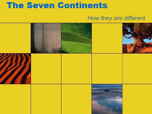
The Seven Continents
¾ of the Earth is covered in water,the big bodies of water on Earth are called oceans and the big pieces of land on Earth are called continents.
United Mexican States ['meksikən] 墨西哥城 Mexico City ['meksikəu]
Canada 渥太华 Ottawa ['ɔtəwə]
巴拿马 Republic of Panama [,pænə'mɑ:]巴拿马城 Panama
古巴 Republic of Cuba [‘kju:bə]哈瓦那 Havana hə’vænə]
Republic
['ɑ:dʒəntain]布宜诺斯艾利斯
Buenos
Aires
Amazon
[,bwenəs'aiəriz]
rainforest
Europe
Europe (43个国家/1个地区)
北欧:芬兰、瑞典、挪威、冰岛、丹麦 法罗群岛(丹)
东欧:爱沙尼亚、拉脱维亚、立陶宛、白俄罗斯、俄罗斯、乌克兰、摩尔多瓦
冰岛 Republic of Iceland 雷克雅未克 Reykjavik ['reikjəvik]
瑞典 Kingdom of Sweden ['swi:dən]斯德哥尔摩 Stockholm ['stɔkhəum]
芬兰 Republic of Finland ['finlənd]赫尔辛基 Helsinki ['helsiŋki]
尼达和多巴哥、 安提瓜和巴布达、 圣基茨和尼维斯
The USA, Mexico, and Canada are the three biggest countries in North America
United States of America 华盛顿 Washington ['wɔʃiŋtən]
Republic of Chile ['tʃili]圣地亚哥 Santiago [,sænti:'eiɡəu]
秘鲁 Republic of Peru 利马 Lima ['li:mə]
巴拉圭 Republic of Paraguay ['pærəɡwai]亚松森 Asuncion
阿根廷
Argentine
中欧:波兰、捷克、斯洛伐克、匈牙利、德国、奥地利、瑞士、列支敦士登
西欧:英国、爱尔兰、荷兰、比利时、卢森堡、法国、摩纳哥
南欧:罗马尼亚、保加利亚、塞尔维亚、马其顿、阿尔巴尼亚、希腊、斯洛文尼亚、克罗地亚、波斯尼亚和墨塞哥维那 意大利、
梵蒂冈、圣马力诺、马耳他、西班牙、葡萄牙、安道尔
挪威 Kingdom of Norway ['nɔ:wei]奥斯路 Oslo ['ɔzləu