COMPASS使用手册,兰德马克说明书
最新COMPASS使用手册,兰德马克说明书

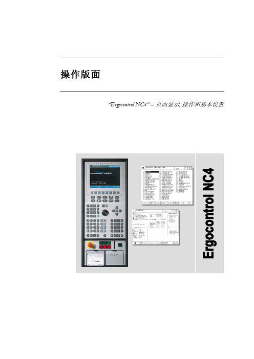
1COMPASS for Windows 5.3.1 2COMPASS for Windows of Landmark Graphics Co. 3简明使用手册456789101112131415161718192021222324252627282930313233343536目录3738一、COMPASS WELLPLAN FOR WINDOWS 功能简介39二、COMPANY SETUP - CREATE NEW COMPANY:公司设置-建立新的公司40三、FIELD SETUP- CREATE NEW FIELD:油气田设置-建立新的油气田41四、SITE SETUP- CREATE NEW SITE:区块设置-建立新的区块42五、TEMPLATE EDITOR:槽口模板编辑器43六、WELLSETUP-CREATE NEW WELL:单井设置-建立新井44七、WELLPATH SETUP-CREATE NEW WELLPATH:轨迹设置-建立新的轨迹45八、TARGET EDITOR:靶点编辑器46九、NEW PLAN & OPEN PLAN:井眼轨迹设计47十、NEW SERVEY& OPEN SERVEY:实测数据建立与编辑48十一、A NTICOLLISION:防碰计算49十二、W ALL PLOT COMPOSER:挂图制作50十三、常用功能简介51525354COMPASS WELLPLAN FOR WINDOWS 功能简介5556COMPASS(指南针)有三个核心功能:57PLANNING(设计)按计划井眼形状设计井眼轨迹58SURVEY(实测计算)已钻井眼实测数据的计算及轨迹预测59ANTICOLLISION(防碰计算)井眼轨迹之间的距离计算6061除此之外,COMPASS还有以下功能:62COMPANY SETUP 允许你为不同的公司设置COMPASS63FIELD SETUP 为同一油田的所有平台定义通用的水平或垂直参考系统64TARGET EDITOR 靶点编辑器,设置靶点位置及靶区形状65TEMPLATE EDITOR 槽口编辑器,用于丛式井井口坐标计算66REFERENCE DATUM ELEVATIONS 定义不同的海拔高度参照基准67MAGNETIC CALCULATOR 计算不同磁场模型的磁场值68GEODETIC CALCULATOR 不同地质坐标系之间的数值转换计算69SURVEY TOOLS 定义不同测量工具的测量误差707172737475767778COMPANY SETUP - CREATE NEW COMPANY79公司设置-建立新的公司8081建立一个新的公司,实际上就是为你建立的这个新公司对COMPASS软件进82行一些基础参数设置,也就是COMPANY SETUP(公司设置)。
德马格中文操作说明书
液压顶出 后退 / 前进
气阀 1-4 打开
中子 抽芯 / 进芯
自动安全门 打开 / 关闭
Rotary table index bolt move in / move out
模厚调整 增加 / 减小
旋转模板 逆时针 /顺时针
提示 “模厚调整”按钮只针对曲轴式机床。“自动安全门”和“气阀 1-4”按钮只有当这些功 能配置以后才起作用。“Rotary table latches”, Rotary table index bolt” and “旋转模板”应 用于带转转模板的多色注塑 。
Sfu服EnRc务tVio页InC面Egr功oup 能组
Afu报LnAc警tRio功Mn能Sgr组oup
Fig. 2: 功能选择键
1.2 手动功能键
在手动和点动模式下可通过下面的按钮(见Fig. 3 和 Fig. 4)进行相应的操作。 Fig. 3: 手动模具装置功能
模具 打开 / 闭合
Rotary table latches move in / move out
4.4
帮助功能键和专家系统 .......................................................................................................19
5
频幕 ..........................................................................................................20
Pfu程RnOc序tGio功Rn能AgrM组oSup
Process 过Pfu程RnOc控tCio制EnS功gSr能oCu组pONTROL
IXBlue G ST TSH 四元机 compass 说明书

QUADRANSIMO grade surface gyrocompass & attitudereference systemTECHNICAL OFFERTable of contents1.Introduction (3)1.1.Technology (3)1.2.Product Description (4)1.3.Software interface (5)1.3.1.“WEB-based” Graphic User Interface (GUI) (5)munication protocol and software library (6)1.4.Certification (7)2.Performance & Specifications (8)2.1.Sensors (8)2.1.1.Gyrocompass and motion sensor (8)2.1.2.Navigation (8)pass safe distance (8)2.3.Mechanical (8)2.4.Control (9)2.5.Power supply (9)2.6.Reliability (9)2.7.Environment (9)3.Scope of supply (10)3.1.Standard product pack (10)3.2.Packing list (10)3.3.Optional accessories and services (10)3.3.1.Accessories (10)3.3.2.Services (10)3.3.3.Ancillaries (11)4.Interface (12)4.1.Electrical interface (12)4.1.1.Power supply connector (S103Z052) (12)4.1.2.Serial ports connector (S104A092) (12)4.1.3.I/O pulses connector (S104A086) (13)4.1.4.Ethernet connector (S103A053) (13)4.2.Mechanical interface (14)4.2.1.Mechanical overview (14)4.2.2.Interface Plate (15)1.IntroductionIMO Grade Surface GyrocompassAll-in-one high-accuracy Attitude and HeadingReference SensorHeading, Roll, Pitch, rate of turnFiber-Optic Gyroscope (FOG), unique strap-down technologyNo spinning element, no gas cavity hencemaintenance freeLow latency for real time control loopsMultiple interfaces – aiding sensors for a rangeof applicationsEthernet for fast and easy integrationTime stamping for all dataCompact, lean and reliableAppropriate for all marine applicationsUp to 5 years free warranty1.1.TechnologyQUADRANS is providing raw accelerations and rotations of a body frame.The inertial measurement unit is the core component of the system. It is the assembly of three Fiber Optic Gyroscopes (FOGs) and three accelerometers mounted on three orthogonal axes.A fiber optic gyroscope is a 2 wave ring interferometer made of a multi-turn fiber coil enclosing anarea A(see Figure hereafter). Light entering the interferometer is split into two counter propagating waves which recombine perfectly in phase after having travelled along the same path in opposite directions. When the FOG is rotating, a relativistic effect, known as Sagnac effect, induces a difference of transit time between the two waves which can be measured by interferometric means. The difference of transit time is proportional to the product of the rotation rate Ω and the area A enclosed by the coil (counted as many times as the fiber coil turns around A).The FOG sensitivity can be increased by increasing the number of turns of the fiber coil and/or the fiber coil diameter.The heart of a FOGFOGs manufactured by iXBlue cover the medium to very high performance range: from 0.1 deg per hour bias to 0.0003 deg per hour bias (for space applications).1.2. Product DescriptionQUADRANS is a small size, low weight, low power consumption, IMO-certified, solid-state Fiber-Optic gyrocompass providing all necessary data for demanding navigation and control applications: True-North heading, roll, pitch and rates of turn.Developed for high end marine gyrocompass applications, it can be interfaced easily with other industry standard navigation sensors and systems.Based on iXBlue’s latest Fiber -Optic Gyroscope (FOG) technology, QUADRANS has no moving part and offers high performance and long lifetime without any need for preventive maintenance.Compact and rugged QUADRANS mechanical design1.3.Software interface1.3.1.“WEB-based” Graphic User Interface (GUI)QUADRANS is delivered with iXBlue WEB-based graphic user interface which is progressively installed to the full range of products, providing a common look-and-feel to the whole iXBlue range.Directly Ethernet compatible, this feature greatly improves the ease of installation and operation of the equipment thanks to its interactive menu screens and network characteristics. QUADRANS is easily interfaced to any TCP/IP network or wireless network, and running the WEB-based GUI is achieved with any terminal with WEB browser installed (PC computer, MAC, pocke t PC’s, etc): dedicated PC and software is no longer required when using the system.Using graphic and conversational menu screens the WEB-based GUI allows:Defining the installation parameters i.e., the parameters that do not change from one missionto another, orientation and misalignment of the system with respect to the vessel(MECHANICAL PARAMETERS option), lever arms for external monitoring points, the INPUTS(external sensors, UTC), the OUTPUTS and the IP address, DHCP and PPP modes, network mask(NETWORK option)Defining the set-up parameters i.e., the parameters that may vary from one mission to anotheror even during the same mission: manual position and speed updates, external sensorsconfiguration, warning configuration, etc.Monitoring the QUADRANS operations such as∙Display data in real time∙Be informed of the system status∙Data logger∙Check the initial alignment procedurePerforming maintenance tasks including:∙System restart∙Firmware updates∙Parameters reset∙Support contactNote:The use of the WEB-based User Interface is not necessary to operate the system. It is a tool for configuring the system, modifying configuration during operation, and displaying or recording data output from the system.WEB based interface screen example1.3.munication protocol and software libraryAll communication to and from QUADRANS are achieved using industry standard NMEA0183, ASCII or binary data telegrams through the Ethernet or serial input/output ports, messages content is fully described in the user manual provided with the equipment.This allows QUADRANS to smoothly interface to iXBlue or already existing third party hardware and software, or easily interface to peripherals or other systems.1.4.CertificationQUADRANS is certified with the International Maritime Organization for gyrocompasses and ISO 8728.QUADRANS is certified with the International Maritime Organization for gyrocompasses for High Speed Craft and ISO 16328.For any other certification request, please contact us.2.Performance & Specifications2.1.Sensors2.1.1.Gyrocompass and motion sensor(1)Secant latitude = 1 / cosine latitude(2)RMS values. 68% of the data is within this value of confidence(3)Initial alignment must be performed in static conditions or at drift(4)Maximum error=3*RMS error2.1.2.NavigationPosition & Speed are available with QUADRANS.Position accuracy is dependent on aiding position sensor accuracy; typically we reduce the level of noise of the external aiding device by a factor 3 and rejects position spikes to provide smooth and high data rate navigation.pass safe distance2.3.Mechanical(5)Two alignment pin holes are provided under the base plate for accurate assembly/removal of QUADRANS2.4.ControlAll inputs/ outputs are available on the Ethernet link. Outputs can be duplicated both on serial and Ethernet port.QUADRANS supports the input of GPS or EM log for ease of operation and full heading accuracy2.5.Power supply2.6.Reliability2.7.Environment(6)IMO specification and criteria3.Scope of supply3.1.Standard product pack3.2.Packing list3.3.Optional accessories and services3.3.1.Accessories3.3.2.Services3.3.3.AncillariesiXBlue offers a complementary range of highly reliable ancillaries which have been qualified for QUADRANS installation. Different types of repeaters, interface box and uninterruptible power supplies with different features are also available on request.For more information, please contact us.4.Interface4.1.Electrical interfaceThe connector references of QUADRANS are as follows:Power supply: S103Z052Serial ports: S104A092I/O pulses: S104A086Ethernet: S103A0534.1.1.Power supply connector (S103Z052)Pin # Signal1 24 V DC2 Electrical Ground (0V)3 Mechanical Ground4.1.2.Serial ports connector (S104A092)Pin # Signal1 Port A TX RS232 / TX RS422 (port A)2 Port A TX RS422 (port B)3 Port A TX GND (7)4 Port B TX RS232 / TX RS422 (port A)5 Port B TX RS422 (port B)6 Port B TX GND (7)7 Port A RX RS232 / RX RS422 (port B)8 Port A RX RS422 (port A)9 Port A RX GND (7)10 Port B RX RS232 / RX RS422 (port B)11 Port B RX RS422 (port A)12 Port B RX GND (7)13 Reserved14 Reserved15 Reserved16 Repeater TX RS23217 Repeater RX RS23218 Reserved19 Repeater RX/TX GND (7)(7)All RX/TX GND are isolated from each other.Plug pin-out (soldering side) Plug pin-out (soldering side)4.1.3.I/O pulses connector (S104A086) Pin # Signal1 PPS input signal2 PPS input GND3 Reserved4 Reserved5 Input pulse A signal (8)6 Input pulse A GND (8) (9)7 Input pulse B signal (8)8 Input pulse B GND (8) (9)9 Input pulse C signal (8)10 Input pulse C GND (8) (9)11 Pulse out A signal12 Pulse out A GND (9)13 Pulse out B signal14 Pulse out B GND (9)15 Reserved16 Reserved(8)Can be used as incoming event marker or EM LOG input pulse signals.(9)All pulse GND signals are common.4.1.4.Ethernet connector (S103A053)Pin # Signal1 Ethernet TX+2 Ethernet TX-3 Ethernet RX+4 Ethernet RX- Body Ethernet shieldPlug pin-out (soldering side) Plug pin-out (soldering side)4.2.Mechanical interface4.2.1.Mechanical overview4.2.2.Interface Plate。
COMPASS软件操作手册

概述COMPASS软件具有3个核心功能:设计用以设计井身轨道测量用以计算所钻井的井眼的位置参数防碰用以计算与参考井之间的距离除此之外还有如下功能:公司设置可以针对不同的公司对COMPASS进行系统参数的配置油田设置用以为一组区块定义统一的和垂直参考系统参数靶点编辑器定义靶点的位置和形状样板编辑器井口坐标的计算器参考数据海拔用以定义不通的垂直数据地磁计算器可以用不同的地磁模型计算磁场的参数测地计算器为不同的坐标系统进行转换测量工具联合多种不同的测量工具定义误差测量历史选择哪一组测量参数作为确定的井身轨迹其中参数的英文对照如下:使用步骤:1)安装,注意安装完毕按照说明进行破解。
并且不能安装在中文目录名内,而且英文字符不能超过8位。
2)安装完毕运行首先进行单位设置,推荐使用国际单位SI标准,方法是点击Utilities菜单,选择units再调入预设的SI单位集合即可,注意此时狗腿度的单位是度/30m,可以根据个人习惯进行调整。
3)第一次使用首先建立一个新公司(company)如二勘、六勘等等,注意在company对话框内一定要选择中国钻井行业规定的标准-曲率半径法(Radius of Curvature),并且根据需要选择坐标的原点(Co-ordinate)是区块(site)的中心还是井口(slot)的中心。
如果不涉及防碰,不需要比较两井的相当位置时,建议选择井口的中心作为原点。
4)建立一个油田(field)如胜利、大庆、塔指等等。
5)建立一个区块(site)如哈得、塔河等等。
可以输入本区块的中心坐标(如果愿意)。
6)建立一口井(well),名字用井号如:轮古37等等,并输入本井的井口坐标。
7)建一个轨道(wellpath),一口井可以建立数个轨道。
并可以指定其中的一个为确定的(definitive)轨道。
8)选择EDIT(编辑)-Wellpath(轨道)-targets(靶点)菜单(或直接点工具栏的按钮),进入靶点设计,输入靶点的名字、垂深、坐标、形状,保存退出。
compass简易教程

compass简易教程概述COMPASS软件具有3个核心功能:l 设计用以设计井身轨道l 测量用以计算所钻井的井眼的位置参数l 防碰用以计算与参考井之间的距离除此之外还有如下功能:l 公司设置可以针对不同的公司对COMPASS进行系统参数的配置l 油田设置用以为一组区块定义统一的和垂直参考系统参数l 靶点编辑器定义靶点的位置和形状l 样板编辑器井口坐标的计算器l 参考数据海拔用以定义不通的垂直数据l 地磁计算器可以用不同的地磁模型计算磁场的参数l 测地计算器为不同的坐标系统进行转换l 测量工具联合多种不同的测量工具定义误差l 测量历史选择哪一组测量参数作为确定的井身轨迹其中参数的英文对照如下:MD 测量深度Company 公司Inc 井斜Field 油田Az 方位Site 区块TVD 垂深Well 井号N/S 南北坐标Well path 井身轨道E/W 东西坐标Plan 设计V.sec 投影位移Survey 测量Dleg 狗腿度(全角变化率)Antcollision 防碰Toolface 工具面角Utilities 功能设置Build 造斜率Radius of Curvature 曲率半径法Turn 扭方位率Targets 靶点使用步骤:1) 安装,注意安装完毕按照说明进行破解。
并且不能安装在中文目录名内,而且英文字符不能超过8位。
2) 安装完毕运行首先进行单位设置,推荐使用国际单位SI标准,方法是点击Utilities菜单,选择units再调入预设的SI单位集合即可,注意此时狗腿度的单位是度/30m,可以根据个人习惯进行调整。
3) 第一次使用首先建立一个新公司(company)如二勘、六勘等等,注意在company对话框内一定要选择中国钻井行业规定的标准-曲率半径法(Radius of Curvature),并且根据需要选择坐标的原点(Co-ordinate)是区块(site)的中心还是井口(slot)的中心。
Compassx流动头操作指南说明书

Fluid HeadOPERATOR’S MANUAL1090 Compass x2Fluid Head 1092 Compass x6 Fluid Head 1093 Compass x8Fluid Head 1096 Compass x10 Fluid Head1098 Compass x18 Fluid HeadThank you for purchasing the Compass x Fluid Head. The Compass x Fluid Head has been designed to suit a wide range of cameras, lenses and accessories as demanded by professional users.The robust design and construction of the Compass x Fluid Head offers maximum stability and durability and includes a precision drag plate system in the pan and tilt assembly to deliver true fluid drag performance over the entire temperature and payload range.The fluid drag and the counterbalance system were designed to provide excellent control and repeatability and offer progressive equal increments of drag and torque through the unique radial ring design.The Compass x Fluid Head will give best performance whenused on a wide range of Miller tripods, including SOLO, T oggle, Sprinter II and HD T ripods (depending on bowl size). This will ensure maximum system stability to suit any professional set-up. The Compass x Fluid Head will suit most industry standard75mm and 100mm tripods as well, please refer to manufactures’ manual for mounting details.Safety InstructionsPlease use this manual to familiarise yourself with the operation of the Compass x Fluid Head and observe these instructionsto prevent any damage to your equipment. Ensure that all equipment is operating correctly and free from defects and damage, also please ensure that the tripod is steady, secure and that the bowl is approximately horizontal when attaching the camera. The operator is responsible for the safe operation of this piece of equipment.• Do not exceed the maximum payload capacity of the Fluid Head.• Do not leave the camera unattended on the Fluid Head.• Do not release the SLIDE LOCK LEVER whilst the camera is at an angle.• Do not adjust the tripod whilst the camera is attached to the Fluid Head.• Ensure PAN HANDLE CLAMP and CLAMP NUT is securely tightened.• Apply TILT LOCK when adding/removing equipment from the camera or when attaching/removing the camera from the Fluid Head.• Hold camera securely whilst changing Counterbalance, Pan Drag or Tilt Drag settings.• Hold the camera securely whilst releasing the SAFETY RELEASE LEVER.• H old camera securely whilst adjusting the CLAMP NUT to level the Fluid Head.2. M ounting Y our Camera2.1 Remove the CAMERA PLATE by lifting the SAFETYRELEASE LEVER on the PLATFORM (SLIDE LOCK LEVER must be unwound (clockwise)) (Fig. 3a).2.2 Attach the CAMERA PLATE to the camera 1 such that the Centre of Gravity (C of G)2 mark on the camera is approximately in the middle of the camera plate.2.3 Tighten PAN/TILT LOCKS, mount the CAMERA PLATEto the PLATFORM non-locking side first. The side load lock mechanism will capture camera plate (distinct click sound will be made when CAMERA PLATE is retained). CAMERA PLATE will be able to slide freely (60mm) until SLIDE LOCK LEVER is tightened.2.4 Untighten TILT LOCK, slide the CAMERA PLATE suchthat the camera’s C of G is directly above the centre axis of the Fluid Head (fig. 3b), camera should be balanced (if not slide camera backward or forward). Once balanced tighten the SLIDE LOCK LEVER (anti-clockwise)3 and tighten TILT LOCK.If this cannot be achieved then reposition the CAMERA PLATE on the Camera – step 2.2.NOTES:1Refer to the camera’s owners manual for correct method of attachment to the CAMERA PLATE. Remove the 1⁄4” screw or 3/8” screw as required.2The camera’s C of G can be estimated by placing the camera on to a round rod and then shifting it backwards or forwards until a balance point – C of G - is achieved. It is recommended to identify this point on the camera as it will be useful in step 2.2.3Ensure SLIDE LOCK LEVER is tightened at all times when you are not finding C of G or mounting/dismounting camera.3. C ounterbalance ControlThe counterbalance system was designed to neutralise theeffect of the camera weight when it is tilted. The Compass xFluid Head offers a 16 position counterbalance system whichis operated with the CB SELECTOR RING and the CB PLUSSELECTOR (Fig. 4). With the Compass x systems it is also Array possible to disengage counterbalance (position zero),NOTE:Be careful when disengaging counterbalance as you coulddamage your equipment with an unwanted tilt drop.The CB SELECTOR RING and the CB PLUS SELECTOR mustbe operated when the BASE PLATE is in a horizontal position.After changing the counterbalance setting it may benecessary to tilt the camera back and forth to ensure that theCB spring has engaged.3.1 For safety it is generally better to start at a highercounterbalance position (e.g. position 14) and work yourway to the correct setting, this is to reduce any chance ofunwanted tilt drops (Fig. 4).3.2 Hold the camera and release the TILT LOCK, then gentlytilt the camera from the horizontal position forwardthen backward and observe its response. If the camera‘springs back’ to the horizontal position then a lowercounterbalance setting is required, use the CB SELECTORRING to cycle through all even number positions (eightpositions including zero).3.3 Finer adjustments can be made by engaging the CB PLUSSELECTOR (upward direction).3.4 Correct counterbalance setting has been achieved whenthe camera does not spring back or drop when panhandle is released.Fig. 44. P an/Tilt Drag ControlThe Compass x Fluid Head offers selectable positions offluid drag in the Pan and Tilt (including zero positions). The settings are equally stepped from lighter drag in position 1 up to heavier drag in position 3 on CX2 and CX6 models and position 5 on CX8, CX10 and CX18 models, the drag plates are completely disengaged in position zero.• D o not pan or tilt the Fluid Head whilst adjusting PAN orTILT DRAG CONTROL or whilst the PAN and TILT DRAGCONTROL is between settings.• The drag setting can be changed at any tilt or pan angle.5. P an/Tilt Lock ControlThe Compass x Fluid Head offers high capacity caliper disc brake system to hold the Fluid Head in a fixed pan and/or tilt position. Camera position will not change when applying or releasing the Pan-tilt locks.• D o not pan or tilt the Fluid Head whilst the PAN or the TILT LOCK is partially applied.6.IlluminationCompass x Fluid Head offers illumination of the BUBBLE TheLEVEL when the low ambient light conditions exist.Illumination can be achieved by pressing the LED BUTTON once. The light will switch off after 10 seconds.The Compass x Fluid Head offers high quality surface coatings, Array dust and moisture seals. Miller recommends keeping the Fluid Head clean at all times by using soft brushes and lint free cloth to wipe over the surfaces.• Do not immerse the Fluid Head in any liquid.• Do not use stiff brushes, abrasives, harsh detergents and solvents.Battery ReplacementT he Compass x Fluid Head uses a single 11A type - 6 Volt bat-tery for Illumination. Miller recommends the following batteries to provide long life performance – GP11A, Duracell MN11 or Vinnic L1016.1. Using a Phillips Head #1 screw driver, remove theRETAINING SCREW and the BATTERY COVER.2. Using a small flat screw driver remove the battery.3. Align the new battery as shown on the back of theBATTERY DOOR and place into the BATTERY HOUSING,then push down the battery into place. A small flat screw driver may be used to push down the battery into theBATTERY HOUSING.4. Align the BATTERY DOOR into the body then tighten thescrew lightly.11The Compass x Fluid Head can be stored for extended periods; Miller recommends storage in a Miller case and the following:• Clean the external surfaces.• Keep in a dry place away from direct sunlight.•Loosen off PAN & TILT LOCK.Spare Parts and AccessoriesService, Sales and SupportMiller Authorised Service Agents must carry out all service and repair work. Failure to observe this requirement may void warranty .It is advisable to notify Miller or a Miller Authorised Service Agent if a change of performance is observed as a result of dropping or rough usage. For information regarding sales and service of Miller products or for your nearest Miller representative please contact us via our website or at the following:MILLER CAMERA SUPPORT EQUIPMENT 30 Hotham ParadeArtarmon, Sydney, NSW 2064 Australia P +61 2 9439 6377 F +61 2 9438 2819 ****************.auMILLER Camera Support (LLC) USA 216 Little Falls Road (Unit 15 & 16), Cedar Grove, New Jersey 07009 USA P +1 (973) 857 8300 F +1 (973) 857 8188 **********************MILLER FLUID HEADS (EUROPE) LTD.12A, Shepperton Business Park Govett Avenue, Shepperton Middlesex, TW17 8BA United KingdomP +44 (0) 1932 222 888 F +44 (0) 1932 222 211******************************ITEM ITEM NO.BatteryP3798Camera screw 3/8”P0037Camera screw 1/4”P0036Serrated washerPN12501Pan handle - fixed with clamp 679Pan handle - telescopic with clamp696Accessory mounting adaptor 1/4” and 3/8” 1217Accessory mounting bracket 1218Sliding Plate Assembly (Euro)*1210X Sliding Plate Assembly (Mini Euro)*1206X1/4” screw and pin carriage493*1206 & 1210 are not compatible with CompassX, use 1206X & 1210X only.WarrantyPlease refer to warranty card for complete details. MILLER CAMERA SUPPORT EQUIPMENT 30 Hotham ParadeArtarmon, SydneyNSW 2064 AustraliaTel: +61 2 9439 6377Fax: +61 2 9438 2819Email: sales@.auD12728-2。
Landmark钻井软件的使用(技术员课件)
二、Compass坐标系统与定位
㈠ 坐标系—地理坐标
过 P 点的子午面与通过英国格林尼治天文台的子午面所夹的二面角, 叫做 P 点的地理经度(简称经度),用字母λ表示。国际规定通过英 国格林尼治天文台的子午线为本初子午线(或叫首子午线),作为计算 经度的起点,该线的经度为 0 度,向东 0-180 度叫东经,向西 0-180 度叫西经。
防碰方法选择—水平面扫描法
水平面扫描是指在扫描井轨迹上任 一井段按需要的精度间距,截取许多水 平截面,求相关邻井与此水平面的截点 坐标。然后在各个水平截面上以扫描点 为圆心,作极坐标图,在图上对扫描点 与邻井同一垂深点的相互距离和方位进 行分析的方法。
相比于本文前述的两种扫描方法, 平面距离扫描方法最为简单,但由于误 差较大,因此常用于直井段以及井斜较 小情况下的扫描计算。
二、Compass坐标系统与定位
㈡ 地图投影方法—UTM投影
UTM 投影全称为“通用横轴墨卡托投影”,美国于 1948 年完成这种 通用投影系统的计算。与高斯-克吕格投影相似,该投影角度没有变形, 中央经线为直线,且为投影的对称轴,在 6 度带内最大长度变形不超过 0.04%。
投影分带
UTM 投影分带方法与高斯-克吕格投影相似,不过是自西经 180°起 每隔经差6 度自西向东分带,将地球划分为 60 个投影带。高斯-克吕格 投影的第 1 带是 UTM 的第 31 带。
㈢ 方位参考 方位修正
二、Compass坐标系统与定位
根据磁偏角的定义,相对于真北,磁北东偏,磁 偏角为“+”,西偏为“-”;
根据子午线收敛角的定义,相对于真北,坐标北 东偏,子午线收敛角为“+”,西偏为“-”。 坐标方位与磁方位角之间的转换:α= Am +δ-γ 坐标方位与真方位角之间的转换:α= A -γ 真方位与磁方位角之间的转换: A = Am+ δ
compass教程
compass教程COMPASS for Windows 5.3.1 COMPASS for Windows of Landmark Graphics Co.简明使用手册目录一、COMPASS WELLPLAN FOR WINDOWS 功能简介二、COMPANY SETUP - CREATE NEW COMPANY:公司设置-建立新的公司三、FIELD SETUP- CREATE NEW FIELD:油气田设置-建立新的油气田四、SITE SETUP- CREATE NEW SITE:区块设置-建立新的区块五、TEMPLATE EDITOR:槽口模板编辑器六、WELLSETUP-CREATE NEW WELL:单井设置-建立新井七、WELLPATH SETUP-CREATE NEW WELLPATH:轨迹设置-建立新的轨迹八、TARGET EDITOR:靶点编辑器九、NEW PLAN & OPEN PLAN:井眼轨迹设计十、NEW SERVEY& OPEN SERVEY:实测数据建立与编辑十一、 ANTICOLLISION:防碰计算十二、 WALL PLOT COMPOSER:挂图制作十三、常用功能简介COMPASS WELLPLAN FOR WINDOWS 功能简介COMPASS(指南针)有三个核心功能:PLANNING(设计)按计划井眼形状设计井眼轨迹SURVEY(实测计算)已钻井眼实测数据的计算及轨迹预测ANTICOLLISION(防碰计算)井眼轨迹之间的距离计算除此之外,COMPASS还有以下功能:COMPANY SETUP 允许你为不同的公司设置COMPASSFIELD SETUP 为同一油田的所有平台定义通用的水平或垂直参考系统TARGET EDITOR 靶点编辑器,设置靶点位置及靶区形状TEMPLATE EDITOR 槽口编辑器,用于丛式井井口坐标计算REFERENCE DATUM ELEVATIONS 定义不同的海拔高度参照基准MAGNETIC CALCULATOR 计算不同磁场模型的磁场值GEODETIC CALCULATOR 不同地质坐标系之间的数值转换计算SURVEY TOOLS 定义不同测量工具的测量误差COMPANY SETUP - CREATE NEW COMPANY公司设置-建立新的公司建立一个新的公司,实际上就是为你建立的这个新公司对COMPASS 软件进行一些基础参数设置,也就是COMPANY SETUP (公司设置)。
Compass 90 硬件说明书
Standard Hardware Con guration Shown
Dead Zone
TOP VIEW (Quick Release Toggle not shown)
Standard Con guration (as shipped)
Flipped 90° Bracket and Cane Clamp Flipped 90° Bracket
90° Compass® Hardware Adjustment Reference Sheet
TOP VIEW (Quick Release Toggle not shown)
Dead Zone
TOP VIEW (Quick Release Toggle not shown)
Standard Con guration (as shipped) Flipped Cane Clamp Flipped Cane Clamp and Cam Latch Bracket Cane Tube Center Line
Angle Adjustment
Standard Hardware Con guration Shown
12˚
SIDE VIEW (Quick Release Toggle not shown)
18˚
-1 0 +1 +2
Compass® hardware with a ipped 90˚ Bracket is width adjustable to 2” (5.1 cm) wider than the ordered backrest width.
Compass® Hardware - US Patent No. 7,104,610 & 7,891,739 Apparatus for Mounting a Wheelchair Back
landmark---COMPASS中文使用手册
COMPASS for Windows 5.3.1 COMPASS for Windows of Landmark Graphics Co.简明使用手册目录一、COMPASS WELLPLAN FOR WINDOWS 功能简介二、COMPANY SETUP - CREATE NEW COMPANY:公司设置-建立新的公司三、FIELD SETUP- CREATE NEW FIELD:油气田设置-建立新的油气田四、SITE SETUP- CREATE NEW SITE:区块设置-建立新的区块五、TEMPLATE EDITOR:槽口模板编辑器六、WELLSETUP-CREATE NEW WELL:单井设置-建立新井七、WELLPATH SETUP-CREATE NEW WELLPATH:轨迹设置-建立新的轨迹八、TARGET EDITOR:靶点编辑器九、NEW PLAN & OPEN PLAN:井眼轨迹设计十、NEW SERVEY& OPEN SERVEY:实测数据建立与编辑十一、ANTICOLLISION:防碰计算十二、WALL PLOT COMPOSER:挂图制作十三、常用功能简介COMPASS WELLPLAN FOR WINDOWS 功能简介COMPASS(指南针)有三个核心功能:PLANNING(设计)按计划井眼形状设计井眼轨迹SURVEY(实测计算)已钻井眼实测数据的计算及轨迹预测ANTICOLLISION(防碰计算)井眼轨迹之间的距离计算除此之外,COMPASS还有以下功能:COMPANY SETUP 允许你为不同的公司设置COMPASSFIELD SETUP 为同一油田的所有平台定义通用的水平或垂直参考系统TARGET EDITOR 靶点编辑器,设置靶点位置及靶区形状TEMPLATE EDITOR 槽口编辑器,用于丛式井井口坐标计算REFERENCE DATUM ELEVATIONS 定义不同的海拔高度参照基准MAGNETIC CALCULATOR 计算不同磁场模型的磁场值GEODETIC CALCULATOR 不同地质坐标系之间的数值转换计算SURVEY TOOLS 定义不同测量工具的测量误差COMPANY SETUP - CREATE NEW COMPANY公司设置-建立新的公司建立一个新的公司,实际上就是为你建立的这个新公司对COMPASS软件进行一些基础参数设置,也就是COMPANY SETUP(公司设置)。
- 1、下载文档前请自行甄别文档内容的完整性,平台不提供额外的编辑、内容补充、找答案等附加服务。
- 2、"仅部分预览"的文档,不可在线预览部分如存在完整性等问题,可反馈申请退款(可完整预览的文档不适用该条件!)。
- 3、如文档侵犯您的权益,请联系客服反馈,我们会尽快为您处理(人工客服工作时间:9:00-18:30)。
COMPASS for Windows for Windows of Landmark Graphics Co.简明使用手册目录一、COMPASS WELLPLAN FOR WINDOWS能简介二、COMPA NY SETUP - CREATE NEW COMP:公司设置-建立新的公司三、FIELD SETUP- CREATE NEW Fl:曲气田设置-建立新的油气田四、SITE SETUP- CREATE NEW SITE块设置-建立新的区块五、TEMPLATE EDITOR槽口模板编辑器六、WELLSETUP-CREATE NEW W E单井设置-建立新井七、WELLPATH SETUP-CREATE NEW WELLPAT迹设置-建立新的轨迹八、TARGET EDITOR?巴点编辑器九、NEW PLAN & OPEN PLAN井眼轨迹设计十、NEW SERVE Y& OPEN SERVE实测数据建立与编辑ANTICOLLISIO N防碰计算十WALL PLOT COMPOSERS 图制作十三、常用功能简介COMPASS WELLPLAN FOR WINDO功S B简介COMPAS(S 指南针)有三个核心功能:PLANNING (设计)按计划井眼形状设计井眼轨迹SURVEY(实测计算)已钻井眼实测数据的计算及轨迹预测ANTICOLLISION:防碰计算)井眼轨迹之间的距离计算除此之外,COMPAS还有以下功能:COMPANY SETUP 允许你为不同的公司设置COMPASSFIELD SETUP 为同一油田的所有平台定义通用的水平或垂直参考系统TARGET EDITOR 靶点编辑器,设置靶点位置及靶区形状TEMPLATE EDITOR 槽口编辑器,用于丛式井井口坐标计算REFERENCE DATUM ELEVATIONS^不同的海拔高度参照基准MAGNETIC CALCULATO R算不同磁场模型的磁场值GEODETIC CALCULATORS同地质坐标系之间的数值转换计算SURVEY TOOLS 定义不同测量工具的测量误差COMPANY SETUP - CREATE NEW COMPANY公司设置-建立新的公司建立一个新的公司,实际上就是为你建立的这个新公司对 COMPASS 件进行 一些基础参数设置,也就是 COMPANY SETUP 公司设置)。
下面按步骤说明: 1、在菜单栏上单击File 菜单,选取New Company 选项或单击工具栏中图标(编辑当前已打开公司),将会出现以下对话框: lonpajiy iietup 一 Craate CompanyAnLhcoNuior Freleiencjes: SEpdidtiuri FduliM Wdiriimy Rntio从tion l M 1- h.oo Iget 2: |1 I L2 1 |1 50 \Defaults : S'urvoy C>jilcuilatiori Mothodl国 Co iardiftalA DBigin:O Clot Q Site W»lc/Turn R^te~ O MD 厂 HDL2、对话框中:在Company 栏填入所在公司的名称,Division 栏中填入子公司或专 业公司的名称,Group 栏中填作业组的名称。
后二栏没有具体作用。
Logo 下拉栏中可以选择已制作好的公司标志,用在图形或报告中 3、 选中Locked 复选框后,在COMPASS^的一些缺省值将不能被改动。
可以配合 密码使用,单击 Company Level Password^ Locked Data Passworc 旁边的按钮,在 出现的对话框中可输入密码。
第一次输入密码,需输二次,如果是修改旧密码, 必需先输入旧的密码。
密码设定后,每次解锁时就需先输入密码。
4、 Anticollision Preferences 防碰参数设定:Error System 下拉栏中可以选择所需的 系统误差模型,一般选择 Systematic Ellipse (椭圆系统);Scan Method 下拉栏中可 以选择扫描模式,一般选择 Closest Approach 3D (3D 渐近);Error Surface 下拉栏 中选择表面误差,一般为 Elliptical Conic (椭圆锥体)。
Separation Factor Warning Levels 对话框中可以设定1~3级的防碰警告距离。
L DQO : ILockcd f Level Paw 件爭rd Locked Dote Paniword; Error S^tonzScan Method:Erron Surface: V.Secrian Chiqin: Q Slot 厂 SiteI Minimum C LB vature5、在Defaults (缺省值)对话栏中,可以在 Survey Calculation Method 下拉栏中选 择实测计算方法(包括最小曲率、曲率半径、平均角、平衡切线等方法) ,一般为 Minimum Curvature (最小曲率)。
而在下面的起始点设定中,可以设定 Origin (垂 直剖面原点)在 Slot (槽口)或Site (区块中心),一般选Slot ; Co-ordinate Origin(坐标中心)在 Slot (槽口)或Site (区块中心),一般选Site ;在 Walk/Turn Rate 中设定比率基准,一般以 MD (斜深)为基准。
FIELD SETUP- CREATE NEW FIELD油气田设置-建立新的油气田新油气田的建立,是对一个将要开发的油气田进行包括地质系统、海拔基准等 在内的基础参数设定(FIELD SETUP 每个公司下可以建立多个油气田。
下面按步骤说明:1、在菜单栏上单击File 菜单,选取New Field 选项或单击工具栏中(编辑当前已打开油气田),将会出现以下对话框:2、对话框中,Field 栏中填入油气田的名称;Location 栏填入油气田所在地区的描述或其他相关信息(可不填);选中Locked 复选框,可设置锁,避免被他人或无意 中修改。
3、在Geodetic system Ellipsoid 、Zone 这三个下拉栏中,可以选择不同的大地坐 Sel/qp - Cre-ete Hew Fit 吧Id.VerUCdii 呂賈tern DMumi.Mean Sea L EWC * Ibot •摇 SifxIriR NwtJh Hcl: C Iruo Q (Jiid任时阳I iBH o 窃怙 r RfldtdecmugirBeijc. Mu del标系及其所在区域,以备计算大地坐标之用(坐标系不同时,需选择 Flat Earth ) 4、Vertical System Datum 下拉栏中选择系统垂直基准面(一般以海平面为基准)下面Vertical Depths to 选择栏中,可选择垂深计算到 Local Datum (钻盘面为准) 还是System Datum (海平面为准)。
有关垂直高度基准,见下面二图:SITE SETUP- CREATE NEW SITEWater Depthhlarvey arrnrs start h a p5、Local Coordinate System (本地坐标系)选项栏中,还是Grid (地理坐标北);Centred on 选择本地是以North Ref 选择 True (真北) Site (区块)还是Field (油气 田)为中心,如选择Field ,需选择此油气田中一个 Site 为中心,见下面二图: 选择Site 选择FieldDahun(MSL)区块设置-建立新的区块这里讲的区块是指,在一个将要开发的油气田中,可能分为一个或多个小区建一个或多个平台进行开发。
一个区块就是一个平台。
建立新区块,需输入这个区块的基本参数,包括中心坐标、水深等,下面按步骤说明:1、在菜单栏上单击File菜单,选取New Site选项或单击工具栏中|舟'’图图标(编辑当前已打开区块),将会出现以下对话框:2、Site栏中填入区块或平台名称,Location栏中填入区块或平台的区域信息或其他描述(可不填),选中Locked复选框可设置锁。
3、在Centre Location选项栏中,选None-Use Co-ordinates Only将以本地为中心;选Map Co-ordinates需输入区块或平台中心的大地坐标;选Global Co-ordinates需输入区块或平台中心的经、纬度(必须在Field Setup中已选大地坐标系);选From Lease Lines需输入方位基线位移。
4、Water Depth栏中输入水深,Position Uncertainly栏中输入不确定性高度(用于浮式平台BR中输晃动范围),Magnetic Declination为磁偏角按Cacl按钮计算,Con verge nce-Azimuth of Grid North 为地理坐标北偏角按Cacl 按钮计算,Default Site Datum下拉栏选择平台海拔基准,Elevation中输入钻盘面海拔高度。
TEMPLATE EDITOR槽口模板编辑器Template Editor (槽口编辑器)是用来编辑区块或平台上丛式井槽口分布形状并根据区块或平台中心坐标计算出各槽口的坐标,以备轨迹设计之用。
下面按操作步骤做具体介绍:1、在菜单栏上单击Edit菜单,选取Site下拉栏,单击Template选项或单击工具栏中图标,将会出现左下对话框:2、规则形状的槽口模板编辑:在Slot Name中输入槽口名(如S,槽口将以S1、S2..表示)并输入模板中心坐标,在Long Name中输入描述(可不输),选择Rectangle 矩形或Circle圆形,然后单击EDIT按钮,将出现右上的对话框。
在此对话框中,可输入起始槽口号码(Start Number,以左顶部1#槽口为起点及其相对平台中心的坐标),由行(By Row)还是由列(By Column)开始,定义行列的数目及其间距,并可输入相对平台中心的旋转角度(正为顺时针,负为逆时针)。
单击0K按钮返回到上一级对话框中,单击ADD按钮,编辑好的槽口模板被储存并显示在模板列表中。
如想对某一槽口模板进行修改,只需在模板列表中点击想要修改的模板名,按步骤修改后,单击UPDATE按钮,修改后的信息将被储存。
在Template Editor对话框中,单击Con vert To Si ngle SlotS按钮后,你已编辑好的槽口模板,将被转换为单独的槽口并以单独槽口的形式显示在模板列表中,此时单击EDIT按钮,可以对每个槽口单独进行名称、坐标的改动。