可可托海英文导游词
海南旅游英文导游词

海南旅游英文导游词This afternoon, we will fly to Hainan Island, the capital of Haikou province. Tomorrow morning, we will go by bus.A tropical plant kingdom, there are many palm trees, such as areca tree, coconut trees, palm and other bottles of Hainan. The biggest bottle is coconut coconut trees, generally have 10 meters high, with a pole so thick. The largest is twenty or thirty meters high. The smallest is also 3 meters tall.Yesterday, the day before yesterday, everyone didnt see the sea. To Hainan is to see the sea. Today we are going to Sanya, the most beautiful coastal city in asia. Were going to Sanya, the most beautiful coastal city in asia. Were going to the first Bay in Asia, Yalong Bay. The beach there is yellow in the white. The water there is clear, blue, clear and blue. The white one after another, from the sea center has been down to coast. When the waves are big, people are washed ashore, and they are a metre high.We have to go to the national AAA level scenic area today, the first known Dongshanling mountain in Hainan. There are lots of boulders. And the stones are like human beings, like some animals. We will go to the national AAAA level scenic spots of monkey island. Monkeys can be seen everywhere. That monkey canbe naughty, maybe it will jump on your shoulder, take off your glasses and grab your camera. As the saying goes:happiness as immense as the Eastern Sea longevity. So today we have to go to the national AAAAA class scenic nanshan. There are many Avalokiteshvara in nanshan. With the altitude of 108 meters, Yu Guanyin Guanyin temple, Nanshan guanyin. Nanshan scenery is also very good, one side of the land, one side of the sea. Today is the last day of the trip. We will return to Haikou by bus from Sanya and then return to Huanghua Airport in Changsha by Meilan Airport in Haikou. I hope we can be together next time!海南旅游英文导游词3All right, friends, have you got everything?Now were ready to go. When we get up in the morning, we all feel how clean the air is and how wonderful life is. The happy journey is going to start. The weather today is , the highest temperature, the minimum temperature . Hainan is a no winter Island, the sun is hot all year round, after getting off, we should pay attention to sun protection, wear hats, umbrellas, sunscreen. Well, heres a schedule for today.How did Haikou get its name?Because the Nandu River empties into the sea, so called Haikou, it also has a beautifulname called Sanya Yecheng, also called Lucheng, is also called the overseas Chinese town, the demon city s cupola.Haikou city is the provinces political, economic, cultural and transportation center, and the newly merged Qiongshan City, the city area increased 10 times, reaching 2300 square kilometers, the population is more than 1 times, reaching 1 million 500 thousand, Haikou city has four districts:Xiuying District and Longhua District, Qiongshan district and Meilan district. To survey the present situation of Haikou, one sentence is more accurate:the foundation of a small city, the size of a medium—sized city, the spirit of a big city. When the province was built in 88, the one hundred thousand talents under Hainan set off an upsurge of immigration, which made a city full of youth and vitality, but also brought about some unstable factors.。
可可托海的风景作文

可可托海的风景作文英文回答:The scenery of Lake Khövsgöl, also known as Lake Khuvsgul or Lake Khubsugul, is absolutely breathtaking. This beautiful lake is located in northern Mongolia, near the Russian border. It is often referred to as the "Blue Pearl of Mongolia" due to its crystal-clear blue waters.One of the things that makes Lake Khövsgöl so special is its pristine and untouched surroundings. The lake is surrounded by mountains covered in lush green forests, creating a stunning backdrop. The air is fresh and clean, and the tranquility of the area is truly refreshing.The lake itself is incredibly vast, stretching over 100 miles in length and 30 miles in width. It is also one of the deepest lakes in the world, with a maximum depth of 262 meters. The water is so clear that you can see the bottom even at great depths. It is a paradise for nature loversand photographers alike.One of the best ways to experience the beauty of Lake Khövsgöl is by taking a boat ride. There are traditional Mongolian boats called "khadags" that you can rent to explore the lake. As you glide across the calm waters, you can enjoy the serenity of the surroundings and soak in the stunning views.Another popular activity at Lake Khövsgöl is hiking. There are numerous hiking trails that take you through the mountains and forests surrounding the lake. The trailsoffer breathtaking views of the lake and the surrounding landscapes. You can also encounter local nomadic families along the way, who are known for their warm hospitality and willingness to share their culture with visitors.Fishing is also a popular activity at Lake Khövsgöl. The lake is home to various species of fish, including the famous taimen, which is the largest salmonid fish in the world. Fishing enthusiasts can try their luck at catching these impressive fish while enjoying the peacefulness ofthe lake.In addition to the natural beauty, Lake Khövsgöl is also rich in cultural heritage. The area is inhabited by the Tsaatan people, who are known as the "Reindeer Herders." They have a unique way of life, relying on reindeer for transportation and sustenance. Visiting their camps and learning about their traditions is a fascinating experience.中文回答:可可托海的风景实在是太美了。
双语导游词(精选8篇)
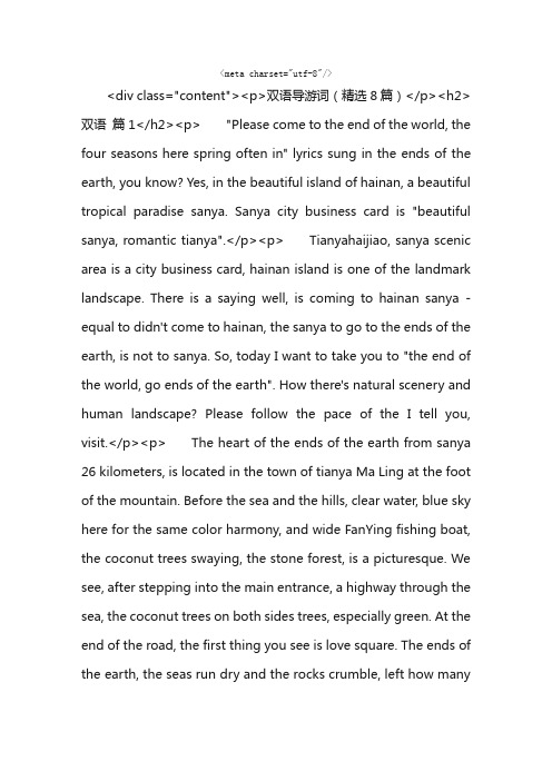
<meta charset="utf-8"/><div class="content"><p>双语导游词(精选8篇)</p><h2>双语篇1</h2><p> "Please come to the end of the world, the four seasons here spring often in" lyrics sung in the ends of the earth, you know? Yes, in the beautiful island of hainan, a beautiful tropical paradise sanya. Sanya city business card is "beautiful sanya, romantic tianya".</p><p> Tianyahaijiao, sanya scenic area is a city business card, hainan island is one of the landmark landscape. There is a saying well, is coming to hainan sanya - equal to didn't come to hainan, the sanya to go to the ends of the earth, is not to sanya. So, today I want to take you to "the end of the world, go ends of the earth". How there's natural scenery and human landscape? Please follow the pace of the I tell you, visit.</p><p> The heart of the ends of the earth from sanya 26 kilometers, is located in the town of tianya Ma Ling at the foot of the mountain. Before the sea and the hills, clear water, blue sky here for the same color harmony, and wide FanYing fishing boat, the coconut trees swaying, the stone forest, is a picturesque. We see, after stepping into the main entrance, a highway through the sea, the coconut trees on both sides trees, especially green. At the end of the road, the first thing you see is love square. The ends of the earth, the seas run dry and the rocks crumble, left how manyintroduction in this moment of happiness and the most precious memories.</p><p> Go forward again, is the seaside square, tourists friends, head of the statue, is approved by the international astronomical union small object naming committee, national astronomical observatory will find 9668 asteroids, named "star ends of the earth". This is the end of the world star signs. Everyone see, behind two sculptures, the left one is the western han dynasty general fubo road Byrd, on the right is the eastern han dynasty fubo general ma yuan, fubo generals, who as an insurgency in, exchanges between the mainland and hainan, to strengthen the communication of hainan and the road made an important contribution.</p><p> You see in my right hand side, the ends of the earth is the botanical garden scenic spot. Strange tropical plants, will make everyone enjoy the austral plants unique charm.</p><p> Here we move on, the ends of the world's most famous beach stone group. The blue sky, white clouds, the blue sea, the graceful coconut trees, a variety of shapes of rocks. Here is beautiful, look at these people behind me, they are all around the country who were tourists, here is the place where the most coveted.</p><p> You to look at the two stones, please see here "sea to south day", this is the end of the world's earliest inside a carved stone. In kangxi years, in orderto revise the calendar, emperor kangxi times, when the astronomical measurement left by the tag. You see, here is the "southern sky column", the word is XuanZheng cliff state of the first year of the year by Fan Yun ladder to prevent flooding. If you think the scenery here is very familiar with? By the way, it is the fourth set of RMB 2 on the back of the pattern. It has long been deeply in our daily life every day, it serves to show its influence in China. Qing dynasty yongzheng years general cliff state the year Cheng Zhe and during the period of the republic of China wang yi, and here two dependent on the sea of adjacent rock, the inscribed copy "tianya" and "the cape" four characters. Make people's tianya complex "was eventually materialized, and find a place, also make the heart of the ends of the earth" complex "the end of the world culture geographical location and specific carrier.</p><p> Three times in the 1960 s, the famous writer guo moruo, came to the end of the scenic area, left the writing "the heart of the ends of the earth". To the ends of the earth, must give their family, friends and relatives, lover to make a phone call. Told them that I in faraway places are still in the miss you, send you a crystal heart. Finally, take the ends of the earth's blessings distance separates no bosom friends, "".</p><p> “请到天涯海角来,这里四季春常在”歌词里所唱的天涯海角,大家知道在哪吗?对,在美丽的海岛海南岛,美丽的热带天堂三亚市。
新疆导游词英语作文

探索新疆之美:导游词英语作文Welcome to the enchanting and mysterious land of Xinjiang, a region that offers a unique blend of natural beauty, rich history, and vibrant culture. Spanning over 166 million acres, Xinjiang is home to diverse landscapes ranging from snow-capped mountains to vast deserts, lush forests to pristine lakes. Let's embark on a journey through this fabled land, uncovering its hidden gems and unforgettable experiences.Our tour begins in the city of Urumqi, the capital of Xinjiang. Here, we are greeted by the majestic Tianshan Mountains, which stretch across the horizon like a dragon's backbone. The mountains are a playground for adventure seekers, offering hiking trails that lead to breathtaking viewpoints and hidden valleys. Don't forget to sample the local delicacy, mutton kebab, while in Urumqi; its succulent flavor is a testament to the region's rich culinary traditions.From Urumqi, we travel to the beautiful Kashgar Old City, a UNESCO World Heritage site that is home to the oldest continuously inhabited Islamic community in China.Walking through the narrow lanes, one is transported to a different era, with the sight of traditional mud-brick houses, vibrant bazaars, and the sound of Arabic script being chanted by calligraphers. Here, you can also witness the intricate art of carpet weaving and taste the sweet flavors of local fruits like pomegranates and apricots.Heading further west, we arrive at the vast Taklamakan Desert, one of the largest deserts in the world. This desolate landscape is a paradise for adventure seekers and nature lovers alike. Off-road driving, sandboarding, and camel rides are just a few of the activities that await you in this otherworldly desert. As the sun sets, the sky turns a shade of orange and red, painting a beautiful canvas that will forever be etched in your memory.Our journey continues to the Kanas Lake, a picture-perfect alpine lake surrounded by snow-capped mountains. The serene atmosphere here is a perfect escape from the hustle and bustle of daily life. Kayaking on the lake or hiking to the nearby observation deck offers breathtaking views that will leave you in awe.As we draw to a close, it's important to note that Xinjiang is not just a destination for its natural beauty; it's also a cultural melting pot where East meets West. The region's rich history and diverse ethnic groups have contributed to its unique identity, reflected in its art, music, and festivals.In conclusion, Xinjiang is a land that offers something for everyone. Whether you're an adventure seeker, a history buff, or simply someone who wants to immerse themselves in a different culture, Xinjiang has plenty to offer. So, pack your bags, put on your探险帽, and come explore this enchanting land that holds the key to a lifetime of memories.**探索新疆之美:导游词英语作文**欢迎来到神秘迷人的新疆,这片土地以其独特的自然风光、丰富的历史和充满活力的文化而闻名。
可可托海介绍解说词

可可托海介绍解说词摘要:1.可可托海地理位置及概况2.可可托海的自然资源3.可可托海的历史文化背景4.可可托海的旅游景点及特色5.可可托海的经济发展与未来规划正文:可可托海,位于我国新疆维吾尔自治区阿尔泰山脉,是一个充满神秘色彩的地区。
这里的自然资源丰富,景色迷人,历史文化悠久,吸引了众多游客前来探访。
首先,我们来了解一下可可托海的地理位置及概况。
可可托海位于新疆阿尔泰山脉,地处中国与哈萨克斯坦、俄罗斯三国的交界地带。
这里属于大陆性干旱气候,四季分明。
独特的地理位置使得可可托海在历史上具有重要的战略地位。
其次,可可托海拥有丰富的自然资源。
这里的矿产资源尤为丰富,已知有84 种矿产资源,其中以金、银、铜、铁等最为著名。
此外,可可托海还拥有丰富的水资源,是我国新疆地区的重要水源地之一。
在历史文化方面,可可托海拥有悠久的历史。
这里是古代丝绸之路北道的必经之地,融合了多种民族文化。
可可托海地区的历史文化遗址众多,如可可苏里古城、可可托海神钟山等,都是游客们向往的旅游胜地。
可可托海的旅游景点及特色丰富多样。
除了前面提到的历史文化遗址外,还有可可苏里大峡谷、可可托海国家地质公园等自然景观。
此外,可可托海还有独特的动植物资源,如阿尔泰山雪豹、金丝猴等珍稀动物,为生物爱好者提供了观赏和研究的好去处。
最后,让我们来了解一下可可托海的经济发展与未来规划。
近年来,可可托海充分发挥其资源优势,积极发展矿产、旅游等产业。
政府还加大了对基础设施建设的投入,提高了当地人民的生活水平。
未来,可可托海将继续优化产业结构,加大旅游业的发展力度,打造国际旅游目的地。
总之,可可托海是一个自然资源丰富、历史文化悠久、旅游景点多样、经济发展迅速的地区。
内蒙古呼伦贝尔草原英文导游词
内蒙古呼伦贝尔草原英文导游词内蒙古呼伦贝尔草原英文导游词作为一位尽职的`导游,总归要编写导游词,导游词可以加深游客对景点的印象,是提升讲解水平的重要工具。
那么问题来了,导游词应该怎么写?以下是小编收集整理的内蒙古呼伦贝尔草原英文导游词,欢迎阅读与收藏。
Lady and Genlenmen:Welcome to HunLunbeier Grassland! First of all, Id like to tell you why People call this bdautiful grassland Hulunbeier grassland. There is a moving legend behind it. A long, long time ago there lived a couple of lovers on the grassland. The girl was a Hu lun. The boy was Bei Er. One day a demon chief called Mang Gusi abducted HuLun and dried up the grassland. The grass withered and yellowed and domestic animals died one after another.In order to save the grassland and Hu Lun, BeiEr traved a great distance on foot, chasing after Mang Gasi day and night. Finally, he fainted from exhaustion. In his weakened state, he dreamt that the demon chief had magically turned Hu Lu,Bei Er traveled a great distance on foot, chasing after Mang Gasi day and night. Finally, he fainted from exhaustion.In his weakened state, he dreamt that the demon chief had magically turned Hu Lun into a flower which was and suffering from the windy dream in front of him. He immediately watered the flower and broke the spell. Hu Lun changed back into her former self. But the demon chief would not give up. He immediately watered the flower and broke the spell. Hu Lun changed back in to her former self. But the demon chief would not give up. He seized Hu Lun and took her away again. Hu Lun racked her brain for a way to escape. She succeeded in getting hold of the magic pearl on the demonchief`s head. On swallowing the pearl Hu Lun turned into a lake. In the meantime BeiEr had killed all of the other demons, but failed to find Hu Lun. Heartbroken, Bei Er jumped in to a lake to kill himself.All of a sudden the earth split open and formed two lakes, Hu Lun lake and Bei Er Lake, with the Wilson River closely connecting them. Later,people living on the grassland named the land hulunbeier Grassland in momory of them.HuLunbeier covers an area of 250.557 square kilometers,with a totel population of 2.66 million. The Mongolian natiality is the dominant ethic group, and 35 other nationlities,such as Dawoer, Ewenke, Elunchun, Han, Manchu, Russian, etc. live in harmony with them on the grassland. Hunlunbeier is called green and clean land because it is relatively free of pollution.(Entering the grassland)Now were setting foot on Hunlunbeier Grassland. All of us have escaped from the city and its clamour and entered a place like a dreamland,Look! The grassland looks like asoft, green cerpet, Nowyou can enjoy the beautiful scenery in the distance; numeros kinds of wild flowers are in bloom, and wisps of smoke are rising continuously from the yurta scattered on the grassland. When the gentle breeze brushes against the grass, herds of horses and cattle and flock of sheep seem to be drifting from here ro there. What a beautiful picture!(Visiting a yurt)This is the yurt we saw from the bus just now. Look!The host and his family have come out of the to greet us. Of couse, this is not an arranged reception, to be sure. But before we enter the yurt, Idlike to make a brief introduction on the folk costoms here. No matter which yurt you happen to visit, you will finethat on hesring your footsteps the Mongolian people will extend a warmwelcome outsite the yurt, to do justice to their reputed hospitality. When greeting you, they will put their hands against their chests and bow slightly. With a how do you do, They invite their guestsin. Male guests are invited to sit on the left and female on the right, while host sits in midle. The moment you take your seats, your host will have milk tea and various kinds of milk products pleaced in front of you. After a white, you will most probably probabyly be asked to help yourself to a special course called shouba lamd. As a way of showing respct to his distinguished guest, your hast will prsent you with a hada( a piece of silk used as a greeting gift), Together with a cup of lacal wine. Mongolians are well known for theirtalent in singing and dancing.Their beautiful songs are as entertaining and pleasant as the blue sky, white clouds, greengrass and fresh flowers, In folk culture, there is a saying that a feast is not a true feast without the company of songs. Every person in the grassland, man or woman, old or young, can sing folk songs. When proposing toasts to their guests, they will show their hospitality by singing folksongs and playing special fiddles. The Mongolian people have lived on the vast grassland for a long time, and they have refined their talent for sing and dancing. You can not only please your eyes with their traditional ethnic dancing but also with their mondern ones featuring merry rhythms and vigorous steps.Now let`s enter the yurt and take advantage of this opportunity to be guests in a Mongolian herdsman`s home.(Stepping out of the yurt)Under the blue sky and white clouds, you will see a vivid picture of flocks of sheep and herds of cattle, galloping horses and skillful herdsen on horseback brandishing horsewhips. Do you want to go for a ride ? If you are skilled at riding, why notride a Mongolian horse for a while or wander about on camelback?If you are afraid of riding horses or camels,never mind. You still can enjoy the nomandic life by taking a special Mongolian vehicle called a Lele.(Briefing on the physique of Mongolians)Now you have had a look at the grassland with your own eyes, but did you noticed that the Mongolian girls are graceful,elegant and vigorous, and the young fellow are robust, heroic and muscular? It is said that this has much to do with their life styles which are connected with horse sports,running and pursuing.Further,the important role played by milk tea and milk products in developing their muscles and bones canot be underestimated.(Briefing on the dietary habit of Mongolians)Lets start with milk tea,The host minces the tea and put it in a kettle to boil it. When the kettle starts boiling with a gurgling sound, the host pours the fresh milk into it. Thus the herdsman coming in from a snowstorm will warm up immediately after having such a cup of milk tea. A bowl of milk tea, stir-fried rice, several piece of a dry milk product and some lamb is regarded as a delicious meal by the ordinary Mongolian herdsman. Milk products include the skin of boiled milk, milk curd, milk wine, cheese, butter and so on. The formal meal may be served with meat and a flour-base product.While you are here on the grassland, it will be a great pity if you do not try Shouba Lamb(boil meat which is eaten using a knife and your hands).The lamb is first cut into big slices and then put into boiling water to cook.When it is half done, you cut it into smaller pieces with the Mongolian knife and eat it. TheMongolian people think that half-done meat contains more nutrients.(Briefing on Mongolian clothing)The Mongolian robe is unique to this ethnic group. The robe is often matched with a belt and head decorations.With its high collar and long sleeves, the robe protects people from mosquitoes. The middle part of the robe is made loose for the convenience of riding horses and is long enough to keep the knees warm. You can find all kinds of clothes here today, but the robe is the cultural heritage of the Mongolians and has become a symbol of their national conscience and identity.(Briefing on Mongolian yurta)You can see mongolian yurta here and there on grassland.But do you know the history and structure of the mongolian yurta?According to the historical records of the Xiongnu,an ancient ethnic group, their ancestors lived in the Northland long ago. Their living quarters were called yurta. In this sense Mongolians, as a ethnic group, can date to 4,000 years ago. So the Mongolian yurta are a symbol of the history of this ethnic group. Now let`s talk about the construction of a yurt are a symbol of the history of this ethnic group, Now let`s talk about the construction of a yurt. Herdsmen first build a round foundation with pieces of stones, Then they set up the structure with wodden wods and beams linked together with wollen or fur ropes,Lastly, they cover the structure with animal skins or felt blankets.The ceiling of the yurt is round. With such a structure, the yurt can withstand snowstorms and heavy rainfalls. The door of the yurt is small and down to the ground. The yurt can be easily moved and this is suitable for nomadic life.This accounts for the reason why the structure of the yurt remains unchanged till today. If the Mongolian yurt is seen as the home of the herdsmen, then the lelecarts can be viewed as their mobilehomes. lelecarts move slowly with big noise. It is hard to tell when the history of lelecarts began. All the carts are made of birch, so they will reain in good condition even in wet weather. The wheels of the carts are tall and can easily roll across the uneven roads, lush bushes, thick snow and marshes. lelecarts are indispensable for herdsmen when they move cross snow-covered areas.(Briefing on Mongolian festivals)There are a lot of Mogolian festivals held every year on the grassland, but the most famous one is Nadam,the carnival the grassland. Nadamin the Mongolian language means recreation or entertainment. When it comes, there will be a lot of performances,such as horse racing, wrestling, archery and some other special ethnic performances. The Nadam fair is a time-honored festival and was known world wide for 700years, Nowadays the Nadam fair is often held during the harvest season of the grassland, either in June or July.During that period, herdsmen often take the opportunity to sell domestic animals and livestock products and purchasse daily necessilties and livelihood-related goods.Acturally, the herdsmen have few chances to get together on such a vast grassland, so Nadam also plays the role of a big trade fair for them, When we talk about Nadam, we should also talk about offering sacrifice at Aobao.Aobao in Mogolian means a pile of rocks or earth. On the vast and endless grassland, it is hard to tell directions, so people thought of pilling rocks or earth to mark them, In its long historical development Aobao has become the shrine to offer scrifices to the God of the Mountain and the God of the Road.During the sacrifice offering ceremony,people tree branches into the Aobao and put pieces of colorful cloth or paper flags with written scripture on the branches There are fourtypes of memorial ceremonies, namely blood,wine,fire and jade. No matter what type it is, a lama will be invited to butn incenses, chant scriptures and pray for the blessing of the people and their livestock. Participants will walk around the Aobao clockwise three times.After the ceremony, the herdmen will not only enjoy horse races,wrestling and archery, but also singing, dancing and drinking to their heart`s content. Around that time, young lovers will probably leave the crowd to be in a world of their own.Dear,distinguished guests,after this tour of this grassland I believe you must have a general idea of how the Mongolian pelple live here and may een feel reluctant to leave the beautiful hulunbeier Grassland. I belive the grassland and its people enjoyed your visit as much as you did and look forward to your next one.Ladies and Gentlemen,I hope to have another chance to meet you again on this very land, the Hulunbeier Grassland. Goodbye and good luck.。
可可托海景区导游词

可可托海景区导游词在中国的版图的西北角上,有一个被人称作鸡尾的地方,在最西北的山岭如海的边境地区,它以美丽和富饶享有着自己的名字,它就是新疆富蕴县境内的可可托海。
可可托海,哈萨克语意思是蓝色丛林。
它距离富蕴县53公里,是中国境内唯一一条流向北冰洋的河流--额尔齐斯河的发源地之一,可可托海镇因此也被人称为额河源头第一镇。
可可托海以是它丰富的矿产宝藏闻名于世,而它的自然风光像一颗璀粲的明珠,镶嵌在阿尔泰的大山深处,为神秘的阿尔泰山又增添着一个新的寓意和旅游圣地。
可可托海和喀纳斯湖同处阿尔泰山区,生物景观基本相似,地貌景观却不相同。
除享有世界赞誉的三号矿坑外,野鸭湖,额尔齐斯河谷原始森林,神钟山,雪山温泉等独特景观,构成了可可托海地质公园的天然画廊,其秀美,恬静、多采、神奇的原始美,令人陶醉。
野鸭湖,四面环山,地势空旷,是一块风光优美的天然牧场。
可可托海得天独厚的自然地理条件,丰沛的降水以及高山冰雪融水,滋养了大片高山草场和原始森林。
生态系统独特,生物种类繁多,是重要的生物物种基因库。
在以新疆落叶松、欧洲山杨、白桦为主体的原始森林中,点缀着雪莲、党参等100余种中草药。
可可托海庇护着54种兽类,包括国家一级野生保护动物蒙古野马、赛加羚羊等;国家二级保护的盘羊、鹅喉羊等荒漠野生动物。
两河源区是新疆鸟类资源最丰富的地区之一,列入国家保护的珍贵鸟类约39种。
可可苏里还有一个名字:野鸭湖,可可苏里是哈萨克语,意思是“蓝色的湖”它是大地震时形成的地震断陷湖,湖面面积180万平方米,平均水深2米,湖中有大小浮岛20多个。
每年春夏季节,野鸭、白鹭、水鸡、红雁,天鹑都会飞到这里生活,抬头远看白雪覆盖着山顶,近处水鸟在湖中嬉戏,湖边绿草如茵,山花盛开牛羊成群,哈萨克牧民的座座毡房点缀其中,形成一幅美丽的边塞牧歌图。
伊雷木湖位于可可托海镇西南7公里额尔齐斯河与它的支流卡依尔特河交汇处,是经拦河筑坝而成的水库型湖泊,湖面海拔1120米,南北长5-6公里,东西宽1-2公里,湖面面积18.5平方公里,蓄水1.13亿平方米,湖水最大深度为100米。
可可托海景区导游词
可可托海景区导游词【篇一:可可托海风景区导游词】可可托海风景区导游词可可托海风景区暨可可托海国家地质公园简介:可可托海风景区地处新疆东北部的富蕴县境内,面积619平方公里,海拔在1200~2400米之间。
可可托海风景区是国家4a级风景名胜区、国家地质公园,由卡拉先格尔地震断裂带、野鸭湖、伊雷木湖及额尔齐斯大峡谷四部分组成,公园以超大型花岗伟晶岩稀有金属矿、富蕴大地震遗迹和额尔齐斯河的变质花岗岩地貌为特色,公园内保存着大量的极具珍贵的地质遗迹和地质景观,在许多方面都具有世界唯一性。
公园内有8处绿柱石产地,有世界罕见的超大型稀有金属矿”三号矿坑”,它是目前世界上已知最大和最典型的含稀有金属矿的花岗伟晶岩脉之一。
公园内有形态各异的花岗岩山峰,它们与我国东部黄山、华山、泰山等地的花岗岩地貌不同,额河源的花岗岩山峰多呈钟状、穹状、锥状,主要的山峰有神钟山、宏泰吉峰、剑锋、倒靴峰、骆驼峰、神象峰、飞来峰等20多个景点。
这些独特的花岗岩石峰和周围的寒温带森林,与叠石湍流的额尔齐斯河相得益彰。
阿尔泰山物华天宝,人杰地灵,特殊的地质构造使峡谷中奇石林立,或似人或似兽或似禽,栩栩如生,堪称一绝。
千百年来,可可托海以其悠久的历史渊源,丰富的资源特产、秀丽的高山风光、传奇的草原文化、古朴的人文特色闻名遐迩。
素有“中国第二寒极”之称的可可托海,以它零下51.5摄氏度的中国第二最低温度,和热情似火的哈萨克民族风情,让游人在冷热两重天的世界里,游美景,泡温泉??游客们,百听为虚,眼见为实。
下面就让我们进入这神奇而又美丽的大自然,去领略可可托海的魅力。
前面十公里处就是我们景区的标志性大门,它主要是用大块花岗岩建造,主题突出了地质公园的变质花岗岩地貌特点。
整体设计美观大方,纯朴自然。
现在请大家顺着我手指的方向看过去,山脚下可以看到几棵高大的白杨树,还有旁边的四个白柱子。
在这几棵杨树的附近有一个泉眼,每当要发生地震的时候,这个泉眼的水位和水质变化很明显,水位升高或降低,水质变混浊,能够预测地震,所以在这里安放了一个地震监测仪,柱子上面放的是太阳能,下面埋着地震监测仪,可以及时的测出地壳运动的迹象。
- 1、下载文档前请自行甄别文档内容的完整性,平台不提供额外的编辑、内容补充、找答案等附加服务。
- 2、"仅部分预览"的文档,不可在线预览部分如存在完整性等问题,可反馈申请退款(可完整预览的文档不适用该条件!)。
- 3、如文档侵犯您的权益,请联系客服反馈,我们会尽快为您处理(人工客服工作时间:9:00-18:30)。
Keketuohai ---Write by:秦慧Good morning ladies and gentlemen,
The view spot what I choose is Keketuohai, May I begin?....Thanks!
Today we are going to visit a special place-Keketuohai. Maybe most of you have knew something about the place where is called "The last Pure Land of human-being" and "The Orient Switzerland of China"--The Kanas. But in my opinion, few people know that there is still an even more mysterious place in the southeast of Kanas--Kekketuohai. Why? The reason is that Keketuohai is an important Military secret place in China’s history . For the demands of defense, Keketuohai had to hide in the forbidding mountains and jungles and did not let any outside world people know it exists. Before 1967, we even couldn't find Keketuohai in the map of the People's Republic of China. It just was replaced by "111 ore" and before 1981, there still were three kinds of customs barrier, people had to show their frontier permit .If you did not have the frontier permit, you were forbidden entering.
But now, Keketuohai has revealed its mysterious veil and became a 5A scenic spot of China. Keketuohai is located in the south of Altay mountains and the source of Irtysh River. There
are 260,000 hectare forests with 22.44% of forest acreage and 10,530,000 hectare of prairie, which is the huge "wild desert and wet island" of arid region in northwest. Keketuohai is composed of KkeSuLi ,Yileimuhu Lake,No.3 Mine crater and Irtysh Grand Canyon. And now I will give you a brief introduction of them one by one.
First, KekeSuLi, with lake surface area of 2km2 and depth of 2m, it has more than 20 small or big laputans shaping from reeds and rich aquatic botany, and the laputans move in response to wind, which make the scene more enchanting .KkeSuLi ALSO BE CALLED "Wild ducks lake", because thousands of wild ducks father here to multiply and live and add a vitality to the lake.
Second,Yileimuhu Lake means ''Whirlpool" in Kazak and "Small sea" in Mongolian ,it covers an area of 212.5km2 with elevation 1120m and depth of 1oom,The overlook is similiar with "8" when you view in the aie.Yleimuhu Lake is the first lake of the upstream of Irtysh River .So the temperature of Yileimuhu Lake is very low and is also be called "Cold Lake".
Third,N.3 Mine Crater.It is one of the known biggest and most typical gratine dike with rare metal in the world .There are more than 86 kinds of mines.It was always famous at home and
abroad as the "Geology Mineral Museum" and made great contributions to our successful lauch of atom bomb,,h-bomb and manmade satellites and also the building up of national defense .What's more, it repay 1/3 debts for our country in the 60s.As a result, it is described as "Hero Minerals" and "Meritorious Minerals".
Last but not least, Irtysh Grand Canyon, witch is the main scenic spot of Keketuohai on the contrary.splendid Irtysh rises from the deep gorge and goes to west. It is 70km long with greenwaves and springs, along the river, campanulate, quaquaversal and coniform continuous gratines mountains towering there. Feilai Peak, Camel Peak, Xiangbi Peak and Shenying Peak and many other pictographic rockscapes "One mountain shapes one world",boasing 108 peaks. The most quintessential one is the Amir Sarah with relative altitude difference 365m, it stays there alone and keeps steep. There are dense primeval forests, including pines, poplars and birches, the rate of coverage reaches up to more than 80%. Streams and valleys cross here, such as ShuiMoGou, Golden Triangle, Waterfall Valleys and Wild Grape Valleys. Here is full of flowery and mountains, water, trees, stones and people. Standing here, you will feel like that you are in a fairyland.。