海岸动力学英文PPT课件Coastal Hydrodynam(7)
Coastal Hydrodynamics_3.1 WAVE TRANSFORMATIONS 海岸动力学课件
Statistically representative waves
➢ The maximum wave corresponds to the maximum height in a given wave group.
➢ The one-tenth highest wave corresponds to the average of the heights of the one-tenth highest waves.
15/39
Chapter 3
Rayleigh distribution curve
16/39
Chapter 3
From statistical theory H110 2.03H
we can obtain important H13 1.60H
relationships using the
distribution function Hrm s1.13H
a function of wave number. In fact, it has
been shown that the wave number and the
frequency are uniquely correlated.
20/39
Chapter 3
If the amplitudes are plotted versus frequency,
There is a great amount of randomness in
the sea, and statistical techniques need to
be brought to bear.
6/39
Chapter 3
Zero-up crossing method
《海岸动力学》课件

实验结果与分析
01 02 03
结果分析
分析潮汐和波浪对海岸的影响机制 。
研究海岸物质的迁移模式与潮汐、 波浪的相互关系。
06
海岸动力学的未来发展
海岸动力学的前沿问题
极端气候和海平面上升的影响
研究极端气候事件对海岸带的影响,以及海平面上升对海岸动力过程、海滩演变和沿海工 程设施的影响。
海洋酸化的影响
实验方法与步骤
• 重复进行多次实验,以获得可靠的实验结果。
实验方法与步骤
使用专业软件进行数据处 理和分析。
对采集的数据进行整理和 筛选。
数据分析
01
03 02
实验结果与分析
潮汐对海岸的影响
潮汐周期与海岸物质的迁移模式之间的关系。
波浪能量耗散
波浪在传递过程中能量损失的规律。
实验结果与分析
• 近岸流速分布:潮汐和波浪共同作用下近岸流速的分布情 况。
数值求解方法
数值求解是解决偏微分方程的重要手段,通过数值方法可以将偏微分方程 转化为离散点上的数值计算。
常见的数值求解方法包括有限差分法、有限元法、谱方法等,每种方法都 有其适用范围和优缺点。
选择合适的数值求解方法需要考虑模型的复杂性和计算精度要求,以及计 算资源的限制。
模型验证与比较
01
模型验证是确保模型准确性的重要步骤,通过与实际观测数据 进行比较,可以评估模型的可靠性和精度。
研究海洋酸化对海岸带生态系统、沉积物化学和矿物学的影响,以及这些变化如何影响海 岸动力过程。
海洋垃圾和塑料污染
关注海洋垃圾和塑料污染对海岸带生态系统和环境的影响,以及如何通过减少垃圾排放和 加强废弃物管理来减轻这些影响。
海岸动力学的研究趋势
海岸动力学英文PPT课件Coastal Hydrodynamics_5.1.
2/39
Chapter 5
1. Physical properties
Beach materials mainly consist of the sand and gravel transported by rivers, the sand composing dunes located in the
1/39
§5.1 Characteristics of Coastal Sediment 1. Physical properties of coastal sediment 2. Modes of coastal sediment movement 3. Threshold of coastal sediment motion
influence of waves and nearshore currents in the
onshore or offshore directions, or parallel to the
shoreline. There are two modes of sediment
movement: suspended sediment movement and
and littoral drift, are distribution of grain size,
shape, roundness, mineral composition,
porosity, permeability, etc. Among them, grain
size distribution and mineral composition are
bed load movement.
8/39
Chapter 5
Incoming waves reach a certain water depth (offshore region), then bed material sand particles there begin oscillatory motion due to wave action. In a slightly more shallow area, waves produce a net motion of sand particles in the onshore or offshore direction. The interesting feature in this region is the generation of sand ripples, which seem to have a strong influence on sediment movement.
海岸动力学英文PPT课件Coastal Hydrodynamics_6.2共42页文档

When Qin is equal to Qout, which indicates that there is neither erosion nor deposition within the compartment, therefore the coast is stable. The lack of either beach erosion or deposition indicates that a state of equilibrium exists between the sources and losses.
Chapter 6
Subsequently, to prevent harbor shoaling, the breakwater was extended seaward and a suction dredge installed to pump sand past the harbor. It is seen that the work done in bypassing the harbor by dredging has replaced the natural transport system due to wave action.
Bay is an excellent example of the way in which
local beaches orient themselves parallel to the
refracted wave crests and develop the same
curvature.
Chapter 6
configuration in an attempt to reach a new
Coastal Hydrodynamics_3.2 Ocean Wave Characteristics 海岸动力学课件

of the wave number vector must be balanced
by spatial changes of the wave angular
frequency.
10/38
Chapter 3
If the wave field is constant in time, the wave
therefore concentrated.
Wave divergence (幅散) refers to a
phenomenon that waves refract and diverge
over the deep water so that the waves are
reduced in height.
wave motions but also provides the theoretical
basis for the experimental simulations
of water waves.
11/38
Chapter 3
2. Wave transformation in shoaling water Assuming that the energy flux is conserved in the process of wave propagation, the wave height at a given water depth can be determined by:
In water with straight and parallel offshore contours, it is possible for us to determine the refraction coefficient(折射系数) kr directly.
海岸动力学课件 Coastal Hydrodynamics_6.1
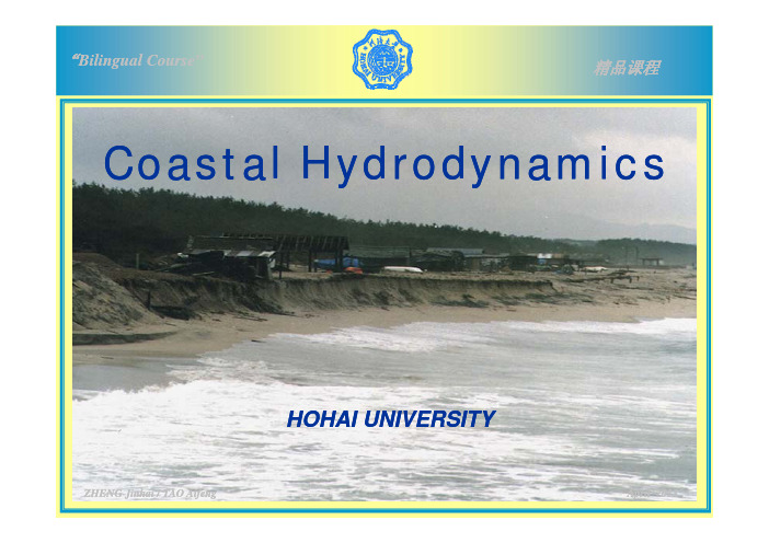
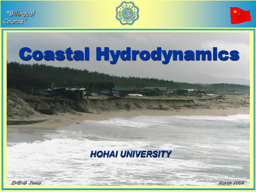
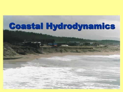
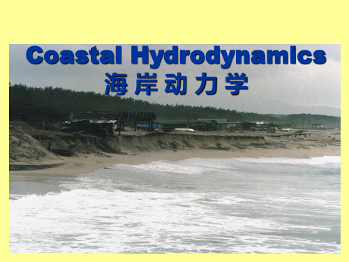
“Bilingual Course”精品课程C t l H d d i Coastal HydrodynamicsHOHAI UNIVERSITYAifeng April 2013 / TAO AifengZHENGZHENG JinhaiJinhai/ TAOChapter 6 COASTAL PROCESSESCh t 6 COASTAL PROCESSESStating beach nomenclatureStating beach profileStating coastal change1/32In the treatment of coastal sediment transport, In the treatment of coastal sediment transport it is quite common to consider separately sediment movement perpendicular to the shoreline and that parallel to it. The sedimenth li d th t ll l t it Th di tp pmovement perpendicular to the shoreline is considered to be the more significant one for the short--term variation of coastal processes, th h t t i ti f t lthe shortpwhile that parallel to the shoreline is the more significant one for the longsignificant one for the long--term variation of the coast.2/3261General Beach Nomenclature §6.16.1 General Beach NomenclatureGeneral Beach Nomenclaturenearshore zoneoffshore zonei h f h backshorecoastline inshore foreshore backshorecliffbeachscarp3/32longshore bar longshore trough beach face berm crest bermsThe beach is an accumulation of unconsolidated The is an accumulation of unconsolidated sediment (sand, shingle, cobbles, and so forth) di h d f h l id extending shoreward from the mean low--tide extending shoreward from the mean lowline to some physiographic change such as ap y g p gsea cliff or dune field, or to the point where permanent vegetation is established. permanent vegetation is establishedWe require a more inclusive term, one that will encompass this underwater portion of the environment, since that is where the more environment,since that is where the more important processes occur which are responsible for the beach formation.i f f i4/32The term littoral is used to denote this entire Th t litt l i d t d t thi ti,environment, which extends across the beach and into the water to a depth at which the sediment is less actively transported by surface waves. This depth varies, of course, but is waves This depth varies of course but is generally considered to be some 10 to 20g ymeters. In the actual practice the term beach commonly is almost synonymous with the above definition of littoral zoneabove definition of littoral zone.5/32The littoral zone(沿岸带)is composed of four li l i f f portions: backshore, foreshore, inshore, and portions:backshore foreshore inshore and offshore.offshore.The nearshore zone extends seaward from the shoreline to just beyond the region in which the waves break, so that this term is particularly useful when discussing waves and currents within this environment.ithi thi i t6/32The comparatively flat Offshore(离岸区): : The comparatively flat Off h Th ti l fl tp p gportion of the beach profile extending seaward from beyond the breaker zone to the edge of the continental shelf. This term is also used to refer to the water and waves seaward of the refer to the water and waves seaward of thegnearshore zone. The interesting feature in this region is the generation of sand ripples, which seem to have a strong influence on sediment movement.movement7/32Inshore(外滩): : The zone of the beach profileThe zone of the beach profile:The zone of the beach profile extending seaward from the shoreline at mean low tide to just beyond the breaker zone.Th i h i i th l hThe inshore region is the place whereg pp distinguishable sediment movement appears, and where longshore bars are generated by breaking waves. In this region, breaking wave b ki I thi i b kip yaction predominates to intensify the turbulent intensity of fluid motion, thus putting a large amount of sediment in suspension.8/32A longshore bar(沿岸沙坝)is a ridge of sand A l h b i id f d running roughly parallel to the shoreline. It running roughly parallel to the shoreline.It may become exposed at low tide. At times there may be a series of such ridges parallel to one another but at different water depths.A longshore trough(槽)is elongatedA l h t h i l t d depression extending parallel to the shoreline depression extending parallel to the shoreline and any longshore bars that are present.9/32The sloping portion of the前滩Foreshore(前滩): : The sloping portion of the beach profile lying between a berm crest (or in beach profile lying between a berm crest(or in,ppthe absence of a berm crest, the upper limit of wave swash at high tide) and the lower--water wave swash at high tide) and the lowermark of the backrush of the wave swash at low tide. In this region, either suspended movement or bed load movement is dominant depending or bed load movement is dominant, dependinggon the breaking wave characteristics.10/32The term foreshore is often nearly synonymouswith the beach face but is commonly more with the beach face but is commonly more,ginclusive, containing also some of the flatportion of the beach profile below the beachface. A beach face(滩面)is the slopingsection of the beach profile below the bermwhich is normally exposed to the action of the which is normally exposed to the action of the wave swash.11/32The zone of the beach Backshore(后滩): : The zone of the beachprofile extending landward from the sloping foreshore to the point of development offoreshore to the point of development ofvegetation or change in the physiography(sea cliff, dune field, and so on).(sea cliff dune field and so on)A beach berm(滩肩)is a nearly horizontalportion of the beach formed by the deposition ti f th b h f d b th d iti of sediment by the receding waves.A beach scarp(滩坎)is an almost verticalp p y escarpment notched into the beach profile by wave erosion.The seaward limit of a berm is named aThe seaward limit of a berm is named a bermcrest(滩肩缘).12/32Beach Profile6.2 Beach Profile§6.262Beach Profile1.Equilibrium beach profile1Equilibrium beach profile2. 2. Beach profile changesBeach profile changes2.Beach profile changes13/321.1. Equilibrium beach profileEquilibrium beach profile During the progress of the experiment inq pg p g pwhich a constant wave input is maintained, the beach profile will reach a steady statecondition, that is, the beach profile in theflume will approach a particular one,which is named the equilibrium beach profile which is named the equilibrium beach profile.(海滩平衡剖面).14/32On natural beaches the changing waves give rise to an ever--varying equilibrium whichrise to an everp pthe beach profile attempts to achieve butseldom does. One of the more importantaspects of a beach is its dynamic personality: aspects of a beach is its dynamic personality: the loose granular sediments continuouslyrespond to the ever changing waves andrespond to the ever--changing waves andrespond to the evercurrents imposed from the adjacent body of the water. However, the only way in whichbeach profiles can be understood is in terms of this equilibrium profile and how it isdetermined by wave conditions and thedetermined by wave conditions and thesediments which compose the beach.15/32It is still debated whether in reality there is It i till d b t d h th i lit th i an equilibrium beach profile in the fieldan equilibrium beach profile in the field where the tide and waves are continuously changing. Nevertheless, the concept of equilibrium beach profile is quite useful in understanding processes of coastal changed t di f t l hand in investigating the mechanisms ofand in investigating the mechanisms of erosion and deposition in the coastal region. 16/32Beach profile changes2. Beach profile changes2.¾Typical beach profiles¾Experimental study17/32There are two typical types of beach profile: Th t t i l t f b h fil one is the longshore bar type(沙坝剖面), one is the longshore bar typewhile the other is the step type(滩肩剖面).p ypThese different beaches are also found in the field. The former is also called a winter beach (冬季剖面)or stormy beach(风暴剖面), and the latter a summer beach(夏季剖面), ordinary beach or swell beachordinary beach or swell beach(常浪剖面). 18/32storm profile swell profilep p常浪剖面bar trough sea cliffbermThe storm beach profile with barsversus the swell profile with a pronouncedberm that occurs under swell waves conditions 19/32The summer profile is characterized by a wideberm, the flat shoreward portion of the profile,and a smooth offshore profile without barsexcept perhaps in relatively deep water.The winter profile has almost no berm, thesand having shifted offshore to form a seriesof bars parallel to the shoreline. The overallprofile slope is smaller in the winter profilethan in the summer one. The volume of sandinvolved remains relatively constant. Thesediment shifts from the berm to bar and back20/32 again.Chapter 6Profile changes along Scripps Pier, California, showing the tendency to shift from a more evenly sloping swell (summer)profile to a storm (winter) profile and back again accordingto the season.21/32Chapter 6This accounts for the terminology---- summerand winter profiles. Such shifts in the profilewas first observed off the west coast of theUnite States, where storm waves are typical ofthe winter and long-period swell waves occurin the summer. Therefore, the shifts in theprofile corresponded with the winter andsummer. However, it is peculiar that thisterminology is sometimes used elsewhere inthe world where the seasonal connotations arenot 22/32 correct.Chapter 6winter profile under swell waves conditions in front of Nanri Sea dikeThe onshore-offshore shift of sand associated withprofile changes from storm to swell conditions isgenerally correlated with the wave steepness andthe grain size of the beach sediment.Johnson classified the stormy beach and theordinary beach by wave steepness parameter indeep water, H0/L0. He determined that with a wave steepness greater than 0.03 an offshore baralways forms, whereas if the steepness is less than0.025 an offshore bar is never formed.23/32Chapter 6Dean presented a model for the shift from a storm to a swell profile based on a consideration of the trajectory of a suspended sand particle during its fall to the bottom, acted upon at the same time by the horizontal water particle velocity of the wave.critical24/32Chapter 6In fact, our understanding of the critical wavesteepness which governs the shift from theswell profile to the storm profile is stillincomplete.This incompleteness is particularly true forfield studies. This is also due in part to thegreat irregularity of profile changes on realbeaches.25/32Chapter 6The development of a storm versus a swell profilecan be understood in terms of the directions ofsediment transport within the surf zone andbeyond the breaker zone. With storm waves thesand seaward of the breaker zone movesshoreward, while sand in the surf zone istransported in an offshore direction. Thisconvergence of the sand transport directions mustresult in an accumulation of sand at the breakerposition, forming a bar. With flatter swell waves,the sand is moved landward at all depths, withinthe surf zone as well as beyond the breaker zone,so that it accumulates on the berm.26/32Chapter 6The beach profile type is of importance to seacliff and coastal property erosion. With a swellprofile the sea cliffs are protected from thewave action by a wide berm and so experiencelittle or no erosion. During storm conditionsthe sand is shifted offshore and the berm lost,so that the more intense swash is able to reachand erode the sea cliffs. In other years thestorms are separated by quieter periods, andthe beach berm may not be entirely eliminated.27/32Chapter 6The beach changes from swell to storm profileinvolve principally onshore-offshore shifts ofsediment. Therefore, the profile changescannot be understood until we comprehendthe details of this transport normal to theshoreline. However, a complete comprehensionas is required is still very remote, so that onlythe broadest understanding is presentlypossible.28/32Chapter 6It is well known that storm waves transport beachmaterial offshore causing beach erosion and material offshore, causing beach erosion andforming a bar. Waves of gentle steepness betweensuccessive storms gradually move bar formingmaterial onshore,resulting in beach accretion material onshore, resulting in beach accretion and creation of a berm.According to their laboratory investigations, According to their laboratory investigations, Sunamura and Horikawa classified beach profiles from a different point of view.fil f diff i f iThey proposed the following semiy p p g p They proposed the following semi--empirical criterion on whether a beach will erode or accrete. This criterion is a function of three accrete This criterion is a function of three parameters, i.e., wave steepness, sediment grain size and bottom slope.The value for C is 4~8 to demarcate erosionTh l f i48t d t iand accretion of laboratory beaches.and accretion of laboratory beachesWhen C>8, beach erodes and the bar type,yp profile occurs.While C<4, beach accretes and the step typeprofile forms.When 4<C<8, the equilibrium profile is found. It was also found that=18for natural beaches It was also found that C=18 for natural beaches. 31/32“Coastal Hydrodynamics”——chapter 6ZHENG ZHENG Jinhai Jinhai / TAO / TAO Aifeng Aifeng Apr 2013THANK YOU。
海岸动力学英文PPT课件Coastal Hydrodynamics_2.2

on z=η
x ,z ,t x c,zt
3/21
Chapter 2
§2.3 Small Amplitude Wave Theory
1. Linearization of basic equations 2. Solution of the linearized equations 3. Dynamic & kinetic characteristics
Coastal Hydrodynamics 海岸动力学
Chapter 2 WAVE THEORY
Stating description of wave motion Stating basic equations of wave motion Stating the small amplitude wave theory Stating the finite amplitude wave theory Stating wave theory limits of applicability
G.D.E. B.B.C. D.F.S.B.C. K.F.S.B.C. L.B.C.
2 0
hz, x
0
z
on z= -h
on t1 2[ x2 z2]p 0g z0 z=η
0
t xx z
1/21
Assumptions Water is treated as a uniform and incompressible fluid.
The fluid viscosity is normally ignored.
The surface tension and Coriolis force are ignored.
2019年-海岸动力学英文PPT课件Coastal Hydrodynamics_2.2-PPT文档资料-PPT精选文档
Chapter 2
Homework
A wave with the period of 5s travels in water of 5m, what is its celerity and what is its length?
2 gktankhh
LgT2 tanh2h 2 L
cgTtanh2h 2 L
17/21
Chapter 2
Dispersion relationship
This relationship shows that the wave length continually decreases with decreasing depth for a constant wave period. That is to say, waves of constant period slow down as they enter shallow water.
The bottom is impermeable. Waves travel in the x-z plane.
2/21
continuity equation
velocity potential
gravity only
zero velocity
Chapter 2
Boundary Value Problem of Wave Motion
13/21
Chapter 2
2. Solution
Coordinates System
14/21
Chapter 2
How to obtain the solution ? L.B.C G.D.E B.B.C
- 1、下载文档前请自行甄别文档内容的完整性,平台不提供额外的编辑、内容补充、找答案等附加服务。
- 2、"仅部分预览"的文档,不可在线预览部分如存在完整性等问题,可反馈申请退款(可完整预览的文档不适用该条件!)。
- 3、如文档侵犯您的权益,请联系客服反馈,我们会尽快为您处理(人工客服工作时间:9:00-18:30)。
from the generation area to the coastline.
6/38
Chapter 3
If R is the distance from the leading edge of the storm fetch to point A on the coast, then time tob of first observation of arrival of the waves is
most obvious is the change in height as the
wave shoals. Other changes such as the
decrease in wave length with shallower
depths and the changes in wave direction
wave motions but also provides the theoretical
basis for the experimental simulations
of water waves.
11/38
Chapter 3
2. Wave transformation in shoaling water Assuming that the energy flux is conserved in the process of wave propagation, the wave height at a given water depth can be determined by:
are clearly observable from the air.
9/38
Chapter 3
1. Conservation of wave equations
The conservation of wave equation can be
expressed as
K 0
t
This equation states that any temporal variation
3. Wave refraction 4. Wave reflection
5. Wave diffraction 6. Wave breaking
8/38
Chapter 3
Several changes occur as a train of waves
propagates into shallow water. One of the
tob
R Cg
4 R
gT
For a line source of waves, the final arrival time of waves is
tobRCgDtob4gDT
7/38
Chapter 3
§3.2 Wave transformations in shallow water 1. Wave conservation 2. Wave shoaling
1. Statistical characteristics of ocean waves
2. Wave height distribution and wave period distribution
3. Ocean wave energy spectra
4. Deep-water wave propagation
period does not change with changes.
This feature is very important because it is
not only of convenience for the analysis of
from the wave period.
14/38
Chapter 3
Wave properties in shallow water
15/38
Chapter 3
It is seen that L and c decrease but n increases
with decreasing depth.
5/39
Chapter 3
What are statistically representative waves?
11/39
Chapter 3
Rayleigh distribution curve
3/38
Chapter 3
JONSWAP spectrum
3/38
Chapter 3
R D
Example: a separate wave group moves
of the wave number vector must be balanced
by spatial changes of the wave angular
frequency.
10/38
Chapter 3
If the wave field is constant in time, the wave
L c tanh2h
L0 c0
L
It is seen that the wave length at the water depth
is determined from the water depth and deep
water wave length, the latter easily calculated
H H0
1 c0 2n c
ks
12/38
Chapter 3
ks is named the shoaling coefficient(浅水变 形系数)
ks
1
tanhkh1 2kh
sinh2kh
13/38
Chapter 3
Using the linear theory and recalling the dispersion relationship, we have
Coastal Hydrodynamics
Chapter 3 WAVE TRANSFORMATIONS
Stating ocean wave characteristics Stating transformations of waves entering shallow water
2/38
§3.1 Ocean Wave Characteristics