贝塞尔大地主题解算分析
勘测-英文术语

勘 测1954年北京坐标系Beijing geodetic coordinate system 19541956年黄海高程系Huanghai vertical datum l9561980年西安坐标系 Xi'an geodetic coordinate system 19801985国家高程基准National vertical datumn 19852000国家大地坐标系China geodetic coordinate system 2000 (CGCS2000) 3S技术3S (GIS/GPS/RS) technique3S集成3S integration/integration of GPS/RS and GIS technology4D产品4D (DEM/DLG/DOM/DRG) productsA阿贝比长原理Abbe comparator principle阿太堡界限Atterberg limits/ moisture index安平精度 setting accuracy安全措施 safety measure安全带safety zone (or area)安全度lovel of satety安全荷载 safe load安全系数 safety facror安山岩 andesite安装测量 building-up surveyinstallation survey岸,海滨 bank/shore/waterside岸,沙洲,边滩 bank岸壁 bulkhead岸壁,堤率 quaywall岸冰 shore ice岸积物 bank materials岸台base station/coast station岸线strandline/ coastline/ shoreline岸线地形测量coast topographic survey凹岸concave bank/concave shore凹地 valley/ depression/recession凹凸不平度(钻孔壁) rugosity凹率 concave rate奥米伽海图 Omega chart奥斯陆桩靴Oslo pile point奥陶纪 Ordovician periodB巴隆固结理论 Barron's consolidation theory拔桩 pile extraction拔桩机 extractor, pile drawer拔桩试验pile pulling test靶场测量shooting range survey靶道工程测量target road engineering survey白垩 chalk白垩纪 Cretaceous period白垩泥灰岩 chalk marl白垩粘土 chalky clay白云母 muscovite白云石 dolomite白云岩 dolomite白纸测图(平板仪测图)topographic mapping with white paper 百年一遇波高100-year wave height百年一遇洪水过程线100-year flood process hydrograph斑岩 porphyry搬运 transportation板式基础 slab foundation板岩 slate板桩sheeting pile/sheet pile板桩挡土墙sheet pile retaining wall板桩锚定sheet pile anchorage板桩帷幕sheet pile curtain半导体激光器 semiconductor laser半干旱的 semiarid半干旱气候 semi-arid climate半干燥的 subarid半经验公式 semi-empirical formula半空间 half-space半球 hemisphere半日潮 semidiurnal tide半日潮港semidiurnal tidal harbor半日的 semidiurnal半色调 halftone半湿润的 semihumid半湿润的 subhumid半水力冲填法 semi-hydraulic-fill method半无限弹性体semi-infinite elastic solid半依比例符号 semi-proportional symbol伴生构造 associated structure拌和加固法 admixture stabilization拌和桩mixed-in place pile包络曲线 enveloping curve上层滞水带 vadose zone雹 hail饱和 saturation饱和带zone of saturation饱和的 saturated/impregnated饱和度degree of saturation/ saturation饱和含水量saturation capacity/ saturation moisture content饱和空气 saturated air饱和密度zero air voids density饱和浓度 saturation concentration饱和区 saturation zone饱和曲线zero air void curve饱和容重saturated unit weight饱和土 saturated soil饱气带 aeration zone保证出水量safe yield/assured water discharge报废孔 abandoned hole暴风 gale/hurricane/storm暴风雪 snow storm/blizzard暴风雨 storm暴雨 rainstorm/hardrain暴雨,暴风雪 rainstorms/snowstorms暴雨,阵雨 rainshowers暴雨强度storm intensity/rain intensity暴雨衰减系数heavy rain attenuation coefficient/rainstorm attenuation factor 暴雨轴线 storm axis爆破挤密 explosive compaction爆破深度 shot firing爆破振密 blast densification爆破桩 exploded pile爆炸挤密法blasting compaction method北半球 northern hemisphere北回归线tropic of cancer北极星任意时角法method by hour angle of polaris贝壳 shell贝塞尔大地主题解算公式Bessel formula for solution of geodetic problem 贝塞尔椭球 Bessel ellipsoid贝叶斯分类 Bayesian classification备用库容 reserve capacity背斜 anticline被动破坏 passive failure被动式遥感passive remote sensing被动塑性平衡状态passive state of plastic equilibrium被动土压力passive earth pressure被动土压力系数passive earth pressure coefficient 被动桩 passive pile被水冲击的 waterworn本初子午线 prime meridian本构定律 constitutive law本构方程 constitutive equation本构关系 constitutive relation崩积层 colluvium崩积土 colluvial soil崩解 disintegration崩解,冰裂 calve崩溃、湿陷 collapse崩落 dilapidation崩塌 devolution, eboulement比奥固结理论 Biot's consolidation theory比表面relative surface area specific surface比贯入阻力specific penetration resistance比降 slope比较地图学 comparative cartography比例尺 scale比例极限 proportional limit比例量表 ratio scaling比例误差 proportional error比湿 specific humidity比肖普简化条分法 Bishop's simplified method of slice比值变换 ratio transformation比值增强 ratio enhancement比重 specific gravity比重 specific gravity, specific weight比重计 areometer比重计 hydrometer, densimeter, gravimeter 比重瓶 density bottle比重试验specific gravity test笔,栏水坝 pen闭合差 closing erro, closure闭合导线 closed traverse闭合流域 cutoff basin,close drainage area闭合水准路线closed leveling line边长中误差mean square error of side length边冲边淤 cut-and-fill边沟,小支梁 ditch边交会法 linear intersection边角测量 triangulateration边角交会法 linear-angular intersection边角网 triangulateration network边界层 boundary layer边界条件 boundary conditions边界条件 edge condition, boundary condition边坡 slope边坡,坡脚base of slope边坡护面 slope revetment边坡破坏 slope failure边坡坍塌 slump边坡稳定性 slope stability边坡稳定性观测observation of slope stability边坡压实 slope compaction边缘检测 edge detection边缘相 border facies边缘增强 edge enhancement边载 surcharge边桩 border pile编绘 compilation编绘原图 compiled original编码技术 coding technology编图工艺map compilation technology变比例投影 varioscale projection变差系数coefficient of variation变动性 mobility变化 variation变化转变 mutation变换光束测图 affine plotting变频激发极化法variable frequency induced polarization变色海水 discolored water变湿 moisten变湿 moistening变水头渗透试验falling head permeability test变水头渗透仪falling head permeameter变线仪 variomat变形 deformation变形测定determination of deformation变形测量 deformation measurement变形分析 deformation analysis变形观测 deformation observation变形观测控制网control network for deformation observation 变形控制 deformation control变形模量modulus of deformation变形条件 deformation condition变形楔 deforming wedge变形仪 deformeter变异系数coefficient of variation变质带zone of metamorphism变质岩 metamorphic rock变质作用 metamorhism标称精度 nominal accuracy标尺 staff/rod标定 calibration标定精度accuracy of calibration标定曲线 calibration curve标定试验 calibration test标高 elevation标高差改正correction for skew normals标界测量survey for marking of boundary标志 indicator标志灯 signal lamp标准 standard标准模型 standard标准层 key bed标准差 standard deviation标准冻深standard frost penetration标准高差、均方差 standard development标准贯入试验standard penetration test(SPT) 标准贯入试验击数SPT blow count标准贯入阻力standard penetration resistance 标准化 standardization标准击实试验standard compaction test标准基线场standardization site for baseline 标准米尺 standard meter标准剖面 standard section标准曲线 standard curve标准砂 standard sand标准筛standard screen/standard sieve标准纬线 standard parallel标准误差 standard deviation标准误差 standard error表层变形 surface deformation表层压实 superficial compaction表观抗剪强度apparent shearing strength表观粘聚力 apparent cohesion表列数据 tabular data表列数据 tabular figure表面剥蚀surface evasion/surface denudation 表面摩擦 mantle friction表面损失surface waste/ surface loss表皮土mantle of soil表土top soil/ surface soil表土层 superficial stratum表岩 mantle rock滨海沉积 shore deposit滨海带 littoral zone滨海区、潮汐区 littoral area滨外,滩外 offshore冰,结冰 ice冰坝 ice gorge冰坝溃决 glacier burst冰崩 icequake冰层,冰丘ice hamp/ drumlin冰川accumulation area/ glacier冰川 glacier冰川沉积 glacial deposit冰川沉积平原apron plain/ outwash plain冰川带glacier bands/ glacier zone冰川的 glacial冰川角砾 glacial breccia冰川喀斯特 glacial karst冰川末端 glacier terminal冰川碎石带 dirt band冰川运动 glacial movement冰川作用 glaciation冰带 ice zone冰冻congelation/ frost/ frozen冰冻岸冰frozen shore ice冰冻法 refrigeration method冰冻裂缝 frozen crack冰冻线 frost line冰斗 glacial cirque冰封的 ice-bound冰封着的 ice-coated/ ice-covered冰覆盖的 ice-covered冰盖 ice-cap冰后回弹post glacial rebound冰花 ice flowers冰夹层 ice sandwich冰孔率 ice-rate冰期stage of freezing/ ice age冰碛沉积 morainal deposit冰碛土drifted soil/ glacial till/ till冰情 ice condition冰穹 ice-dome冰丘 drumlins冰群,冰山ice-group/ ice berg/ iceberg冰群积成 ice-group plot冰塞 ice jam冰塞,冰障ice jam/ ice barrier冰山 iceberg冰舌 glacier tongue冰舌 ice tongue冰蚀 glacial erosion冰蚀,耕作 glacial erosion冰图 ice atlas冰下的 subglacial冰雪融化thaw of snow and ice冰雪融区snow and ice melting area冰原,大冰块ice field/ berg冰灾 ice damage冰啧物 glacial till冰砖till/ ice brick冰渍 morainal/ drift波 wave波长 wavelength波带板 zone plate波的传播 wave propagation波动,膨胀swelling/ wave/ fluctuate波动带belt of fluctuation波动方程分析wave equation analysis波峰,浪头wave ogive/ wave crest波幅wave range/ amplitude波高 wave height波谷,低压槽,水槽 trough波痕 ripple mark波节node of tide波节,海里 knot波浪 wave波浪,波动,膨胀 heave波浪,沙波 undulation波浪补偿heave compensation/ compensation of undulation 波浪补偿器 heave compensator波浪冲蚀 wave erosion波浪的频,谱diagram/ wave spectrum波浪颠簸的 sea-tossed波浪发生区area of wave generation波浪发生区wave generating area波浪平息extinction of waves波浪破碎带break point/ waves shattered zone/ breaker zone,wave breaking zone 波浪衰减decay of wave/ wave attenuation波浪图 wave chart波浪折射图wave refraction diagram波浪振动 vibration wave波列wave train/ wave line波罗-科普原理 Porto-Koppe principle波谱测定仪 spectrometer波谱特征空间spectrum feature space波谱特征曲线spectrum character curve波束角wave beam angle/ beam angle波速 wave velocity波状层理 wave-like stratification波状面 wavy surface玻璃量杯 measuring glass剥蚀breaking-off/ erosion/ degradation剥蚀能力 erosion capacity剥蚀台地 abrasion table-land剥蚀作用 denudation泊松比 poisson's ratio薄壁管thin walled pipe薄壁取土器thin wall sampler薄冰glare ice/cat ice薄冰 verglas薄冰,浓雾glare ice/ fog薄层 thin stratum薄层粘土 paper clay薄膜 diaphragm薄膜水 adhesive water补偿器 compensator补偿器补偿误差compensating error of compensator补偿式基础 compensated foundation补充 replenishment补充网 complementary network/ filled network补给 alimentation补给 recharge/ supply补给不足 underfeed补给漏斗cone of recharge补给面积area of supply补给区 alimentation area补给区 nourishment area补给区 recharge area补浆孔slurry replenishing hole补救措施 remedial neasure不冻的 unfrozen不冻地 tabetisol不对称,偏态 asymmetry不对称荷载 unsymmetrical loading不对称褶皱 asymmetrical fold不固结不排水试验 unconsolidated-undrained test不固结排水试验unconsolidated-drained shear test不结冰的 uncongealable不精确性 inaccuracy不均一土 erratic subsoil不均匀沉降 non-uniform settlement不均匀级配 non-uniform grading不均匀系数coefficient of uniformity不均匀性 heterogeneity不连续构造面discontinuity structural plane不连续滑动面broken sliding surface不连续级配 gap gradation不连续级配曲线skip grading curve不连续级配土gap graded soil不良地基 poor subsoil不良地质现象undesirable geologic phenomena不排水剪切试验undrained shear test不排水抗剪强度undrained shear strength不排水三轴剪切强度unconsolidated-undrained triaxial shear strength 不排水三轴试验unconsolidated-undrained triaxial test不确定性 uncertainty不透气的 air tight不透水层impermeable layer/ impermeable stratum不透水层 impervious bed不透水带 impermeable zone不透水带 impervious zone不透水的 water tight不透水的 waterproof不透水地基 impervious foundation不透水系数coefficient of imperviousness不透水性 impermeability不透水性 unpermeablity不完整井partly penetrating well不吻合,误差 misfit/ error不稳定 instability不稳定边坡 unstable slope不稳定流 nonstationary flow不稳定流 non-steady current不稳定性 instability不稳定状态 unstable state不依比例符号 scale-independent database不整合 discordance/ unconformity不整合层理 irregular bedding布格改正 Bouguer correction布格异常 Bouguer anomaly布隆斯公式 Bruns formula布设 layout布西涅斯克理论 Boussinesq theory部分饱和 partial saturation部分断面 subarea玢岩 porphyrite洪水淹没区 flooded area结冰 icing/ freeze曝光 exposureC擦痕 slickenside材料特性 material properties材料阻尼 material damping裁弯取直 bend improvement裁弯取直,排水 drainage采剥工程断面图striping and mining engineering profile 采剥工程综合平面图synthetic plan of striping and mining 采掘工程平面图mining engineering plan采空区 work-out area采空区(矿) goaf采空坍陷 mining subsidence采料场 borrow area采区测量survey in mining panel采区联系测量connection survey in mining panel采砂场 sand pit采石场quarry/ stone pit采芯器 core catcher采样 sampling采样间隔 sampling interval采样器 sampler彩色编码 color coding彩色变换 color transformation彩色复制 color reproduction彩色感光材料color sensitive material彩色红外片color infrared film/ false color film彩色片 color film彩色摄影 color photography彩色线划校样dye line proof彩色校样 color proof彩色样图color master drqwing彩色增强 color enhancement彩色坐标系color coordinate system参考模型 reference model参考椭球 reference ellipsoid参考椭球定位orientation of reference ellipsoid参考椭球面reference ellipsoid surface参数 parameter参数平差 parameter adjustment参照效应 reference effect参证站port of reference/reference station残差 residual error残积层 eluvium残积土eluvial soil/ residual soil残积相 eluvial facies残余变形 residual deformation残余沉降 residual settlement残余结构 relict texture残余抗剪强度residual shear strength残余内摩擦角residual angle of internal friction残余强度 residual strength残余土 saprolith残余应力 residual stress残余粘聚力residual cohesion intercept残渣 residue糙率 roughness糙率系数 roughness factor槽壁法 slurry-trench method槽段 wall panel草皮 sod草图 sketch侧边测角网side-angle measurement network侧边测角网平差side-angle measurement network adjustment 侧方交会 side intersection侧面摩擦 side friction侧面侵蚀 lateral erosion侧摩阻力 skin friction侧扫声纳side scan sonar侧视雷达side-looking radar/ SLR侧限抗压强度confined compressive strength侧限模量 constrained modulus侧限压缩confined compression/ lateral compression侧限压缩模量 oedometric modulus侧限压缩试验confined compression test侧向变形 lateral deformation侧向荷载 lateral load侧向侵蚀 lateral erosion侧向土压力lateral earth pressure侧向应变 lateral strain侧向应力 lateral stress侧向约束 lateral restraint侧压力系数coefficient of lateral pressure侧胀仪 dilatometer测标[measuring] mark测波仪 ondometer测锤 plumb/ plummet测地卫星 geodetic satellite测定 determination测定年代 dating测杆 measuring bar测杆 rod测杆,水尺 staff测高计 altitude gauge测高仪 altimeter测回 observation set测绘 surveying测绘标准standards of surveying and mapping测绘词典dictionary of surveying and mapping测绘法规the laws and regulations for surveying and mapping 测绘观测记录records of surveying and mapping measurement 测绘观测手簿observational book for surveying and mapping 测绘规范specifications for surveying and mapping测绘机构organization for surveying and mapping测绘基本术语basic terms of surveying and mapping测绘期刊journal of surveying and mapping测绘学geomatics/ surveying and mapping/ SM测绘学会society of geodesy photogrammetry and cartography 测绘仪器instrument of surveying and mapping测角网angle measurement network测角中误差mean square error of angle observation测井 log测井曲线解释interpretation of logs测距 distance measurement测距差定位 hyperbolic positioning测距差定位系统hyperbolic positioning system测距定位系统range positioning system测距经纬仪 distance theodolite测距卷尺 tape测距雷达 range-only radar测距盲区 range hole测距误差 distance-measuring error测距仪distance measuring instrument rangefinder/ distancemeter 测距仪 ranger测力计 load gauge测量 survey测量 survey测量、水文测验 gauging测量报告书 survey report测量标志 survey mark测量觇标 observation target测量船 survey vessel测量规范specifications of surveys测量控制网surveying control network测量平差survey adjustment/ adjustment of observations测量师(测量员) surveyor测量误差 measurement error测量误差 measurement error测量线 measurement line测量学 surveying测量仪器 measuring instrument测流 current surveying测流 flow gauging测流槽、水槽 flume测流浮标 current float测流控制断面 channel control测流仪 current meter测区、测区面积 survey area测深 sounding测深垂线 sounding vertical测深垂线标志sounding line layout测深锤 sinker测深法bathymetry/ sounding method测深改正correction of depth测深杆 sounding pole测深杆 stick测深精度total accuracy of sounding测深绳string of bathometers测深线 sounding line测深仪deep sounding apparatus测深仪读数精度reading accuracy of sounder 测深仪发射线transmiting line of sounder测深仪回波信号echo signal of sounder测深仪记录纸recording paper of sounder测深仪零线transmiting line of sounder测水深计 hydrobarometer测速标marks for measuring velocity测速垂线 velocity vertical测图卫星 map-making satellite测微密度计 microdensitometer测微目镜 micrometer eyepiece测微器 micrometer测线 survey line测斜仪clinometer/ deflection inclinometer测压管 piezometer测站 station测站改正 station correction测站归心 station centring测站基点actual zero point/ base point测站基点 post测站平差 station adjustment层次,滞流 stagnation层底标高 bottom level层间改正 plate correction层间含水层 confined aquifer层间水 interlayer water层间系数coefficient between layers层理 stratification/ bedding层理,带状 stratification层理面 bedding planes层流laminar flow/ streamline flow层流边界层 sublayer层面 bedding surface层面滑动bedding plane slip层序sequence of strata/ succession of strata 层状地层 layered strata层状构造bedded structure / bedding structure 层状土 stratified soil插补,内插 interpolation查勘 reconnaissance汊路,分支 arm差分GPS differential GPS差分定位 differential positioning差分技术 difference technique差分接收机 differential receiver差分全球定位系统differential global positioning system 差分台 track station差热分析differential thermal analysis差组线differential mass curve柴油打桩锤diesel pile hammer觇牌 target掺合料 additive掺合物 admixture产流历时duration of rainfall excess产流面积、产流区域 contributing area产流雨量 rainfall excess产状 attitude/ occurrence长度标准检定场standardization site of length长度检定standardization of length长基线干涉仪long baseline interferometer长期观测 long-time observation长期观察资料 long-term record长期荷载 longtime loading长期强度 long-term strength长期试验long run test长期稳定性 long-term stability长期性状 long-term behavior长期预报 long-term forecast长石 feldspar长石砂岩 arkose长周期 long-period常规的 conventional/ routine常规试验 routine test常规条分法conventional method of slices常规土工试验routine soil test常流河 permanent stream常年 perennial常数 constant quantity常水头渗透试验constant head permeability test常水头渗透仪constant head permeameter常水位ordinary water level厂址测量surveying for site selection场地查勘 site reconnaissance场地地质适宜性geological suitability of site场地复杂性complexity of site场地勘察 site investigation场地勘察报告site investigation report场地勘探 site exploration场地烈度 site intensity场地稳定性 site stability敞孔钻探 open-hole drilling超采 overdrat超打(桩工)overdriving超打桩 overdriven pile超导重力仪 superconductor gravimeter超固结 overconsolidated超固结比 overconsolidation ratio超固结土 overconsolidated soil超固结粘土 overconsolidated clay超过剩余物 over超焦点距离 hyperfocal distance超近摄影测量 macrophotogrammetry超静水压力excess pore water pressure超孔隙水压力excess pore water pressure超灵敏粘土extra-sensitive clay/ quick clay超平面 hyperplane超填 overfill超挖 overbreak超微量分析 supermicro-analysis ultramicroanalysis 超载surcharge load/ excess load/ excess freight 潮,潮汐 tide潮差 tidal range潮锋,涌潮 pororoca潮侯时改正lagging of tide潮间的 intertidal潮间地 tidal land潮流,潮水河 tideway潮流间隙 tide interval潮流转向turn of tidal stream潮区 intertidal zone潮湿 damp潮汐表 tidal table潮汐表 tidal tables潮汐波 tidal wave潮汐常数 tidal constant潮汐带 littoral zone潮汐带littoral zone/ intertidal zone潮汐调和常数tidal harmonic constants潮汐调和分析tidal harmonic analysis潮汐非调和常数tidal nonharmonic constants 潮汐非调和分析tidal nonharmonic analysis 潮汐改正 tidal correction潮汐观测 tidal observation潮汐混合 tidal stirring潮汐基准面 tidal datum潮汐计算 tidal calculation潮汐区 tidal zone潮汐摄动 tidal perturbation潮汐图 tidal atlas潮汐位相 tide phase潮汐因子 tidal factor潮汐预报 tidal forecasting潮汐预报 tidal prediction潮相phase of tide潮信表tidal information panel炒干法 fry-dry-method车辆导航系统vehicle navigation system车载传感器 car-borne sensor沉淀 sedimentation沉淀池 setting basin沉淀分析 sedimentation analysis沉淀物 sediment沉管法 pipe sinking沉积 deposit沉积 deposit沉积,沉积物 deposit沉积带 sedimentary bands沉积盆地 sedimentary basin沉积条件mode of deposition沉积土 sedimentary soil沉积物 deposit沉积物 sediment沉积岩 sedimentary rock沉积作用 sedimentation沉降 settlement沉降测量 settlement measurement沉降等值线 settle contour沉降分析 settlement analysis沉降缝 settlement joint沉降观测 settlement observation沉降观察 settlement observation沉降盒 settlement cell沉降计算 settlement analysis沉降计算经验系数settlement calculation factor 沉降记录 settlement record沉降量 settlement沉降曲线 settlement curve沉降速率rate of settlement沉降系数 settlement factor沉降影响范围seat of settlement沉降影响深度distance of settlement influence 沉降预测prediction of settlement沉井 open caisson沉井基础sunk shaft foundation沉沙池desilting basin/ sand basin/ settling basin 沉陷 subsidence沉陷盆地 subsidence basin沉箱 caisson沉箱墩 caisson pier沉箱基础 caisson foundation沉淤地带 settling zone沉锥法(液限试验)falling cone method衬砌 lining成薄层的 lamellar成层的 stratified成层土 layered soil成层岩 stratified rock成层粘土 varved clay成果表 data sheet成洪区 flood-source area成土母岩 soil-forming rock成土作用 pedogenesis成像光谱仪 imaging spectrometer成像雷达 imaging radar成岩作用 diagenesis承压(持力)层 bearing layer承压板 loading plate承压变形 bearing deformation承压含水层 artesian aquifer承压面积 bearing area承压水 confined water承压水流 confined flow承压水头 artesian head承压水头 artesian head承压状态bearing pressure condition承载力系数bearing capacity factor承载能力 bearing capacity城市测量 urban survey城市测量数据库database for urban survey城市地图 urban map城市地形测量urban topographic survey城市地形图topographic map of urban area城市基础地理信息系统urban geographical information system( UGIS) 城市控制测量urban control survey城市制图 urban mapping乘常数 multiplication constant持力层bearing layer/ bearing stratum持水量 moisture holding持水量 moisture-holding capacity持水量 water holding持水能力 water retentiveness持续时间 duration尺寸 size尺寸效应 size effect尺度参数 scale parameter尺度误差 scale error尺度效应 scale effect赤铁矿 hematite充盈系数 fullness coefficient冲沟combe/ comb/ gully/ gulch冲沟erosion gully/ gulch冲沟,排水沟 gully冲沟形成 gullying冲击 impinge/impact冲击堆 talus冲击荷载 impact load冲击钻进boring by percussion/ percussion drilling冲击钻探 percussion boring冲击钻头 chopping bit冲积(作用) alluviation冲积层alluvial deposit/ allavion/ alluvium冲积层 alluvium冲积的 alluvial/diluvial冲积堆 alluvial heap冲积河槽 alluvial channel冲积河谷 alluvial valley冲积阶地 alluvial terrace冲积平原 alluvial plain冲积区 alluvial district冲积扇 alluvial fan冲积扇alluvial fan/ fan冲积土atteration/ alluvial soil冲积物 alluvial deposit冲积岩 hydrogenic rock冲剪破坏 punching failure冲沙沟 flush [ing] gutter冲沙渠 flushing canal冲蚀作用 erosion role冲刷 degradation/ scouring冲刷 scour冲刷tearing/ washing/ washout冲刷,取样勺 scoop冲刷、风化 erosion冲刷、退化 degradation冲刷凹处,河曲 swashway/meander冲刷河岸 caving bank冲刷深度depth of scour冲刷深度depth of scour/ scouring depth 冲洗 wash冲抓法percussion and grabbing method 抽水 bailing/ pump抽水 pumping抽水,取水 withdrawal抽水,泄流 export抽水降落漏斗pumping depression cone 抽水降落面积pumping depression area 抽水井 pumping well抽水量 pump discharge抽水能力、扬水能力 pumping capacity 抽水试验well-pumping test/ pumping test 抽水试验孔water pumping test hole抽象符号 abstract symbol抽样检验 sampling inspection稠度 consistency稠度界限 consistency limit稠度试验 consistency test稠度指数 consistency index出版原图 final original出口河汊 outlet arm出口控制 outlet control出流面积area of efflux出水量yield of water出水量,喷出量 yield初步勘察 preliminary investigation初步设计 preliminary design初测 facts survey初设阶段schematic design phase (stage)初始沉降 initial settlement初始含水量initial moisture content初始孔隙比initial void ratio初始孔隙水压力initial pore water pressure初始填筑条件initial placement condition初始条件 initial condition初始稳定水位intial steady level初始下渗量initial infiltration capacity初始压缩 initial compression初始应力 initial stress除涝water log control储量变化fluctuation of stock储水量、含水量moisture storage capacity/ water content 储水系数coefficient of storage处理 treatment触变性 thixotropy触变硬化 thixotropic hardening触觉地图 tactual map触探 penetrating cone触探杆 sounding rod触探试验 penetration test触探仪 penetrometer穿岩庄靴 rock shoe穿岩桩尖 rock point传导,流动,输送 transfer传感器 sensor传感器 sensor/ transfucer船台 mobile station船闸,水闸lock/ flood gate吹填 hydraulic fill吹填土 dredger fill垂核面vertical epipolar plane垂核线vertical epipolar line垂球 plumb bob垂线偏差the deflection of vertical垂线偏差改正the deflection correction of the vertical垂线曲率curvature of the vertical垂直,垂线 vertical垂直地形vertical configuration (topography)垂直角 vertical angle垂直折光差vertical refraction error垂直折光系数vertical refraction coefficient垂准仪 plumb aligner锤击能energy of blow纯剪pure shear/ simple shear纯重力异常pure gravity anomaly磁测深 magnetic sounding磁测深仪 magnetic sounder磁方位角 magnetic azimuth磁力扫海测量 magnetic sweeping磁力异常区magnetic anomaly area磁偏角 magnetic variation磁倾角 magnetic dip磁铁矿 magnetite磁象限角 magnetic bearing磁性沉降仪magnetic probe extensometer磁性勘探 magnetic prospecting磁子年线 magnetic meridian次固结secondary compression/ secondary consolidation次固结沉降secondary consolidation settlement次固结沉降量delayed settlement/ secondary consolidation settlement 次固结速率rate of secondary consolidation次固结系数coefficient of secondary consolidation次固结指数secondary consolidation index次生构造 secondary structure次生黄土redeposited loess/ secondary loess次生矿物 secondary minerals刺点仪point transfer device刺入破坏 punching failure丛生水草 bloom粗糙度 asperity粗差 gross error粗差检测gross error detection粗砾 coarse gravel粗粒料 coarse aggregate粗粒砂岩 kern stone粗粒土coarse grained soil粗粒组含量coarse fraction content粗码coarse/ acquisition code(C/A code)粗砂 coarse sand粗砂岩 gritstone粗筛 coarse screen粗岩屑 coare waste脆性破坏 brittle failure脆性破裂 brittle fracture脆性指数 brittleness index护面 protective cover滤水层 filter bed罗经航向 compass course淤积的 deposition重采样 resampling重测 reobservation重叠度 overlap重复平差 readjustment重复水准测量 releveling重塑土样 remolded sampleDDDC工法downhole dynamic compaction冰雹 hail达西定律 darcy's law打板桩sheet pile driving打夯 ram打夯机 tamper打开,冰隙,海峡 opening/ channel打入桩 driven pile打桩piling/ pile driving/ pile installation打桩锤 pile hammer打桩动阻力dynamic pile driving resistance打桩工程 piling work打桩公式pile driving formula打桩机pile driver/ ram machine打桩记录 driving record打桩试验 driving test打桩速率rate of driving打桩应力driving stress/ pile driving stress打桩阻力pile driving resistance大坝变形观测dam deformation observation大坝测量 dam survey大比例尺 large scale大比例尺测图large scale topographical map大冰雹 hailstorm大潮 springtide大地参考椭球geodetic reference ellipsoid大地测量 geodetic surveying大地测量边值问题geodetic boundary value problem 大地测量参考系geodetic reference system大地测量数据库 geodetic database大地测量学 geodesy大地测量仪器 geodetic instrument大地点 geodetic point大地方位角 geodetic azimuth大地高geodetic height/ ellipsoidal height大地构造学 geotectology大地基准 geodetic datum大地经度 geodetic longitude大地水准面 geoid大地水准面高 geoidal height大地天顶延迟atmosphere zenith delay大地天文学 geodetic astronomy大地网 geodetic network大地纬度 geodetic latitude大地线 geodesic大地线微分方程differential equation of geodesic大地原点 geodetic origin大地震 violent earthquake大地重力学 geodetic gravimetry大地主题反解inverse solution of geodetic problem 大地主题正解direct solution of geodetic problem大地坐标 geodetic coordinate大地坐标系geodetic coordinate system大浮冰块 hummock大洪水 deluge大环投影 gnomonic projection大开挖 open cut大孔土 macroporous soil大孔隙 macropore大块浮冰 pack大块石 stone plums大块式基础 massive foundation大理石 griotte大理岩 marble大陆 continent大陆冰川 continental glacier大陆沉积 continental sedimentation大陆架 continental shelf大陆架shelf/ continental shelf大陆架地形测量continental shelf topographic survey 大陆漂移 continental drift大陆漂移说continental drift theory大陆气候 mainland climate。
控制测量白赛尔大地主题解算程序

double sinu1=sin(B1)*sqrt(1-(e2))/W1;
double cosu1=cos(B1)/W1;
//计算辅助函数值
double sinA0=cosu1*sin(A1);
double cotO1=cosu1*cos(A1)/sinu1;
O=atan(sinO/cosO);
//判断O的符号
if(cosO>0)
{
O=abs(O);
}
else
{
O=PI-abs(O);
}
sinA0=cosu1*sin(A1*PI/180);
cosA0=sqrt(1-sinA0*sinA0);
}//绝对值是防止输入的是负值角度
return HUDU;
}
int _tmain(int argc, _TCHAR* argv[])
{
//判断正反算
int k;
cout<<"白赛尔大地主题解算"<<endl<<endl;
cout<<"请选择:1---正算 2---反算"<<endl;
cout<<"请输入大地线终点纬度L2:"<<endl;
cin>>F[0]>>F[1]>>F[2];
L2=ZH(F[0],F[1],F[2])*PI/180.0;
//辅助计算
double W1=sqrt(1-e2*sin(B1)*sin(B1));
A1=atan(p/q)*180/PI;
贝塞尔大地主题反解的改进算法

第9卷 第1期2009年2月交通运输工程学报Journal of Traffic and T ransport ation EngineeringVo l 9 No 1Feb.2009收稿日期:2008-10-12基金项目:国家自然科学基金项目(60774046,60874056)作者简介:史国友(1969-),男,安徽桐城人,大连海事大学副教授,工学博士,从事交通信息工程与控制及航海仿真研究。
文章编号:1671-1637(2009)01-0077-06贝塞尔大地主题反解的改进算法史国友1,赵庆涛1,王玉梅2,贾传荧1(1 大连海事大学航海学院,辽宁大连 116026;2 青岛港(集团)有限公司安技部,山东青岛 266011)摘 要:为了解决目前贝塞尔大地主题反解算法不统一与存在适用条件限制的问题,根据球面三角形正、余弦定理和拉格朗日级数理论,用计算机代数系统推导并给出一种改进的大地主题直接反解的微分改正方法。
该算法消除了逐次趋近计算,适用传统反解算法中的奇异情况,解决了求解三角方程中方位角的多值对应问题。
试验结果表明,当大地线长度小于20000km 时,算法精度高达0 0001s,具有通用性,特别适用于电算化,对远洋大地线航法计算具有一定的应用价值。
关键词:大地测量;大地主题反算;大地距离;大地线航法;贝塞尔公式中图分类号:U 675.4 文献标志码:AImproved algorithm for inverse solution of Bessel s geodetic problemSH I Guo -you 1,ZH AO Qing -tao 1,WA NG Yu -mei 2,JIA Chuan -y ing1(1.Schoo l of Nav igat ion,Da lian M ar itime U niv ersity ,Dalian 116026,L iaoning ,China; 2.Department of Secur ity T echnolog y,Qing dao Po rt(Gr oup)L imited Co mpany ,Q ingdao 266011,Shando ng ,China)Abstract:In o rder solve the nonuniform algorithms of Bessel s inverse pro blem and the application restrictions of the algor ithms,sine and cosine theories based on sphere triangle and Lag rang e series theor y w ere analy zed,and an im pro ved arithmetic of differential cor rectio n fo rthe direct inverse so lution of g eo detic pro blem w as put fo rw ar d by using com puter alg ebra system.Simulation r esult show s that the im pr oved alg orithm is suitable for the arbitrar ily special situations w ithout iterative calculations,and has high accuracy of 0 0001s w hen geodetic length is less than 20000km.T he azimuth multiple -valued corresponding pro blem in the solution of tr ig onometric equation is solv ed.T he im pro ved algo rithm is also suitable for the prog ram im plementation w ithout g enerality loss,and can be applied in the area o f ocean geodetic line sailing computation.4tabs,4fig s,11refs.Key words:g eodetic surv ey ing;inverse solutio n of geodetic problem;geodesic distance;geodesic line sailing;Bessel form ulaAuthor resume:SH I Guo -you (1969-),m ale,associate pr ofessor,PhD,+86-411-84727953,shiguoyo udmu@163.co m.0 引 言大地线是椭球面或圆球面上任意两点间最短距离的曲面曲线,多年来,出现了大量大地主题正反算公式[1-5]。
北斗导航系统导航显示器设计

北斗导航系统导航显示器设计张鹏;杜航航【摘要】目前民航飞机导航方式主要依靠惯性导航系统,辅助无线电导航,而无线电导航主要以美国的GPS为主.现在我国有了自己的卫星导航系统——北斗导航系统(BDS),将其应用于民航领域成为一种趋势.鉴于GPS在民航的垄断,设计了基于大地主题贝塞尔算法的BDS导航显示器,它能够实时解析出飞机的实时位置以及UTC 时间.与ADS-B配合进行实验测试,结果验证了所设计的导航显示器能够实现精确的飞机导航定位以及飞机之间的防撞监视功能,表明北斗应用于民航的可行性.【期刊名称】《自动化仪表》【年(卷),期】2015(036)009【总页数】4页(P96-99)【关键词】北斗导航系统(BDS);导航显示器;贝塞尔算法;ADS-B;UTC【作者】张鹏;杜航航【作者单位】中国民航大学,天津300300;中国民航大学,天津300300【正文语种】中文【中图分类】TP391目前,民航客机无线导航系统以美国的GPS为主,导航设备主要依靠进口,成本较高。
随着北斗卫星导航系统的不断完善与发展,北斗卫星导航系统产业化即将全面到来[1]。
将北斗系统运用于民航导航设备的研制是对我国北斗导航系统的一个探索,利用自己的平台研制机载设备也是建设民航强国的一个趋势。
随着低空空域逐步开放,未来我国通用航空飞机的发展潜力巨大。
至2020年预计通用飞机将超过10 000架[2],届时空域内的飞机将成倍增加,通用航空飞行安全的问题也随之而来。
本文所研究的是北斗卫星导航系统在通用航空飞机导航领域内的应用,通过北斗卫星接收机实时获得飞机的经纬度信息,模拟机载导航计算机计算出与各导航台的相对位置,在导航显示器(ND)上实时将飞机当前位置及导航台位置显示出来。
机载的广播式自动相关监视(ADS-B)系统会将飞机的数据广播给地面基站,地面的空管人员可以很清晰地看到空域冲突状况,及时提醒飞行员,提高飞行的安全性。
电子飞行仪表系统(EFIS)由飞行显示器(PFD)、导航显示器(ND)、显示管理计算机(DMC)及方式控制面板组成。
大地主题解算方法综述

测绘科学 Sc ience o f Survey ing and M app ing
V o l132 N o14 Ju l1
大地主题解算方法综述
周振宇, 郭广礼, 贾新果
(中国矿业大学 环测学院, 江苏徐 州 221008)
【摘 要】大地主题解算是大地测量中的 重要问 题, 由于 椭球的 复杂性, 随 之产生 的解算 方法也 是多种 多样。本
和方位角差。
像这类方法 还有 很多, 就 不再一 一赘 述, 其 基本 原理
大致相同。
21 2 以白塞尔 大地投影为基础
可以近似认 为地球 椭球 的形状 与圆 球区 别不大。 在椭
球面上解算大地主 题问题 时可 借助于 球面 三角 学公式 简单
而严密的进 行。因此, 如 将椭 球面上 的大 地线长 度投 影到
在于: 解算精 度与距 离有 关, 距离 越长, 收敛 越慢, 因此
只适用于较短的距离。当公式 为四次项时 , 在中纬度 地区,
公式可用于 200km 以下的 大地主 题解算, 经纬 度计算 精度
可达 01 0001", 方位 角计 算精度 达 01001", 计算 边长 可精
确至厘 米。是 短 距离 解 算 的理 想 公式。 当距 离 小于 70km
椭球的过渡。
白塞尔 ( Besse l) 首先提出并解决了投影条件, 使这一解
法得以实现。
这类公式的特点是计算 公式展 开 e2 或 的幂级 数, 解算
精度与距离 长短无 关。因此 它既 适用于 短距 离解 算, 也适 用于长距离 解算 [ 5] 。其主 要缺 点在 于: 由 S 求 R、由 L 求 K, 或相反的运算, 需要进行迭代。同时还要预先 计算辅助
大地主题的数值解法

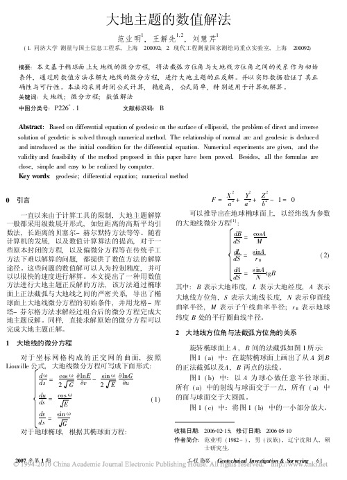
大地主题的数值解法范业明1,王解先1,2,刘慧芹1(1 同济大学测量与国土信息工程系,上海 200092;2 现代工程测量国家测绘局重点实验室,上海 200092)摘要:本文基于椭球面上大地线的微分方程,将法截弧方位角与大地线方位角之间的关系作为初始条件,通过用数值方法求解大地线的微分方程,进行大地主题的正反解。
并以实际数据验证了其正确性与可行性。
本法均采用封闭公式计算,精度高,公式简单,特别适用于计算机解算。
关键词:大地线;微分方程;数值解法中图分类号:P226+1文献标识码:BAbstract :Based on differential equation of geodesic on the surface of ellipsoid,the problem of direct and inverse solution of geodetic is solved through numerical method.The relationship of normal arc and geodesic is deduced and introduced as the initial condition for the differential equation.Numerical experiments are given,and the validity and feasibility of the method proposed in this paper have been proved.Besides,all the formulas are close,simple and easy to be realized by computer.Key words :geodesic;differential equation;numerical method 收稿日期:2006 02 15;修订日期:2006 05 10作者简介:范业明(1982-),男(汉族),辽宁沈阳人,硕士研究生.0 引言一直以来由于计算工具的限制,大地主题解算一般都采用级数展开形式,如短距离的高斯平均引数法,长距离的贝塞尔-赫尔默特方法等等。
Bessel大地主题解算程序

// 计 算 终 点 大 地 坐 标 及 方 位 角
B2,L2,A2
sinu2=sinu1*cos(sigma)+cosu1*cos(A1)*sin(sigma);
B2=atan(sinu2/sqrt((1-e2)*(1-sinu2*sinu2)));
//计算 B2
lambda=atan(sin(A1)*sin(sigma)/(cosu1*cos(sigma)-sinu1*sin(sigma)*cos(A1))); //求 λ
大地主题解算的意义bessel函数bessel卫星坐标解算程序基线解算besseljmatlabbesselgps基线解算原理gps基线解算南方gps解算软件
#include<stdio.h> #include<math.h> #include<stdlib.h>
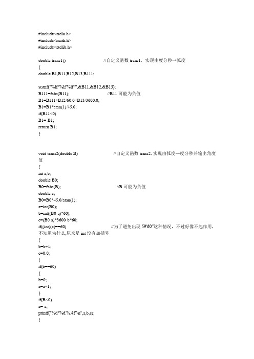
double trans1() { double B1,B11,B12,B13,B111;
//计算归化纬度
double sinA0,cotsigma1,sin2sigma1,cos2sigma1; //计算辅助三角函数值 sinA0=cosu1*sin(A1); cotsigma1=cosu1*cos(A1)/sinu1; sin2sigma1=2*cotsigma1/(1+cotsigma1*cotsigma1); cos2sigma1=(cotsigma1*cotsigma1-1)/(cotsigma1*cotsigma1+1);
//计算 A,B,C 以及 α,β 的值 //P144(4-265)
//P146(4-284)
(好像有问
double sigma0,sin2sigma1sigma0,cos2sigma1sigma0,sigma; //计算球面长度 σ sigma0=(S-(B+C*cos2sigma1)*sin2sigma1)/A; sin2sigma1sigma0=sin2sigma1*cos(2*sigma0)+cos2sigma1*sin(2*sigma0); cos2sigma1sigma0=cos2sigma1*cos(2*sigma0)-sin2sigma1*sin(2*sigma0); sigma=sigma0+(B+5*C*cos2sigma1sigma0)*sin2sigma1sigma0/A;
白塞尔大地主题解算(正算和反算)

大地测量实验报告实验名称:白塞尔大地主题解算(正算和反算)实验目的:1.通过编写白塞尔大地主题电算程序进一步掌握白塞尔法解算大地主题的基本思想。
2.熟练掌握将椭球面上的大地元素按照白塞尔投影条件投影到辅助球面上,继而在球面上进行大地主题解算,最后再将球面上的计算结果换算到椭球面上的基本方法和步骤。
3.学会掌握计算机编程的基本能力。
实验环境:Microsoft Visual C++注意事项:1.在编写程序的过程当中要注意代码的前后统一和重复。
2.注意数值类型的转换和度分秒的换算。
实验步骤:正算:1.计算起点的规划纬度2.计算辅助函数值3.计算系数A,B,C及d,e.4计算球面长度5.计算经度差改正数6.计算终点大地坐标及大地方位角。
反算:1.进行计算辅助函数值2.用逐次趋近法同时计算起点大地方位角、球面长度及经差。
3.计算系数A,B,C及大地线长度S.4.计算反方位角及确定符号。
程序源代码:正算:#include<stdio.h>#include<math.h>#define ee 0.006694384999588#define I 3.141592653double F(double,double,double);void main(void){double A1,B1,L1,S,A2,B2,L2; double x1,x2,x3,y1,y2,y3,z1,z2,z3; double W1,sinu1,sinu2,cosu1,sinA0;doublecota1,cos2a1,sin2a1,cosA0A0;double A,B,C,d,e,a0,a1,m;double n,a,Q,R;printf("请输入数据B1= "); scanf("%lf %lf %lf",&x1,&x2,&x3);B1=F(x1,x2,x3);printf("请输入数据L1= "); scanf("%lf %lf %lf",&y1,&y2,&y3);L1=F(y1,y2,y3);printf("请输入A1= ");scanf("%lf %lf %lf",&z1,&z2,&z3);A1=F(z1,z2,z3);printf("请输入S= ");scanf("%lf",&S);printf("B1=%f\n",B1);printf("L1=%f\n",L1);printf("A1=%f\n",A1);printf("S=%f\n",S);/*计算起点的规划纬度*/W1=sqrt(1-ee*sin(B1)*sin(B1));sinu1=sin(B1)*sqrt(1-ee)/W1;cosu1=cos(B1)/W1;printf("W1=%f\n",W1);printf("sinu1=%f\n",sinu1);printf("cosu1=%f\n",cosu1);/*计算辅助函数值*/sinA0=cosu1*sin(A1);cota1=cosu1*cos(A1)/sinu1;sin2a1=2*cota1/(cota1*cota1+1);cos2a1=(cota1*cota1-1)/(cota1*cota1+1);printf("sinA0=%f\n",sinA0);printf("cota1=%f\n",cota1);printf("sin2a1=%f\n",sin2a1);printf("cos2a1=%f\n",cos2a1);/*计算系数ABC及de*/cosA0A0=1-sinA0*sinA0;A=6356755.288+(10710.341-(13.534*cosA0A0))*cosA0A0;B=(5355.171-9.023*cosA0A0)*cosA0A0;C=(2.256*(cosA0A0))*cosA0A0+0.006;d=691.46768-(0.58143-0.00144*cosA0A0)*cosA0A0;e=(0.2907-cosA0A0*0.0010)*cosA0A0;printf("cosA0A0=%f\n",cosA0A0);printf("A=%f\n",A);printf("B=%f\n",B);printf("C=%f\n",C);printf("d=%f\n",d);printf("e=%f\n",e);/*计算球面长度*/a0=(S-(B+C*cos2a1)*sin2a1)/A;m=sin2a1*cos(2*a0)+cos2a1*sin(2*a0);n=(cos2a1)*(cos(2*a0))-(sin2a1)*(sin(2*a0));a=a0+((B+5*C*n))*m/A;printf("a0=%f\n",a0);printf("m=%f\n",m);printf("n=%f\n",n);printf("a=%f\n",a);/*计算经度差改正数*/Q=(d*a+(e*(m-sin2a1))/3600/180*I)*sinA0;printf("Q=%f\n",Q);/*计算终点大地坐标及大地方位角*/sinu2=sinu1*cos(a)+cosu1*cos(A1)*sin(a);B2=180*atan(sinu2/((sqrt(1-ee))*(sq rt(1-sinu2*sinu2))))/I;R=180*atan(sin(A1)*sin(a)/(cosu1*co s(a)-sinu1*sin(a)*cos(A1)))/I;printf("sinu2=%f\n",sinu2);printf("B2=%f\n",B2);printf("R=%f\n",R*180/I);/*确定R的值*/if(sin(A1)>0 && tan(R)>0)R=abs(R);else if(sin(A1)>0 && tan(R)<0)R=I-abs(R);else if(sin(A1)<0 && tan(R)<0)R=-abs(R);elseR=abs(R)-I;/*确定L2A2的值*/L2=(L1*180/I+R-(Q/206265*180/I));A2=atan(cosu1*sin(A1)/(cosu1*cos(a) *cos(A1)-sinu1*sin(a)));if(sin(A1)<0&&tan(A2)>0)A2=(fabs(A2))*180/I;else if(sin(A1)<0&&tan(A2)<0)A2=(I-fabs(A2))*180/I;else if(sin(A1)>0&&tan(A2)>0)A2=(I+fabs(A2))*180/I;elseA2=(2*I-fabs(A2))*180/I;printf("A2=%3f\n B2=%3f\nL2=%3f\n",A2,B2,L2);}double F(double a2,double b2,doublec2){double d2;d2=(double)(a2+1.0*b2/60+1.0*c2/3600);d2=(d2/180)*I;return (d2);}注:A1,B1,L1,S分别为大地线起点的大地方位角、纬度、经度、大地线长;B2,L2,A2为大地线终点纬度、经度及方位角。
- 1、下载文档前请自行甄别文档内容的完整性,平台不提供额外的编辑、内容补充、找答案等附加服务。
- 2、"仅部分预览"的文档,不可在线预览部分如存在完整性等问题,可反馈申请退款(可完整预览的文档不适用该条件!)。
- 3、如文档侵犯您的权益,请联系客服反馈,我们会尽快为您处理(人工客服工作时间:9:00-18:30)。
东华理工大学
测绘工程学院
2.问题分析
1.球面三角函数计算
球面大地主题解算不同球面角距计算误差 检验方法:先反算再正算
东华理工大学
测绘工程学院
2.问题分析
1.球面三角函数计算
球面大地主题解算不同方位角计算误差
东华理工大学
测绘工程学院
2.问题分析
q接近0赋值1d-20
东华理工大学
测绘工程学院
3.计算分析
1.基本原理
1.白塞尔大地主题解算
•以白塞尔大地投影为基础: •1)按椭球面上的已知值计算球面相应值; •2)在球面上解算大地主题问题; •3)按球面上得到的数值计算椭球面上的相应数值。 • 特点:解算精度与距离长短无关,它既适用于短距离解算,
也适用于长距离解算。可适应10000km或更长的距离,这对 于国际联测,精密导航,远程导弹发射等都具有重要意义。
1.B=0,大地线长误差
3.计算分析
1.B=30,大地线长误差
3.计算分析
1.B=70,大地线长误差
3.计算分析
1.B=90,大地线长误差
3.计算分析
200km时大地方位角误差
东华理工大学
测绘工程学院
3.计算分析
800km时大地方位角误差
东华理工大学
测ห้องสมุดไป่ตู้工程学院
3.计算分析
10000km时大地方位角误差
贝塞尔大地主题计算分析
东华理工大学 报告人:王建强
目录
• 1.基本原理 • 2.问题分析 • 3.数值计算 • 4.结论及问题
东华理工大学 测绘工程学院
1.基本原理
大地主题解算
• • • •
主题解算分为: 短距离(<400km) 中距离(<1000km)
长距离(1000km以上)
东华理工大学
测绘工程学院
东华理工大学
测绘工程学院
结论及问题
• 距离精度优于2cm • 角度精度优于2ms • 距离精度有提高空间
东华理工大学 测绘工程学院
