TURBULENT FLOWS AROUND SAND DUNES IN ALLUVIAL RIVERS
淤泥质海岸挖槽回淤计算探讨
3. 半经验半理论公式
在近海和河口地区,目前已有许多国内学者建立了半经验半理论的回淤强度计算公式。
3.1 虞—金公式
华东师范大学虞志英和连云港建港指挥部金镠[3]从研究粘性细颗粒泥沙冲淤特性出发,
认为细颗粒泥沙冲淤率取决于水流切应力τ b 。在潮汐水流中,τ b 呈周期性变化,当水流切 应力低于淤积临界切应力τ cd 时,悬沙落淤,而当水流切应力超过冲刷临界切应力τ c 时,发
θ:水流方向与航道轴向的夹角,°; n:水流跨越航道的转向系数。 罗氏公式是从河道悬沙运动方程简化而导出的,因而在水流与航道夹角较大时计算误差
较大[7]。其主要应用于 d50 ≤ 0.03mm ,工程后的水深和工程前的水深的比值 H 2 H1 ≤ 2.0,
含盐度在1‰~20‰且水流方向与航道轴向不宜太大的区域[9]。
定计算。
4.2 动力因素
我国近岸地区沿海海域[14],潮汐、潮流运动普遍存在,对海岸泥沙运动是一种有规律 的且经常作用的动力因素。其规律性随地区不同,有全日潮、半日潮和混合潮。另一个动力
-5-
因素是风浪,这是沿岸泥沙运动的强大动力。其规律性与潮汐、潮流不同,有随机性。因此,
)−1
其中:P:回淤厚度,m; α:泥沙沉降机率; ωf:淤泥质泥沙的絮凝沉速,m/s; S:平均含沙量,kg/m3; T:淤积历时,s;
γ o :与粒径有关的表层淤积物的干密度,kg/m3;
V1 、V2 :航道开挖前、后的流速,m/s;
(4)
-3-
d1 、 d 2 航道开挖前、后的水深,m;
⎪⎫ ⎬ ⎪⎭
其中 P :淤泥质海岸航道淤积厚度,m; ω:淤泥质泥沙的絮凝沉速,m/s,计算中取ω=0.0004~0.0005m/s;
地理相关英语词汇
地理相关英语词汇--------------------------------------------------------- abandoned land 弃耕地abiltic factor 非生物因素;非生命因素abiotic environment 非生物环境;非生命环境ablation 消融〔作用〕Abney level 手水准仪aborigine 土著abrasion (corrasion) 磨蚀〔作用〕刻蚀〔作用〕abrasion (wave-cut) platform 海蚀平台absolute humidity 绝对湿度absolute instability 绝对不稳定〔状态〕absolute stability 绝对稳定〔状态〕absolute temperature 绝对温度absorption 吸收〔作用〕abyssal region 深海区acacia 合欢树Acacia confusa 台湾相思accelerated erosion 加速侵蚀accessibility 可达度;能达度acclimatization 气候适应accordant drainage 协调水系;调和水系accretion 加积〔作用〕accumulated temperature 积温acid lava 酸性熔岩acid rain 酸雨acid soil 酸性土壤acidic rock 酸性岩acidity (1) 酸度,(2) 酸性activated sludge 活性污泥active layer 活动层;活土层active recreation 主动性康乐active volcano 活火山activity space 活动空间actual evapotranspiration 实际蒸散〔量〕adiabatic cooling 绝对冷却;绝热降温adiabatic heating 绝对增温adiabatic lapse rate 绝热递减率;绝热直减率adiabatic process 绝热过程adiabatic temperature change 绝热温度变化adit mining 棋坑开采法advection 平流advection fog 平流雾aeolian deposit (sediment) 风积物aeration (1)通气[性],(2)曝气aeration tank 曝气池aerial photograph 航空照片;空中照片aerobic 需氧aerobic treatment 需氧处理aerosol 气溶胶;雾体;大气微粒aesthetic pollution 美感污染aesthetic quality 美感质素afforestation 造林;植林aftershock 余震age composition 年龄构成age group 年龄组别age structure 年龄结构aged-dependency ratio 老年人抚养〔比〕率agents of erosion 侵蚀作用力;侵蚀营力age-sex pyramid 年龄性别金字塔age-specific fertility rate 年龄别生育率age-specific marriage rate 年龄别结婚率age-specific mortality rate 年龄别死亡率agglomerate 集块岩agglomerated settlement 集居聚落agglomeration (1)结集;聚结,(2)聚居点agglomeration economies 集聚经济效益aggradated plain (aggradation plain) 加积平原;填积平原aggradation 右积作用;填积作用aggradation plain (aggradated plain) 加积平原;填积平原aggregate 团聚体;集合体aging of population 人口老化agrarian reform 土地改革agricultural location theory 农业区位理论agricultural waste 农业废料agriculture 农业agro-ecosystem 农业生态系统agrosystem 农业系统A-horizon A层;淋溶层air circulation 空气环流;空气循环air composition 空气成分;空气组成air control zone 空气管制区air mass 气团air mass modification 气团变性air parcel 气块air pollutant 空气污染物air pollution 空气污染;大气污染air pollution source 空气污染〔来〕源air pressure 气压air quality monitoring network 空气质素监察网albedo 反射率alfalfa 苜蓿alfisol 淋溶土algae 藻类algal bloom 藻类过量繁殖alkaline soil 碱性土alkalinity (1)碱度,(2)碱性alkalization 碱化〔作用〕allogenic river 外源河alluvial cone 冲积锥alluvial deposit 冲积物alluvial fan 冲积扇alluvial plain 冲积平原alluvial soil 冲积土alluvial terrace 冲积阶地alluviation 冲积作用alluvium 冲积物;冲积层alpine 高山alpine meadow soil 高山草甸土Alpine mountain-building movement 阿尔卑斯造山运动alpine vegetation 高山植物Alpine-Himalayan Belt 阿尔卑斯--喜马拉雅山带altimeter 高度计altiplano 高原(玻利维亚)altitude 高度altocumulus 高积云altostratus 高层云aluminium sesquioxide 三氧化二铝amenities 市容ammonia 氨ammophilous 喜砂amorphous 无定形amplitude (1)幅度,(2)振幅anabatic wind 上坡风anaerobic 厌氧anaerobic treatment 厌氧处理;缺氧处理ancillary service 辅助性服务〔行业〕anemometer 风速计aneroid barometer 空盒气压计angle of depression 俯角angle of elevation 仰角angle of incidence 入射角angle of inclination 倾角angle of repose 休止角angular (compass, whole circle) bearing 方位角angulate drainage 角状水系animal husbandry 畜牧〔业〕anion 阴离子;负离子annotated map 注释图annual flood 年最大流量;年最大洪水annual mean temperature 年平均温annual rainfall 年雨量annual range of temperature 年温差annual runoff 年径流;年径流量annular drainage 环状水系Antarctic Circle 南极圈antecedent drainage 先成水系anthracite 无烟煤anthropogenic factor 人为因素anticline 背斜anticyclone 反气旋anticyclonic circulation 反气旋式环流anvil cloud 砧状云apartment building 住宅大厦apex (1)冲积扇顶,(2)顶点aquaculture 水产养殖aquatic plant 水生植物aqueduct 引水槽aquifer 畜水层arable farming 耕作农业arable land 〔可〕耕地arch (1)背斜,(2)拱顶,(3)穹窿Archimedes' screw 〔阿基米得式〕螺旋水斗archipelago 群岛Arctic air mass 北极气团Arctic Circle 北极圈Arctic climate 北极气候arctic front 北极锋arcuate delta 弓形三角洲;扇形三角洲area sampling 区域抽样;地区抽样areal association 地区联系;地域联系areal differentiation 地域分异areal distribution 地区分布;地域分布areal specialization 地区专门化;地域专门化areal variation 地区差异;地域差异arete 刃脊;冰脊arid 干旱arid {dry} climate 干旱气候arid land 旱地aridisol 旱成土aridity 干燥〔度〕干旱〔度〕arithmetic mean 算术平均;等差中项;算术中项arithmetic progression 等差级数;算术级数arterial highway 干线公路artesian basin 自流水盆地artesian water 自流水artesian well 自流井artificial climate 人造气候asbestosis 石棉沉着病ash and cinder cone 凝灰火山渣锥ash cone 凝灰火山锥ash lagoon 煤灰湖asker 蛇〔形〕丘aspect 坡向assembly industry 装配工业assembly line 装配线assimilation 同化〔作用〕association 联系assumed mean 假定平均数asthenosphere 软流圈;岩流圈asymmetrical fold 不对称折曲atlas 地图集atmosphere 大气;大气圈atmospheric absorption 大气吸收atmospheric circulation 大气环流atmospheric disturbance 大气扰动atmospheric heat balance 大气热平衡atmospheric heat source 大气热源atmospheric motion 大气流动atmospheric pollutant 大气污染物atmospheric pollution 大气污染atmospheric pressure 大气压力;气压atmospheric radiation 大气辐射atmospheric refraction 大气折射atoll 环礁attrition 磨耗〔作用〕自磨〔作用〕aureole 〔接触〕变质带autotroph 自养生物autotrophic nutrition 自养营养autumnal equinox 秋分available relief (relative relief) 有效地势;相对地势avalanche 雪崩;山崩average cost 平均成本axial growth 轴向增长axial plane 轴面axial stream 山谷主要河流azimuth 方位角azonal soil 泛域土baby boom 生育高峰back bearing 倒后方位backshore 后滩;滨后〔滩〕backwall 后壁;后坡backwash 回流badland 劣地bajada (bahada) 山麓冲积扇带balanced community 均衡社区balanced ecosystem 平衡生态系统Baltic-Danish farming 波罗的--丹麦农业bank deposit 河岸沉积〔物〕bank erosion 河岸侵蚀bank failure 塌岸bank full stage 满岸水位bank protection 护岸bankfull discharge 满岸流量bar 沙洲;沙坝bar chart (graph) 条形图;棒形图barbed drainage 倒状水系barchan 新月形沙丘barogram 自记气压曲线图barograph 自记气压计barometer 气压计barometric gradient 气压梯度barren land 荒地;瘠地barrier reef 堡礁;堤礁barrier to migration 迁徙障碍barysphere 重圈basal sapping 基部掏蚀basalt 玄武岩base flow 基本径流;底流base level 基准面base map 底图;基本图basic industry 基础工业basic lava 基性熔岩basic rock 基性岩basic sector 基础部门basin 盆地basin irrigation 淹灌basin perimeter 流域周长;流域周界basin planning 流域规划basin-and-range terrain 盆山相间地形batholith 岩基bauxite 铝土矿bayhead beach 湾头滩bazaar-type economy 摊贩经济beach 海滩beaded stream 串珠〔状〕河流Beaufort scale 蒲福风级bed load 推移质;底沙bed scour 河床冲刷bedding 层理bedding plane 层面bed-load discharge 推移质输送量;底沙输送量bed-load transport 推移质输送;推移质搬运bedrock 基岩;底岩beef cattle 肉用牛behavioral adjustment 行为适应beheaded river (stream) 断头河bell-shaped curve 钟形曲线belt transect 样带bench 阶地bench mark (BM) 水准点beneficiation 矿物增效处理;富集bergschrund 冰后隙;冰斗隙best fit line 最优拟合线B-horizon B层;淀积层bias 偏误;偏差bidder 投标人;出价人bid-rent 出价地租bid-rent curve 出价地租曲线bifurcation ratio 分叉比;分叉率bimodal 集峰binomial curve 二项曲线biochemical oxygen demand(BOD) 生化需氧量biocycle 生物循环biodegradation 生物降解biogeochemical cycle 生物地球化学循环biogeography 生物地理学biological concentration 生物密集biological control 生物防治biological indicator 指示生物biological monitor 生物调节者biological productivity 生物生产力biological purification 生物净化biological weathering 生物风化biomass 生物量biome 生物群落biosphere 生物圈biota (biotic community) 生物群biotic balance (equilibrium) 生物平衡biotic barrier 生物阻限biotic climax 生物顶极〔群落〕biotic community (biota) 生物群biotic component 生物组元biotic condition 生物条件biotic environment 生物环境;生命环境biotic equilibrium (balance) 生物平衡biotic factor 生物因素;生命因素biotite 黑云母biotype 生物〔类〕型bird's foot delta 鸟足状三角洲birth control 节育;计划生育birth rate 出生率birth-death ratio 生死比率bituminous coal 烟煤black alkali soil 黑碱土black earth 黑土blast furnace 鼓风炉bleached horizon 漂白层blighted area (1)萎缩地区,(2)枯萎区blizzard 暴风雪;雪暴block diagram 立体图block disintegration 块状崩解;块状分裂block mountain 断块山blood rain 血雨blood worm 红虫;颤虫blow-hole 吹穴blowout (deflation hollow) 吹蚀穴;风蚀洼地bluff 陡坡;陡崖body wave 体波bog 藓沼;沼泽bog peat 沼泽泥炭bora 布拉风(地中海北岸)boreal climate 北部〔森林〕气候boreal forest 北部针叶林borehole 钻孔;探孔boulder 巨砾;石砾boulder clay 泥砾boulder fan 巨砾扇boulder-controlled slope 砾块控制坡boundary (1)界限,(2)边界boundary layer 边界层brackish water 微咸水brackish water habitat 微咸水生境braided stream 分汊河道branching channel 辫状河breaching of dyke 决堤break8ing point 市场分界点breaker zone 碎波区;破波区break-of-bulk-point 转运点breakwater 防波堤breccia 角砾岩breeder reactor 增殖反应堆breeze 微风bridging point 架桥点broad-leaved forest 阔叶林bromine 溴bronchial ailment 支气管失调brown desert steppe soil 棕色荒漠草原土;棕钙土brown earth 棕壤brown forest soil 棕色森林土brown podzolic soil 灰化棕色土;灰化棕壤browsing stock 放牧牲畜buckling (1)弯曲,(2)地壳弯曲buffer 缓冲built-up area 已建区bulk carrier 散装货轮bund 堤Burgess's Concentric Model 伯吉斯同心区模式burrowing animal 穴居动物;钻洞动bush fallowing 灌丛休耕法bush veld 灌丛草原(南非)bushfire 林火business turnover 营业额butte 小方丘;孤丘buttress root 板根by-census 中期人口普查;中期户口统计cactus 仙人掌cadmium 镉Cainozoic (Cenozoic) era 新生calcareous crust 代钙质地表层;石灰结皮;石灰结壳calcareous rock 钙质岩calcareous soil 钙质土;石灰性土壤calcic horizon 钙质层calcification 钙化作用calcimorphic soil 钙成土calciphilous plant 适钙植物;喜钙植物calcite 方解石calcium carbonate 碳酸钙caldera 破火山口Caledonian mountain-building movement 加里东造山运动caliche 钙质层calm (1)无风,(2)静calorie 卡路里;卡Cambrian period 寒武纪camouflage 保护色作用canopy 冠层canyon 峡谷cape 岬〔角〕capillary action 毛〔细〕管作用capital (1)资金;资本,(2)首都capital accumulation 资本累积capital city 首都capital goods 资本货物capital investment 资本投资capital-intensive industry 资本密集工业cap-rock 冠岩;覆盖石caravan 商队(北非)carbohydrate 碳水化合物carbon cycle 碳循环carbon monoxide 一氧化碳carbonaceous rock 炭质岩carbonation 碳化作用carbonic acid 碳酸Carboniferous period 石炭纪carcinogen 致癌物cardinal points 方位基点caribou 驯鹿carnivore 食肉动物;食肉生物carrying capacity 负载能力cartographic technique 绘图技巧cartography 绘图学cascade 小瀑布case study 个案研究;学习事例cash crop 经济作物;现金作物cash tenancy 现金租用耕地制cassava 木薯cast iron 铸铁cataract 急流catastrophic effect 灾难性后果catch crop 填闲作物catchment area (1)集水区,(2)从属区catchwater 引水道category 类型;类别catena (soil catena) 土链cation 阳离子;正离子cation exchange capacity 阳离子交换能力;正离子交换能力cattle rearing 牧牛业cavern 岩洞cavitation 空化〔作用〕cellular circulation 环型环流Celsius scale 摄氏温度表cementation 胶结〔作用〕Cenozoic (Cainozoic) era 新生代census 代人口普查;户口统计central business district (CBD) 商业中心区central city 中心城central place 中地;中心地central tendency 集中趋势centrality 中心性centralization 集中centrally-planned economy 中央计划经济centre of gravity 重心centrifugal drainage 离心水系centrifugal force 离心力centripetal drainage 向心水系centripetal force 向心力cereal 谷类cesspool 污水池;粪池chain island 列岛chain shop 连锁店chalk 白垩chance factor 机遇因素channel (1)海峡,(2)水道,(3)河槽;河床channel capacity 河道容量channel cutting 河道割切channel density 河网密度channel equilibrium 河道平衡channel erosion 河道侵蚀channel filling 河道淤塞channel flow 河道径流;河槽径流channel frequency 河道频数channel gradient (slope) 河道坡度;河床坡度channel improvement 河道整治channel length 河道长度channel realignment 河道改道channel roughness 河床糙度channel slope (gradient) 河道坡度;河床坡度channel width 河道宽度channelled runoff 河道径流channelling 开渠;开新槽chaparral 浓密常绿阔叶灌丛(美国加利福尼亚和墨西哥) chart 图;图表chemical industry 化学工业chemical oxygen demand (COD) 化学需氧量chemical waste 化学废物chemical weathering 化学风化chemically formed sedimentary rock 化学作用形成的沉积岩chemosynthesis 化合作用;化学合成chernozem 黑钙土chestnut brown soil 栗钙褐土chestnut soil 栗钙土child-bearing age group 生育年龄组chili 奇利风(突尼斯的干热风)chinook 钦诺克风(北美)chi-square 卡方chloroflurocarbons (CFCs) 氯氟碳chlorophyll 叶绿素C-horizon C层;母质层choropleth map 等值域图Christaller's Central Place Theory 克里斯泰勒中地学说chute (1)奔流;瀑流,(2)流槽cinder cone 火山渣锥circular causation 循环因果circum-Pacific belt 环太平洋带circumpolar westerlies 环极西风cirque (corrie, cwm) 冰斗cirrocumulus 卷积云cirrostratus 卷层云cirrus 卷云city 城市city (urban) planner 城市规划师city (urban) planning 城市规划city centre 市中心city plan 城市平面图city proper 城市市区部分class 区;组;类class boundary 组界class interval 组区间;组距class limit 组限;区限class mark (class mid-point) 组中点;组中点class mid-point (class mark) 组中点;区中点clastic deposit 碎屑沉积clay 黏土clay loam 黏质壤土clay pan 黏盘clay particle 黏土颗粒clayey 黏质clay-humus complex 黏粒腐殖质复合体cliff 悬崖;峭壁climate 气候climate modification 〔人工〕改变气候climatic amelioration 气候改良climatic anomaly 气候异常climatic barrier 气候障壁climatic change 气候变化;气候变迁climatic classification 气候分类climatic climax 气候顶极〔群落〕climatic deterioration 气候恶化climatic element 气候要素climatic factor 气候因子climatic graph 气候图〔表〕climatic map 气候图climatic oscillation 气候变化;气候变动climatic prediction 气候预报climatic region 气候区climatic regulation 气候调节〔作用〕climatology 气候学climax 顶极〔群落〕climax community 顶极群落climax vegetation 顶极植物climber 攀绿植物climbing plant 攀绿植物climograph 气候图clinometer 倾角仪;测斜仪clint 石灰岩岩脊;石芽closed system 密闭系统clothing industry 制衣业cloud 云cloud cover (cloudiness) 云量cloud reflection 云盖反射cloud seeding 播云;云的催化cloud type 云型cloudiness (cloud cover) 云量cluster sampling 类集抽样coagulation 混凝coal seam 煤层coalfield 煤田coarse texture soil 粗质地土壤coarse tuff 粗粒凝灰岩coarse-grained rock 粗粒岩石coastal landform 海岸地貌;海岸地形coastal plain 海岸平原coastline 海岸线cobble 中砾coding 编码cohesion 内聚力;凝聚力cohort 同期组群coking coal 〔炼〕焦煤col 山口;山坳cold current 寒流cold desert 寒〔带荒〕漠cold front 冷锋cold resistance 耐寒性cold temperate climate 寒温带气候cold wave 寒潮collective farming 集体农业collectivization 集体化colloid 胶体colluvium 崩积物;崩积层;坡积物colonization (1)殖民;拓殖,(2)集群;定殖;占据colony 集群;群体columnar jointing 柱状节理columnar structure 柱状结构combine harvester 联合收割机;多用途收割机commercial centre 商业中心commercial farming 商业性农业commercial zone 商业区commercialization 商业化commune 公社communication (1)交通,(2)通讯community (1)社区,(2)群落community facility 社区设施community organization 社区组织community shopping centre 社区购物中心commuter 通勤者;往返市区工作地点及郊区住所的人commuter zone 通勤带compact texture 致密结构comparative advantage 相对优势comparison goods 需比较商品compass 罗盘;指南针compass (angular, whole circle) bearing 方位角compass points 罗盘指标;罗盘方位competence of stream 河流搬运最大颗粒能力competition for location 区位竞争competition for space 空间竞争component 组元composite cone 复合火山锥composting 堆肥comprehensive redevelopment area 综合性重建区compressional force 挤压力computation 计算concave bank 凹岸concave slope 凹坡concentration 集结concentric zone theory 同心圆地带论concordant (longitudinal) coast 顺向海岸;纵式海岸concretion 结核〔作用〕condensation 凝结condensation level 凝结高度condensation nuclei 凝结核心conduction of heat 热传导conelet 小型火山锥confluence 汇流点congelifraction 融冻〔崩解〕作用conglomerate 砾岩conical hill 锥形山conifer 针叶树coniferous forest 针叶林connectivity 连接程度consequent drainage 顺向水系conservation 养护;保养;保护;保存;节约conservation of resources 资源保养constant slope 直坡constructive plate boundary 建设性皮块边界constructive wave 建设性波浪;堆积浪consumer 消费者consumer behaviour 消费行为;消费者行为container 集装箱;货柜container terminal 集装箱码头;货柜码头containerization 集装箱化;货柜化continent 洲;大陆continental air mass 大陆气团continental apron (rise) 大陆隆continental climate 大陆〔性〕气候continental collision 大陆碰撞continental crust 大陆地壳;陆壳continental drift 大陆漂移continental edge (fringe, margin) 大陆边缘continental fringe (edge, margin) 大陆边缘continental glacier 大陆冰川continental island 大陆岛continental margin (edge, fringe) 大陆边缘continental nucleus 陆核continental plate 大陆板块continental plate boundary 大陆板块边界continental rise (apron) 大陆隆continental rupture 大陆破裂continental shelf 大陆〔棚〕架continental shield 地盾continental slope 〔大〕陆〔斜〕坡continental suturing 大陆缝合作用continentality 大陆性;大陆度contour farming (ploughing) 等高耕作〔法〕contour line 等高线contour map 等高线图contour mapping 等高线绘图contour method 等高线法contour ploughing (farming) 等高耕作〔法〕contraception 避孕contract farming 合约式农业controlled flooding 控制漫灌〔法〕controlled tip 废物堆填区controlled tipping 废物堆填法conurbation 联都;集合城市〔区〕convection (convectional) rain 对流雨convection (convective) current (1)对流,(2)对流气流convection of heat 热对流convective (convection) current (1)对流,(2)对流气流convenience goods 日用品;常用商品conventional sign 图例;沿用图例;惯用符号convergence (1)辐合,(2)聚合convex bank 凸岸convex slope 凸坡cool temperate climate 凉温带气候co-operative farming 合作社式农业coordinate 坐标coral reef 珊瑚礁cordillera 雁列山(美洲 )core (1) 地核;地心,(2)核心core area 核心区corestone 核心石;岩心Coriolis effect 科里奥效应Coriolis force 科里奥利力;地球自转偏向力Corn Belt 玉米带(美)corrasion (abrasion) 磨蚀〔作用〕刻蚀〔作用〕corrective measure 改善措施correlation 相关corrie (cirque, cwm) 冰斗corrosion 溶蚀〔作用〕cosmic ray 宇宙射线cost minimization 生产成本最低化;成本的极少化cost of living 生活费cost-benefit analysis 损益分析;成本收益分析cottage industry 家庭式工业counter radiation 逆辐射counter-urbanization 逆城市化country park 郊野公园country rock 围岩crag and tail 鼻尾丘crater 火山口crest 山脊Cretaceous period 白垩纪crevasse 冰隙;裂隙critical discharge 临界流量critical isodapane 临界等总运费线crop and livestock farming 耕牧混合农业crop breeding 作物育种crop failure 作物失收;作物减产crop rotation 轮植;轮作;轮耕cropping pattern 作物生产型式cropping region 作物区cropping system 耕作制度;农作制度cross breeding 杂交育种;杂交繁育cross section 横剖面;横切面cross-bedding 交错层crown 树冠crude birth rate 粗出生率;毛出生率crude death rate 粗死亡率;毛死亡率crumb structure 屑粒结构crust (earth's crust) 地壳crystal 晶体crystalline rock 结晶岩crystallization 结晶〔作用〕cuesta 单斜脊;单面山cuesta scarp 单斜脊崖(前坡);鬣崖cultural landscape 文化景观cumulative causation 累积因果cumulative frequency 累积频数;累积频率cumulative frequency curve 累积频数曲线;穹形线cumulonimbus 积雨云cumulus 积云cup anemometer 转杯风速计curde oil 原油current meter 流速计current speed 流速cuspate delta 尖头三角洲cut off slope 削蚀坡cut-and-fill (1)边冲边淤(曲流) (2)先冲后淤(河床) cuticle 角质层cut-off (1)截流;断流,(2)裁湾〔作用〕cut-off lake (oxbow lake) 牛轭湖cutting 〔削〕切面cwm (cirque, corrie) 冰斗cycle of erosion 侵蚀循环cycle of poverty 贫穷循环cyclone 气旋cyclone track 气旋路线cyclonic circulation 气旋环流cyclonic flow 气旋流动cyclonic rain 气旋雨daily (diurnal) range of temperature 日温差dairy cattle 乳牛;乳用牛dairy farming 乳牛畜牧业Dalmatian coast 达尔马提亚型海岸;顺向海岸dam 水坝dam-failure 溃坝;垮坝data analysis 数据分析;资料分析data collection 数据搜集;资料搜集data interpretation 数据阐释;资料阐释data processing 数据处理;数据处理data representation 数据表达;资料表达de facto population 现住人口de jure population 常住人口death rate 死亡率debris avalanche 岩屑崩落debris flow 泥石流debris slope 岩屑坡decalcification 脱钙作用decay 腐烂;分解decentralization 分散;离心decibel (dB) 分贝deciduous forest 落叶林decision maker 决策者declining region 衰落区decomposer 分解者decomposing organism 分解生物decomposition 分解〔作用〕deep-focus earthquake 深源地震deferred junction 延长汇点deferred stream 延长河deflation 吹蚀〔作用〕deflation hollow (blowout) 吹蚀穴;风蚀洼地deflation varnish 吹蚀漆皮deflection 偏向deflection (deflective, deviating) force 偏向力;偏转力deflective (deflecting, deviating) force 偏向力;偏转力defoliation 去叶;落叶;脱叶deforestation 伐林deformation 变形;变态deglomeration 反聚集力degradable plastics 可降解塑料degradation 陵削〔作用〕减坡degrading stream 夷低河;削蚀河;下切河流dehydration 脱水〔作用〕deionized water 去离子水delta 三角洲demand potential 需求潜在力demographic data 人口数据;人口资料demographic structure 人口结构demographic transition 人口过渡;人口转变demographic transition theory 人口过渡论demography 人口统计学;人口学dendritic drainage 〔树〕枝状水系denitrification 反硝化作用densely populated 人口稠密density 密度density map 密度图denudation 剥蚀〔作用〕denudation chronology 剥蚀年代dependency population 依赖人口;受抚养人口dependency ratio 依赖比率;抚养比率dependent variable 应变量;应变数depopulation 人口减少;人口下降deposit 沉积物deposition 沉积〔作用〕depreciation (1)折旧,(2)贬值;货币贬值depressed region 葨落区域depression (1)低气压,(2)洼地deranged drainage 冰碛平原水系;扰乱水系desalinization 脱盐作用descriptive statistics 描述统计学desert 荒漠;沙漠desert climate 荒漠气候;沙漠气候desert encroachment 荒漠扩展;沙漠扩侵desert pavement 荒漠〔卵石〕覆盖层;沙漠〔卵石〕覆盖层desert plateau 荒漠高原;沙漠高原desert varnish 荒漠漆皮desertification 荒漠化;沙漠化desiccation 干燥作用;变旱desilication 脱硅作用destructive plate boundary 破坏性板块边界destructive wave 破坏性〔波〕浪detached building 独立式楼宇detritus (1)碎屑;岩屑,(2)腐屑developed country 已发展国家developing country 发展中国家development level 发展水平deviating (deflecting, deflective) force 偏向力;偏转力deviation 偏差Devonian period 泥盆纪dew 露dew point 露点D-horizon D层;基岩层diagenesis 成岩作用diagonal linkage 对角联系diastrophism 地壳运动differential erosion 差别侵蚀differential weathering 差别风化diffuse radiation 扩散辐射diffusion 漫射;扩散dike (dyke) (1)岩墙;岩脉,(2)堤dilution 稀释diminishing return 收益递减dip 倾斜dip angle 倾角dip direction 倾向dip slope 倾向坡direct proportion 正比例disaster relief 救灾discharge 流量disclimax 亚演替顶极discordant coast 横或海岸discordant drainage 不协调水系discrete data 不连续数据disease control 疾病控制diseconomies of scale 规模不经济disintegration 崩解;分解dismembered drainage 解体水系dispersed settlement 分散聚落dispersion (1)离〔中〕趋势;离〔中〕差,(2)离散displacement 位移disposal 处置;处理dissected plateau 切割高原dissection 切割〔作用〕分割〔作用〕dissipation 消散〔作用〕dissolved load 溶解〔搬运〕质dissolved oxygen (DO) 溶解氧distance decay 随距递减;随距衰减distributary 分流distribution 分布distributional pattern 分布形态diurnal (daily) range of temperature 日温差divergence (1)辐散,(2)分向diversification 多元化divided circle (pie graph) 圆瓣图division of labour 分工doldrums 赤道无风带dolerite 粗玄岩doline 溶斗;〔漏斗形〕灰岩坑domain 领域dome 穹丘,圆丘domesti refuse 家庭废物domestic sewage 生活污水;家庭污水domesticated animal 驯养家畜domestication 驯化;驯养dominant animal 优势动物dominant plant 优势植物dominant species 优势种dormancy 休眠dormant volcano 睡火山dormitory suburb 郊外居住区;郊外住宅区dormitory town 居住城镇dot map 点示图double cropping 雨造耕作;双作downcutting 下蚀〔作用〕下切侵蚀downdraft (downdraught) 下沉气流downfold 向斜downstream 下游downthrow 下盘downtown 市中心;城市商业区(美)downward filtering process 下滤过程downwelling 沉降流downwind effect 下沉风效应drag velocity 摩阻流速drainage (1)水系,(2)排水drainage area (1)流域,(2)排水区drainage basin 河盆;河域drainage density 河网密度;排水密度drainage network (1)河网,(2)排水网drainage pattern 水系型〔式〕drainage system 水系draught animal 役畜dredging 清淤;疏浚dreikanter 三棱石;风棱石drift (adlt) mining 横坑开采法drift material 飘流物;漂流物drill rig 钻油台;钻塔drip-tip 滴水叶尖drizzle 微雨;毛毛雨drought 干旱drought-resistant plant 抗旱性植物drowned river valley (rai) 溺谷;溺河drumlin 脊背丘;鼓丘dry (arid) climate 干旱气候dry (wind) gap 旱峡;风口dry adiabatic lapse rate 干绝热〔温度〕递减率;干绝热〔温度〕直减率dry crop 旱田作物dry farming 旱耕〔法〕dry rice 旱稻dry valley 干谷;涸谷dry-bulb thermometer 干球温度计drying agent 干燥剂duckweed 浮萍;青萍dumping area 倾卸区dune 沙丘dune encroachment 沙丘扩侵duplex house 复式房屋durable goods 耐用品duricrust 铝铁硅钙壳duripan 硬盘Dust Bowl 尘暴区(美)dust storm 尘暴dwelling unit 居住单位dyke rock 脉岩dyke(dike) (1)岩墙;岩脉,(2)堤dynamic equilibrium 动态平衡earth movement 地壳运动earth pillar 土柱earth revolution 地球公转earth rotation 地球自转earth-flow 泥流earthquake 地震earthquake focus 震源earthquake intensity 地震强度earthquake origin 震源earthquake period 地震期earthquake prediction 地震预报earthquake scale 地震震级earthquake wave 地震波earthquake zone 地震带earthquake-prooff design 抗震设计earth's axis 地轴earth's crust (crust) 地壳earthy 土状easterlies (1)东风,(2)东风带easting 东行线ecocline 生态变异;生态差型ecological balance 生态平衡ecological community 生态群落ecological crisis 生态危机ecological damage 生态破坏ecological efficiency 生态效率ecological niche 生态位;小生境ecological pyramid 生态塔ecological succession 生态演替ecology 生态学economic base 经济基础economic bloc 经济集团economic depression 经济萧条economic development 经济发展economic growth 经济增长economic man 经济人economic recession 经济衰退economic recovery 经济复苏economic region 经济区economic rent 经济租值economic take-off 经济起飞economic utility 经济效用economically active population 经济活动人口economically inactive population 非经济活动人口economies of scale 规模经济效益ecosphere 生态圈ecosystem 生态系统ecotone 群落过渡带;群落交错区ecotype 生态型edaphic climax 土壤演替顶极〔群落〕edaphic factor 土壤因素eddy 旋涡effciency of energy transfer 能量变换效率;能量转换效率effective precipitation 有效降水〔量〕effluent (1)污水;废水,(2)湖源河eight point compass 八方位罗盘elasticity of demand 需求弹性elasticity of supply 供给弹性elbow of capture 袭夺〔河〕弯electrical conductivity 导电性;导电率electromagnetic wave 电磁波electronics industry 电子业elevated peneplain 上升准平原elevation (1)海拔;高度,(2)仰角eluvial deposit (1)残积物,(2)淋溶沉积物eluvial horizon 淋溶层eluviation 淋溶〔作用〕淋失〔作用〕embankment 堤基emergence 上升emergent (1)露生植物,(2)挺水植物emergent coast 上升海岸emigrant 移民emigration 移居国外empirical data 实验数据employment structure 就业结构end (terminal) moraine 终〔冰〕endangered species 濒临灭绝的生物品种;濒危物种endogenic process 内力作用;内成作用energy balance 能量平衡energy budget 能量收支energy conservation 能源节约energy crisis 能源危机energy deficit 能量亏损energy efficiency 能量效率;能源效率energy flow 能〔量〕流energy level 能量级energy ratio 能量比率energy reserve 能源蕴藏energy resources 能源〔资源〕energy source 能源energy subsidy 能源补助energy surplus 能量过剩energy transfer 能量转移engineering industry 机械工业englacial moraine 内〔冰〕碛entisol 新成土entrenched meander 嵌入曲流;深切曲流entrenched stream 嵌入河;深切河entrenched valley 嵌入〔河〕谷;深切〔河〕谷entrepot 转口港entrepreneur 企业家entrepreneurial factor 企业管理因素environmental capacity 环境容量environmental conservation 环境保护environmental constraint 环境限制environmental degradation 环境退化environmental education 环境教育environmental gradient 环境梯度environmental hazard 环境灾害;环境危害environmental impact 环境影响environmental impact statment 环境影响报告environmental improvement 环境改善environmental lapse rate 环境〔温度〕递减率;环境〔温度〕直减率environmental perception 环境感观environmental planning 环境规则environmental pollution 环境污染environmental quality 环境质素environmental resources 环境资源environmental risk 环境风险Eocene epoch 始新世epeirogenic movement 造陆运动ephermeral (1)短生植物,(2)短生ephermeral stream 季节性河流;间歇〔性〕河〔流〕epicdermis 表皮epicentre 震央;震中epiphyte 附生植物Equator 赤道equatorial air mass 赤道气团equatorial climate 赤道气候equatorial low 赤道低〔气〕压equatorial rain forest 赤道雨林equatorial trough 赤道低压槽eradication of disease 消除疾病erg (sandy desert) 砂质荒漠;砂质沙漠erodibility 可侵蚀性erosion 侵蚀erosion cycle 侵蚀循环erratic 漂石eruption 爆发escarpment 单斜山;马头丘estancia 大牧场(南美)estate (1)大农场,(2)estuarine delta 河口三角洲estuary 河口湾ethnic area 种族区ethnic group 种族群ethnic minority 少数种族ethnic segregation 种族隔离Eurasia 欧亚大洲eustasy 海面升降;海面进退eustatic movement 海面升降运动eutrophic 富养分eutrophication 富养化〔作用〕evaporation 蒸发〔作用〕evapotranspiration 蒸发蒸腾作用even (regular) slope 均匀坡evergreen forest 常绿林evolution 演化;进化excavation (1)掘蚀,(2)挖掘excessive urbanization 过度城市化exchange capacity 交换量exchangeable cation 交换性阳离子;交换性正离子exfoliation 剥离〔作用〕;页状剥落〔作用〕exhaust gas 废气;排气exhumation 剥露〔作用〕exogenic process 外力作用;外成作用exotic river 外源河exponential curve 指数曲线export 出口export-oriented industry 出口导向工业exposed coast 裸露海岸;暴露海岸extended family 大家庭extensive farming 粗放式农业;广耕法external economies 外部经济效益external force 外〔营〕力external migration 国外迁移;境外迁移extinct species 已灭绝生物品种extinct volcano 死火山extinction of species 品种灭绝extrapolation 外推法;外插法extreme climate 极端气候extreme environment 极端环境extreme event 极端事件extreme value 极值extrusion 喷出;挤出extrusive rock 喷出岩extrusive vulcanicity 喷出火山作用eye of tropical cyclone 〔热带气旋〕风眼fabricating industry 装配工业factor of location 区位因素;布局因素factor of production 生产因素。
感潮河段船闸下引航道水沙运动及泥沙淤积

文章编号:1005-9865(2004)04-0086-09感潮河段船闸下引航道水沙运动及泥沙淤积杨 红,张幸农(南京水利科学研究院,江苏南京 210024)摘 要:通过建立一维非恒定水流泥沙数学模型,对规则断面引航道中的水流泥沙运动规律及淤积特性进行了数值模拟计算,并对影响感潮河段船闸下泥沙淤积的各种因素(如干支流水位差、开通闸水头差、主流潮差等)进行了深入分析和研究。
研究结果可为有关工程设计及运行管理提供参考。
关键词:感潮河段;引航道;泥沙淤积;数值模拟中图分类号:TV142 文献标识码:AAnalysis on flow and sedi ment movement in approachchannels of tidal river branchesYANG Hong,ZHANG Xing -nong(Nanjing Hydraulic Research Insti tute,Nanjing 210024,China)Abstract:Siltation is a common problem in approach channels of river branches in tidal areas,and it is very complex because of many influ -encing factors.A one -dimensional unsteady numerical model is developed to simulate the movement of flow and sediment in a regular approach channel and to analyze the influence of some factors on siltation.The results supply a scien tific basis for the design and management of pro -jects.Key words:tidal reach;approach channel;siltation;numerical modeling收稿日期:2003-10-10作者简介:杨 红(1977-),山西临猗人,硕士,主要从事水力学与河流动力学研究。
港口航道与海岸工程-海岸动力学:第一章至第五章 详尽知识点整理 复习备考资料
第一章 波浪理论1.波浪分类(1)按波浪形态:分为规则波和不规则波(2)按波浪传播海域的水深:h/L ≥1/2 为深水波;1/2>h/L>1/20 为有限水深波;h/L ≤1/2 为浅水波(3)按波浪破碎与否:分为破碎波、未破碎波和破后波2.波浪运动控制方程 (1)描述一般水流运动方法有两种:一种叫欧拉法,亦称局部法,另一种叫拉格朗日法,亦称全面法(2)描述简单波浪运动的理论: 一个是艾利(Airy )提出的为微幅波理论,另一个是斯托克斯(Stokes )提出的有限振幅波理论3.参数(1)波高H :两个相邻波峰顶之间的水平距离(2)振幅a :波浪中心至波峰顶的垂直距离,H=2A (3)波周期T : 波浪推进一个波长所需的时间(4)波面升高 )t , x (ηη= :波面至静水面的垂直位移(5)函数表达式: )t -kx (Acos ση=(6)圆频率:T 2πσ= (7)波速c : 波形传播速度,即同相位点传播速度,又称相速度4.建立简单波理论的假设:流体是均质和不可压缩的,其密度为一常数;流体是无粘性的理想流体;自由水面的压力是均匀的且为常数;水流运动是无旋的;海底水平、不透水;流体上的质量力仅为重力,表面张力和柯氏力忽略不计;波浪属于平面运动,即在xz 平面内作二维运动。
5.速度φ的控制方程(拉普拉斯方程): 02222=∂∂+∂∂z x φφ 就是势运动的控制方程。
6.拉普拉斯方程的边界条件:(1)海底表面边界条件:海底水平不透水 0z=∂∂φ ,h z -= 处(2)自由水面动力学边界条件: 0])()[(21t 22=+∂∂+∂∂+∂∂==ηφφφηηg zx z z (3)自由水面的运动边界条件:自由水面上个点的运动速度等于位于水面上个水质点的运动速度0zx x t =∂∂-∂∂∂∂+∂∂φφηη ,η=z 处(4)二维推进波,流场上、下两端面边界条件可写为:)z ,ct -x ()t ,z ,x (φφ=7.微幅波理论假设:假设运动是缓慢的,波动的振幅A 远小于波长L 或水深h7.微幅波波面方程:)t -kx (cos 2σηH =弥散方程)kh (gktanh 2=σ 波长:)kh (tanh 2gT L 2π= 波速:)kh (tanh 2gT c π= 深水波长:π2gT L 2o = 深水波速:π2gT c o = 浅水波长:gh T L s = 浅水波速gh c s =8.色散(弥散)现象:不同波长(或周期)的波以不同速度进行传播最后导致波的分散现象称为波的色散现象。
基于CFD-DEM耦合模拟方法的水流泥沙运动研究
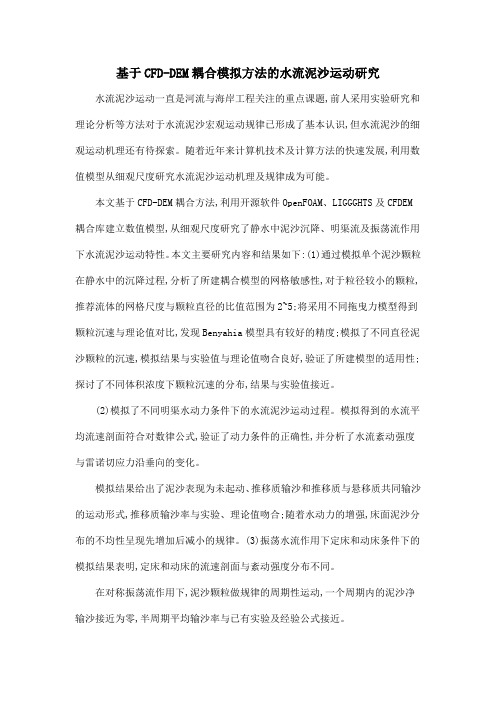
基于CFD-DEM耦合模拟方法的水流泥沙运动研究水流泥沙运动一直是河流与海岸工程关注的重点课题,前人采用实验研究和理论分析等方法对于水流泥沙宏观运动规律已形成了基本认识,但水流泥沙的细观运动机理还有待探索。
随着近年来计算机技术及计算方法的快速发展,利用数值模型从细观尺度研究水流泥沙运动机理及规律成为可能。
本文基于CFD-DEM耦合方法,利用开源软件OpenFOAM、LIGGGHTS及CFDEM 耦合库建立数值模型,从细观尺度研究了静水中泥沙沉降、明渠流及振荡流作用下水流泥沙运动特性。
本文主要研究内容和结果如下:(1)通过模拟单个泥沙颗粒在静水中的沉降过程,分析了所建耦合模型的网格敏感性,对于粒径较小的颗粒,推荐流体的网格尺度与颗粒直径的比值范围为2~5;将采用不同拖曳力模型得到颗粒沉速与理论值对比,发现Benyahia模型具有较好的精度;模拟了不同直径泥沙颗粒的沉速,模拟结果与实验值与理论值吻合良好,验证了所建模型的适用性;探讨了不同体积浓度下颗粒沉速的分布,结果与实验值接近。
(2)模拟了不同明渠水动力条件下的水流泥沙运动过程。
模拟得到的水流平均流速剖面符合对数律公式,验证了动力条件的正确性,并分析了水流紊动强度与雷诺切应力沿垂向的变化。
模拟结果给出了泥沙表现为未起动、推移质输沙和推移质与悬移质共同输沙的运动形式,推移质输沙率与实验、理论值吻合;随着水动力的增强,床面泥沙分布的不均性呈现先增加后减小的规律。
(3)振荡水流作用下定床和动床条件下的模拟结果表明,定床和动床的流速剖面与紊动强度分布不同。
在对称振荡流作用下,泥沙颗粒做规律的周期性运动,一个周期内的泥沙净输沙接近为零,半周期平均输沙率与已有实验及经验公式接近。
基于SWAT_模型的渠江流域径流侵蚀功率时空规律分析

第22卷 第2期2024年4月中国水土保持科学Science of Soil and Water ConservationVol.22 No.2Apr.2024 D OI :10.16843/j.sswc.2023084基于SWAT 模型的渠江流域径流侵蚀功率时空规律分析黄 幸1,2,莫淑红2†,李平治2,乔殿新3,李斌斌3(1.河海大学水文水资源学院,210098,南京;2.西安理工大学省部共建西北旱区生态水利国家重点实验室,710048,西安;3.水利部水土保持监测中心,100053,北京)摘要:探明流域径流侵蚀功率的演变规律对重点侵蚀区识别和土壤侵蚀防治至关重要㊂以嘉陵江右岸支流渠江流域为研究区,基于SWAT 模型模拟计算流域径流侵蚀功率,分析其时空分布特征与空间尺度效应,并通过聚类分析㊁相关性分析揭示其对流域气象㊁地形㊁土壤等因素的关系㊂结果表明:渠江流域年尺度的径流侵蚀功率大于季尺度,其中第3季度为土壤侵蚀重点防治时段;全年和第3季度的多年平均径流侵蚀功率均呈现出北部大南部小㊁西部大东部小㊁上游大下游小的空间分布特征;渠江干流与其支流大通江的多年平均径流侵蚀功率和流域控制面积之间均呈幂指数关系,且其变化规律存在空间阈值,在年尺度干流和大通江的阈值面积分别为8549.4和8504.4km 2,在第3季度干流和大通江的阈值面积分别为4834.9和6223.5km 2;气象因子㊁地形因子和流域形态因子为渠江流域径流侵蚀功率的主要影响因素㊂研究结果可为制订渠江流域土壤侵蚀治理方案提供决策依据㊂关键词:SWAT 模型;径流侵蚀功率;时空分布;空间尺度效应;渠江流域中图分类号:S157.1;P333文献标志码:A文章编号:2096⁃2673(2024)02⁃0025⁃09引用格式:黄幸,莫淑红,李平治,等.基于SWAT 模型的渠江流域径流侵蚀功率时空规律分析[J].中国水土保持科学,2024,22(2):25-33.HUANG Xing,MO Shuhong,LI Pingzhi,et al.Spatial and temporal analysis of runoff ero⁃sion power in Qujiang River Basin based on SWAT model[J].Science of Soil and Water Conservation,2024,22(2):25-33.收稿日期:20230508 修回日期:20240110项目名称:国家自然科学基金 基于侵蚀能量过程的集合式流域水土流失预报模型”(U2040208), 陕北黄土高原区人 水耦合系统互馈及协同进化机理研究”(52179024)第一作者简介:黄幸(2000 ),女,硕士研究生㊂主要研究方向:水文水资源㊂E⁃mail:809319042@†通信作者简介:莫淑红(1972 ),女,博士,教授㊂主要研究方向:旱区水文及水资源㊂E⁃mail:moshuhong@Spatial and temporal analysis of runoff erosion powerin Qujiang River Basin based on SWAT modelHUANG Xing 1,2,MO Shuhong 2,LI Pingzhi 2,QIAO Dianxin 3,LI Binbin 3(1.College of Hydrology and Water Resources,Hohai University,210098,Nanjing,China;2.State Key Laboratory of Eco⁃hydraulics in Northwest Arid Region,Xi′an University of Technology,710048,Xi′an,China;3.The Center of Soil and Water Conservation Monitoring,Ministry of Water Resources,100053,Beijing,China)Abstract :[Background ]Soil erosion destroys soil and water resources,exacerbates natural disasters such as droughts and floods,and threatens human survival and development.Qujiang River Basin is severely affected by soil erosion,and runoff erosion power can reflect dynamic characteristics of water erosion better than rainfall erosion force.Therefore,it’s important to use runoff erosion power theory to study erosion in Qujiang River Basin to reveal mechanism of water⁃sand response.[Methods ]This paper中国水土保持科学2024年took Qujiang River Basin as a research object,calculating seasonal as well as annual runoff erosion power based on runoff,which was simulated by SWAT model in terms of utilizing meteorological forcing data such as precipitation,temperature,wind etc.In addition,features of spatial⁃temporal pattern and effects of spatial scale were analyzed.Cluster and correlation method were adopted for investigation into relationships between runoff erosion power with meteorological,topographic and soil conditions. [Results]1)The constructed SWAT model had high accuracy in runoff simulation and good applicability in Qujiang River Basin.R2and NS coefficients were0.69and above,while PBIAS coefficient was below 16.72%in both parameter rate setting period and validation period.2)In aspect of time,annual runoff erosion power outweighed that in season.However,erosion during seasonⅢwas more serious than that in other season,which requires more attention on soil erosion prevention and control.Besides,runoff erosion power for whole year and for season III demonstrated a decreasing trend from north to south,west to east and up to down inspace.3)The thresholds of drainage control area for whole year in Qujiang river and Datong river were8549.4and8504.4km2respectively,while those for season III were4834.9and 6223.5km2respectively,indicating runoff erosion power decreased smoothly with increasing area when the area was larger than spatial thresholds,then gradually tended to a stable value.4)Meteorological, topographic and watershed morphological characters were main factors influenced runoff erosion power in Qujiang River Basin.Erosion in upstream area of basin presented greater performance than downstream, due to the steep topography,uneven precipitation distribution and morphological ease of runoff generation and flow concentration processes in upper reaches.[Conclusions]This paper illustrated feasibility of SWAT model and its simulated outcome in Qujiang River Basin.The spatial⁃temporal runoff erosion power characteristics together with impacts are closely related to meteorological constituents,terrain and basin shape.Therefore,the results contribute to effective identification of key sand producing areas in watershed,and also provide supports for soil erosion prevention,ecology restoration and environmental carrying capacity enhancement.Keywords:SWAT model;runoff erosion power;temporal and spatial distribution;spatial scale effect; Qujiang River Basin 土壤侵蚀是全球公认的最严重的环境问题之一,其破坏水土资源,加剧旱涝等自然灾害,威胁人类的生存和发展㊂嘉陵江流域地质地貌条件复杂㊁降水丰富㊁土壤可蚀性强,且不合理生产活动多,使得流域内水土流失面积和土壤侵蚀总量曾常居长江流域前列,水土流失治理刻不容缓[1]㊂当前有许多量化土壤侵蚀对流域影响的模型,如通用土壤流失方程㊁修正土壤流失方程和中国坡面土壤流失方程等[2]㊂降雨侵蚀力反映降雨及其产生的径流剥离和携带土壤颗粒的能力,其作为水蚀动力指标被广泛应用于土壤侵蚀模型及土壤侵蚀分析中[34]㊂但是降雨侵蚀力的计算通常需要高精度且不易获取的长序列场次降雨数据,资料处理较繁琐,且其仅通过雨滴的击溅效应表征土壤侵蚀作用,并未体现水蚀动力过程中的径流侵蚀和径流输沙作用[56],具有一定的局限性㊂与降雨侵蚀力相比,径流侵蚀功率能更好的反映水蚀动力特性,对于侵蚀动力机制的反应更敏感,数据要求更低[7]㊂目前已有众多学者基于径流侵蚀功率理论研究黄土高原地区的土壤侵蚀空间分布特征及尺度效应,取得较好成果[89]㊂长江流域的降水特征及下垫面条件与黄河流域不同,其侵蚀产沙和主要驱动机制也会有所差异[10],而此类研究在长江流域相对较少㊂因此,利用径流侵蚀功率理论研究长江流域地区的侵蚀情况对揭示其水沙响应机理具有重要意义㊂笔者以嘉陵江子流域渠江流域为例,基于SWAT(Soil and Water Assessment Tool)模型模拟流域径流,计算并分析径流侵蚀功率的时空分布特征㊁空间尺度效应及主要影响因子,以期为流域有效识别重点产沙区㊁合理开发利用水土资源等做出贡献㊂1 研究区概况渠江流域面积为3.92万km2(E106°28′~ 109°00′,N30°00′~32°48′),属亚热带湿润季风气62 第2期黄幸等:基于SWAT模型的渠江流域径流侵蚀功率时空规律分析候㊂其雨季集中于7 9月,多年平均降雨量为1078mm,输沙量主要来自汛期,多年平均输沙模数为347t/km2㊂流域地势东北高西南低,源头地势坡度较大,至下游浅丘区比降逐渐减小,土壤类型以棕壤㊁黄棕壤和紫色土为主㊂渠江流域水系及水文站点分布见图1㊂图1 渠江流域水系及水文站点分布图Fig.1 Distribution of river system and hydrological stations in Qujiang River Basin2 数据与方法2.1 数据来源笔者采用的数据主要包括摘自‘长江流域水文年鉴“的2008 2018年渠江流域上㊁中㊁下游巴中㊁七里沱和罗渡溪水文站实测日流量资料,由中国大气同化驱动数据集整理的逐日降水㊁风速㊁温度等气象数据,以及中科院地理空间数据云㊁中科院数据中心遥感影像㊁世界土壤数据库提供的30m分辨率地形数据㊁1∶10万土地覆盖数据和1∶100万土壤类型等空间数据㊂2.2 径流侵蚀功率计算2.2.1 SWAT模型构建与应用 笔者使用SWAT 模型[11]模拟渠江流域2009 2018年月径流,进而分析计算流域径流侵蚀功率㊂先依据集水面积㊁坡度等级㊁土地利用与土壤类型将渠江流域划分为77个子流域和1377个水文响应单元㊂然后,选取2008年作为预热期进行参数预调,2009 2013年作为率定期,2014 2018年作为验证期㊂在SWAT-CUP中选择径流相关参数进行参数敏感性分析和参数率定,并运用决定系数R2(R-Square)㊁纳什效率系数NS(Nash-Sutcliffe efficiency coefficient)㊁偏差比例PBIAS(percent bias)作为评价指标检验径流模拟精度㊂一般认为R2>0.6㊁NS>0.5㊁PBIAS≤±25%时,结果较好㊂满足精度要求时,输出渠江各子流域出口的模拟月径流过程㊂2.2.2 径流侵蚀功率计算 径流侵蚀功率属于经验模型指标中的侵蚀动力因子,其计算原理及应用详见文献[7]㊂依此推出的季径流侵蚀功率和年径流侵蚀功率计算公式分别见式(1)和式(2)㊂E s=Q s H s㊂(1)式中:E s为季径流侵蚀功率,m4/(km2㊃s);Q s为季最大月流量模数,m3/(km2㊃s);H s为季径流深,m㊂E y=Q y H y㊂(2)式中:E y为年径流侵蚀功率,m4/(km2㊃s);Q y为年最大月流量模数,m3/(km2㊃s);H y为年径流深,m㊂2.3 径流侵蚀功率影响因素分析选用系统聚类方法[12]和斯皮尔曼相关系数[13]对径流侵蚀功率影响因子进行合并归类与相关性分析㊂斯皮尔曼相关系数的绝对值越大,指标之间相关性越高,其表达式见式(3)㊂ρ=1-6∑n i=1d2in(n2-1)㊂(3)式中:ρ为斯皮尔曼相关系数;n为系列长度;d为72中国水土保持科学2024年按升序或降序排列后,同次序指标间的差值,量纲均为1㊂3 结果与分析3.1 模型率定与验证结果率定期㊁验证期巴中㊁七里沱和罗渡溪水文站模拟与实测月径流量值对比见图2~4㊂分析可知,巴中水文站率定期R 2=0.96㊁NS =0.92㊁PBIAS =16.2%,验证期R 2=0.70㊁NS =0.69㊁PBIAS =16.43%,率定结果较好,验证结果评级为可信;七里沱水文站率定期R 2=0.95㊁NS =0.93㊁PBIAS =-0.3%,验证期R 2=0.82㊁NS =0.80㊁PBIAS =-14.81%,率定结果极好,验证结果评级为较好;罗渡溪水文站率定期R 2=0.93㊁NS =0.92㊁PBIAS =-3.5%,验证期R 2=0.87㊁NS =0.84㊁PBIAS =-16.72%,率定结果极好,验证结果评级为较好㊂综上所述,在率定期和验证期内,3个水文站模拟所得月径流过程与实测月径流过程吻合度较高,表明所构建的SWAT 模型能较真实地反映渠江流域水文情势㊂图2 巴中水文站月径流量模拟值与实测值对比图Fig.2 Comparison of simulated and measured monthly runoff at Bazhong station图3 七里沱水文站月径流量模拟值与实测值对比图Fig.3 Comparison of simulated and measured monthly runoff at Qilituo station3.2 径流侵蚀功率的时空分布基于SWAT 模型得到2009 2018年渠江77个子流域季尺度和年尺度的多年平均径流侵蚀功率,其空间分布见图5和6㊂从时间角度看,全流域多年平均年径流侵蚀功率为0.049m 4/(km 2㊃s),总体上大于各季度多年平均径流侵蚀功率;在季尺度,第3季度多年平均径流侵蚀功率最大(0.028m 4/(km 2㊃s)),其次为第2季度㊁第4季度和第1季度,其变化周期与水文周期一致㊂显然,第3季度的径流侵蚀功率对全年贡献最大,应当重视该季度的水土流失治理㊂在空间尺度上,流域全年和第3季度的多年平均径流侵蚀功率均呈现出 北部大㊁南部小;西部大㊁东部小;上游大㊁下游小”的空间分布特征㊂第4季度的空间分布虽在南北和上下游部分与全年相似,但在东西部表现出 东部大㊁西部小”的特征㊂第1季度和第2季度的空间分布82 第2期黄幸等:基于SWAT模型的渠江流域径流侵蚀功率时空规律分析图4 罗渡溪水文站月径流量模拟值与实测值对比图Fig.4 Comparison of simulated and measured monthly runoff at Luoduxi station与全年相反,表现为 南部大㊁北部小;东部大㊁西部小;下游大㊁上游小”,但因其径流侵蚀功率较小,对年尺度空间分布影响也较小㊂3.3 径流侵蚀功率的空间尺度效应渠江流域的径流侵蚀功率空间差异明显,可能存在空间尺度效应,即径流侵蚀功率随流域控制面积变化可能呈现出一定规律㊂首先利用SWAT 模型计算2009 2018年渠江77个子流域出口断面及以上控制面积的全年和第3季度的多年平均径流侵蚀功率,结果见图7㊂由图7可知,对全年和第3季度,渠江各子流域出口断面及以上控制区域的多年平均径流侵蚀功率总体呈现出 上游大,下游小;干流大,支流小”的分布特点㊂为量化径流侵蚀功率与流域控制面积的相关关系,选取侵蚀较严重的渠江干流和支流大通江为研究对象,将流域控制面积分别与全年和第3季度的多年平均径流侵蚀功率进行拟合分析㊂干流的拟合结果分别见式(4)㊁式(5)和图8,大通江的拟合结果分别见式(6)㊁式(7)和图9㊂E my =0.0761A -0.158,R 2=0.67;(4)E ms =0.0438A-0.137,R 2=0.52;(5)E my 1=0.0771A -0.153,R 2=0.46;(6)E ms 1=0.0510A-0.165,R 2=0.49㊂(7)式中:E my ㊁E my 1分别为干流和大通江多年平均年径流侵蚀功率,m 4/(km 2㊃s);E ms ㊁E ms 1分别为干流和大通江多年平均季径流侵蚀功率,m 4/(km 2㊃s);A 为流域控制面积,103km 2㊂由图8和9可知,渠江干流和支流大通江存在较显著的空间尺度效应,其多年平均径流侵蚀功率与流域控制面积之间均呈幂指数关系,且干流相关关系优于支流大通江,全年相关系数与第3季度接近㊂随着流域控制面积的增大,多年平均径流侵蚀功率逐渐减小并趋于平缓,减小速率由大变小,说明存在空间阈值㊂为确定阈值,对式(4)~(7)求导,导数方程见式(8)~(11)㊂E′my =-0.0120A -1.158;(8)E′ms =-0.0060A-1.137;(9)E′my 1=-0.0118A -1.153;(10)E′ms 1=-0.0084A-1.165㊂(11)经计算可知,渠江干流在全年和第3季度的空间阈值分别为8549.4和4834.9km 2,大通江在全年和第3季度的空间阈值分别为8504.4和6223.5km 2㊂即当流域控制面积小于空间阈值时,|E |≥0.001,多年平均径流侵蚀功率随流域控制面积增加而迅速减小,反之则变化平缓,并逐渐减小至某一稳定值㊂其中干流的全年和第3季度径流侵蚀功率稳定值分别为0.04和0.02m 4/(km 2㊃s),大通江的全年和第3季度径流侵蚀功率稳定值分别为0.056和0.035m 4/(km 2㊃s)㊂3.4 径流侵蚀功率影响因素为探究渠江流域径流侵蚀功率时空分布及空间尺度效应的主要驱动因素,选用SPSS (statistical product and service solutions)软件对多年平均的年径流侵蚀功率进行聚类分析㊂本文共选取地形(75°以上坡度面积比例)㊁流域形态(圆度)㊁气象(各子流域上的多年平均降水量)㊁侵蚀动力(多年平均径流侵蚀功率)㊁土地利用(林草地面积比例)和土壤(易受侵蚀土壤面积比例)6类聚类因子,经分析将渠江77个子流域划分为3种聚类类型,其空间分布见图10㊂可知,第1聚类与第2聚类主要分布于上游地区,其面积所例分别为26.0%和19.3%,多年平均径流侵蚀功率分别为0.05892中国水土保持科学2024年 4个季度的季径流侵蚀功率量级不同,值越大侵蚀越严重,其总体范围为0.00001≤E s≤0.08000㊂下同㊂Magnitude of seasonal runoff erosion power varies among four periods,with larger values indicating more severe erosion.The over⁃all range is0.00001≤E s≤0.08000.The same below.图5 渠江流域多年平均季径流侵蚀功率空间分布图Fig.5 Spatial distribution of multi⁃year average runoff erosion power at season scale in Qujiang River Basin 和0.052m4/(km2㊃s),均大于多年平均径流侵蚀功率中值0.049m4/(km2㊃s),该地区径流侵蚀能量较大,受侵蚀程度较剧烈㊂第3聚类是渠江流域的主导聚类,主要分布在中下游地区,其面积比例为54.7%,流域内多年平均径流侵蚀功率为0.046m4/(km2㊃s),小于多年平均径流侵蚀功率中值,该地区植被类型多样,下垫面条件较好,受侵蚀程度较小㊂03 第2期黄幸等:基于SWAT模型的渠江流域径流侵蚀功率时空规律分析图6 渠江流域多年平均年径流侵蚀功率空间分布图Fig.6 Spatial distribution of multi⁃year average runoff erosionpower at year scale in Qujiang River Basin 统计侵蚀动力因子与其余聚类因子的斯皮尔曼相关系数见表1,结果表明气象因子㊁地形因子和流域形态因子为渠江流域径流侵蚀功率排名前3的主图7 渠江各子流域出口断面及以上控制面积的多年平均径流侵蚀功率空间分布图Fig.7 Spatial distribution of multi⁃year average runoff erosion power for control area at and abovethe outlet cross⁃section of each Qujiang River subbasin要影响因子㊂且在显著水平为0.05时,第1聚类中的气象因子与径流侵蚀功率呈显著相关,说明降雨的空间分布不均性对该地区径流侵蚀能量影响较大;第2聚类中气象因子㊁地形因子和流域形态因子与径流侵蚀功率呈显著相关,说明该地区75°以上坡度面积比例很大,流域内地势陡峭,降雨空间分布差异较显著,流域形态偏圆形,产汇流过程较快,能显著影响径流侵蚀功率的空间分布和规律;第3聚类中流域形态因子与气象因子与径流侵蚀功率呈一般相关,其对该聚类地区径流侵蚀功率的影响远不如第2聚类地区,说明该地区整体地势较平缓,各子流域多年平均降雨量差距不大,流域形态较狭长,产汇流过程相对较慢㊂4 结论1)所构建的SWAT 模型径流模拟精度较高,在渠江流域适用性好㊂巴中㊁七里沱㊁罗渡溪水文站率定期R 2㊁NS 系数均在0.92及以上,PBIAS 系数均<16.20%;验证期R 2㊁NS 系数均在0.69及以上,PBIAS 系数均在16.72%以下㊂这说明该模型能较真实地反映渠江流域水文情势㊂2)渠江流域多年平均年径流侵蚀功率总体上大于季径流侵蚀功率,其中第3季度>第2季度>第4季度>第1季度㊂流域全年和第3季度的多年平均径流侵蚀功率空间分布均呈现出 北部大㊁南部小;西部大㊁东部小;上游大㊁下游小”的特征;第4季度的空间分布在东西部呈现出 东部大㊁西部小”的特征,其余部分与全年相似;第1㊁第2季度的空间分布与全年分布规律相反㊂ 3)渠江干流及其支流大通江的径流侵蚀功率具有较为显著的空间尺度效应,全年和第3季度的多年平均径流侵蚀功率与流域控制面积之间呈13中国水土保持科学2024年图8 渠江干流多年平均年和第3季度径流侵蚀功率与流域控制面积关系图Fig.8 Fitting results of multi⁃year average runoff erosionpower and watershed control area at year and seasonscale(season Ⅲ)in the main stream of Qujiang River图9 渠江支流大通江多年平均年和第3季度径流侵蚀功率与流域控制面积关系图Fig.9 Fitting results of multi⁃year average runoff erosionpower and watershed control area at year and seasonscale(season Ⅲ)in Datong River图10 渠江流域聚类空间分布图Fig.10 Clustering spatial distribution of Qujiang River Basin幂指数均关系㊂当流域控制面积分别>8549.4和4834.9km 2时,干流全年和第3季度的多年平均径流侵蚀功率随着面积增加变化幅度极小,并逐渐稳定于0.04和0.02m 4/(km 2㊃s);当流域控制面积分别大于8504.4和6223.5km 2时,大通江全年和第3季度的多年平均径流侵蚀功率随着面积增加变化幅度极小,并逐渐稳定于0.056和0.035m 4/(km 2㊃s)㊂表1 斯皮尔曼相关系数计算结果表Tab.1 Spearman correlation coefficient calculated results table聚类名Cluster name地形因子Topographical factor流域形态因子Watershed morphology气象因子Meteorology 土地利用因子Land use 土壤因子Soil第1聚类Cluster Ⅰ-0.451-0.4840.621*-0.280-0.022第2聚类Cluster Ⅱ0.636*0.622*0.678*0.441-0.336第3聚类Cluster Ⅲ0.0680.349*0.336*-0.2610.072 注:*表示在0.05水平上相关性显著㊂Notes:*indicates significant correlation at the 0.05level. 4)气象因子㊁地形因子和流域形态因子对渠江流域径流侵蚀功率的分布有主要影响作用㊂流域上游区因地势陡峭㊁降水分布不均㊁形态易于产汇流而表现出较大的径流侵蚀功率;下游地区因地势平坦,产汇流过程缓慢受侵蚀情况较轻㊂5 参考文献[1] 万彩兵,程冬兵,李昊.水土保持法修订实施十年来长江流域水土流失治理成效[J].中国水土保持,2021(6):1.WAN Caibing,CHENG Dongbing,LI Hao.Effect of soil and water loss control in the Yangtze River Basin since the revision and implementation of soil and water conser⁃vation law for ten years [J].Soil and Water Conservation in China,2021(6):1.[2] 史志华,刘前进,张含玉,等.近十年土壤侵蚀与水土保持研究进展与展望[J ].土壤学报,2020,57(5):1117.SHI Zhihua,LIU Qianjin,ZHANG Hanyu,et al.Study on soil erosion and conservation in the past 10years:Pro⁃23 第2期黄幸等:基于SWAT模型的渠江流域径流侵蚀功率时空规律分析gress and prospects[J].Acta Pedologica Sinica,2020,57(5):1117.[3] 许功伟,徐立荣,张云苹,等.1970 2019年大汶河流域降雨侵蚀力时空变化分析[J].水土保持研究,2022,29(6):45.XU Gongwei,XU Lirong,ZHANG Yunping,et al.Spati⁃otemporal variation of rainfall erosivity in the Dawen RiverBasin during1970-2019[J].Research of Soil and Wa⁃ter Conservation,2022,29(6):45.[4] WISCHMEIER W H,SMITH D D.Predicting rainfallerosion losses:A guide to conservation planning[M].Washington:Department of Agriculture,1978:26.[5] 徐晶,时延锋,徐征和,等.1961 2020年沂蒙山区降雨侵蚀力时空变化特征[J].水土保持研究,2022,29(6):36.XU Jing,SHI Yanfeng,XU Zhenghe,et al.Spatiotem⁃poral variation characteristics of rainfall erosivity in theYimeng Mountain area from1961to2020[J].Researchof Soil and Water Conservation,2022,29(6):36. [6] TU Anguo,ZENG Jianling,LIU Zhao,et al.Effect ofminimum inter⁃event time for rainfall event separationon rainfall properties and rainfall erosivity in a humidarea of southern China[J].Geoderma,2023,431:116332.[7] 鲁克新.黄土高原流域生态环境修复中的水沙响应模拟研究[D].西安:西安理工大学,2006:18.LU Kexin.Study on runoff⁃sediment response simulationin watershed eco⁃environmental rehabilitation on loessplateau[D].Xi′an:Xi′an University of Technology,2006:18.[8] 张译心,徐国策,李占斌,等.不同时间尺度下流域径流侵蚀功率输沙模型模拟精度[J].水土保持研究,2020,27(3):1.ZHANG Yixin,XU Guoce,LI Zhanbin,et al.Simula⁃tion accuracy of runoff erosion power⁃sediment transfermodel at different time scales[J].Research of Soil andWater Conservation,2020,27(3):1.[9] 杨光,鲁克新,李鹏,等.基于SWAT模型的清水河流域年径流侵蚀功率空间分布[J].水土保持研究,2022,29(6):90.YANG Guang,LU Kexin,LI Peng,et al.Spatial distri⁃bution of annual runoff erosion power in Qingshui RiverBasin based on SWAT model[J].Research of Soil andWater Conservation,2022,29(6):90. [10]CHANG Enhao,LI Peng,LI Zhanbin,et al.The impactof vegetation successional status on slope runoff erosion inthe Loess Plateau of China[J].Water,2019,11(12):2614.[11]HUSSAINZADA W,LEE H S.Effect of an improved ag⁃ricultural irrigation scheme with a hydraulic structure forcrop cultivation in arid northern Afghanistan using the Soiland Water Assessment Tool(SWAT)[J].Scientific Re⁃ports,2022,12(1):5186.[12]倪鹏,包为民,张乾,等.基于主成分分析的系统聚类分析方法在洪水预报中的应用[J].三峡大学学报(自然科学版),2018,40(1):1.NI Peng,BAO Weimin,ZHANG Qian,et al.Applica⁃tion of hierarchical cluster analysis to flood forecastingbased on principal component analysis[J].Journal ofChina Three Gorges University(Natural Sciences),2018,40(1):1.[13]张钰荃,高成,陈旭东,等.西江上游流域年径流系数变化规律及其影响因素分析[J].水电能源科学,2021,39(5):37.ZHANG Yuquan,GAO Cheng,CHEN Xudong,et al.Variation of runoff coefficient and its influencing factors inupper reaches of Xijiang River Basin[J].Water Re⁃sources and Power,2021,39(5):37.33。
一个概化的潮汐河口羽状流动力学的初步研究
分析表明:a )羽状流的长度在潮汐的作用下递增,而其最大宽度近似呈周期性的变化{b )羽状流的长度和最大宽度都随着河流径流 量的增大而分别变长和变宽;c )羽状流的长度和最大宽度都随底床粗糙长度的增大而变小{d )无潮情况下羽状流的凸起 明显并存在 沿岸流,然而在有潮情况下凸起不明显且无沿岸流;e )水平扩散可能限制了沿岸羽状流的发展。
收稿 日期 ;20 .91; 收修 改稿 日期: 20.21 0 50.6 0 51.2 基 金项 目:国家 杰 出青年 科学 基 金 ( 口海岸 学 42 5 1 );国家 自然 科学 基金 (07 00 河 0 2 04 5 69 4)
维普资讯
4
江冲淡水在冬、夏季的流 向与扩散范围。计算结果表明:冬季长江冲淡水南下 的主要动力是冬季季风;夏 季长江冲淡水的转 向及其流经范围主要是由于斜压、夏季季风与地形变化的相互作用 ,而 台湾暖流似乎主 要是通过对斜压场大小的改变起作用 。崔茂常 (94 [ 建立 了一个简化的物理模型,运用流体力学 的方 18 )2 1
张洪龙,刘亚男,卢丽锋,时钟
(上海交通大学船舶海洋与建筑工程学院港口与海岸工程系,上海 20 3 00 0
摘 要:基于区域陆架海水动力一 生态耦台模型( H R NS 的三维水动力模型,对一个概化的潮汐河 口羽状流动力学进行了初步研 CO E E )
究 。在 均~ 水深 和无 风 的理想 条 件下 。模 拟得 到 了一个 潮周 期 内概 化 的潮汐 河 口表层 水体 :a 状流 流 场和 盐度 场 的平 面分 布 ;b 3 )羽 ) 种 不同 河流径 流 量作 用下 的羽 状 流流 场和 盐度 场 的平 面分 布 ;c )4 种 不 同底 床 粗糙 长度 下 的羽 状流 流场 和 盐度 场 的平面 分 布 。结 果
第四章流水地貌
横向环流与河流侧蚀
(3)涡流
环流轴直立的涡流——掏蚀河岸
环流轴水平的涡流——使床底沙波向下游移动, 并掏蚀河底。
2.河流作用
向源侵蚀(溯源侵蚀)—裂点后退
侵蚀作用 下切侵蚀(磨蚀、冲蚀、溶蚀)
侧方侵蚀(横向环流,地球偏力)
悬移 河流作用 搬运作用
跃移
推移(滚动或滑动)
V
堆积作用
侧压力
mg
河流裂点
天然堤决口 天然堤 地上河 河间积水洼地 沼泽 牛轭湖 河床 河间地泛滥平原
决口扇 天然堤决口 天然堤 河间积水洼地 沼泽 牛轭湖 河床 河间地泛滥平原
冲积平原的结构与微地貌
山前平原
地上河
中部平原
滨海平原
1.地上河;2.决口扇;3.天 然堤决口;4.天然堤;5.河 间积水洼地;6.沼泽;7.牛 轭湖;8.河间地泛滥平原
微弯河流与弯曲河流示意图
Figure 10.54 Incised meanders can form by uplift
(3)分汊型河床
河床呈莲藕壮,窄段 为单一河床,宽段河 槽中有一个或多个江 心洲,水流分成多股 汊道。 江心洲与河漫滩一样, 洪水期才被淹没。
Figure 10.19 (A) A midchannel bar can divert a stream around it, widening the stream. (B) Braided stream. Bars split main channel into many smaller channels, greatly widening the stream.
第四章 流水地貌
Chapter 4 Fluvial Landforms
风沙物理学 整理修改修改!!!
1.奠基人:拜格诺(英国)《风沙和荒漠沙丘物理学》以空气动力学为基础,利用风洞和野外观测的实验手段。
2.中值粒径:对应于重量百分数为50%的粒径。
当量直径:具有相同体积的球体直径。
分选系数:Sc = (d 75 / d 25)^1/2 分选的结果使沙物质更均匀(其中值粒径变大,分选系数变小)。
平均粒径:do = 1/3 (φ16 + φ50 + φ84) 梯级频率粒配曲线:颗粒粒径为横坐标,重量或粒数的频率百分数为纵坐标得到的一系列相邻的矩形图组。
累积频率粒配曲线:颗粒粒径为横坐标,以小于(或大于)某一粒径的颗粒重量占样品总重量百分数为纵坐标得到的图形。
粒径分析方法:沙粒级筛析法、粉沙和粘粒吸管法或液体比重计法。
先进的方法有粒度分析仪。
泥沙颗粒分析:千分卡尺测量法,筛析法,沉降法。
中国沙物质的主要粒径范围:0.1-0.25mm起动风速:沙粒在一定的风力作用下开始运动,使沙粒开始运动的临界风速。
冲击起动风速值:在风沙流的作用下,沙床面沙颗粒从静止到运动状态时的临界风速值。
流体起动风速值:单纯在气流作用下,沙床面沙颗粒从静止状态到开始运动时流体临界风速值。
3.非饱和风沙流:风沙流中的含沙量小于能运载的沙量时候称为非饱和风沙流,地表沙粒就被携带运移,地表产生风蚀;(置换率大于1)4.过饱和风沙流:风沙流中含沙量大于其能够运移的沙量时候称为过饱和风沙流,地表就会有沙粒跌落沉降,地表产生堆积; (置换率小于1)5.饱和风沙流:风沙流中的含沙量等与气流可载运的沙粒数量时候称为饱和风沙流,地表无蚀积. (置换率小于1)6.横向沙丘(transverse dune):沙丘形态走向和起沙风合成风相垂直或成60~90度.(复合)新月形沙丘,(复合)新月形沙丘链,抛物线沙丘、梁窝状沙丘、格状沙丘。
7.纵向沙丘(longitudinal dune):沙丘形态走向和起沙风合成风相平行或成30度以下交角.新月形沙垄。
沙漠沙的来源河流冲积物湖河相沉积物洪积—-冲积物基岩风化的残积——坡积物8.细小沙颗粒的特殊理化性质表面积大、附面层保护、粘结性强、絮凝现象。
青藏铁路巴索曲特大桥沙害形成原因分析
青藏铁路巴索曲特大桥沙害形成原因分析李良英;石龙;蒋富强;薛春晓;李晓军【摘要】Through on‐the‐spot investigation and numerical simulation ,the formation causes of aeolian sand dis‐asters on Basuoqu Bridge were analyzed from sand material source and wind field change .The results showed that the aeolian sands on both sides of Basuoqu bridge of the Qinghai‐Tibet Railway were mainly from lakeside sediments ,alluvial deposit from Basuoqu and Sangqu ,fixed sand dunes on the shores of the lake and weathered rocks .The direct cause of aeolian sand formation on both sides of the Basuoqu bridge lay in the bridge beam′s change of sand flow field around the bridge ,w hich destroyed the balanced state of wind sand flow ,and caused reduction of local wind speed and airflow carrying capacity ,and deposition of the sands on both sides of the beam .The indirect cause was the beam′s high degree of disturbance on the airflow due to small designed clear‐ance of the beam bottom .Although the sand was easier to pass through the beam bottom ,it was more likely to accumulate along both sides of the bridge .Compared with simple beam under the same condition ,blown sand may not easily accumulate on both sides of the box girder .The farther the blown sand region of the leeward side was from the beam and the longer the sand cleaning cycle ,the lower the protection cost was .%通过现场调查与数值仿真分析,从沙物质来源与风场变化两方面分析巴索曲特大桥风积沙害的形成原因。
- 1、下载文档前请自行甄别文档内容的完整性,平台不提供额外的编辑、内容补充、找答案等附加服务。
- 2、"仅部分预览"的文档,不可在线预览部分如存在完整性等问题,可反馈申请退款(可完整预览的文档不适用该条件!)。
- 3、如文档侵犯您的权益,请联系客服反馈,我们会尽快为您处理(人工客服工作时间:9:00-18:30)。
Available online at www.sciencedin ̄t.oom 伽一一萨 搭: ScienceDirect
Journal of Hydrod)mam ics 2010,22(1):103—109 DOI:1 0.1 0 1 6/S1 001—6058(09)6O034—2
103 H , ¨ sciencedirect.come seience/journal/10016058
TURBULENT FLOWS AROUND SAND DUNES IN ALLUVIAL RIVERS LIU Shi—he.YIN Shu—ran College of Water Resource and Hydropower,Wuhan University,Wuhan 430072,China, E—mail:shihe3086⑥1 63.com GUO Wei Yangtze River Scientific Research Institute,Wuhan 4300 1 0,China
(Received November 9,2009,Revised December 29 2009) Abstract:The sand dunes are typical bed fclrlTIS of natural alluvial rivers.In this article.a vertica1 2一D Reynolds stress model is established for the simulation of turbulent flows around sand dunes.and water—sand boundary conditions are set with particular attention.By numerical simulations,the following conclusions can be drawn.(1 1 The flow resistance in rivers with sand dunes could be divided into the sand—grain resistance and the sand dune resistance.and the sand.grain resistance coefficient mainly depends on Reynolds number.relative sand grain roughness and sand dune steepness.This coefficient in rivers with sand dunes would be larger than that calculated in a f1at riverbed,and the steeper the sand dunes,the larger the sand—grain resistance coe衔cient.f2)The sand dune resistance coemcient mainly depends on the relative sand dune height and sand dune steepness.the steeper the sand dunes.the larger the sand dune resistance coemcient.f31 For the flat riverbed,the turbulent eddy viscosity coefficient and the sediment diIhlsion coefficient are approximately identical but for the sand dune riverbed.in the vertica1 position,where the sediment di sion coefficient reaches its maximum.it would be higher than the turbulent eddy viscosity coefficient.
Key words:sand dune,flow resistance,sediment diffusion coefficient,eddy viscosity
1.IntroductioH The sand dunes are typical bed forlns of natural alluviaI rivers.The study of flows around sand dunes in alluvial rivers is very important both in basic sciences and engineering applications,because it not only concems the mechanism of flow resistance and sediment transport but also can help to establish a better mathematical model to simulate sediment—laden flows for flood contro1.navigation.etc.Liu et a1.【 J analyzed the river flow around sand waves and sandbars based on the rapid distortion theory.Bai et a1.【一 conducted experimenta1 research on turbulent characteristics of flows over sand ripples.Huo et a1.LJ J performed experimental research on the time variation Project support by the National Natural Science Foundation of China(Grant No.5053 9060). Biography:LIU Shi—he(1962一),Male,Ph.D.,Professor of the bed shear stress under the wave ef-fect.In the field of numerical simulations.Yoon and Patel【 simulated turbulent flows over sand dunes by k一 turbulence mode1. Yue【 further simulated the turbulent flow over a fixed two—dimensional sand dune by large eddy simulation.On the other hand.the riverbed with sand dunes is also one kind of wavy boundaries, similar to the ocean surface with wind—waves LoJ.the corrugated tubes and sinusoida1 wavy cylinder【 in some industrialinstallations.There were numerous researches on turbulent flows around common wavy boundaries such as the sine wave boundary.For example.Zilker and Hanratty used the hot film sensor to measure the velocity distribution, and adopted the electric—chemical method to make the actual measurement of the wall shear stress on the sine wave boundary.Hudson et a1.tuJ used LDV to measure velocity on the sine wave train.Markatos【 used a standard k一 model to simulate turbulent flows 104 over arbitrary shapes.Cherukat et a1.L ii adopted the direct numerical simulation to study fully developed turbulent flows over a sine wave wal1. Generally speaking,the formation and evolution of sand dunes in natural alluvial rivers depend on both the bed material composition and flow characteristics. The calculation of sand—grain resistance in alluvial rivers with sand dunes is currently simplified to the calculation in a static flat bed fwithout sand dunes) due to the lack of appropriate information,which inevitably results in some errors.In addition.the sediment diffusion coefficient is generally approximated by the turbulent eddy viscosity coefficient of flows in the study of the vertica1 distribution of the suspended sediment concentration in river dynamics.However.there is not much study concerning the validity of this simplification for river flows with sand dunes.Furthermore,very few numerical simulations for flows around sand dunes consider water.sand boundary conditions.which would lcad to inaccurate results to some extent due to the effect of sand grains on the characteristics of turbulent flows around sand dunes composed of sand