汽车导航外文翻译中英
汽车导航系统中英文对照外文翻译文献

汽车导航系统中英文对照外文翻译文献(文档含英文原文和中文翻译)中英文资料外文翻译文献使用GIS数据库和激光扫描技术为汽车导航系统获取路标索引现在的汽车导航系统以地图,图形,以及声音的形式提供给用户行驶中的信息,然而他们还远远不能支持基于道路标记的导航,而这也是对我们来说更简单的导航理念,并且这也在不久要实现的个人导航系统中占据重要的位置。
为了提供这样的一种导航,第一步就要识别恰当的道路标记——乍一看似乎很简单,但是如果考虑到要把覆盖了欧洲、北美、日本大部分地区的信息传输给数据库的挑战,我们就有理由自命不凡了。
在这里,我们将讲解从已存在的GIS数据库中获取道路标记的方法。
因为这些数据库大多数没有包含建筑物的高度和视图信息,我们将展示这些信息怎样从激光扫描数据中分离出来。
1简介1995年在上层阶级的汽车里汽车导航系统就已经出现了,而且现在几乎可以在任何样式的汽车中找到导航系统。
他们是相对复杂和成熟的系统可以以数字地图,行驶方向图形,以及行驶中的声音信息提供路线导航。
回溯1980年汽车导航系统开始兴起的时候,一些大的问题都得到了解决:例如绝对位置,适合导航的大量地图的提供,快速算路以及可靠的路线导航。
然而,传送这些信息的原始概念并没有得到较大的改善。
声音的导航仍然用相对小的提示:(例如现在向右转),这只涉及到了道路分布的属性。
这不是最理想的,因为1)路线分布的特征在较大距离的时候是不可见的,这是因为司机受局限的位置以及视角,2)人们最习惯的导航方式是通过道路标记,也就是沿路中一系列的可识别可记忆的的图像的提供。
很明显,作为道路标记的建筑物的提示与声音提示结合起来,将是导航发展中更人性化的一个方向,就像我们下边讨论的那样,这将很好的集成到今天的汽车导航系统中去因为不意味着对系统和数据结构的大的改动。
所以,主要的问题在于识别合适的道路标记以及估计他们对于导航提示的可用性。
这里,我们将解释已存的数据库怎样开发以解决第一个问题,而激光浏览数据库将解决后一个。
车辆定位系统中英文对照外文翻译文献
中英文对照外文翻译文献(文档含英文原文和中文翻译)原文:Based on the GPS, GPRS, GIS and Internet vehicle positioningsystemAbstractThis paper introduces an integrated geographic information system (GIS), combined with the application of global positioning system ( GPS ), general packet radio service (GPRS) and Internet vehicle positioning system. For a need to study and management of vehicle positioning of the enterprise, choose a suitable vehicle positioning system is very important. The main feature of the system is the use of open geographic information system platform to access to resources, using the Internet based user interface, realization of vehicle positioning information update. The system consists of GPS based positioning device of the vehicle, communication server, web server, database server and desktop map composition. Positioning device installed in the vehicle interior, through the GPS position to collect real-time information, the information is transmitted to a central database through GPRS. The user can through the Internet in real-time show the location of each vehicle, and then for all vehicles management. Vehicle position and other related information will be displayed in the desktop map generated by an electronic map. This system is the use of information and communication technology combined with each other and form. The sharp rise in fuel prices, this system was successfully used on a company'sresources for effective management of great help.Key words:the global positioning system(GPS), general packet radio service(GPRS), vehicle positioning, desktop map, Internet, information communication technology.1、Introduction:This vehicle positioning system the integrated use of modern information technology and communication technology, applied to have more vehicles enterprises, enterprises can use this system for vehicle tracking and management.This system consists of vehicle tracking device, the central server system and Internet. Through this system, users can use their computer control desktop map, and then understand the geographic location of the vehicle and other relevant information.This paper focuses on the design and development of vehicle positioning system in the. However, this system has a lot of other units, including the management of system resources (drivers, vehicles ), and efficient use of (vehicle allocation problem ) and report generation and audit activities such as part of.The system is designed to serve a large fleet of vehicles or complex requirements of the use of enterprise. Workers may need frequent use of short trips, as well as some long-distance travel. Some may visit a short period of time can be determined, and some travel may need to match the corresponding daily schedule. Employees may sometimes require extended trips or a parking lot, but the vehicle repair often meet temporary needs. These issues require a more effective vehicle positioning system to solve, in order to meet the above requirements, need a diversification strategy. In order to improve the company overall productivity, must on all vehicle centralized management.This paper uses a variety of techniques to achieve this goal. The following example shows: we can take a variety of science and technology are combined to solve a real problem.2 GPS and GPRS definition2.1 GPSGPS English called Global Position System, through a simple translation we will be:" the global positioning satellite system" this results. In the nineteen fifties years, Americans for 30 years, spent $about 30000000000, the construction of such a brilliant and huge system, can be said to be a brilliant history of space flight.Figure1 GPS navigation satelliteBuilt at the beginning of the global positioning system GPS inspiration was born in meridian instrument satellite navigation system, and radial navigation system cannot display the fixed-point elevation, position accuracy and the positioning time unsatisfactory shortcomings led to the birth of GPS.This system consists of24 satellites, in 11 hours, 58divided into periodic uninterrupted around the earth, as we provide pictures, data. Although some 12000km altitude, can be insight into every corner of the earth. Therefore, at first, this set of equipment is only used in military and civil fields related to important national interests, given its great value to later really used as a civilian, and completely free. Now, GPS is the product of more emerge in an endless stream, GPS mobile phone, car GPS, GPS module. Then, the latitude and longitude of the concept is also more and more be filed, so we shuttle in the earth will be more easily.2.2 GPRSGPRS Gerneral Packer Radio Service English, Chinese translation for the communication packet radio service. At present the domestic GPRS carrier is China mobile communication, we often send MMS when I need it, say simply, it is a kind of infinite data transmission tool.Specifically, GPRS in the existing GSM system developed out of a new packet data bearer service. GPRS and GSM system the most fundamental difference is, GSM is a circuit switching system, and GPRS is a packet switch system. GPRS is especially suitable for intermittent, abrupt or frequent, small amounts of data transmission, but also suitable for occasional large volume data transmission. We can understand the GSM GPRS to a higher level.Figure2 GPRS a simple caseGPRS charging methods and the traditional GSM also has very big different, it is only by data flow charging, namely according to the user the amount of transmitted data to billing, for example, we downloaded information, not by the time online charging that is to say, as long as the transmission of the data, even if a straight" online", also need not pay for. Then make a" call" for example, in the use of GSM+WAP mobile phone online, like the phone started charging; and the use of GPRE+WAP online is more reasonable, as the phone does not collect fees, only dialogue to calculate costs.3、System overview3.1 The targetThe system's main purpose is to solve a large enterprise in the problem of existence, as follows:(1) The lack of a perfect system, cannot master the vehicle real time condition.(2) Employees in the work can not be timely appropriate transport, leading to the lack of productivity.(3) Due to transport the inefficient use of or unauthorized use, cause the decline of productivity.In order to solve the above problem, we use the system made the following attempt:(1) More easy to operate the Internet interface.(2) An accepted, already existing communications facilities use.(3) A more accepted by the people reflect the geographic information to the operation of the device.(4) Open information resource tool use, reducing the cost of system.3.2 Information technology overviewAt present, there are several different forms of the locating scheme. Some are by the server to the client for unified operation, some on each car were independent of the mode of operation. If we consider the cost factor, the client server system is a better solution. If we consider the problem of timeliness factor, independent of the mode of operating system advantage. There are other methods, such as strengthening the geographic information application, this applies to client server environment, this software upgrades can be in client server operation. For independent mode, if the geographic information needs to be improved, it will need to link each of the softwareupgrade.At present, there are several different forms of the locating scheme. Some are by the server to the client for unified operation, some on each car were independent of the mode of operation. If we consider the cost factor, the client server system is a better solution. If we consider the problem of timeliness factor, independent of the mode of operating system advantage. There are other methods, such as strengthening the geographic information application, this applies to client server environment, this software upgrades can be in client server operation. For independent mode, if the geographic information needs to be improved, it will need to link each of the software upgrade.3.3 System architectureThe vehicle positioning system considering the constraints and restrictions, based on the Internet provides a solution. The system described here architecture is mentioned above client server system architecture, the client here refers to the web browser. In this architecture, the Web server, communication server, database server and desktop map together, play a role in. In order to make the lowest cost, the system selects the open platform resources to serve the desktop map.This system uses general packet radio service ( GPRS ) to achieve the tracking unit and client server connection. General packet radio service ( GPRS ) is a 2.5G mobile communication technology, it is omnipresent. GPRS can also be applied to a center point with its surrounding mobile data transmission between devices. Using GPRS cost depends on every thousand bytes of data passed by, as the SMS information cost calculation method.Through the GPS collection of real-time location information, stored in the user has a central database. The system for each user can get information through the internet. Figure 1shows the architecture of the system.Fig3 system architecture4 System designThis section describes the system hardware and software design, and the function of each component.4.1 Hardware designThe positioning system through the GPS collection positioning information, then the information system compression for a specific packet format, through the GPRS and send it to the server. If the GPRS cannot real-time application, has the timelabeled packet is stored in a temporary storage unit, such as GPRS when available, are stored data packets will instantly upload. Therefore, even if a transmission failure, vehicle real-time location information is not lost.The positioning system by micro controller, GSM module, GPS receiver, the data storage unit and a power supply. The positioning device diagram as shown in figure 2.Fig4 Diagram of positioning deviceThe microcontroller is the main component of the positioning device. It is directly through the I/O interface with other components connected.Positioning device of vehicle GPS receiver the longitude, latitude and speed information is sent to the microcontroller. Then GSM module through a previously established GPRS server transmits the data to the microcontroller. First of all, the device requires the establishment of a connected with the server and general packet radio service (GPRS), then the need to build a TCP / IP protocol, the IP packet can be smoothly transfer.Positioning device adopts the design of the vehicle battery, and the battery design in the inside of the vehicle, is used as an emergency and design.In GPRS is not available, the GPS data will be stored in the temporary storage unit, once the GPRS recovery effect, these stored GPS data will immediately be sent to the server.According to some basic fault, the positioning device is equipped with several LED indicating lamp. The indicator shows the availability of GPS, GPRS availability as well as power availability.Figure 3 shows the inner structure of positioning device.Fig5 the internal structure of positioning device4.2 Software designThe system software system comprises a communication server, web server and GIS desktop map.The positioning device communication server is the most important part of it with the other components to be connected. Through the communication server establishes the TCP / IP protocol, thereby and remote hardware system linking. Communication server can be connected through threads and a client connects, customize an application level protocol can be used to transfer data. The server will create an TCP interface, the application program interface connected with, and then the server receives transmitted data coming in.When a client (remote positioning device ) to connect, the server will verify and confirm the client. Then the server will begin receiving the client information, and the storage server database.The Web application will retrieve database server according to the requirements of users within the data, and data pretreatment. The Web application is the system of main management tools, the user through the application log on to the system, the program according to the user of the different modules of the request, to verify a user's identity.5 Geographic spatial information application5.1 Related geographic information componentThe system of geographic data module collects all the relevant spatial geographic information. Geographic data module by location, geography edge, route and route or distance of travel.Locations include the city, township, including user parking lot, other landmarks.The geographical edge refers to a particular location in the surrounding region, the user can define the area around the center point and radius. The GPS system is defined by the region 's center position, and the geographical edge refers to the definition of the radius of the region. In this paper a positioning system, if a vehicle is defined in the region, it can detect the location of.Route may contain multiple sites. In a certain route to add a location, it will forma new route. By this method, the main line and the secondary line can be added to the route system to.In order to facilitate a particular car faster starting from the destination, positioning system operators can be designed for the specific line. When a vehicle needs in one stroke to stay, the system operator can combine the previous route and add new stroke, so that the vehicle can be normal operation.Like a car needs from Colombo to hurry that, on the way to Lavigna to take a person. This trip is the first from the Colombo Galle trunk in Colombo - Carter Bea section sets out, via Carter Biya - philia trunk, then via Colombo Galle trunk of philia, Healy the trunk, finally reach the fountain. If a car along this route, once the tour any deviation, positioning system will immediately found and put this case in short form of information feedback to the management. The enterprise can through the use of geographic information to meet their requirements. Line selection interface as shown in figure 4.Figure6 line interfaceManagers can through geographic information module to create their own location, geography edge, route and travel data. In order to better operation and easy to observe, can use the map to determine the location, travel, route and other related data, this can be done by a by the electronic map consisting of a graphical userinterface to achieve. For example, can design the electronic map cordinates, at the click of the mouse to a particular position, set a specific city will be revealed. On the system of course design is shown in figure 4.5.2 Geographic information system tools-- Open Source SoftwareIn order to make the positioning system part of the electronic map is more perfect, the system uses a called desktop map of open source software. The geographic information system tools is a widely accepted with the standard format of the electronic map, it can be used to display on the electronic map geographic information.Desktop map on the Internet showing excellent data, such as maps, image and vector data. In addition to browse the geographic information system data, the user can also through the map browser released on the Internet on the geographic location of the picture.Electronic map is saved in a SHP format, but the information in the database is saved in DBF format in the file. Database of the electronic map are at different levels in order to save the. Whenever there is a customer need to browse the data, the client application can be based on customer requirements to load the data at different levels.On the positioning system of electronic positioning module, desktop map will get geographic information system data, then the data to generate electronic map. Then the server will generate JPEG format images and transmit it to the Web server, users can browse the. All of the electronic map is generated in a desktop map.In the transmission of location information at the same time, the positioning device also the speed, time and power level data is transmitted to the server, the information is also stored in the database. Positioning module according to each car. The license plate number to all vehicle positioning. Each vehicle is positioned vehicle in the electronic map is displayed to a point. For every 8 seconds to refresh the browser interface, thus they can know the vehicle real-time status.The map also has a general electronic map has the functions, such as in the map a particular magnification, and reduce translation used in the module can be realized. These functions can browser through the output, then the image displayed.Figure 5shows a car positioning system within the display of information status.Fig7 vehicle positioning information display6 Conclusion and ProspectThis paper introduces an integrated geographic information system (GIS), combined with the application of global positioning system (GPS), general packet radio service (GPRS) and Internet vehicle positioning system. This system is the use of information and communication technology combined with each other and form. The sharp rise in fuel prices, this system was successfully used on a company's resources for effective management of great help.In the selection of support the positioning system of science and technology and the software and hardware structure, some have the same purpose platform do research. In considering the implementation and operation cost basis, the system selects application of science and technology and the software and hardware structure.The positioning system in trial operation of moving vehicles, real-time positioning, the positioning error does not exceed 50meters, in the electronic map the system clearly distinguishes between the road each a moving car. When GPRS connection is broken, the electronic map information can be updated. However, once the GPRS to establish a connection, the data stored in the temporary memory quickly upload to the database. The precision of the system depends largely on the collected GPS data, and the reliability of the system depends on the mobile communication network reliability. If an area of mobile communication network coverage rate is high, so the positioning system can play a better role.In enterprise of vehicle location system, the client application should be based on a personal computer 's Web browser. AlthoughThrough the mobile client operating this application, but the positioning system is not suitable for mobile client mode. In the future, people may study the new positioning module, these modules positioned may be suitable for mobile users. If this idea can be implemented, people will need to focus on what can be in an appropriate way in the mobile equipment storage and mapping.7 ThanksThanks to Dialog Telekom Ltd on the help.8 The reference literature[1] 蒋文怡.GSM短消息传输时延及其对GPS定位数据传输的影响.移动通信.2001.2.p32-35[2] 李建平,闫科,熊修波.GPS车辆监控系统设计与实现技术.长沙大学学报2001.V01.15(i).p14-19[3] 唐依珠,郑茜颖,黄金虎.GPS车辆导航系统的研究和开发.福州大学学报2001.V01.29(2).p16-19[4] 张勤,李家权等.GPS测量原理及应用.北京.科学出版社.2005.p32-50[5] 谭国真.车辆定位与导航系统.北京.电子工业出版社.1999.p68-120[6] 韩斌杰.GPRS原理及其网络优化.北京.机械工业出版社.2003.p59-76[7] Greg Gerten.Protecting the global positioning system.InternationalcA3nferellca on integrated navigateon systems.St Petersburg,RUSSIA.2004.PISCATAWAY,USA.IEEE.2005.p160-168[8] 吕捷.GPRS 技术.北京北京邮电大学出版社.2001.p34-37[9] 蒋文怡,王虹英,钟章队..GSM 短消息传输时延及其对GPS定位数据传输的影响.移动通信.2001(2).p24-25[10]彭志煜.GPS/GSM 移动目标监控系统简介.现代通信.2000(8).p66-69[11]Siemens. AT COMMAND SET Siemens Module Cellular Engines.TC35Module.2001(5) p88-188英文文献翻译基于GPS、GPRS、GIS和互联网的车辆定位系统摘要本文介绍了综合地理信息系统(GIS),联合应用全球定位系统(GPS),通用分组无线业务(GPRS)和互联网的车辆定位系统。
英文导航常用语

英文导航常用语在国际旅行、商务交流以及日常使用英文导航软件时非常实用。
以下是一些常用的英文导航表达和短语,可以帮助您更好地理解和使用英文导航系统:1. **Start/End the trip** - 开始/结束行程- "Let's start the trip to the museum."- "End the trip here, please."2. **Turn left/right** - 向左/右转- "Turn left at the next intersection."- "Take a right turn after the gas station."3. **Go straight ahead** - 直行- "Go straight ahead for two miles."- "Continue straight through the next three traffic lights."4. **Make a U-turn** - 掉头- "Make a U-turn at the next available spot."- "You missed the turn, please make a U-turn when possible."5. **Take the exit** - 走出口- "Take the exit 24B on the right towards Downtown."- "In half a mile, take the exit on the left."6. **Merge onto [road/highway]** - 合并到[道路/高速公路]- "Merge onto I-95 South."- "Gently merge onto the main road."7. **Keep left/right** - 保持左/右侧行驶- "Keep left at the fork to continue on Route 9."- "Keep right to stay on the express lane."8. **At the roundabout, take the [nth] exit** - 在环岛上,走第[n]个出口- "At the roundabout, take the second exit onto Main Street."- "Take the third exit at the roundabout to join the freeway."9. **Your destination is on your left/right** - 您的目的地在您的左/右手边- "Your destination is on your right, next to the coffee shop."- "You have arrived at your destination, it's on your left."10. **Recalculating route** - 重新计算路线- "Recalculating route, please wait."- "Route recalculated due to traffic ahead."11. **Traffic ahead** - 前方有交通- "Expect heavy traffic ahead."- "Traffic is building up ahead, consider an alternate route."12. **Estimated time of arrival (ETA)** - 预计到达时间- "The estimated time of arrival is 3:45 PM."- "Your ETA has been updated to 30 minutes from now."掌握这些基本的英文导航常用语能够帮助您更顺畅地使用英文导航系统,无论是在国外旅行还是需要用英语与他人沟通路线时。
汽车相关英语翻译
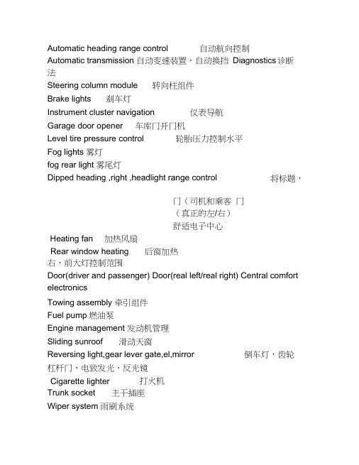
Automatic heading range control 自动航向控制Automatic transmission 自动变速装置,自动换挡 Diagnostics 诊断法Steering column module 转向柱组件 Brake lights刹车灯Instrument cluster navigation 仪表导航 Garage door opener 车库门开门机Level tire pressure control轮胎压力控制水平Fog lights 雾灯 fog rear light 雾尾灯Dipped heading ,right ,headlight range control右,前大灯控制范围Door(driver and passenger) Door(real left/real right) Central comfort electronicsTowing assembly 牵引组件 Fuel pump 燃油泵Engine management 发动机管理 Sliding sunroof滑动天窗Reversing light,gear lever gate,el,mirror 倒车灯,齿轮杠杆门,电致发光,反光镜 Cigarette lighter打火机Trunk socket 主干插座Wiper system 雨刷系统将标题,Rear window heating 后窗加热门(司机和乘客 门(真正的左/右) 舒适电子中心Heating fan 加热风扇Intelligent power module 智能功率模块Radio1.无线电;无线电话(或电报)[U][C]2. 无线电传送,无线电广播[the S]3. 收音机;无线电设备[C]Horn 1.角;触角,触须2. 角质[U]3. 角制物[C]Electronic stability program 电子稳定程序Engine Engine 1.弓I擎2.运行,使用3.发动机engine 1.引擎”发动机2.引擎3.(牙)钻机,发动机Seat heating 座椅加热Air suspension 空气悬架Anti-theft alarm system 防盗报警系统CD changer换光盘Central locking system 中央锁系统Electronic damper control 中央锁系统Fuel pump燃油泵Heated rear window 后窗加热Independent heater 独立加热器Independent ventilation 独立通风Navigation system 导航系统On-board monitor 车载显示器Rear washer 后洗涤器Rear washer pump 后洗涤器泵Telephone 1. 电话机[C]2. 电话[U]3. 电话耳机,听筒[C]Acoustic parking system 声停车系统Instrument cluster 组合仪表Diagnostics connector 诊断连接器Electronic stabilization program 电子稳定程序Audi lane assist 电子稳定程序Brake light switch 制动灯开关Phone 1.电话[U]2. 电话机[C]3. 听筒,耳机[C Driver identification 驾驶员识别Trailer control unit or RSE-system拖车控制单元Adaptive cruise control 自适应巡航控制Heated washer jets 加热清洗喷嘴Tyre pressure monitoring system轮胎压力监测系统Hom 坎Windshield wiper system 雨刷系统Switch illumination照明开关Onboard power supply,light control 车载电源,光源控制Left rear footwell heater 左后脚坑加热器Audi side assist 奥迪侧向辅助Onboard power supply,light control Steering columnadjustment Door control unit front left Vehicleaccess system Adaptive light left (right) Air-mass meter diesel Climatic seat 气候座 Fuel cooling pump 燃料冷去卩泵 Parking seat 停车场座位Automatic gearbox/Multitronic Air cond water valves water pump Sunroof 天窗 Fuel injectors 燃料喷射器 Ignition coils点火线圈车载电源,光源控制转向柱调节控制单元门前左进入系统自适应光左(右) 柴油机空气质量计Fuel pump right gasoline(MPI)Brake servo 伺服制动Door control unit rear heater 车门控制单元后加热器Headlight washer system 大灯清洗系统Heater fan 加热器风扇Crankcase ventilation heating 曲轴箱通风加热Radiator fan electronics 散热器风扇电子Airbag weight-sensing mat安全气囊的重量传感垫Air-mass meter diesel 柴油机空气质量计Fuel cooling pump 燃料冷去卩泵Parking brake 停车制动Climatic seat 气候座Lambda probe 拉姆达探针Rail-pressure 铁道压力Air conditioning 空调,,dash panel buttons 仪表面板按钮Adaptive air suspension 自适应空气悬架Light /rain sensor 光/雨水传感器Display-/control unit 显示/ 控制单元Media-player front 媒体播放前Battery energy management 电池能量管理Shift gate 移门Fusebox illumination 保险丝箱照明自动变速箱空调水阀门水泵燃油泵对汽油(下)Cigarette lighter front Cigarette lighter rear Auxiliary radiator fan Door control unit front right打火机前打火机后辅助散热器风扇控制单元门前右Heated washer jets 加热清洗喷嘴Brake server 制动服务器Maintenance monitor 维护监视器Radiator fan 散热器风扇Automatic headlight range control 自动程序控制。
汽车导航外文翻译中英对照
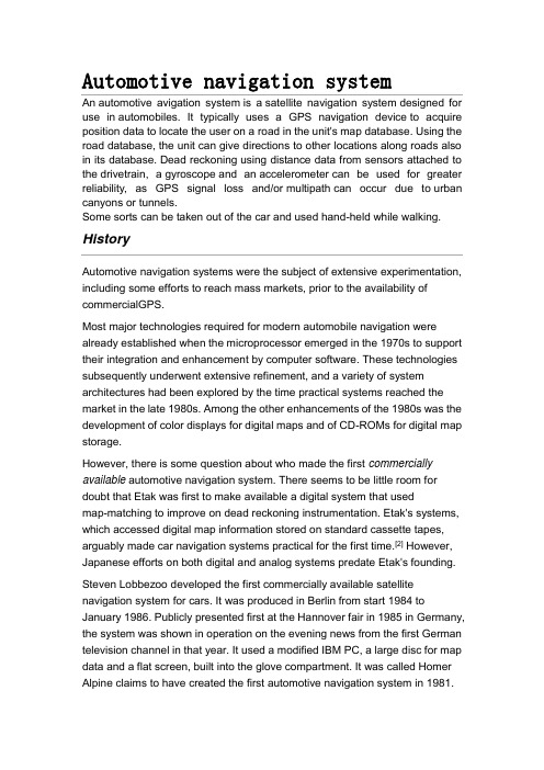
Automotive navigation systemAn automotive avigation system is a satellite navigation system designed for use in automobiles. It typically uses a GPS navigation device to acquire position data to locate the user on a road in the unit's map database. Using the road database, the unit can give directions to other locations along roads also in its database. Dead reckoning using distance data from sensors attached to the drivetrain, a gyroscope and an accelerometer can be used for greater reliability, as GPS signal loss and/or multipath can occur due to urban canyons or tunnels.Some sorts can be taken out of the car and used hand-held while walking. HistoryAutomotive navigation systems were the subject of extensive experimentation, including some efforts to reach mass markets, prior to the availability of commercialGPS.Most major technologies required for modern automobile navigation were already established when the microprocessor emerged in the 1970s to support their integration and enhancement by computer software. These technologies subsequently underwent extensive refinement, and a variety of system architectures had been explored by the time practical systems reached the market in the late 1980s. Among the other enhancements of the 1980s was the development of color displays for digital maps and of CD-ROMs for digital map storage.However, there is some question about who made the first commercially available automotive navigation system. There seems to be little room for doubt that Etak was first to make available a digital system that usedmap-matching to improve on dead reckoning instrumentation. Etak's systems, which accessed digital map information stored on standard cassette tapes, arguably made car navigation systems practical for the first time.[2] However, Japanese efforts on both digital and analog systems predate Etak's founding.Steven Lobbezoo developed the first commercially available satellite navigation system for cars. It was produced in Berlin from start 1984 to January 1986. Publicly presented first at the Hannover fair in 1985 in Germany, the system was shown in operation on the evening news from the first German television channel in that year. It used a modified IBM PC, a large disc for map data and a flat screen, built into the glove compartment. It was called Homer Alpine claims to have created the first automotive navigation system in 1981.However, according to the company's own historical timeline,[3] the company claims to have co-developed an analog automotive navigation product called the Electro Gyrocator, working with Honda. This engineering effort was abandoned in 1985. Although there are reports of the Electro Gyrocator being offered as a dealer option on the Honda Accord in 1981, it's not clear whether an actual product was released, whether any customers took delivery of an Electro Gyrocator-equipped Accord, or even whether the unit appeared in any dealer showrooms; Honda's own official history appears to pronounce the Electro Gyrocator as not practical.Honda claims[4] to have created the first navigation system starting in 1983, and culminating with general availability in the 1990 Acura Legend. The original analogElectro Gyrocator system used an accelerometer to navigate using inertial navigation, as the GPS system was not yet generally available. However, it appears from Honda's concessions in their own account of the Electro Gyrocator project that Etak actually trumped Honda's analog effort with a truly practical digital system, albeit one whose effective range of operation was limited by the availability of appropriately digitized street map data.TechnologyVisualizationNavigation systems may (or may not) use a combination of any of the following:▪top view for the map▪top view for the map with the map rotating with the automobile (so that "up" on the map always corresponds to "forward" in the vehicle)▪bird's-eye view for the map or the next curve▪linear gauge for distance, which is redundant if a rotating map is used ▪numbers for distance▪schematic pictograms▪voice promptsRoad databaseContentsThe road database is a vector map of some area of interest. Street names or numbers and house numbers are encoded as geographic coordinates so that the user can find some desired destination by street address .Points of interest will also be stored with their geographic coordinates. Point of interest specialties include speed cameras, fuel stations, publicparking, and "parked here".Contents can be produced by the user base as their cars drive along existing streets and communicating via the internet, yielding a free and up-to-date map.Physical Storage FormatThe Physical Storage Format (PSF) initiative is an industry grouping of car manufacturers, navigation system suppliers and map data suppliers whose objective is the standardization of the data format used in car navigation systems, as well as allow a map update capability. Standardization would improve interoperability, specifically by allowing the same navigation maps to be used in navigation systems from 19 manufacturers. Companies involved include BMW, Volkswagen, Daimler,Renault, ADIT, Aisin AW, Alpine Electronics, Navigon, Bosch, DENSO, Mitsubishi, Harman Becker, Panasonic, PTV, Continental AG, Clarion, Navteq, Tele Atlas and Zenrin.MediaThe road database may be stored in solid state read-only memory (ROM), optical media (CD or DVD), solid state flash memory, magnetic media (hard disk), or a combination. A common scheme is to have a basemap permanently stored in ROM that can be augmented with detailed information for a region the user is interested in. A ROM is always programmed at the factory; the other media may bepreprogrammed, downloaded from a CD or DVD viaa computer or wireless connection (bluetooth, Wi-Fi), or directly used utilizing a card reader.Some navigation device makers provide free map updates for their customers. These updates are often obtained from the vendor's website, which is accessed by connecting the navigation device to a PC.汽车导航系统汽车导航系统是一个设计供汽车使用的卫星导航系统。
汽车导航主机专业术语翻译
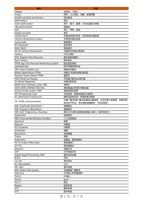
英文中文tailgate后挡板;下闸门torque转矩,[力] 扭矩;项圈,金属领圈double rod drive mechanism双杆驱动deformation变形trunk swith button树干;躯干;象鼻;汽车车尾的行李箱cab switch button驾驶室stall停止,停转;拖延beeper prompts提示infotainment车载信息娱乐系统;综合信息处理系统vehicle infotainment system车用资讯娱乐系统mute mode静音模式BT/ Bluetooth蓝牙模式NAV/ NAVI导航模式IVI /In-Vehicle Infotainment车载综合信息处理系统Camera行车记录仪DVR /Digital Video Recorder数字视频录像机Rear Camera倒车镜头TPMS app /Tire Pressure Monitoring System胎压监控系统alphabetically照字母顺序排列地OPL/ Open Problem List待解决问题点Wheel-Speed Based TPMS间接式-轮速传感器/被动型Pressure-Sensor Based TPMS直接式HUD /Head Up Display平视显示器/抬头显示器On-Board Diagnostic车载诊断系统Malfunction Indicator Lamp /MIL故障灯DATA LINK CONNECTOR /DLC具有数值分析资料传输功能antilock brake system /ABS制动防抱死系统PTY /Programme Type节目类型;程序类型显示与搜寻AF /Alternative Frequencies搜索当前电台同一网络的其它频率TA /Traffic Announcement 交通广播/区域广播;自动接收交通信息,无论在哪个音频源,如果当前电台有TP标志,有交通信息播报时,可自动收听。
地图、导航、车载、交通、通讯终端中英文对照词汇表
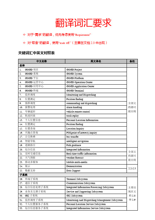
POI(point of interest) inquiry
17.公交换乘
bus transfer
18.智能导航
intelligent navigation
19.道路指引
Path guidance
20.综合信息
Integrated Information
全部文档都可能出现
21.实时交通信息
84.内部子系统协议
Internal Subsystem Protocol
85.通信配置管理
Communication Config Management
86.通信日志管理
Communication Log Management
87.业务调度综合管理
Business Dispatching Integrated Managerment
Receiving Thread Of Command Data Of Business Message
79.业务消息上报数据发送(线程)
Sending Thread Of Escalation Data Of Business Message
80.业务消息上报(线程)
Escalation Thread Of Business Message
4.GOGD运营中心
GOGDOperationCenter
5.GOGD应用中心
GOGDApplicationCenter
6.GOGD终端
GOGD Terminal
7.监控调度
Monitoring and Dispatching
8.位置测定
Position finding
9.指挥调度
commanding and dispatching
英文导航常用语
英文导航常用语全文共四篇示例,供读者参考第一篇示例:英文导航是日常生活中不可或缺的工具之一,无论是在旅行、驾车还是探险时,都能为我们提供准确和方便的路线指引。
当我们使用英文导航时,有一些常用的术语和短语能帮助我们更好地理解和应用导航系统。
在本文中,将介绍一些关于英文导航常用语,希望能帮助大家更好地利用导航系统。
1. Turn left/right:向左转/向右转这两个是最基本的导航用语,用来指示驾驶者在交叉路口或者转弯时需要向哪个方向转弯。
3. Make a U-turn:掉头当导航系统指示你“Make a U-turn” 时,表示需要掉头返回之前的路段。
4. Take the next exit:在下一个出口处驶离在高速公路上,导航系统可能会指示你在下一个出口处驶离高速公路。
5. Merge onto:驶入6. Follow the signs for:按照标志指示行驶7. Destination on the right/left:目的地在右边/左边当接近目的地时,导航系统会提示你目的地在哪个方向。
8. You have arrived:已到达目的地这是导航系统提示你已经到达目的地的常见用语。
9. Recalculating route:重新规划路径当你偏离原定路线或者错过转弯时,导航系统会提示你“Recalculating route” ,表示系统正在重新规划路径。
10. Continue on the current road:继续沿当前道路行驶有时候导航系统会提示你继续沿当前道路行驶,不需要进行任何转弯。
导航系统有时候会提示你在交通繁忙的道路上保持在某个车道行驶,以便更快到达目的地。
第二篇示例:在现代社会,人们出行的方式越来越多样化,导航已经成为我们日常生活中不可或缺的一部分。
尤其是在外出旅行或者到陌生的地方,我们更加依赖导航来指引我们前进的方向。
而在使用英文导航的过程中,掌握一些常用的导航术语将会更加方便和顺利。
- 1、下载文档前请自行甄别文档内容的完整性,平台不提供额外的编辑、内容补充、找答案等附加服务。
- 2、"仅部分预览"的文档,不可在线预览部分如存在完整性等问题,可反馈申请退款(可完整预览的文档不适用该条件!)。
- 3、如文档侵犯您的权益,请联系客服反馈,我们会尽快为您处理(人工客服工作时间:9:00-18:30)。
Automotive navigation systemAn automotive avigation system is a satellite navigation system designed for use in automobiles. It typically uses a GPS navigation device to acquire position data to locate the user on a road in the unit's map database. Using the road database, the unit can give directions to other locations along roads also in its database. Dead reckoning using distance data from sensors attached to the drivetrain, a gyroscope and an accelerometer can be used for greater reliability, as GPS signal loss and/or multipath can occur due to urban canyons or tunnels.Some sorts can be taken out of the car and used hand-held while walking. HistoryAutomotive navigation systems were the subject of extensive experimentation, including some efforts to reach mass markets, prior to the availability of commercialGPS.Most major technologies required for modern automobile navigation were already established when the microprocessor emerged in the 1970s to support their integration and enhancement by computer software. These technologies subsequently underwent extensive refinement, and a variety of system architectures had been explored by the time practical systems reached the market in the late 1980s. Among the other enhancements of the 1980s was the development of color displays for digital maps and of CD-ROMs for digital map storage.However, there is some question about who made the first commercially available automotive navigation system. There seems to be little room for doubt that Etak was first to make available a digital system that usedmap-matching to improve on dead reckoning instrumentation. Etak's systems, which accessed digital map information stored on standard cassette tapes, arguably made car navigation systems practical for the first time.[2] However, Japanese efforts on both digital and analog systems predate Etak's founding.Steven Lobbezoo developed the first commercially available satellite navigation system for cars. It was produced in Berlin from start 1984 to January 1986. Publicly presented first at the Hannover fair in 1985 in Germany, the system was shown in operation on the evening news from the first German television channel in that year. It used a modified IBM PC, a large disc for map data and a flat screen, built into the glove compartment. It was called Homer Alpine claims to have created the first automotive navigation system in 1981.However, according to the company's own historical timeline,[3] the company claims to have co-developed an analog automotive navigation product called the Electro Gyrocator, working with Honda. This engineering effort was abandoned in 1985. Although there are reports of the Electro Gyrocator being offered as a dealer option on the Honda Accord in 1981, it's not clear whether an actual product was released, whether any customers took delivery of an Electro Gyrocator-equipped Accord, or even whether the unit appeared in any dealer showrooms; Honda's own official history appears to pronounce the Electro Gyrocator as not practical.Honda claims[4] to have created the first navigation system starting in 1983, and culminating with general availability in the 1990 Acura Legend. The original analogElectro Gyrocator system used an accelerometer to navigate using inertial navigation, as the GPS system was not yet generally available. However, it appears from Honda's concessions in their own account of the Electro Gyrocator project that Etak actually trumped Honda's analog effort with a truly practical digital system, albeit one whose effective range of operation was limited by the availability of appropriately digitized street map data.TechnologyVisualizationNavigation systems may (or may not) use a combination of any of the following:▪top view for the map▪top view for the map with the map rotating with the automobile (so that "up" on the map always corresponds to "forward" in the vehicle)▪bird's-eye view for the map or the next curve▪linear gauge for distance, which is redundant if a rotating map is used ▪numbers for distance▪schematic pictograms▪voice promptsRoad databaseContentsThe road database is a vector map of some area of interest. Street names or numbers and house numbers are encoded as geographic coordinates so that the user can find some desired destination by street address .Points of interest will also be stored with their geographic coordinates. Point of interest specialties include speed cameras, fuel stations, publicparking, and "parked here".Contents can be produced by the user base as their cars drive along existing streets and communicating via the internet, yielding a free and up-to-date map.Physical Storage FormatThe Physical Storage Format (PSF) initiative is an industry grouping of car manufacturers, navigation system suppliers and map data suppliers whose objective is the standardization of the data format used in car navigation systems, as well as allow a map update capability. Standardization would improve interoperability, specifically by allowing the same navigation maps to be used in navigation systems from 19 manufacturers. Companies involved include BMW, Volkswagen, Daimler,Renault, ADIT, Aisin AW, Alpine Electronics, Navigon, Bosch, DENSO, Mitsubishi, Harman Becker, Panasonic, PTV, Continental AG, Clarion, Navteq, Tele Atlas and Zenrin.MediaThe road database may be stored in solid state read-only memory (ROM), optical media (CD or DVD), solid state flash memory, magnetic media (hard disk), or a combination. A common scheme is to have a basemap permanently stored in ROM that can be augmented with detailed information for a region the user is interested in. A ROM is always programmed at the factory; the other media may bepreprogrammed, downloaded from a CD or DVD viaa computer or wireless connection (bluetooth, Wi-Fi), or directly used utilizing a card reader.Some navigation device makers provide free map updates for their customers. These updates are often obtained from the vendor's website, which is accessed by connecting the navigation device to a PC.汽车导航系统汽车导航系统是一个设计供汽车使用的卫星导航系统。