环境艺术设计外文翻译—城市景观设计中的生态规划
城市规划滨水景观设计中英文对照外文翻译文献

城市规划滨水景观设计中英文对照外文翻译文献中英文对照外文翻译文献(文档含英文原文和中文翻译) Riverfront Landscape Design for London 2012 Olympic ParkHow do you plant along a river's edge, knowing that millions of people could be passing through thesite in the near future? How do you design, create and maintain the surrounding wetlands, knowing that man-made wet woodland is very rare and transitionalby nature? How do you ensurethat the habitat being created remains viable and sustainable in the long-term? Atkins’engineers of the wetlands and river edges on the London 2012 Olympic Park were tasked with fi nding answers to all of these questions.Covering more than 246 hectares of formerly derelict industrial land, London’s new Olympic Park for the London 2012 Olympic and Paralympic Games is one ofEurope’s biggest-ever urban greening projects. Rivers and wetlands are at the heart of the vision for the new park, which lies in east London’s Lower Lee Valley. Th e landscape that’s now emerging will provide a backdrop for the main action of theLondon 2012 Games.As river edge and wetland engineers for the project, Atkins has played a critical role in turning the vision into reality. Atkins’remit includes design of the soft river edges and wetlands, including riverbank restoration and bioengineering.The transformation is unprecedented. More than 8km of riverbanks have been restored as part of the project; in tandem with this, 2 hectares of reed beds and ponds have been created, along with 9,000 square meters of rare wet woodland(Fig.01).The challenge was about getting people both visual and physical access down to the river-to actually make the rivers more accessible and more open, and therefore the centerpiece of the Park.Mike Vaughan heads up Atkins' multidisciplinary design team, which includes river engineers, geomorphologists and ecologists. “The idea was to open up the river corridor by making the steep sl opes that line the river fl att er,”explains Mike. “By dropping the slopes, we’ve brought the river into the park and made it much more accessible-people can get close to the river and see what’s going on there.”Gett ing the riverbank geometry just right was a delicate balancing act. Too steep, and the banks would need costly artifi cial reinforcement; too shallow, and they would start to eat into valuable space on the site. An optimum slope of 1 in 2.5-about 22 degrees- was chosen. The space occupied by river bank was restricted by the need to convey fl oodwater and the location of terrestrial landscape and infrastructure. As such, the banks were over-steepened using two approaches. Firstly, where possible, the riverbanks were terraced using coir rolls and timber stakes. In other locations, where only a 70 degree bank was possible, a reinforced detail was used, providing layers of geo-grid and steel mesh cages, faced with a riverside turf.Today, with the new landscape rapidly taking shape, it’s easy to forget how the Lee Valley used to look. Until the Olympic Delivery Authority (ODA) took possession of the site in 2006, many of the river channels that criss-cross the site were clogged with invasive weeds, along with the predictable detritus of urban decay: abandoned shopping trolleys and car tires.Th e Lee Valley’s neglected river network wasn’t only an eyesore, but also an obstacle-a gulf separating Hackney and Tower Hamlets in the west from Waltham Forest and Newham in the east.Now, the revitalized waterways-and the new crossings spanning them-will be vital not only during the Games, but also aft er 2012. Th ey are an integral part of the legacy solution, stitching the new Park and its waterways into the wider fabric of east London.1 Bringing Habitats back to LifeMaking the most of the site’s rivers and natural features to create sustainable habitats is a key part of the Olympic Delivery Authority’s vision for the Olympic Park. But the process of transforming the park’s rivers from weed and rubbish-infested gulches into pristine watercourses has been long and tough.For Atkins, that process started with developing an intimate understanding of the labyrinth of waterways and channels that wind their way through the site. Flows and velocities were measured at diff erent points over a period of time, with data used to construct a detailed hydraulic model to predict flood risk. That’s of critical importance, because Atkins had responsibility for everything up to a contour of 4 meters above ordnance datum (sea level) on the site.A full flood risk assessment was undertaken at environmental impact assessment stage. Atkins undertook analyses of the risk of fl ooding caused by frequent rainfall, taking into account the automated regulation of water levels in the impounded reaches and the impact of tidal lockout. The modeling exercise was made considerably more complicated by the impoundment of the river system during the course of 2008; in effect, this eliminated thedirect tidal infl uence of the Th ames. But its indirect infl uence is still felt. “When the tide comes in on the Th ames, it stops water fl owing out of the River Lee,”explains Mike Vaughan. “So the river levels fl uctuate by an average of 400mm a day.”Atkins’modeling calculations correctly predicted th is phenomenon, and also the increased risk of flooding. “These discoveries led to some changes in the landscaping profile,”says Mike. “The riverside paths have been raised by up to a meter and the profile of the wetlands was also raised, as maintaining cor rect water levels is critical to their survival.”Sustainable drainage techniques have also been used across the Park. In the landscape areas, porous strips have been used in the concourse, feeding into bioswales which drain down into the riverside ponds. Surface conveyance, underground pipes and storage features have also been utilized(Fig.02).The first step in the river restoration process was to “lay back”the banks, many of which were precipitously steep. This re-profiling was necessary because much of the surrounding land was “made”ground, the result of centuries of tipping that had raised the ground level by as much as 10 meters in places. The cocktail of materials on the banks included rubble, glass, animal bones and, more recently, wartime demolition materials from London’s east end.Another challenge facing the Atkins team was the prevalence of invasive weeds. These included Himalayan balsam, Japanese knotweed and giant hogweed. All are fast-growing non-native plants introduced to Britain in the 19th century as gardencuriosities; all have prospered on the wrong side of the garden wall.Invasive species are bad news for riverbanks. They reproduceand grow with prodigious speed, driving out native plant species. And they’re highly resilient. Knotweed ca n force its way through solid concrete, while giant hogweed contains furocoumarins, sun-activated toxins that can cause skin ulceration. Elimination was a priority –soil was treated throughout the site and the banks stripped of all remaining vegetation.In addition, Atkins was responsible for ensuring the protection of the existing fl ora and fauna on the site. Phase one habitat surveys were undertaken as part of the environmental impact assessment in 2006, including bird and fi sh surveys. A major translocation of species was undertaken to suitable receptor sites including a specially-created 1 hectare site just outside the Park. Atkins translocated 330 commonlizards, 100 toads and 4,000 smooth newts. In order to protect the flora on the site, Atkins maint ained a ‘permit to clear’system for contractors, and specifi ed safeguarded habitat areas that were not to be touched including areas of sycamore trees.2 Choosing Plants to PlantAtkins is responsible for the final look of the riverbanks and wetlands-and deciding what to re- plant presented a challenge. With banks now bare, new planting would have to fulfi ll not only ecological and aesthetic demands-they’d be expected to be in bloom for the Olympic Games-but engineering imperatives too.The Atkins design team chose bioengineering techniques, rather than culverting and hard engineering, for the project. That means protecting and consolidating riverbanks by using vegetation and natural products instead of concrete. Choosing the right species with the right root systems would be critical to protect the banks from erosion.An added challenge was that the river network is semi-tidal. The twice-daily rise and fall of around 400mm had the potential to play havoc with new planting, and the river’s high sediment loads threatened to smother anything planted from seed or plugs. “We don’t actually have a natural river system,”notes Mike. “Plants don’t cop well in those conditions.”To fi nd out which plants would fare best-and to establish the most eff ective planting methods -Atkins conducted a unique riverbank planting trial along a 50-metre stretch of the Lee in the Olympic Park.“We trialled plants of different elevations and different installation techniques. These were monitored over a year,”says Ian Morrissey, senior environmental scientist with Atkins. “That’s really helped to inform exactly what species we should plant and where.”The trial revealed that plug plants would be just too vulnerable. But plants pre-grown in coir -coconut fibre matting-resisted being washed away or swamped. Coir has other benefi ts too-it’s easy and quick to install in rolls and pallets two meters long and a meter wide(Fig.03).“Th e mat itself acts like a mulch, so you prevent any weeds growing up through it that might already be within the bank material. But more importantly, when the banks become inundated, you get fine sediment trapped within the coir. Th at helps to bind the roots and feed the plants,”says Ian.3 Banking on Tomorrow’s SeedlingsCreating a sustainable riverbank ecosystem means using native species. So before the banks were scraped back, seed was collected from suitable native aquatic species-a process managed by Atkins -and stored in a seed bank. Some of this seedwas then used by bioengineering and nursery specialists, Salix, who were appointed by the Olympic Delivery Authority to cultivate plants off site in what’s believed to be one of Britain’s biggest-ever nursery contracts.The offsite growing operation was huge and sowing for the project commenced in June 2009, as plants must be a year old and well established in their coir pallets before encountering the tough riverbank environment.Plants for the wet woodlands, including sedges, were raised in more than 7,000 pots at Salix’s nursery on the Gower peninsula, near Swansea. And in Norfolk, the company created a new 16-acre nursery dedicated to the 2012 project(Fig.04). Here, more than 300,000 plants representing some 28 different species, including sedges, common reed, marsh marigolds and yellow fl ag irises, were grown on more than a thousand coir pallets, ready to be transported to London in the following months.During the summer of 2010, the 18,000 square metres of planting were then pieced together like a giant jigsaw. This was a massive logistical challenge. To make it easier, each of the pallets and rolls was tagged. It was vitally important that each one went in exactly the right space so as to avoid cutting and trimming the roots and rhizomes of the plants. The team laid them out in blocks, to a plan, to make sure this didn’t happen.4 Ponds and Wet Woodlands from ScratchWhile the riverbanks of the “Old River Lee”occupied much of the attention ofthe Atkins team, there were also entirely new bodies of water to consider. A fundamental part of the biodiversity of the river edges in the north of the Park lies in three new triangular ponds, off the east bank. Two of these were designed to dry up in thesummer, forming moist grassy hollows. Th e third pond was created to retain water, enabling species such as water lilies and marsh marigold to thrive(Fig.05).Preventing that third pond from drying out -while also ensuring that it did not fl ood along with the River Lee-was a conundrum. Atkins responded by designing a connection between the pond and the river to act as both overfl ow and feed. Flows could be regulated: when the pond level rose too high, water could be drained back into the river; when it started to dry out, a valve could be opened to release river water back into the pond. It sounds simple, but it is believed to be the fi rst of its kind for a habitat feature of this scale.As well as the improved waterways and riverbanks, new wet woodlands will be a notable feature of the Olympic Park. They’re now a rare habitat in the UK, and the ones in the Park are being created from scratch.“It was quite a novel thing to be asked to do,”recalls Atkins’Ian Morrissey. “The challenge was to make sure we had the right water levels within the wetwoodland areas. Atkins was responsible for working out the topographies and the channels, and how they would interact with the river.”Wetlands have a tendency to become dry land eventually, a process that can be slowed down through selecting the right vegetation, careful water level management and maintenance.“The sedge spec ies we selected were chosen because they are quite vigorous so are able to compete well with terrestrial species,”says Ian.Tree species for the wet woodland include willow, alder, birch and the now rare black poplar, points out Atkins’Mike Vaughan: “It’s fantastic for wildlife. You get a lot of invertebrates in there,as well as nesting birds.”Birds, though, can present a challenge, particularly on the freshly planted riverbanks.“There’s a risk of wildfowl grazing our plants when they get on site,”says M ike. To prevent that happening, hundreds of meters of deterrent fencing were erected around new vegetation. That stayed there until spring 2012(Fig.06).5 Beyond the Finishing LineThe transformation of the lower Lee Valley and the creation of the new park, now nearing completion, is remarkable by any standards. Visitors to the Olympic Park –up to 250,000 every day at the peak of the Games –will encounter one of the greenest and most environmentally friendly parks ever to be created for the Olympics.And th e benefits will be felt long after 2012. “We’re pulling that really difficult trick of putting in infrastructure that’s good for the Games, but will work in legacy,”said the ODA's John Hopkins. “This will be a great place to live and work, with rivers and parklands at the heart. Socially, economically and environmentally, there will be a terrifi c legacy-it’s a new landscape powering a new piece of city.”伦敦2012奥林匹克公园滨水景观设计与营造如果在不久的未来,将有数百万人途经这块滨水区域,沿河该如何种植?如果了解到自然界中人造湿林地已十分罕见,该如何设计、创造并维护周边这种湿地环境?该如何长期保持栖息地的活力和可持续性?在伦敦2012奥林匹克公园项目中,来自阿特金斯的工程师们受托负责湿地和河滨地区设计及建设,将会找到所有这些问题的答案。
生态景观设计相关 中英对照

本科毕业论文外文文献翻译Agriculture Ecosystems and EnvironmentThe landscape as an ecosystem作为生态系统的景观H. DoingDepartment of Vegetation Ecology Plant Ecology and Weed Science,AgriculturalUniversity Wageningen The Netherlands植被生态学,植物生态学与杂草科学学院荷兰瓦赫宁根农业大学。
Abstract 摘要Landscape in this paper is defined as quota complex of geographically functionallyand historically interrelated ecosystemsquot also: quotorganised landquot.风景,在本文中,被定义为“历史性与功能性相互关联的生态系统地理的结合”(也定义为:“有组织的土地”)。
For its planning and management mapping of geomorphological hydrological andclimatic conditions is crucial to understand the ecological patterns.规划管理,地貌,水文,气候条件对于了解它的生态格局是非常重要的。
To warrant the landscapes sustainability its ecosystems multiple andinterdependent functions should be carefully identified on macro- meso- andmicro-level.为了保证景观的可持续发展,其生态系统的多元化和相互依存的作用在宏观,中观和微观几个层面应仔细确定。
城市规划原理与设计中的景观生态规划与设计

城市规划原理与设计中的景观生态规划与设计城市规划原理与设计中的景观生态规划与设计是在城市发展过程中日益重要的一个方面。
随着城市化的加速和人们对生态环境的关注,景观生态规划与设计在城市规划中的作用越来越凸显。
本文将从概念、原则和实践三个方面来探讨城市规划原理与设计中的景观生态规划与设计。
一、概念景观生态规划与设计是指在城市规划过程中,充分考虑生态环境的保护和恢复,通过合理规划和设计城市景观,达到人与自然和谐共生的目标。
景观生态规划与设计不仅关注城市的外部环境,也关注城市内部的绿地系统、水体系统、生物多样性等。
二、原则1. 生态优先原则景观生态规划与设计应该以保护和恢复生态环境为出发点,将生态需求和自然过程纳入规划和设计的考虑范围。
通过营造自然景观、保护生物多样性等手段,让城市与自然环境相融合。
2. 可持续发展原则景观生态规划与设计应遵循可持续发展的原则,合理配置资源,实现资源的节约利用。
通过推广低碳、环保的设计理念,建立可持续的城市生态系统。
3. 社区参与原则景观生态规划与设计需要积极引入社区居民的参与,听取他们的意见和需求。
通过与社区居民的合作,使规划和设计更加符合实际情况,更好地满足居民的需求。
三、实践1. 绿地系统规划与设计绿地系统是城市中的重要景观要素,对城市生态环境有着重要的保护和改善作用。
景观生态规划与设计应该合理规划和设计城市的绿地系统,包括公园、广场、街头绿化等,以提供人们休闲娱乐和生态服务功能。
2. 水体系统规划与设计水体是城市生态系统中的重要组成部分,涉及到城市的水资源、水环境等方面。
景观生态规划与设计应考虑城市水体的保护与治理,包括湖泊、河流、河道绿化等,通过湿地恢复、水体净化等手段,改善城市水环境。
3. 生物多样性保护与景观设计生物多样性是生态系统的重要指标,也是保护生态环境的重要目标之一。
景观生态规划与设计应该注重保护和提升城市的生物多样性,通过合理的景观设计,提供适宜的生境条件,吸引和保护各种植物和动物物种。
城市规划设计中的生态城市规划分析
城市规划设计中的生态城市规划分析生态城市规划是城市规划设计的一种新型方法,旨在实现城市与自然环境的协调共生。
生态城市规划的核心理念是保护生态系统,减少环境污染,提高资源利用效率,提供宜居环境。
本文将从城市空间规划、交通规划、绿化规划和资源利用等方面对生态城市规划进行分析。
生态城市规划的空间规划方面,注重减少土地的开发和利用,提倡保留自然景观和优化空间布局。
通过合理编制城市土地利用总体规划,将城市功能分区,合理安排居住区、工业区、商业区和公共服务设施等功能区域的布局,从而减少空间资源的浪费和碎片化。
生态城市规划鼓励加强城市景观保护和恢复,保留和修复自然景观,提高城市生态系统的稳定性和适应力。
生态城市规划倡导合理的城市密度和建筑规模,通过合理规划建筑布局和高密度开发,减少土地占用,提高土地利用效率。
交通规划是生态城市规划的重要组成部分。
生态城市规划强调公共交通系统的建设,减少个人车辆的使用和道路拥堵。
生态城市规划鼓励开展非机动交通,建设自行车道和步行系统,促进居民步行和骑车出行,减少尾气排放和交通事故。
生态城市规划也推崇建设便捷的公共交通系统,如地铁、轻轨和公交车,提供低碳出行选择,减少私人汽车使用。
绿化规划是生态城市规划的关键要素之一。
生态城市规划提倡绿地建设和生物多样性保护。
绿地被视为城市的肺部,能够吸收废气、降低气温、净化环境。
生态城市规划要求合理设置城市绿地系统,提供充足的绿地供市民休闲和娱乐,同时保护和增加城市绿化覆盖率。
生态城市规划强调生物多样性保护,建设公园和自然保护区,保护珍稀和濒危物种的栖息地,提升城市生态环境质量。
资源利用是生态城市规划的核心考虑因素之一。
生态城市规划倡导高效利用水资源、能源和废弃物资源。
生态城市规划鼓励建设水资源循环利用系统,包括收集雨水、净化废水、节约用水等措施,实现水资源的可持续利用。
在能源利用方面,生态城市规划推动清洁能源的使用,如太阳能和风能,减少对化石燃料的依赖,降低能源消耗和碳排放。
城市规划中的生态景观设计

青海省西宁市第一场透雨特征分析余学英;孙正美;赵娟【摘要】本文主要利用常规资料,对2016年3月21—24日西宁地区第一场透雨的环流形势、成因及相关物理量场特征进行分析.结果表明,稳定的\"东高西低\"环流形势为第一场透雨的发生和持续提供了稳定有利的形势场;高空冷槽和地面冷锋为降水发生提供了触发机制;偏南低空急流和地面回流为降水发生和持续提供了充沛的水汽;20—24日,西宁上空整层为负值区,-30×10-5s-1以下的上升运动为产生较大降雨提供了必要的动力抬升条件.【期刊名称】《河南科技》【年(卷),期】2018(000)031【总页数】3页(P156-158)【关键词】第一场透雨;成因;暴雪【作者】余学英;孙正美;赵娟【作者单位】西宁市气象台,青海西宁 810016;西宁市气象台,青海西宁 810016;西宁市气象台,青海西宁 810016【正文语种】中文【中图分类】P458.121青海气象业务规定[1],春季(3—5月)出现的第一场≥10mm或48h过程降水量≥15mm的降水称为春季第一场透雨。
由于特殊的气候条件,青海春季降水较少,容易形成春旱,而这个时期正是农作物的播种至分蘖期,春旱是影响青海粮食产量丰歉的重要因素之一。
春季降水的多寡、第一场透雨出现的迟早是春季干旱是否发生的关键因子。
1 西宁地区春季第一场透雨时间分布通过统计1961—2015年西宁地区(辖西宁市、大通县、湟源县和湟中县)春季第一场透雨出现的频次(见表1),93%的透雨出现在春季,近一半集中在4月中旬到5月上旬出现,4月前5月后出现第一场透雨的概率各占7%,3月中旬仅出现过一次:2012年3月16日大通降水量为12.5mm,达到第一场透雨标准,是历年最早的一次。
大通、湟中春季降水量偏多,第一场透雨基本都在春季出现,时间也相对偏早,最多频次出现在4月中旬;西宁、湟源最多频次则在5月上旬,西宁春季出现第一场透雨的概率为91%,湟源为85%,西宁2015年第一场≥10mm的降水直到6月19日才出现,仅次于1980年,为第二晚的一年。
城市规划 外文翻译英语词汇总结
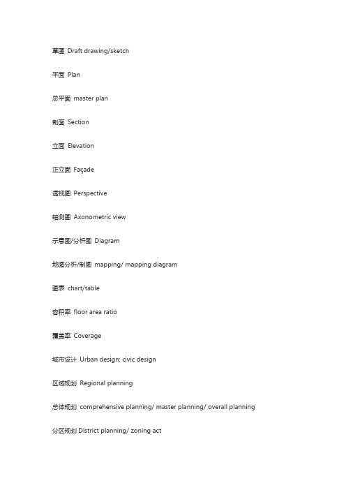
草图Draft drawing/sketch平面Plan总平面master plan剖面Section立面Elevation正立面Façade透视图Perspective轴测图Axonometric view示意图/分析图Diagram地图分析/制图mapping/ mapping diagram图表chart/table容积率floor area ratio覆盖率Coverage城市设计Urban design; civic design区域规划Regional planning总体规划comprehensive planning/ master planning/ overall planning 分区规划District planning/ zoning act控制性详细规划Regulatory Plan修建性详细规划Site planning (constructive-detailed planning)场地规划Site planning近期建设规划Immediate planning步行轴Walking axis概念设计conceptual design方案设计schematic design扩初设计design development详细设计、细部设计Detail Design城市化Urbanization城市生态Urban ecology城市农业urban farming/ urban agriculture经济能量来源Economy energy sources可持续发展Sustainable development历史性城市的保护规划Preservation Plan of historic cities旧城更新、改造-Urban Regeneration/Urban Revitalization/Retrofitting Plan 城市再开发-Urban Redevelopment开发区Development area城市化水平Urbanization level城市群Urban Agglomeration/ Metropolitan Area/ Metropolitan Coordinating Region/mega region城市系统Urban system卫星城市(城镇)Satellite town/ affiliate township城市基础设施Urban infrastructure市政基础设施Municipal Infrastructure绿色基础设施Green Infrastructure生态基础设施Ecological Infrastructure居民点Settlement城市City市Municipality; city城镇Town城市管理区域Administrative region of a city商业区Commercial district民政区域Civil district居住区规划Residential area planning护林区Ranger district绿地Percentage of greenery coverage绿化覆盖率Ratio of green space绿地率Landscaping within factory工厂绿化Landscaping of square广场绿化Landscaping of residential area居住区绿化Improved vegetation & wildlife谷底植栽场Landscaping around public building公共建筑绿化Indoor garden室外绿化Urban green 城市绿化Urban green space system城市绿化系统Public green space公共绿地Park公园Green belt 绿地Specified green space专用绿地Green buffer防护绿地空间(建筑)Parlor客厅Washroom; toilet卫生间、洗手间Balcony阳台、包厢Bathroom浴室Cabinet橱柜Courtyard building庭院建筑Dining-room ; dining hall餐厅Entrance入口Kitchen厨房Roof屋顶Kid room儿童房Dollhouse儿童游乐室Living room起居室Pavilion亭、阁Private garden私家花园Resident住宅Shared zone共享空间Toilet洗手间Servants hall用人房Scale比例Element要素、自然环境conference center会议中心Retail shop零售商店Theatre剧院园林景观Arbor乔木Shrub灌木Band stone铺石Car park below地下车库Carved paving bands曲线形铺地Cartilage Garth 庭园Courtyard identification sign标志牌Courtyard 庭院Fall瀑布Feature景色Footpath步道Garden bridge园桥Garden and park园林Herbage草本植物Liana藤本植物Natural cut stone砌石Pave铺地Pavilion 亭、阁Pavilion on terrace榭Planting植被Planting beds 花坛Plaza大广场Platform台Deck promenade栈道Pole lights灯柱Pool小水池Sculpture雕塑常用的景观英文参考1.主入口大门/岗亭(车行& 人行)MAIN ENTRANCE GATE/GUARD HOUSE main entrance gate/guard house (FOR VEHICLE& PEDESTRIAN ) for vehicle& pedestrian2.次入口/岗亭(车行& 人行)2ND ENTRANCE GATE/GUARD HOUSE 2nd entrance gate/guard house (FOR VEHICLE& PEDESTRIAN )3.商业中心入口ENTRANCE TO SHOPPING CTR. Entrance to shopping ctr.4.水景WATER FEATURE water feature5.小型露天剧场MINI AMPHI-THEATRE mini amphitheatre6.迎宾景观-1WELCOMING FEATURE-1 welcoming feature-17.观景木台TIMBER DECK (VIEWING) timber deck (viewing)8.竹园BAMBOO GARDEN bamboo garden9.漫步广场WALKWAY PLAZA walkway plaza10.露天咖啡廊OUT DOOR CAFE out door cafe11.巨大迎宾水景-2GRAND WELCOMING FEATURE-2 grand welcoming feature-2 12.木桥TIMBER BRIDGE timber bridge13.石景、水瀑、洞穴、观景台ROCK'SCAPE WATERFALL'S rock's cape waterfall's GROTTO/ VIEWING TERRACE grotto/ viewing terrace14.吊桥HANGING BRIDGE hanging bridge15.休憩台地(低处)LOUNGING TERRACE (LOWER ) lounging terrace (lower ) 16.休憩台地(高处)LOUNGING TERRACE (UPPER ) Lounging terrace (upper )17.特色踏步FEATURE STEPPING STONE feature stepping stone18.野趣小溪RIVER WILD river wild19.儿童乐园CHILDREN'S PLAYGROUND children's playground20.旱冰道SLIDE Slide21.羽毛球场BADMINTON COURT badminton court 网球场Tennis court 22.旱景DRY LANDSCAPE dry landscape23.日艺园JAPANESE GARDEN Japanese garden24.旱喷泉DRY FOUNTAIN dry fountain25.观景台VIEWING DECK viewing deck26.游泳池SWIMMING POOL swimming pool27.极可意JACUZZI JacuzziWADING POOL wading pool29.儿童泳池CHILDREN'S POOL children's pool30.蜿蜒水墙WINDING WALL winding wall31.石景雕塑ROCK SCULPTURE rock sculpture32.中心广场CENTRAL PLAZA central plaza33.健身广场EXERCISE PLAZA exercise plaza34.桥BRIDGE bridge35.交流广场MEDITATING PLAZA meditating plaza36.趣味树阵TREE BATTLE FORMATION tree battle formation 37.停车场PARING AREA paring area38.特色花架TRELLIS trellisSCULPTURE TRAIL sculpture trail40.(高尔夫)轻击区PUTTING GREEN putting green41.高尔夫球会所GOLF CLUBHOUSE golf clubhouse42.每栋建筑入口ENTRANCE PAVING TO UNIT entrance paving to unit43.篮球场BASKETBALL COURT basketball court44.网球场TENNIS COURT tennis court45.阶梯坐台/种植槽TERRACING SEATWALL/PLANTER terracing seat wall / planter 46.广场MAIN PLAZA main plaza47.森林、瀑布FOREST GARDEN WATERFALL forest garden waterfall48.石景园ROCKERY GARD。
外文翻译--生态景观设计的原则

生态景观设计的原则Principles of Ecological LandscapeDesign学部(院):建筑与艺术学院专业:艺术设计(环境艺术设计)学生姓名:学号:指导教师:完成日期:4ComplexCreations:Designing and ManagingEcosystemsA dragonflyflitsoverthesun-mirroredsurfaceofapond,snappingathatchingmosquitoesbeforecom- ing to rest on an overhanging rush. This is an ecosystem: animals, plants, and theirphysicalenviron- mentlinked together in the exchange of energy and materials. If this were our pond,ourecosystem,wewouldhaveitall:abeautifullandscapefeature,enlivenedbycreaturesweneve rhadto carefor,andhassle-freepestcontrol.Ecosystemslikethisponddoquiet,crucialwork,keepingalivethebiosphereofwhichweareapart.W heresuchanaturalpond,oraforestorfloodplain,exists,itbehoovesustoprotectit.Whereonehasbeen degraded,wewouldbewellservedtorestoreit(seechap.10).Butwheresuchecosystemshavebeenplo wedunderorpavedover,wecanendeavortoreplacethembyfillingthebuiltenvironmentnot justwithlaw nsandplazasandfountainsbutwithecosystems.Anecosystemconsistsofallofthelivingorganismsinanareaalongwiththeirphysicalenviron-ment,anditspropertiesarisefromtheinteractionsbetweenthesecomponents.Anoceanbayisanecos ystem,asisanalpinemeadoworagreenroof.Perhapsbecauseoftheirclearboundaries,lakes andstreams wereimportantobjectsofstudyinthedevelopmentofecosystemecology.Wherebound- ariesarelessdistinct,thelimitsofanecosystemcanbe defined,evenarbitrarily,basedonthequestionanecol ogistisstudyingortheboundariesofa designer’s site.Designedlandscapesalreadybringtogetheramanipulatedphysicalenvironmentandlivingor-ganisms.Theydonotnecessarilyfunctionasnaturalecosystemsdo,however.Theyaredisconnect-ed,toooftenwastefulanddemanding,orelsetheysimplyfailtothrive.Whenwesucceedincreat-ingintegratedecosystems,theresultscanberemarkable.Lifecanspringforth,almostunbidden.Waste scanbetransformedintoresources.Thevariousmembersofalivingcommunitycanreacha tentativebalance.Thebuiltenvironmentcanpurifywater,protectusfromfloods,andstrengthenour sense ofwell-being.T.Beck,PrinciplesofEcologicalLandscapeDesign,DOI10.5822/978-1-61091-199-3_4,©2013TravisBeckComplex Creations: Designing and ManagingTHE ECOSYSTEMCONCEPTTheideathatplantsandanimalsandtheirenvironmentformanintegratedwholeisattherootofthedi sciplineofecology,althoughittookdecadestoarticulateinitsmodernform.In1887,inanaddresstothe Peoria ScientificAssociation,StephenForbesdescribedthelakeas“amicrocosm.”In orderforascientisttounderstandanyonespecies,heargued,Hemustevidentlystudyalsothespeciesuponwhichitdependsforitsexistence,andthevariouscondi tions upon which these depend. He must likewise study the species with which it comesincompetition,andtheentiresystemofconditionsaffectingtheirprosperity;andbythetimehe has studiedallthese sufficiently hewillfindthathehasrunthroughthewholecomplicatedmechanismofthe aquaticlifeofthelocality,bothanimalandvegetable,ofwhichhisspeciesformsbutasingleelement. (Forbes 1887:537)Theterm microcosm didnotenterintowiderecologicaluse.However,theideaofmanyorganisms formi ngalargerentitygainedexpressionintheturn-of-the-centuryconceptoftheclimaxcommu-nity(seechap.2).ThisconceptwassingledoutbyBritishecologistArthurTansleyina1935articleprovoca tively titled“TheUseandAbuseof VegetationalConceptsand Terms.”Theabusetowhichhereferredwas theinsistenceofClementsandotherecologistsonapplyingtheterm organism tothe climaxcommunity.“Thereisnoneedtowear ythe reader,”hewrote,“withalistofthepointsinwhichthebiotic communitydoes n ot resemblethesingleanimal orplant”(Tansley1935:290).However,hedidnot holdbackfrommentioningtha ta community’sprocessofdevelopmentisverydifferentfromthelife cycle of animals and plants. At best, Tansley offered, vegetation might resemble a“quasi-organism,”thoughonenotnearlysowellintegratedasahumansocietyorahiveofbees.Thisacceptance ofa quasi-organismalstatusforcommunitiesdifferentiatesTansley’s criticismofClementsianecology fromGleason’s purelyindividualisticfocus.Thereisacertaintruthtotheideaoftheclimaxcommunitybeing wellintegrateda ndself-regulating,Tansleyargued,butitcouldbestatedmoreaccuratelyanotherway.Tansleypreferredtothinkintermsofintegratedsystems.Hisnotionofsystemswasborrowedfrom thephysical sciences.“These ecosystems,aswemaycall them,”hewrote,“areofthemost variouskinds andsizes.Theyformonecategoryofthemultitudinousphysicalsystemsoftheuniverse,whichrange from the universe as a whole down to the atom” (Tansley1935: 299). An essential partof T ansley’sdescriptionoftheecosystemisthatheincludedinitnotonlyalloftheplantsandanimalsandoth erlivingthingsinagiven“weboflife”butalsothe entiretyofthephysicalcomponentsoftheir environmen t,suchassoil,sunlight,andwater.CREATEECOSYSTEMSBuiltlandscapesalsohavephysicalandbiologicalcomponents:crudely,inindustryterms, hardscapeandsoftscape.Toooften,thesecomponentsarefarfromintegrated.Thehardscapeissetin respo nse to programmatic needs, and plants are tucked into the remaining spaces. If thephysicalenvironmentisnotrightforthebiologicalcomponents,thenitisaltered,byprovidingirrigati on,forinstance (seechap.1).Complex Creations: Designing and Managing Consideratypicallandscapepond.Anestateownermightpayacontractortoclearanarea,ex-cavateahole,lineit,fillitfullofwaterfromawell,andtrimthewholesetupneatlywithrocksorlawnandpe rhapsafewaquaticplantsonaplantingshelf.Aswaterevaporatesfromtheunshadedpond,thewellpum pkicksinandtopsoffthepond.Evensuburbanhomeownerswanttheirownpondsandwaterfalls,fullofmunicipalwaterandlinedwithdwarfconifersorJapaneseiris(Irisensata)sittinglike rockyp uzzlepiecesontheirlawns.Thesesystemsare fullyartificial,rely onsupplementalwater,and often require filtration or even sterilization to remain aesthetically acceptable. Physical andbiological elements are divorced from each other and from theirsurroundings.Bycontrast,apondthatisconceivedofasanecosystemfusesphysicalandbiologicalelements intoawholethatintegrateswith,ratherthansitsapartfrom,ndscapearchitectsAndropogonAssociatescreatedsuchapondonapropertyinGreenwich,Co nnecticut.Naturally,throughout NewEngland’s forests,inthespringsmalldepressionsintheland-scapefillwithwater,which infiltrates asgroundwaterlevelsdropinthesummer.Thesevernalpoolsprovid eimportanthabitatforamphibianssuchassalamandersandfrogs.Onthispropertysuchadepressionexi sted,setagainstagraniticoutcrop,onlyithadlongbeenfilledwithbranches,leaves,andothergreenwast ebygenerationsofgardeners.WhenColinFranklin,foundingprincipalatAndro-pogon,discoveredtherockydellandthesmallspringatitsbase,hesawanopportunity.AndropogonAssoci ates’design philosophy haslongbeentobuild“d ynamic,holisticsystems,”thatis,ecosystems.Franklin’s approachwastolinethecenterofthedepressioninordertomaintainaminimumwaterlevelbutleavethe edgesunlined.Waterfromthespringiscollectedinasumpbeneaththepondandpumpedviaaslenderw aterfallofftherockoutcropandintothepond.Inspringthepond overflows,recharginggroundwaterinthe area(fig.4.1).Themarginsareplantedwithtreesandotherplantsthatareadaptedtothisseasonalflooding.Betweentheopenwater,theplantedwetlandatthepond’sedge,a ndtheseasonalwetlandbeyond,thedesignprovidesdiversehabitat(seechap.7).When waterlevelsdroptotheleveloftheliner,thewettedmarginsdry,mimickingthecycleofvernalpools.Ifwa terlevelsdropfurther,thesumppumpandwaterfallcanmakeupthedifferencefromthe rechargedgroundwater.Becausethepondisintheforest,however,evaporationandthe needformakeupwaterareminimal.Thisforestedpondisnowahuboflifeandthecenteroftheentirelandscape.Ratherthancreatea sterilewaterfeatureofdissociatedelements,Andropogoncreatedanecosystem,withnaturalphysicalcycle sandplantsandanimalsadaptedtothem. ECOSYSTEMSARECOMPLEXADAPTIVESYSTEMSEcologists’ understanding of the multitudinous systems of the universe has evolved since Tansleywrote hiscritiqueofClementsin1935.Mostrecently,ecosystemshavebeenregardedascomplex adap-tivesystems.SimonLevin(1998,1999),abiologistatPrinceton,isachiefproponentofthisview.Incompl exadaptivesystems,asexplainedbyLevin,heterogeneousindividualagentsinteractlocallytocreatelar gerpatterns,andtheoutcomeofthoselocalinteractionsaffectsthefurtherdevelopmentofthesystem(fig.4.2).Itiseasytoseehowthisappliestoecosystems.Theplantsandanimals,rocks andwateranddetrit usthatmakeupapondarealldifferent,yettheyinteracttocreatearecognizableComplex Creations: Designing and ManagingFigure4.1SchematicdesignoftheAndropogon-designedpondecosystem.Duringnormaldryweatherconditions(a)alinerandgroundwaterpumpmaintainaper manentwaterlevel.Duringnormalwetseasonconditions (b) overflow enters peripheral seasonal wetlands and recharges groundwater. (Drawing byColinFranklin.)systemwithpropertiesofitsown.Ifaplantthatproducesmorebiomasscompetitivelyexcludesothe rs alongthe pond’s margins,thentheaccumulationofdetritusinthepond,thepopulationsof bottomfeeders,andotherecosystempropertieswillallbeaffected.Levinfurtherdescribedfourcharacteristicsofcomplexadaptivesystems.Theyarediverse,ag-gregated,nonlinear,andconnected byflows.Ecosystemsincludeindividualorganismswithdiversechar acteristics.Throughtheirinteractions,theindividualagentsinanecosystembecomegrouped intolargerorganizationalentities.Forexample,populationsaregroupsofinteractingindividualsofthe sames pecies(seechap.2).Themostaccuratewaytoviewaggregationisthroughthecompositionofahierarchy (seechap.9).Nonlinearitymeansthatsmallchangesinanecosystemcanleadtooutsizedeffects.Remov alofasinglekeystonespecies,forinstance,canchangethecompositionofanentire community(seechap.7).Nonlinearityalsoreferstothefactthatecosystemsareaffectedbyhistoryas muchasbypresentconditio ns.Finally,asweshallseeinthefollowingsections,ecosystemsclearly exhibitflowsofenergyandmaterial sthatconnectalltheirindividualparts.LET CONSTRUCTED ECOSYSTEMSSELF-DESIGNIf ecosystems are complex adaptive systems that develop from the interaction oftheir componentsandtheeventsofhistory,thensuccessfulecosystemsareunlikelytospringforthfromour headsfullyformedbutshouldemergeinsteadthroughaprocesswemightcallself-design.Complex Creations: Designing and ManagingFigure4.2Turingpatterns,likethisone,areanexampleofacomplexsystemformedfromlocalinteractions.Inthisc ase,each pixel’s colorisdeterminedbythecolorofthesurroundingpixelsaccordingtoacomputer algorithm.Startingfromarandomi nitialstate,thepatterncontinuestoevolve.(ImagebyJonathanMcCabe,underCreativeCommons2.0GenericLicense.) BillMitschandhiscolleaguesexploredself-designattheWilmaH.SchiermeierOlentangyRiver WetlandResearchParkinColumbus,Ohio(Mitschetal.1998).Theyintentionallyleftoneoftwobasinsintheir newlycreatedexperimentaloxbowunvegetated.Theyknewthatwind,water,andanimalswould bringinne wplantssoonenough,andtheywantedtoseehowcloselytheunplantedwetlandwouldresembletheon etheyplanted.Within3years,thetwowetlandswereremarkablysimilarintermsofvegetativecover,dive rsityofplants,waterchemistry,andseveralothermeasuresofecologicalfunc-tion(fig.4.3).Thiscongruenceresultsnotsimplyfromtheunplantedwetlandcomingtoresemblethepla ntedonebutfrombothwetlandschangingto reflect siteconditionsandmigrations.Ofthethirteenorigin alspeciesintheplantedwetland,fourdiedoff.Thesurvivingspecieswerejoinedbyanaddi-tionalfifty-twounplantedspecies.BecausethewetlandswereconnectedhydrologicallytothenearbyOlentangyRi ver,thenatural inflow ofspecieshadamuchgreater influence onthemakeupoftheplant communitiesinthetwowetlandsthandidtheinitialplantingofonebasin.Thesuccessofthetwobasinsasself-designedecosystemsisindicatedbytheOlentangyRiver Wetland’s designation under the RamsarConvention as a Wetland of International Importance.Complex Creations: Designing and ManagingFigure4.3AerialviewofthetwoOlentangyRiverWetlands.(CourtesyofWilliamJ.Mitsch,WilmaH.Schierm eierOlentangy River Wetland ResearchPark.)ECOSYSTEMSAREORGANIZEDINTROPHICLEVELSAs complex adaptive systems, ecosystems are animated by the interactions betweentheirconstituentpartsandtheflowsthatconnectthem.Inthe1940sayoungAmericanecologi st,RaymondLindeman, suggestedawayofanalyzingecosystemsintermsofenergyflow.AswithForbesbeforehim,Linde-man’s focuswasonlakes.After5yearsoffieldworkonthesmallCedarBogLakeneartheUniversityofMin nesota,LindemansignedupforapostdoctoralyearatYaleUniversitywithG.EvelynHutchinson (wholateradvisedRobertMacArthuronhisstudyofresourcepartitioninginwarblers)(seechap.3).Duri ngthatyearheandHutchinsonworkedonthearticlethatwas tobecome“The Trophic–DynamicAspectof Ecology”(Lindeman1942).Tragically,Lindemandiedattheageof27,afewmonthsbe forehisarticle,whichwasinitiallyrejectedasbeingtootheoretical,wasfinallypublishedintheflagshipj ournaloftheEcologicalSocietyofAmerica.Theideasheputforthhavehadalastingimpactonthefieldofecosystemecology.Lindeman’s focus was on the trophic, or “energ y-availing,” relationships within an ecosystem.Bor- rowingfromGermanlimnologistAugustThienemann,heabstractedthefamiliarfoodwebsthatnatural-istsandecologistshadproducedforlakesandothersystemsintotrophiclevels:Producersareorgan-ismssuchasplantsandphytoplanktonthatobtaintheirenergyfromthesun,consumersareorganisms suchaszooplanktonandfishthatobtaintheirenergyfromeatingproducers,anddecomposersarethe bacteriaandfungithatobtaintheirenergyfrombreakingdowntheorganicsubstancesinthewastes and remainsofotherorganisms.Byabstractinganecosystemtotrophiclevels,Lindeman sacrificed aComplex Creations: Designing and Managingcertainamountofbiologicalreality.Healsocreatedtheproblemofhowtoclassifyorganismsthateat both producers and consumers. There can be several levels of consumers in anecosystem,although earlier ecologists had noted that rarely are there more than five trophic levels intotal.Lindeman’s analysisexplainedthisphenomenon.Unlikethechemicalelements,whichcan cycleindefinitely inanecosystem(seechap.6),energy flow sthroughanecosysteminonedirectiononly:fromthesuntoproducerstoconsumerstosecond-aryconsumerstodecomposers.Ateachtransferofenergybetweentrophiclevels,Lindemannoted,a certainamountislost (fig.4.4).Primaryconsumerssuchasbrowsingsnailsexpendacertainamountofenergyjustlivingand findingproducerstoeat.Someofthemdiebeforetheyareeatenbybenthic predat ors.SomeoftheenergycontainedinthebodiesofthosethatareeatenistiedupintissuessuchFigure4.4Lindeman’s diagramofthefoodwebanddifferenttrophiclevelsinageneralizedlake.Energyandnu trientsenterthesystemfromtheoutside.Thesearecapturedandtransformedbybothmicroscopicand macrosco pic producers (phytoplanktersand pondweeds, A 1). Primary consumers (zooplankters and browsers, A 2)eattheproducersandinturnareeatenbysecondaryconsumers(planktonpredatorsandbenthicpre dators,A 3).Tertiaryconsumers(planktonpredatorsandbenthicpredators,A 4)areatthetopofthe foodchain.Alltheorganicmatterinthesystemultimatelycyclesthroughthebacterialdecomposersintheoozeatthebottomofthelake,whichinturnfeedszooplanktersandbrowsers.(FromLindeman,R.L.Copyright©1942,Ecolo gicalSocietyofAmerica.Thetrophic –dynamicaspectofecology.Ecology 23:399–417.WithpermissionfromtheEcologicalSocietyofAmerica.)Complex Creations: Designing and Managingλasshellsthatare difficult todigestandwhoseenergyisnotpassedalong.Theavailableenergyineacht rophiclevel,then,islessthanthatintheprecedinglevel.Lindemanexpressedthisrelationship usingthep roductivitysymbollambda(λ):0 >λ1 >λ2 . . . >λn .Aswemovetohigherandhighertrophiclevels,lessandlessenergyisavailable.Becausehigher-orderconsumersalsoneedever-greaterlevelsofenergytoseekouttheirprey,atsomepointin everyecosystem,thereisnolonger sufficientenergy tosupportanothertrophiclevel.Lindemancalculatedtheproductivityand efficiency ofenergytransferbetweentrophiclevelsforse verallakesforwhichhehaddataanddrewsomepreliminaryconclusions.This prefigured themore precisemodelingofecosystemsthatwastocomeinthenextphaseofecosystemecology.INTEGRATEPRODUCERS,CONSUMERS,ANDDECOMPOSERSAllecosystemsaregovernedbytherulesofenergy flowthatLindemanoutlined.Aswemanageexisti ngecosystemsandstrivetocreatefunctioningecosystemsofourown,weneedtobesurethedifferenttr ophiclevelsarerepresentedintheirproperratios.Ifalevelismissingortherearetoofeworganismsattha tlevel,energy,intheformoforganicmatter,willaccumulateaswaste,orundesirableorganismsmaytakea dvantageofthebounty.Iftherearetoomanylevelsortoomanyorganisms,theywill need supplemental inputs to survive, or else they will die or move away. Using anecosystemapproach,wecancreateamorebalanceddesignedlandscapeinwhichvariouscomponen tssupport eachotherandproducelittlewaste.AtElMonteSagrado,anecologicallymindedluxuryresortinTaos,NewMexico,alinkedseriesofcaref ullydesignedaquaticecosystemsprovidewastewatertreatmentandanessentialpartofthelandscape.The systems’ability to filterwaterdependsontheintegrationofdifferenttrophiclevels.Attheheartofth ewastewater filtrationprocessisaLivingMachine.LivingMachineswereoriginallydeveloped by ecological designer John Todd in the 1970s and 1980s (Todd and Todd 1993).Theyhavesincebeen refined andarenowdesignedandsoldbyLivingMachineSystems.Inthewor dsofgeneralmanagerEricLohan,oneofthedesignersofthesystematElMonteSagrado,theyworkby tak ingnaturalecosystemprocessesand “turbo -charging”them.Inthewastewater system,muchoftheinitialenergycomesnotfromsunlightbutfromthewa steproductsthemselves,whichareconsumedby bacterialdecomposers.Thusfartheprocessresembles aconventionalsepticsystem,inwhichexcessbacterialbiomasssettlesoutassludgethateventuallyhast oberemoved.IntheLivingMachine,the bacteriathatperformtheinitialdecompositionarecentraltoanen tireecosystem(justasbacteriaarein Lindeman’s diagramofalakeecosystem),inwhichtheyareconsumed byprotozoans,microcrusta-ceans,andsnails.Plants floatingabovethewastewaterasitistreatedtakeupaportionofthenewly availa blenutrientsandprovideintheirrootsalivingsubstrateforthisdiversecommunity.Afterdisinfectionand finalpolishinginanoutdoorwetland,thenowclearwaterentersindoordis-playpondsandanotheraquaticecosystem.Hereproducersincludeavarietyoftropicalplants,phyto-plankton,andalgae,and fishplaytheroleofconsumers.Resortguestsalsoserveasconsumerswhen they enjoystarfruit(Averrhoacarambola )andkumquatfromtheplantsthatareirrigatedbythetreatedwastewa ter.Byincludingallthetrophiclevels,thissystemfullyusestheenergyandnutrientspresentComplex Creations: Designing and Managing inthewastewatergeneratedbyresortguests,resultinginclearwaterandvaluableendproductsrath erthanmurkygraywaterandsewagesludge.Ontopofthis,thankstothe efficient reuseofwater thatthea quaticecosystemsallowandtheircentralitytotheoveralldesignoftheresort,eveninthehigh desertElMont eSagradohasalushambiencethatinvitesgueststorelaxandfeelthemselvesapartof living processes (fig.4.5).Figure4.5TreatedwaterfromtheLivingMachineentersanindoordisplaypondatElMonteSagrado resortinTao s,NewMexico.(PhotocourtesyofWorrellWaterTechnologies.)NEGATIVEFEEDBACKLOOPSHELPECOSYSTEMSMAINTAINSTABILITYOne of the aspects of ecosystems that fascinated the early ecologists who studied themwas that ecosystems can demonstrate, in Arthur Tansley’swords, a “relatively stabledynamic equilibrium.”Fifteenyears afterthepublicationofLindeman’sarticleontrophic dynamics,HowardOdum(1957)am assedlargeamountsofdataintoamuchmoreexactpictureofthesurgingdynamics behind such apparentstability.TheecosystemOdumstudiedwastheheadwatersofSilverSprings,Florida.Sincethenineteenth cen turySilverSpringshasbeenatouristattractiontowhichvisitorsflocktoadmirethecrystalclearwa-ter,schoolsoffish,andwavingfreshwatereelgrass(Sagittariasubulata)(fig.4.6).Theglass-bottomed boatwasinventedatSilverSprings,infact,andtothisdayonecantakeaboatridearoundthethr ee quartermilesofwateryattractionswithfolksynamessuchasFishReceptionHall.SilverSpringsmadeComplex Creations: Designing and ManagingFigure4.6ResearchdiversinmainboilofSilverSpringsholdherbivorousturtlesamidalgae-coveredeelgrass.(FromOdum,H.T.Copyright©1957,EcologicalSocietyofAmerica.Trophicstructureandproducti vityofSilver Springs,Florida.EcologicalMonographs27:55–112.WithpermissionfromtheEcologicalSocietyofAmerica.)an excellent natural laboratory for Odum because of the constancy of its flow, temperature,and chemi-calproperties.Odumnotedthatthesprings’“hydrographicclimate”wasata steadystateand thatalong-standingclimaxcommunityhadresulted.Odumandhisteamofresearcherswenttoremarkablelengthstocapturedataoneveryaspectofthe SilverSpringsecosystem.Bendingoverthebowofamotoringboat,theymeasuredthetempera-turechangesinwaterasitflowedoutofthemainboilanddownstream.Byharvestingandweighingsampl esofeelgrassandthealgaethatcoveredit,theydeterminedthebiomassoftheseproducers.Theygrews nailsincagesonthebottomofthestreamandmeasuredtheirincreaseinweight.Theysnuckuponquadr atsmarkedintheeelgrassandpartedtheleavestocountatypeof sunfishcalled stumpknockers(Lepomisp unctatus)wheretheyhid.Cleverly,Odumandhisteamwereabletomeasuretheoverallmetabolismofthecommunitybycomparingoxygen levels in the water during the day and at night. The regular flow of SilverSprings carried all the “waste products” of the ecosystem past the measuring station three quarters of amiledownstreamfromtheboil.Atnightalltheorganismsinthecommunityrespired,loweringoxygenlevelsto apoint that reflected their cumulative metabolism. During the day, respiration continued, butthe photosyntheticproducersalsogaveoffoxygen.Thedifferencebetweendaytimeandnighttimeoxygenlevel s,multipliedbythevolumeofthecurrent,thereforeprovidedameasureofthedifferencebetweenphotosynthesisand respiration, which is the ecosystem’s net primaryproduction.Combiningallthesemeasurements,Odumwasabletocreateadetaileddescriptionoftheflowofenergyin the entire ecosystem. This analysis also allowed him to explain how Silver Springs maintained itself inaseeminglyunchangingstate.Basedontheratioofcommunityproductivitytostandingbio-mass,Odum estimatedthattheentirecommunityturnedover(diedandwasreplaced)eighttimesperyear.Clearly,smaller organi smsturnedovermanytimesmorethantheaverageandlargerlonger-livedorganismsless.Becauseofthedifferentamountofsunlightreachingtheprimaryproducersinwinterands ummer,therewasanaturalpulseinproductioninthesystem.Onemightexpectthisburstofproductivitytober eflected inaflushofnewgrowthintheeelgrassoranincreaseinthepopulationofprimaryconsumers.Infact,sta ndingbiomassandpopulationlevelswerestablethroughouttheyear.Odumevenreportedanoldboatcaptain askinghim whethertheeelgrassevergrew.Seasonalspikesinconsumer reproduction seemedto betimedto matchtheincreasedproductivity,andtheextrayounginonetrophiclevelwerequicklyeatenbytheextrayounginthenext,so thatalthoughmoreenergymayhavebeenflowingthrough,standingbiomassintheecosystemremained const ant.Negativefeedbackloopssuchasanincreaseinconsumptionthatabsorbsanincreaseinproduction helpecosystemsre-mainstable.Wherenegativefeedbackloopsmeetaconstantenvironment,asatSilver Springs,overall stabilitycanbemaintainedforanextendedperiod.第4章复杂的作品:生态景观设计的原则Principles of Ecological LandscapeDesign设计和管理生态系统一只蜻蜓掠过波光粼粼的池塘表面,抓住孵化后的蚊子之前在一个悬臂冲旁休息。
城市景观规划设计毕业论文中英文资料外文翻译文献

- 1、下载文档前请自行甄别文档内容的完整性,平台不提供额外的编辑、内容补充、找答案等附加服务。
- 2、"仅部分预览"的文档,不可在线预览部分如存在完整性等问题,可反馈申请退款(可完整预览的文档不适用该条件!)。
- 3、如文档侵犯您的权益,请联系客服反馈,我们会尽快为您处理(人工客服工作时间:9:00-18:30)。
城市景观设计中的生态规划Ecological planning in the urban landscape design城市景观设计中的生态规划Ecological planning in the urban landscape design Abstract: This article discusses the urban landscape from the relation of the following three concepts: the landscape, the city and the ecology. This paper mainly discusses how the landscape influences the city's living environment.The landscape is a stigma in the land, which is of the relationship between human and human, between man and nature. There exists some subtle relationship among landscape, city and humanized design.key word:Urban landscape、Living environment、HumanizationI. City and The Landscape(1) Overview of Landscape DesignLandscape design, first, is a people's thinking activity, performed as an art activity.Diversified thoughts formed complex diverse landscape art style. Contemporary landscape design apparently see is the diversity of the landscape forms,in fact its essence is to keep the closing up to the natural order system, reflected the more respect for human beings, more in-depth perspective of the nature of human's reality and need, not to try to conquer the nature.it is not even imitating natural, but produce a sense of belonging. Landscape is not only a phenomenon but the human visual scene. So the earliest landscape implications is actually city scene. Landscape design and creation is actually to build the city.(2) The Relationship Between Landscape and UrbanCity is a product of human social, economic and cultural development, and the most complex type. It is vulnerable to the artificial and natural environmental conditions of interference. In recent decades, with worldwide the acceleration of urbanization, the urban population intensive, heavy traffic, resource shortage, environment pollution and ecology deterioration has become the focus of attention of the human society. In the current environment condition in our country, the problem is very serious. and in some urban areas, the pollution has quite serious, and greatly influenced and restricts the sustainable development of the city.Landscape is the relationship between man and man, man and nature. This is, in fact, a kind of human living process. Living process is actually with the powers of nature and the interaction process, in order to obtain harmonious process. The landscape isthe result of human life in order to survive and to adapt the natural. At the same time, the living process is also a process of establishning harmonious coexistence. Therefore, as a colony landscape, it is a stigma of the relationship between man and nature.II the city landscape planning and design(1) city landscape elementsThe urban landscape elements include natural landscape and artificial landscape. Among them, the natural landscape is mainly refers to the natural scenery, such as size hills, ancient and famous trees, stone, rivers, lakes, oceans, etc. Artificial landscape are the main cultural relics, cultural site, the botanical garden afforestation, art sketch, trade fairs, build structure, square, etc. These landscape elements must offer a lot of examples for creating high quality of the urban space environment. But for a unique urban landscape, you must put all sorts of landscape elements in the system organization,and create an orderly space form.(2)the urban landscape in the planningThe city is an organic whole, which is composed with material, economy, culture, and society.To improve the urban environment is a common voice.The key of the urban landscape design is to strengthen urban design ideas, strengthen urban design work. and blend urban design thought into the stages of urban planning. The overall urban planning in the city landscape planning is not to abandon the traditional garden, green space planning, but the extension and development of it.Both are no conflict, but also cannot be equal.In landscape planningof city planning, we should first analysis the urban landscape resources structure, fully exploit landscape elements which can reflect the characteristics of urban.Consider carefully for the formation of the system of urban landscape.III ecological planning and urban landscape (1) the relationship of urban landscape and ecological planning Landscape ecology is a newly emerged cross discipline, the main research space pattern and ecological processes of interaction, its theme is the fork the geography and ecology. It's with the whole landscape as the object, through the material flow, energy flow and information flowing the surface of the earth and value in transmission and exchange, through the biological and the biological and the interaction between human and transformation, the ecological system principle and system research methods of landscape structure and function.the dynamic change of landscape has interaction mechanism, the research of the landscape pattern, optimizing the structure, beautify the reasonable use and the protection, have very strong practicability. Urban ecological system is a natural, economic and social composite artificial ecosystem, it including life system, environment system, with a complex multi-level structure, can be in different approaches of human activity and the mutual relationship between the city and influence. Urban environment planning guidance and coordination as a macro department interests, optimizing the allocation of land resources city, reasonable urban space environment organization the important strategic deployment, must have ecological concept. Only to have the ecological view, to guide the construction of the city in the future to ecological city goal, to establish the harmonious livingenvironment. In recent years, landscape planning in urban landscape features protection and urban environment design is wide used.(2) landscape in the living environment of ecological effectLandscape as a unit of land by different inlaid with obvious visual characteristics of the geographic entities, with the economic, ecological and aesthetic value, the multiple value judgment is landscape planning and management foundation. Landscape planning and design always is to create a pleasant landscape as the center. The appropriate human nature can understand the landscape for more suitable for human survival, reflect ecological civilization living environment, including landscape, building economy, prudent sex ecological stability, environmental cleanliness, space crowded index, landscape beautiful degree of content, the current many places for residential area of green, static, beauty, Ann's requirement is the popular expression. Landscape also paid special attention to the spatial relationship landscape elements, such as shape and size,density and capacity, links, and partition, location and of sequence, as their content of material and natural resources as important as quality. As the urban landscape planning should pay attention to arrange the city space pattern, the relative concentration of the open space, the construction space to density alternate with; In artificial environment appeared to nature; Increase the visual landscape diversity; Protect the environment MinGanOu and to promote green space system construction.(3) the urban landscape and ecological planning and design of the fusion of each other.The city landscape and ecological planning design reflects human a new dream, it is accompanied by industrialization and after the arrival of the era of industrial and increasingly clear. Natural and cultural, design of the environment and life environment, beautiful form and ecological functions of real comprehensive fusion, the landscape is no longer a single city of specific land, but let the ablation, to thousands; It will let nature participate in design; Let the natural process with every one according to daily life; Let people to perception, experience and care the natural process and natural design.(4) the city landscape ecological planning the humanized design1. "it is with the person this" design thought Contemporary landscape in meet purpose at the same time, more in-depth perspective on human of the nature of reality and needs. First performance for civilian design direction, application of natural organic materials and elastic curve form rich human life space. Next is the barrier-free design, namely no obstacle, not dangerous thing, no manipulation of the barrier design. Now there have been the elderly, the disabled, from the perspective of the social tendency, barrier-free design ideas began to gain popularity, at the same time for disadvantaged people to carry on the design also is human nature design to overall depth direction development trend. "It is with the person this" the service thoughts still behave in special attention to plant of bright color, smell good plant, pay attention to ZuoJu texture and the intensity of the light. The detail processing of considerate more expression of the concern, such as the only step to shop often caused visual ignored and cause staggered, in order to avoid this kind of circumstance happening, contemporary landscape sites do not be allowed under 3 steps; And as someresidential area and square in the bush set mop pool, convenient the district's hygiene and wastewater recycling water. "It is with the person this" the service thoughts in many ways showed, the measure of the standard is human love.1. 1 human landscape design concept is human landscape design is to point to in landscape design activity, pay attention to human needs, in view of the user to the environment of the landscape of a need to spread design, which satisfied the user "physiological and psychological, physical and mental" multi-level needs, embodies the "people-oriented" design thought. Urban public space human landscape design, from the following four aspects to understand:1. 1.1 physical level of care. Human landscape design with functional and the rationality of design into premise condition, pay attention to the physical space reasonable layout and effective use of the function. Public space design should not only make people's psychology and physiology feel comfortable, still should configuration of facilities to meet people's complex activities demand1. The level of caring heart 1.2 Daniel. In construction material form of the space at the same time, the positive psychology advocate for users with the attention that emotion, and then make the person place to form the security, field feeling and belonging.1. 1.3 club will level of care. Emphasizes the concern of human survival environment, the design in the area under the background of urban ecological overall planning and design, to make the resources, energy rationally and effectively using, to achieve the natural, social and economic benefits of the unity of the three.1. 1.4 to a crowd of segmentation close care. Advocate barrier-free design, and try to meet the needs of different people use, and to ensure that the group of mutual influence between activities, let children, old people, disabled people can enjoy outdoor public the fun of life.1. 2 and human landscape design related environmental behavior knowledge the environment behavior is human landscape design, the main research field, pay attention to the environment and people's explicit behavior and the relationship between the interaction, tried to use the psychology of the some basic theory, methods researchers in the city and architecture in activities and to the environment of the response, and the feedback the information can be used to guide the environment construction and renovation. Western psychologist dirk DE Joan to put forward the boundary effect theory. He points out that the edge of space is people like to stay area, also is the space of the growth of the activity area [3]. Like the urban space, the margin of the wood, down the street, and the rain at the awning, awnings, corridor construction sunken place, is people like the place to stay. At the edge of space, and other people or organizations to distance themselves are is better able to observe the space of the eyes and not to be disturbed. "Man seeth" is the person's nature. A large public space are existing "the man seeth" phenomenon: the viewer consciously or unconsciously observation, in the space in front of the all activities. At the same time, some of the people with strong performance desire, in public space in various activities to attract the attention of others, so as to achieve self-fulfillment cheerful. The seemingly simple "man seeth" phenomenon, but can promote space moreactivities production. For example, for a walk of pedestrians may be busy street performance and to join the ranks of the show attracts, with the strange because the audience is the sight of the activities of the wonderful and short conversation, art lovers of the infection by environmental atmosphere began to sketch activities. Environmental design, according to environmental behavior related knowledge, actively create boundary space provide people stay, rest, the place of talking to facilitate more spaceThe Landscape Urbanism exhibition contained an international survey of public urban spaces by designers including Adriaan Geuze/West 8, Michael Van Valkenburgh, Patrick Schumacher, Alex Wall, and several Barcelona landscape architects (such as Enric Batlle and Joan Roig, who completed Trinitat Cloverleaf Park in a highway intersection for the 1992 Olympics). American exhibitors included Corner and Mathur, Waldheim’s teachers from Penn, Mapillero/ Pollack from New York, Conway-Schulte of Atlanta Olympics fame, and Jason Young/Omar Perez/Georgia Daskalakis/Das: 20 from Detroit. Corner’s premiated but sadly unbuilt Greenport Harborfront, Long Island Project (1997), stood out in this show. His office, Field Operations, proposed creating a sense of urban activity around the annual raising and lower-ing of the town’s ancient sailing ship Stella Maris up and down a newly created slip, with a historic, children’s carousel housed in an adjacent band shell. Corner envisioned this staged, biannual event as an attractor for peo-ple, the press, and media, who would flock to the town in its off season, inhabiting the newly created commons on the harbor front to watch the ship’s spectacular movements. In the winter, the ship would become a monumental, sculptural presence lit at night in the center of the small port’s commons; in the summer it would return to its accustomed quayside, where its masts would tower above the rooftops. 21Corner’s project in the Landscape Urbanism exhibition illustrates his concept of a “performative” urbanism based on preparing the setting for programmed and unprogrammed activi-ties on land owned in common. The three projects presented in Stalking Detroit provide further insights into this emerging strategy, and each is paired with a commentary by a landscape architect. 22 The Waldheim and Marli Santos-Munne Studio proposes the most comprehensive of landscape urbanism practices in “Decamping Detroit” (104–122). They advocate a four-stage decommissioning of land from the city’s legal control: “Dislocation” (disconnection of services), then “Erasure” (demolition and jumpstarting the native landscape ecology by dropping appropriate seeds from the air), then “Absorption” (ecological reconstitution of part of the Zone as woods, marshes, and streams), and then “Infiltration” (the recolonization of the landscape with heteropic village-like enclaves). As Corner writes in his commentary, this project “prompts you to reflect on the reversal of the traditional approach to colonization, from building to unbuilding, removal, and erasure” (122). This reversal of normal processes opens the way for a new hybrid urbanism, with dense clusters of activity and the reconstitution of the natural ecology, starting a more ecologically balanced, inner-city urban form in the void.All of Landscape Urbanism’s triumphs so far have been in such marginal and“unbuilt” locations. These range from Victoria Marshall and Steven Tupu’s premiated design for ecological mudflats, dunes, canals, and ramps into the water in the Van Alen East River Competition (1998), which would have simultaneously solved the garbage disposal problem of New York and reconstituted the Brooklyn side of the East River as an ecology to be enjoyed as productive parkland. 23 In the Downside Park, Toronto Competition (2000), Corner, with Stan Allen, competed against Tschumi, Koolhaas (who won), and two other teams, pro-viding a showcase for their “Emerging Ecologies” approach. 24 This was further elaborated in the Field Operations’ design that won first place in the Freshkills Landfill Competition, Staten Island (2001). Together with Stan Allen (now Dean at Princeton), Corner analyzed the human, natural, and technological systems’ interaction with characteristic aerial precision. Field Operations presented the project as a series of overlaid, CAD-based activity maps and diagrams, that stacked up as in an architect’s layered axonometric section. These layered drawings clearly showed the simultaneous, differentiated activities and support systems planned to occupy the site over time, creating a diagram of the complex settings for activities within the reconstituted ecology of the manmade landfill. 25 In the Freshkills competition, Mathur and da Cunha’s used a similar approach but emphasized the shifting and changing eco-logical systems of the site over time, seeking suitable places for human settlements including residences. In the first conference on Landscape Urban-ism at the University of Pennsylvania in April 2002, Dean Garry Hack (who coauthored Kevin Lynch’s 1984 third edition of Site Planning) questioned the interstitial and small-scale strate-gies of participants (asking, “Hyper-urbanization: Places of Landscape Architecture?”). Mohsen Mostafavi, the Chairman of the AA, delivered the keynote speech, “Landscape as Urban-ism,” showing the Barcelona-style, large-scale, infrastructural work of the first three years of the AA Landscape Urbanism program. 26Dean Hack identified a key problem for landscape urbanists as they face the challenge of adapting to complex urban morphologies beyond that of an Anglo-Saxon village and its commons. Rifle ranges, the spectacle of the “Devil’s Night,” and the “Staging of Vacancy” suggested in Stalking Detroit may prove to be inadequate responses in an age when many Europeans and Americans live in idyllic, landscaped suburbs. Suburbanites are willing to pay a premium to visit staged urban spectacles. These spectacles can take the form of the Palio annual horse race in Siena, a parade on Disneyworld’s Main Street, or a week-end in a city-themed Las Vegas casino like The Venetian, with its simulation of the Grand Canal as a mall on the third floor above the gaming hall. The desire for the city as compressed hustle and bustle in small spaces remains strong. Even in ruined downtown Detroit, small ethnic enclaves like “Greek Town” or “Mexico Town” satisfy this demand, in the midst of the void. Commercial interests like Disney clearly understand how to stage an event and create an urban street spectacle based in a village-like setting. As yet, the dense urban settings of Hong Kong or New York, or even mid-rise urban morphologies like Piano’s eco-logically sensitive Potsdam Platz, Berlin (1994–1998), do not feature as part of this performative urbanism. Stalking Detroit does not begin to deal with the issue of urban morphologies or the emergence of settlement patterns over time. Itconcentrates on their disappearance and erasure. The problem of this approach is its amnesia and blindness to preexisting structures, urban ecologies, and morphological patterns. A common ground is useless without people to activate it and to surround it, to make it their commons. Housing, however transient or distant, is an essential part of this pattern of relationship, whether connecting to a village green or a suburban mall. With this logic, the International Building Exhibition in Berlin of 1984–1987 sponsored the recolonization of vacant inner-city lots with high-density, low-rise infill blocks in anticipation of the construction of Potsdamer Platz and the demolition of the Berlin Wall. Adaptive reuse, as in the conversion of dockland warehouses or multi-story factories to lofts and apartments, is another successful strategy that has provided housing and workplaces to activate inner-city areas. These approaches have been slowly applied with some success in other American empowerment zones, such as those in the South Bronx and Harlem. Chicago, also a viciously segregated city, is rising slowly from its ashes; North Michigan Avenue functions as a great urban boulevard, comparable to Fifth Avenue in New York, populated with many strange hybrid skyscraper towers containing malls, department stores, hotels, offices, apartments, and parking lots (a form pioneered there by Skidmore Owings and Merill’s mixed-use Hancock Tower in 1966). Even in Detroit, Henry Ford’s grand-son is rebuilding the Ford River Rouge Plant as a model, hybrid, “green” facility. 27Landscape urbanists are just beginning to battle with the thorny issue of how dense urban forms emerge from landscape and how urban ecologies support performance spaces. The lin-ear organization of the village main street leading to a common space, with its row-house typology and long thin land subdivisions, is one of the oldest global urban patterns, studied by the pioneer urban morphologist Michael R.G. Conzen in the 1930s. 28 Urban morphologists look for the emergence of such characteristic linkages between activity and spatial patterns in human settlements. Such linkages, when repeated over time, form islands of local order structuring the larger pat-terns of global, ecological, and economic flows. 29 The pattern of the town square and approach street is another, more formal example of an urban morphology, focusing on a sin-gle center, setting up the central agora or forum as in a Greek or Roman city grid (and echoed in the courtyard-house typology). The Islamic city, with its irregular cul-de-sac structure, accommodating the topography, emerged as a variation on this classical model, with the mosque, bazaar, school, and baths replacing the forum and temples at the center. 30 Medieval European cities, also with cul-de-sacs, but based on a row-house typology, formed another morphological variation of the classical city, with market halls and cathedrals on the city square. In The Making of the American Landscape (1990), edited by Michael P. Conzen of the University of Chicago, contributors illustrate how the morphology of the city shifted from a dense single center to a “machine city.” This bipolar structure was based on railways creating a regional division between dense center and suburban villa edge (involving the separation of consumption from production, industry from farmland, rich from poor, etc.). In the second phase, the “machine city” of the Modernists (best exemplified by the morphology of Le Corbusier’s Ville Radieuse (1933) with its slab blocks and towers set in park-land) replaced the old, denseIndustrial City. With the advent of the automobile, a third morphology emerged in a multi centered pattern and isolated, pavilion, building typologies, a pattern that was further extended by airports on the regional periphery. Joel Garreau identified this as the postmodern “Edge City” morphology of malls, office parks, industrial parks and residential enclaves in 1991. 31In Europe Cedric Price jokingly described these three city morphologies in terms of breakfast dishes. There was the traditional, dense, “hard-boi led egg” city fixed in concentric rings of development within its shell or walls. Then there was the “fried egg” city, where railways stretched the city’s perimeter in linear, accelerated, space-time corridors out into the landscape, resulting in a star shape. Finally there was the postmodern city, the “scrambled egg city,” where everything is distributed evenly in small granules or pavilions across the landscape in a continuous network. Koolhaas and the younger Dutch groups like MVRDV continue this tra-dition of urban, morphological analysis with a light, analogical touch. The organizing group of the 2001 International Conference of Young Planners meeting in Utrecht, for instance, used Price’s metaphors to study the impact of media and communications on the city.32 Franz Oswald , from the ETH Zurich Urban Design program, also examines the “scrambled egg” network analogy in the Synoikos and NEt city Projects . These projects study the distribution of urban morphologies in central Switzerland as layers in a cultural, commercial, industrial and informational matrix within the extreme Alpine topography and its water-sheds. 33 Schumacher, at the AA’s Design Research Laboratory, has also extended his work from Stalking Detroit into an investigation of the role of personal choice in a dynamic, typo-logical, and morphological matrix forming temporary housing structures in the city. 34 His colleagues in the Landscape Urbanism program have also shifted to a more urban orient-tion, studying Venice and its lagoon.This rationalist, morphological and landscape tradition seems to be centered in Venice. Here Bernardo Secchi and Paola Viganò continue the typo-logical analysis begun in the 1930s, but now applied to the voids of the post-modern city-region, the “Reverse City.” Viganò’s La Città Elementare (The Elementary City, 1999; it deserves translation into English) is exemplary of this larger European Landscape Urbanism movement. For Viganò, large landscape infrastructures form the basis for later urbanization. Le Corbusier’s work at the Agora in Chandigarh is exemplary in its monumental manipulation of the terrain, orientation to the regional landscape, and attempt to form an urban space. Xaveer de Geyter Architects’ A fter Sprawl (2002), with its fifty-by-fifty kilometer “Atlases” of European cities made by various university groups, gives an easily accessible cross section of a wider landscape urbanism and morphological network linked to Venice. In America, Carol Willis in Form Follows Finance (1995) and my colleague at Columbia Urban Design, Brian McGrath, have created a portrait of one building ecology, the sky-scraper, and its typological evolution in the flows of New York in Time formations(2000), viewable at the Sky-scraper Museum website.Activities of generation, the rich visitors sensory experiences2. The design of the sustainable developmentSustainable development principle, it is the ecology point of view, to the city system analysis, and with the minimum the minimal resource consumption to satisfy the requirements of the human, and maintain the harmony of human and the natural environment, guarantee the city several composition system-to protect natural evolution process of open space system and the urban development system balance. People are to landscape 'understanding of the contemporary landscape design and the function to reflect, have been completely out of the traditional gardening activities, the concept of landscape art value unconsciously and ecological value, the function value, cultural value happened relationship, landscape art category than before more pointed to the human is closely linked with the various aspects, become more profound and science. Contemporary landscape also actively use new technology to improve the ecological value. Such as the use of solar energy for square garden, lighting and sound box equipment supply electricity; The surface water "cycle" design concept, collecting rainwater for irrigation and waterscape provides the main resources; Using the principle of the construction of the footway, buoys that environmental protection level a kiss and interesting. And by using water scene drought, landscape water do ecology (ecological wetland), ecological XiGou "half natural change" landscape humanized waterscape design, avoid the manual water scene is the difficulty of the later-period management, but in the water since the net, purifying environment and promote biodiversity play a huge role. Therefore, to experience the landscape will surely is contained to nature and the tradition, to human compatibility.The urban landscape the principles of sustainable development and implementation details:2.1 the efficiency of land use principle for land to the survival of humans is one of the most effective resources, especially in China's large population, land resources are extremely deficient, urbanization rapidly increase background, the reasonable efficient use of land, is that we should consider an important issue. For the city landscape is concerned, how to productive use of the land? Three-dimensional is efficient land use is the most effective means. The urban landscape "three-dimensional to take" ideas contains the following six aspects of meaning. (1) in the limited on land, as much as possible to provide activity places, form the three-dimensional multi-layer activities platform landscape environment. (2) improve afforestation land use efficiency, in the same land, adopt appropriate to niche by, shrubs and trees of co-existence and co-prosperity between three-dimensional planting layout. (3) to solve the good man, for the contradiction in green, the green space and human activity space layout of the interchanges. (4) the up and down or so, all sides three-dimensional view observation, increased the landscape environment the visual image of the visual rate. (5) from the static landscape to dynamic landscape. 6 not only from the traditional technology of modern technology to introduce more (such as crossing bridge, light rail, electric rail, etc), show a colorful three-dimensional space.2.2 energy efficiency principle along with the rapid development of urbanization, China's energy demand is more and more big, the energy gap also more and more big.。