地质学滑坡中英文对照外文翻译文献
地质中英译文(DOC)
The South China Sea is a classic example of the marginal basins that typify the margin of Southeast Asia, and one with a relatively complicated tectonic history that has been linked both to the development of the active margins of the Western Pacific and to the tectonics of continental Asia following the India–Asia collision starting around 50 Ma.南海边缘盆地是一个典型的例子,代表的东南亚边缘,它有一个相对复杂的构造史,与西太平洋活动大陆边的发展以及从5000万年前开始的印度-亚洲大陆碰撞所形成的地质构造都密切相关。
The tectonics of continental break-up and seafloor spreading have been studied in this area for a significant period of time, yet our understanding of why the basin formed in the first places still remains controversial.大陆解体的构造和海底传播研究在这一区域已有相当一段时间,但是我们对于该盆地最初的形成的理解仍然是有争议的。
Two competing schools have suggested two opposing visions for what caused the basin to open.两个相互对立的学派对于该盆地的形成提出了两种对立的观点。
地质专业常用术语中英文对照词典
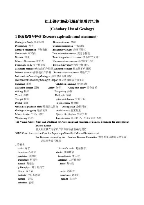
红土镍矿和硫化镍矿地质词汇集(Cabulary List of Geology)1地质勘查与评估(Recourse exploration and assessment)Geological Study 地质研究Reconnaissance 踏勘Prospecting 普查General exploration 一般勘探Detailed exploration 详细勘探Economic viability 经济可靠性Extractable 可采的Total mineral resources 资源总储量Reserve 储量Remaining mineral resources其余矿产资源Mineral Occurrence矿化点Uneconomic occurrence非经济矿化点Feasibility study可行性研究Prefeasibility study预可行性研究Measured resource确定级矿产资源Indicated resource推定级矿产资源Inferred resource推测级矿产资源Reconnaissance resource踏勘矿产Independent Consulting Geologist 独立咨询地质专家Independent Consulting Geologist’ Report独立咨询地质专家报告Sampling 采样Validation sampling 验证取样Duplicate sample 副样Assay 分析Composite assay 组合分析drilling 钻探Test pitting 井探Treach 探槽Drill hole 钻孔Test pit 探坑patial distribution 空间分布Profile 剖面cross-section 横剖面Geological penetrate rader地质雷达污染Grid spacing 勘探网度Geological mapping 地质填图Aerial survey航空测量Mineralication矿化,成矿Spatial distribution 空间分布Weathering 风化Lateritisation 红土矿化,红土矿成矿作用The V almin Code : Code and Guideline for Assessment and valuation of Mineral Securities for Independent Experts Report澳大利亚独立专家矿产资源评估报告编写规范JORC Code :Australasian Code for Reporting of identified Mineral Resources andOre Reserves released by the Joint ore Reserve Committee 澳大利亚资源委员会资源评估报告编写规范2岩石名schist 片岩ultramafic rocks 超基性岩,limestone石灰岩dunite 纯橄榄岩peridotite 橄榄岩hornblendite 角闪岩pyroxenite 辉石岩lherzolite 二辉橄榄岩diabase 辉绿岩gabro 辉长岩gabbrophyre 辉长煌斑岩diorite 闪长岩norite 苏长岩tholeiite 拉班玄武岩ferrobasic 铁质的magma 岩浆granite 花岗岩petroface 岩相phyllite 千枚岩mylonite糜棱岩3矿物名Laterite红土矿limonite 褐铁矿goethite 针铁矿magnetite 磁铁矿haematite 赤铁矿nickel sulphate 硫酸镍(iron,magnesium)hydroxide (铁,镁)氢氧化物nickel-bearing clay mineral 含镍粘土矿物nickel silicate 硅酸镍hdrosulphide 硫化氢serpentine 蛇纹石antigorite 叶蛇纹石chrysotile 纤蛇纹石garnierite 镍叶蛇纹石millerite 针镍矿talc 滑石chlorite 绿泥石montmorillonite 蒙脱石saprolite 腐泥土clay mineral 粘土矿物serpentinization 蛇纹石化kaoline 高岭石magnesite 菱镁矿calcite 方解石Sulphide硫化矿pyrite 黄铁矿pyrrhotite 磁黄铁矿ilmenite 钛铁矿chromite 铬铁矿chalcopyrite 黄铜矿cubanite 方黄铜矿valleriite 墨铜矿bornite 斑铜矿chalcocite 辉铜矿conellite 铜蓝pentlendite 镍黄铁矿violarite 紫硫镍铁矿mackinovite 马基诺矿millerite 针镍矿bravoite 方硫铁镍矿chrome spinal 铬尖晶石olivine 橄榄石pyroxene 辉石tremolite 透闪石hornblende 角闪石mica 云母biotite 黑云母muscovite 白云母phlogopite 金云母plagioclase 斜长石orthoclase 正长石gangue 脉石isotope 同位素major mineral 主要矿物minor mineral 次要矿物accessory mineral 副矿物trace mineral 痕量矿物4构造stock 岩株dike 岩墙basin 岩盆outcrop 露头tectonics构造学tectono-stratigraphics 构造地层学ore-bearing structure 含矿构造subfault二次断层synclinorium 复向斜volcanic 火山的colcano 火山imbricate thrust fault 叠瓦状逆掩断层detrital material 碎屑物质mantle 地表覆盖物,地慢concretion 胶结作用mottling 斑状构造flame structure 火焰状构造spongy structure 海绵状构造drop-like structure 乳滴状构造disemminated structure 浸染状构造strike 走向decline 倾向dip 倾角porosity孔隙度moistur content 含水量bulk density 块比重General tectonic setting 地质构造环境evolve 演化Gabbroid 辉长岩状Fauld displacement 断距fauld plane 断面6地貌与气候landscape and climatehillocky area 丘岭地区stony semi-desert area 碎石半沙漠地区气候sharply continental arid climate 大陆性干旱气候7其他普通地质词汇isochronous 等时的,同步的variscian 古生代8采矿词汇(Mining)Mining report开采报告Ore pass 溜井ramp 斜坡道hoist 卷杨机crosscut 川脉道stope 采场development works 采准工程tunnel 巷道filling 充填cement filling 胶结充填undercut and cement filling 胶结充填采矿main shaft 主井vice shaft 副井ventilation shaft 风井support支护steel set 钢架shotcrete 素喷pressure grouting 注浆bolt 锚杆cable bolts 长锚索bolts to hold mesh 喷锚网surface subsidence地表沉降ore to waste 采剥比open pit minning 露天开采excavater 铲运机5选矿词汇(Consentrate)Pilot scale testing 工业实验crusher 破碎机mill 磨矿机flotation 浮选Consentrate 选矿厂,精矿tailler dam尾矿坝6冶金词汇(Extract)Smelter 冶炼厂(火法)Refinery 精炼厂Hydrometallurgic湿法冶炼的Pyrometallurgic 火法冶炼的Liquation 溶液Heap leaching 堆浸Bioleaching 生物浸出high pressure acid leach 高压浸出Ion exchange 离子交换strip反萃Resin 树脂萃取Dissolve 溶解Roast 培烧roaster 培烧窑flash furnace 闪速炉convertor 转炉slag渣matte 锍pour into moulds 浇铸sulphate-chlorite solution 硫酸-盐酸电解液electrolyte 电解,电解池,电解质cathodyte 阴极电解质anode 阳极anode slab 阳极板Solution Neutralisation 溶液中和precipitation 沉淀Washing and filtering 洗矿与过滤solvent 溶剂Iron removal 除铁purification 提纯7一些矿物的分子结构serpentine 蛇纹石A3[Si2O5](OH)4, A=Mg,Fe2+,Ni等,A为镍时为镍蛇纹石,蛇纹石为层状硅酸盐,(OH)+在层间以分子间力连结上下两层。
毕业论文(设计)文献翻译(地质工程方面)-中英文对照

Formation Mechanism and Distribution of Paleogene-Neogene Stratigraphic Reservoirs in Jiyang DepressionAbstractDuring Paleogene-Neogene period, multiple scale unconformities had been formed in Jiyang depression, which provided favorable conditions for stratigraphic reservoirs. In recent years, various Paleogene-Neogene stratigraphic reservoirs in Jiyang depression have been found, and proved reserves were rising significantly, which fully showed a great exploration potential for this kind of reservoirs. But the practice of exploration in recent years indicated that the unconformities carrier system and its ability of sealing, petroleum migration and its accumulation model, distribution of stratigraphic reservoirs are uncertain, which deeply restrict the exploration degree of stratigraphic reservoirs in Jiyang depression.Based on the analysis of a large number of exploration wells and seismic data for Typical reservoirs, the paper analyses unconformities construct and its effect to generation in the Paleogene—Neogene, and summarize the distribution pattern of stratigraphic reservoirs based on petroleum mechanism and accumulation model. Finally, a highly quantitative prediction modclof height of pools in stratigraphic reservoirs was established, the research results effectively guided the explorationPra- ctice of stratigraphic reservoir .There are four macro unconformity types of Paleogene—Neogene formation which including truncation-overlap, truncation·paral lel, parallel—overlap and paralel unconformity in Jiyang depression.Besides truncation-overlap unconformity lies in slopes of depression, and parallel unconformity developed inside of depression,another two types lie in local areas. Unconformity can be developed vertically three-layer structure which including unconformity roof rock, weathered clay layer and semi-weathered rock. It also Can be two—layer structure if without weathered clay layer.And part of semi—weather rock Can be form a hard shell accuse of its filling process during the laterstage.Geological characteristic of the structure layer of unconformity is different in lithology,mineralogy, element geochemistry and weather degree index. Based on optimal partition of sequential number and principal component analysis, logging quantification recognition method about unconformity structure layers were established, on which effective identification of unconformitystnlcture layers can bu achieved in the case of no rock core. The formation of various unconformity structure types isrelated to many factors such as, parent rock lithology, interval of deposition hiatus, palaeotopography,and preservation conditions, which aretogether to control spatial distributions of unconformity structure types .Macro styles and its vertical structure of unconformity can be effected as a blocking, reservoir, trap or carrier system.Blocking affection to fluid depends on weathered clay layer,hard shell of semi-weathered rock and mudstone. So petroleum migration and accumulation units is relatively independence above and belowunconformity if structure layers mentioned above existed. Reservoir affection is due to permeable rock, including roof sandstone .Semi-weathered sandstone, semi-weathered carbonate rock, semi—weathered igneous rock and semi-weathered metamorphic. Trap—controlling affection related to macro unconformity type and its juxtapose to permeability and impermeability rock above and below unconformity. It is easy to develop stratigraphy traps where the permeability and impermeability beds juxtapose in a truncation-overlap unconformity, where up permeability and down impermeability in parallel-overlap unconformity, and down permeability and up impermeability beds juxtapose in a truncation-parallel. Transporting affection is owing to lateral continuity of permeable rock of unconformity. In a terrestrial rift basin, petroleum migration in transverse or vertical short distance in local area, and is not conducive to petroleum long distance along unconformity, because interbedding pattern of mudstone and sandstone is dominated, and its physical property of mudstone improved poorly .Because of the long distance from resource to trap, migration and accumulation procese is very complicated.. Accumulation process of Paleogene-Neogene stratigraphic traps can be summarized as following:allochthonous source rock , compound transportation , later period charging, buoyancy and pressure conversion driving for accumulation, and blocking by non-permeable layer of unconformity, Trap types and its distribution are controlled by unconformity structure styles. Petroleum distribution and its scale are controlled by generating ability of Source rock. Petroleum accumulation area is decided by positive tectonic units. If carrier systemexisted , oil column of stratigraphic reservoirs is effected by four mainfactors which including generation expulsion quantity,migrating distance, dip angle and capillary resistance of carrier layer. Based on the analysis of single factor, the prediction model of height of oil columu through multi—factor regressions was established . Based on the model , the paper defruited favorable areas, which reserves in these areas exceed 1.5 x 1 08t .Research results of the paper combined closely with exploration practice, and according to previous research results,31 exploration wells had been drilled, which of them 17 wells were successfully from 2006 to 2009. There is accumulation proved reserves Was up to 2362x104t. and predict reserves was to 3684x104t .Keywords:Paleogene; Neogene; unconformity stratigraphie reservoirs; Fomation mechanism; distribution pattern; Jiyang depression1. Preface1.1 Foundationnd and signifacance of the topic1.1.1 Theme originThe theme is from the Sinopcc project:Forming and distribution of Tertiarystratigraphic reservoir of Jiyang depression .Theme number:P06012,deadline:2006-20081.1.2 Foundation and baekground of the themeThe tectonic events frequently occurred in Jiyang depression in paleogene-Neogene.It was favour of forming stratigraphic reservoir because of existence of several kinds of unconformity . Based on statistical data , beneficial area reservoired oil is about 9500km2, and the remaining resource is about 16x 108t in stratigraphic reservoirs of paleogene-Neogene stratas.Since 1980s,many overlap and unconformity reservoirs have been founded , explored reserves Was apparently increased with deep exploring. By the end of 2006 , explored resource had been up to 3.7×10⁸t which showed a large exploring potential.But , in fact , the research on stratigraphic reservoir is lack or Uttle , especially,Accumulation pattern and forecasting model of oil have not been studied systematically. For example , the successful ratio of exploration well testing which is the lowest in allkinds reservoirs Was only 35.7%about stratigraphie reservoir in paleogene-Neogene in Jiyang depression from2001-2005. The main loss reason for the overlap andunconformity reservoirs exploration is migration and trap of oil that is separently53.5%and 23.9%.Hereby , oil migration problem and trap validity are importantaspects for overlap and unconformity reservoir exploring.In short,it has three aspects as followed:(1)Shallow comprehension about conduction of ability of unconformity Research on unconformity in present indicated that it is not a simple surface three-dimension body which is important for migration of oil and gas.There has some deep knows about the basins in west China and the marine basins in China. The systematic theory is lack about structure characteristic which deeply affect accumulating oil and gas.(2)The remain uncertain migration and accumulation process of oil and gas about stratigraphic reservoir remain uncertain .Stratigraphic reservoir lay in edge of basin . So it is difficult to exactly hold accumulation regular of oil and gas because far distance traps and hydrocarbon resources make a complicated migration process.(3)Forecasting model of stratigraphic reservoir that could be used to guide explore is lack It is necessity to finely evaluate and explore stratigraphic reservoir along with degree of exploration. Mayor controlling factors remain uncertain in construction offorecasting model of stratigraphic reservoirs.1.1.3 Aim, sense and application value of themeThe study resolves the problem of statigraphic reservoir formation and distribution of Paleogene-Neogene in Jiyang depression. By analysis of uniformity structure, their affect on statigraphic reservoir formation will be identify; The accumulation model will be established through study on static geologic characteristic of statigraphic reservoir ; Forecast mode of oil extent will be achieved through research on oil extent and to predict oil quality.Research results Can not only be used to effectively guide statigraphic reservoirExploring, to raise drilling Success ratio, provide technical support for increasing oilproduction of the Sinopec, and also provide reference to statigraphic reservoir exploring of Bohai Bay area . Research will enormously deepen statigraphic reservoir accumulation regular and further enrich and improve subtle reservoir exploring theory .1.2 Research present at home and abroad1.2.1 Present research and development at home and abroadUnconformity reservoir is one of important exploring object since Levorsen proposed the concept of stratigraphic trap and then published paper on‘‘Stratigraphic oil field ” in 1 936.It turns into stratigraphic reservoir and lithology reservoir based on scholars deepenly research the Levorsen stratigraphic eservoir .Stratigraphic trap is formed as a result of the updip reservoir directly contigence with unconformity above. According to trap place, accurrence and barrier, stratigraphic oil pools is divided into overlap pool, unconformity barbered pool and ancient buried-hill pool .Unconformity reservoir research covers three main sections. One is unconformityand its effect on oil accumulating. The second section is developing paaem of stratigraphic trap. The third is mechanism of migrating and accumulating of oil and gas. Present studies mainly focus on the three sections above .(1)Unconformity and its effect on oil accumulationUnconformity is geology base and key element to form the overlap and unconformity barriered traps and relevant reservoir . In generally,research on overlap and unconformity barrier reservoirs is first unconformity research target.Oil geologists started to understand relationship between inconformity and oil and gas acumination in 1930s. Levorsen published the book of“geology of petroleumin'1954. The book entirely introduced definition and significance of unconformity and the relatiooships with oil accumulation .The research and application of unconformity were promoted by stratigraohy andrecent oil and gas accumulation theory,especially,thesequence stratigraohy pay a important role in predict of geological discontinuity .Pan zhongxiang[2’3]referred to unconformity importance for oil and gas accumulation in 1983. Unconformity is benefit to find petroleum because it is favour of oil and gas migration and accumulation. From 1990s, the research on unconformity and accumulation effect were also be done in Tarim basin, ordos basin, Bohai bay basin and Jungar basin, a important and innovation result were be achieved .Fuguang[4,5],Wu kongyou[l6,7]and Zhang jianlin[8]had noted that unconformity is not only a simple surface but also a special geology body, a migration and accumulation passageway of oil and gas. It is represent for tectonic movement, sea or lake suface change,and geologic alteration to earlier rocks.The inhomogeneity of alteration and later overlap make the a. rchitecture of unconformity. There ale three layers structure in a ideal unconformity: roof rock above unconformity, weathered clay horizon and semi-weathered rock.Unconformity formation is related to denudation time,climate, elevation, tectonic movement and lithology. Two layers structure layers were formed as the weathered clay horizon was lack. Liuhua[16], Suifenggui[17], etc. divided unconformity into four types sand/mud, sand/sand, mud/mud and mud/sand . According to lithologic deploy of unconformity. They refcred that the migrating and accumulating ability of unconformity are decided by lithologic deploy of unconformity .Panzhongxiang[2'3],Liuxiaohant[11],Zhangkeyin[12],Chenzhonghong[14],Hedengfa,Aihuaguo[19],Wuyajun[20],Chenjianping[22'23], Zhangjiguang[2l], John S[26]etc . had a deepresearch on unconformity and refered that unconformity has an apparent controllingeffect on oil and gas accumulation. In summery, five main aspects is included: charging reservoir, charging trap,charging migrating, charging accumulating anddestroying reservoir. Based on physical modeling of oil migration, Lv xiuzheng Bekele thought the oil migration is followed the rule “migration through thin bed”, namely, migration through prevailing passway, otherwise anywhere in a conformity .(2)Development regularity of stratigraphic trapsOverlapped and unconformity is premise of overlap and unconformity reservoirExiting. so, this kind reservoir developed based on overlapped and unconformity trap formation first.Chensizhong proposed four conditions for developing overlap and unconformity reservoirs in 1982 based on research on the characteristics of overlapped and unconformity reservoirs and its distribution patterns. First is that Multiple overlapped and unconformity reservoir formed as a result of Multiple unconformityies and overlaps.second is that oil avvumulation area is above and below unconformity nearby hydrocarbon source rock. Third is that Torque subsidence of dustpan depression cause wide rang of overlap and unconformity reservoir. Fourth is that favourable overlap and unconformity reservoir lies in anti-cycle litbofacies fold play. Tong xiao guang referred four main controlling factors in 1983. First is time, lithology, attitude and weathering degree of pre-Paleogene-Neogene base rocks. Second is structure of faulted depression and movement strength.Third is overlap distribution of overlap line and feature of overlap lay above unconformity. Fourth is distribution of unconformity surface, permeability of overburden rocks above unconformity. Hujianyi[1lreferred that unconformity is the base of forming overlap and unconformity barrier trap, but not all good trap exits bearby unconformity in 1 984 and 1 986. The basic condition of forming overlap and unconformity barrier trap are six elements:three lines and three surfaces. Three lines are lithologic wedging line, layer overlap line and intended zone contour line. Three surface are unconformity surface, adjacent rock surface of reservoir and fault surface. It exits kinds of trap types when six elementsarraies.People deeply know development regularity of overlap and unconformity trapwith sequence stratigraphy spring up. Zhangshanwen[31] refer that multi. type breakcontrol overlap and unconformity trap, base on researching sequence of Zhungaer basin, Bohaibay basin and Songliao basin in 2003. Lipilong[35-39] refer that tectonic and deposit control overlap and unconformity trap in 2003 and 2004. Tectonic movement cause basin up and down, formed large area exceed peel zone in edge of basin. It is benefit to form trap.Tectonic form nosing structures in basin. It is benefit to form traps, Deposit control reservoir and barrier layer forming. Yishiwei[42] propose that oil accumulation controlled three surface, lake extensive surface, unconformity surface and fault surface, according to Erlian basin, Jizhong depression overlap andinconformity reservoir characteristic. Overlap and unconformity reservoir distributionare controlled by truncation zone and overlap zone. Enriching is controlled by beneficial accumulating phase belt.(3)Oil and gas migration and accumulation mechanism of stratigraphic trapReservoir is resuk of oil and gas migrating and accumulating in long distance, due to stratigraphic trap far from hydracarbon source rock. It is controlled by migrating dynamic, passageway, path, distance and accumulation etc.Lipilong[35-39]refer that the most effective oil path is fault-sandfault-unconformity and fault-sand-unconformity compound transmit system for overlap and unconfortuity trap in 2003 and 2004.Lichunguang[44]refer that heavy crude is secondary gas/oil pool through unconformity path migrating and accumulating in unconformity accompany trap, based on researching feavy crude reservoir of Dongyingdepression in 1999. Zhangjiazhent and Wangyongshi[48]refer thatY'Lhezhuang reservoir mainly lie in 100m above old burial hill old layer reflect shaft in 2005. Capping formation and barrier formation control the accumulation of the area oil and gas. Better Capping formation and barrier formation, better oil accumulation Suifenggui[17]refers that it is key for stratigraphic trap accumulation that‘T-S’transmit system validity and ability consist of oil soures fault,sand and ubconformity in 2005 in Jiyang depression. Layer unconformity style affects the stratigraphy trap forming and oil and gas migration.Lvxiuxiang refer that migration in uncomformity is thin bed migration through oil migrating physical analog in 2000. Oil migrates along advantage path, but not unconformity surface.All in one, there are many researches and outcome about trap develop and oil/gas accumulation of land facies basin stratigraphy reservoir home and abroad. But trap forcast is difficult because stratigraphy lie in basin edge and changeable lithofacies.Accumulation regular known less than other type reservoir, especially how unconformity affect stratigraphic reservoir develop, accumulation process, model and distribution, because of long distance between trap and hydrocarbon ,complex migtation process.1.2.2 Developing tendencyOverlap and unconformity reservoir show more and more important position with development of un-anticlinal trap exploratory development and rising of degree of exploration of petroliferous basin.Survey showed that although large of reseach and probe,research of overlap and unconformity are limited at quality. But, the common understanding include following respects:(1)Evaluation of structure, carrier system and barrier abilityUnconformity is important to develop overlap and unconformitty barrier reservoir. Now research about unconformity focus on one angle. It is tendency that begins with contributing factor of unconformity, analysis structure, make definite forming characteristic, evaluate transmiting and barrier ability,analyze the relationship between unconformity and oil/gas reservoir. (2)Mayor controlling factors and developing regularity of overlap and unconformity reservoir.It is common understanding that key overlap and unconformity barrier trap formation in develop system in home and abroad. Based Oll many research, this type trap is controlled by reservoir, cap rock and crossrange barrier, especially their valid matching.However,there is not deep research on three elements on system and contributing because of exploration phase confinement.(3)Oil and gas migration mechanism and accumulation model of overlapped andstratigraphic reservoir.With long distance migration and accumulation, reservoir development relate toDynamic, fashion, path, distance, process, etc. Element. They limit the understandingabout oil migrating mechanism. It is tendency that based on quantification, combinating type dissect, establishing accumulating model, effectively guide unconformity reservoir exploration .1.3 Research content and technique route1.3.1 Research contentThe subject confh'm following three research contents in view of key problembased on research present and development tendency .(1)Characteristic and distribution ofunconformity architecturesBased on basin the evolution of basin structure and deposition, through structural geology and sedimentology, and combined lab analysis, geophysical interpretation and mathematical statistics, the geology characteristic of unconformity and mayor controlling factors were analysised to definite spatial distribution unconformity architectures .(2)Formation mechanism and accumulation model of stratigraphic reservoirBased on geology comprehensive research and mathematical statistics ofstatic-characteristic of stratigraphy reservoir and by analysis migration and accumulation.Process, the migration path, accumulation stage and accumulation dynamic mechanism were analyzed to evaluate unconformity affect on oil/gas accumulation in geological history .Based on above research, sum up stratigraphy reservoir accumulating mechanism of Paleogene-Neogene, establish accumulating model through positive and negative respects research .(3)Distribution paRem and predict of favorable area of stratigraphy reservoirAccording to accumulation process and model, sum up distribution of stratigraphy reservoir. Based on mathematics statistics and geology analysis, make definite main element and quantification token parameter of oilness altitude, probe quantification forcast model of oilness altitude of stratigraphy reservoir starting from oil/gas migrating and accumulation process .Based on research findings above, it mainly focus on forecasting of stratigraphicreservoir nearby unconformities between Paleogene—Neogene and pre—Paleogene, and between Neogene and Paleogene .1.3.2 Technique routeUsing for reference from outcome of predecessors, based on type characteristic and distribution of unconformity of Jiyang depression, keep layer unique feature and accumulation process dissecting loss trap analyze as key, make geology comprehensive research and mathematical statistics method, sum up accumulation process and model, sum up main element, establish quantification forcast model of trap oilness, evaluate benefit exploring area .Figl-1: Frame picture showing research technique route ofdistribution patternand formationof samigraphy reservoir in Paleogene and Neogene slratas in Jiyang depression济阳坳陷古近系一新近系地层油藏形成机制与分布规律摘要济阳坳陷古近系.新近系发育过程中,形成了多个规模不等的不整合,为地层油藏的发育提供了有利条件。
地质专业词汇中英文对照
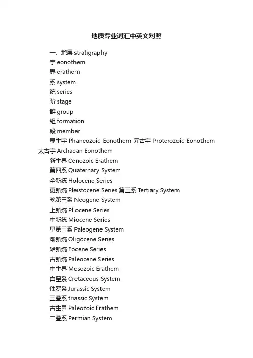
地质专业词汇中英文对照一、地层stratigraphy宇eonothem界erathem系system统series阶stage群group组formation段member显生宇Phaneozoic Eonothem 元古宇Proterozoic Eonothem 太古宇Archaean Eonothem新生界Cenozoic Erathem第四系Quaternary System全新统Holocene Series更新统Pleistocene Series 第三系Tertiary System晚第三系Neogene System上新统Pliocene Series中新统Miocene Series早第三系Paleogene System渐新统Oligocene Series始新统Eocene Series古新统Paleocene Series中生界Mesozoic Erathem白垩系Cretaceous System侏罗系Jurassic System三叠系triassic System古生界Paleozoic Erathem二叠系Permian System石炭系Carboniferous System泥盆系Devonian System志留系Silurian System奥陶系Ordovician System寒武系Cambrian System新元古界Neoproterozoic Erathem震旦系Sinian System中元古界Mesoproterozoic Erathem 古元古界Palaeoproterozoic Erathem 地层对比stratigraphic correlation 层位horizon标志层key bed哑层barren bed缺失lacuna尖灭feather edge透镜状结构lensoid连续continuity不连续discontinuity整合conformity不整合unconformity角度不整合angular unconformity平行不整合para-unconformity产状occurrence走向strike倾角dip真倾角true dip视倾角apparent dip倾伏角plunge侧倾角pitch层理bedding层面bedding planes交错层理cross bedding二、岩性lithology粘土clay粉质粘土silty clay砂sand砾石gravel沉积岩sedimentary rock火成岩igneous rock变质岩metamorphic rock粘土岩claystone, clay rock页岩shale泥岩mudstone粉砂岩siltstone泥质粉砂岩argillaceous siltstone, pelitic siltstone, muddy siltstone砂岩sandstone泥质砂岩argillaceous sandstone, pelitic sandstone, muddy sandstone砾岩conglomerate煤coal灰岩limestone泥灰岩marl, marlstone白云岩dolomite蒸发岩evaporite岩浆岩magmatic rock, magmatite 花岗岩granite玄武岩basalt凝灰岩tuff大理岩marble片麻岩gneiss夕卡岩skarn三、矿物mineral 石英quartz长石feldspar云母mica白云母muscovite 方解石calcspar角闪石hornblende 石膏gypsum硬石膏anhydrite 石盐rock salt钾石盐sylvine光卤石carnallite溢晶石tachydrite 水氯镁石bischofite 四、颜色colour灰色gray白色white黄色yellow蓝色blue绿色green黑色black红色red棕色brown黄褐色tan深色dark浅色light暗色dull五、构造tectonics 断层fault正断层normal fault逆断层reverse fault冲断层thrust走滑断层strike-slip fault 倾滑断层dip-slip fault 断层面fault surface断层线fault line地垒horst地堑graben节理joint上盘hanging wall下盘foot wall落差throw平错heave断层泥fault gouge断层角砾fault brecci海侵transgression海退regression褶曲fold背斜anticline向斜syncline褶轴fold axis轴隆区culmination轴陷区depression翼limb穹窿dome盆地basin六、水文地质hydrologic geology河流river水库reservoir泉spring地表水surface water地下水groundwater大气降水atmospheric precipitation潜水phreatic water承压水confined water层间水interstrated water地下水位groundwater level含水层aquifer, water bearing layer隔水层aquiclude, water-resisting layer 弱含水层aquitard透水层permeable bed孔隙含水层porous aquifer裂隙含水层fissured aquifer岩溶含水层karst aquifer无压含水层unconfined aquifer承压含水层confined aquifer含水岩组water-bearing formation 含水岩系water-bearing rock series 持水度water-holding capacity给水度specific yield透水性permeability富水性water yield property溶洞karst cave孔隙水pore water裂隙水fissure water岩溶水karst water补给区recharge area径流区runoff area排泄区discharge area地下径流underground runoff地下水排泄groundwater discharge降水补给precipitation recharge地表水补给surface water recharge越流补给leakage recharge水文地质单元hydrogeological unit地下水赋存条件 groundwater occurrence水文地质条件hydrogeological condition 水文地质类型hydrogeological type地下水储存量groundwater storage地下水监测groundwater monitoring抽水试验pumping test注水试验injection test入渗试验Infiltration test水文调查hydrologic investigation渗透系数osmotic coefficient矿床充水flooding of ore deposit矿床充水条件flooding condition of ore deposit矿床充水水源Water source of ore deposit flooding 矿床充水通道flooding passage in ore deposit充水岩层flooding layer老窿水goaf water矿坑涌水量water yield of mine正常涌水量normal water yield最大涌水量maximum water yield大井法Large diameter well method开采疏干simultaneous draining in mining地下疏干underground draining地表疏干surface draining疏干钻孔drain well疏干巷道draining tunnel矿井突水water bursting in mines突水点water bursting point防水矿柱ore pillar preventing water burst矿井堵水water blocking in mines探水钻孔water exploration borehole注浆孔grouting well最高洪水位maximum flood level七、工程地质egineering geology顶板roof顶板稳定性roof stability顶板冒落带caving zone of top wall顶板裂隙带fissure zone of top wall顶板管理roof control顶板支护roof support顶板崩落collapse of roof底板floor, footwall底鼓footwall heaving岩石物理性质physical properties of rock岩石力学性质mechanical properties of rock 抗压强度compressive strength抗拉强度tensile strength岩爆rock burst软弱结构面weak structural plane工程地质条件engineering geologic condition 八、环境地质environmental geology岩崩rock fall滑坡landslide泥石流mud-rock flow地震earthquake地面沉降subsidence地面开裂land crack地面塌陷ground surface collapse塌陷坑collapse pit地下水污染groundwater pollution地表水污染surface water pollution污染源pollution source地下水资源枯竭 groundwater resource depletion地下水质恶化deterioration of groundwater quality 九、资源/储量resource/reserve矿产资源mineral resources储量reserves基础储量reserve base资源量resources可采储量proved reserves预可采储量probable reserves探明的measured控制的indicated推断的inferred预测的prognostic远景储量prospective reserves经济的economic边际经济的marginally economic次经济的subeconomic内蕴经济的intrinsically economic矿石ore矿层ore bed矿床ore deposit矿块ore block矿柱ore pillar, ore column矿石品位ore grade富矿体ore shoot, ore course 贫矿poor ore。
地质学常用中英文词汇对照表(按章节)
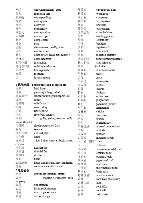
阐述expound(explain),state引入introduce into相应的corresponding概念conception概论overview概率probability概念化conceptualize宏观的macroscopic补充complement规划plan证明demonstrate,certify,attest证实confirmation补偿compensate,make up,imburse组合式combined type相互作用interaction稳定性评价stability evaluation均质性homogeneity介质medium层layer,stratum1地形地貌geographic and geomorphic地形land form地貌geomorphology,relief地貌单元landform unit,geomorphic unit 坡度grade地形图relief map河谷river valley河道river course河床river bed(channel)冲沟gully,gulley,erosion gully, stream(brook)河漫滩floodplain(valley flat)阶地terrace冲积平原alluvial plain三角洲delta古河道fossil river course,fossil stream channel冲积扇alluvial fan洪积扇diluvial fan分水岭divide盆地basin岩溶地貌karst land feature,karst landform 溶洞solution cave,karst cave2地层岩性地层geostrome(stratum,strata)岩性lithologic character,rock property岩层bed stratum岩层layer,rock stratum母岩matrix,parent rock相变facies change 硬质岩strong rock,film软质岩weak rock硬质的competent软质的incompetent基岩bedrock覆盖层overburden交错层理cross bedding层面bedding plane片理schistosity层理bedding波痕ripple-mark泥痕mud crack雨痕raindrop imprints造岩矿物rock-forming minerals 粘土矿物clay mineral高岭土kaolinite蒙脱石montmorillonite伊利石illite云母mica白云母muscovite黑云母biotite石英quartz长石feldspar正长石orthoclase斜长石plagioclase辉石pyroxene,picrite角闪石hornblende方解石calcite构造structure结构texture组构fabric(tissue)矿物组成mineral composition 产状attitude火成岩igneous岩浆岩magmatic rock火山岩(熔岩)lava火山volcano侵入岩intrusive(invade)rock 喷出岩effusive rock深成岩plutonic rock浅成岩pypabysal rock酸性岩acid rock中性岩inter-mediate rock基性岩basic rock超基性岩ultrabasic rock岩基rock base(batholith)岩脉(墙)dike岩墙rock dike岩床rock sill岩脉vein dyke花岗岩granite流纹岩rhyolite闪长岩diorite辉长岩gabbro玄武岩basalt橄榄岩dunite火山角砾岩vulcanic breccia火山集块岩volcanic agglomerate凝灰岩tuff沉积岩sedimentary rock碎屑岩clastic rock粘土岩clay rock粉砂质粘土岩silty claystone化学岩chemical rock生物岩biolith砾岩conglomerate角砾岩breccia砂岩sandstone石英砂岩quartz sandstone粉砂岩siltstone钙质粉砂岩calcareous siltstone泥岩mudstone页岩shale盐岩saline石灰岩limestone白云岩dolomite泥灰岩marl泥钙岩argillo-calcareous泥砂岩argillo-arenaceous砂质arenaceous泥质argillaceous硅质的siliceous有机质organic matter粗粒coarse grain中粒medium-grained沉积物sediment(deposit)漂石、顽石boulder卵石cobble砾石gravel砂sand粉土silt粘土clay粘粒clay grain砂质粘土sandy clay粘质砂土clayey sand壤土、亚粘土loam砂壤土、亚砂土轻亚粘土sandy loam浮土、表土regolith(topsoil)软泥ooze淤泥mire,oozed mud,sludge,warp clay冲积物(层)alluvion冲积的alluvial洪积物(层)proluvium,diluvium,diluvion洪积的diluvial冰川沉积物(层)glacier(drift)deposits崩积物(层)colluvial deposits,colluvium残积粘土residual clay变质岩metamorphic rock板岩slate千枚岩phyllite片岩schist片麻岩gneiss石英岩quartzite大理岩marble3地质构造地质构造geologic structure大地构造geotectonic构造运动tectogenesis造山运动orogeny升降运动vertical movement水平运动horizontal movement完整性perfection(integrity)产状要素elements of attitude产状attitude,orientation走向strike倾向dip倾角dip angle,angle of dip褶皱fold褶曲fold单斜monocline向斜syncline背斜anticline穹隆dome挤压squeeze上盘upper section下盘bottom wall,footwall,lower wall断距separation相交intersect断层fault正断层normal fault逆断层reversed fault平移断层parallel fault层理bedding,stratification地堑graben地垒horst,fault ridge断层泥gouge,pug,selvage,fault gouge 擦痕stria,striation断裂fracture破碎带fracture zone节理joint节理组joint set裂隙fissure,crack微裂隙fine fissure,microscopic fissure 原生裂隙original joint次生裂隙epigenetic joint张裂隙tension joint剪裂隙shear joint卸荷裂隙relief crack碎裂结构cataclastic texture板状结构platy structure薄板状lamellose块状的lumpy,massive层状的laminated巨厚层giant thick-laminated薄层状的finely laminated软弱夹层weak intercalated layer夹层inter bedding,intercalated bed,interlayer,intermediate layer夹泥层clayey intercalation夹泥inter-clay连通性connectivity切层insequent影响带affecting zone完整性integrity n.Integrate v.&a.degree of integrality破碎crumble胶结cement泥化argillization尖灭taper-out错动diastrophism错动层面faulted bedding plane断续的intermittent共轭节理conjugated joint透镜状的lens-shaped a.岩屑cuttings,debris薄膜membrane,film层理stratification高角度high dip angle缓倾角low dip angle反倾anti-dip互层interbed v.Interbedding n.粒径particle size构造层tectonosphere挤压compression均一的homogeneous致密close,compact 构造岩tectonite糜棱岩mylonite断层角砾岩fault breccia方解石脉calcite vein碎块岩clastic rock角砾breccia岩粉rock powder岩屑debris,debry固结consolidation4水文地质条件hydrogeological conditions大气圈atmosphere水圈hydrosphere岩石圈geosphere地表径流surface runoff地下径流subsurface runoff流域valley,drainage basin流域面积drainage area,river basin area 汇水面积catchment area地下水ground water,subsurface water 地表水surface water大气水atmospheric water气态水aqueous(vapour)water液态水liquid water固态水solid water吸着水hygroscopic(adsorptive)water 介质medium空隙void孔隙水压力pore water pressure静水压力hydrostatic pressure外静水压力external hydrostatic pressure动水压力hydrodynamic pressure渗透力seepage pressure外水压力external water pressure内水压力internal water pressure水位water level,stage level水头water head含水层aquifer透水层permeable layer,pervious layer 不透水层(隔水层)aquifuge,impervious layer,impermeable layer, aquiclude地下分水岭groundwater ridge孔隙水pore water裂隙水fissure water岩溶水karstic water结合水bound water,combined water吸着水hydroscopic water薄膜水pellicular water毛细水capillary water重力水gravitational water凝结水condensation water地下水埋藏条件condition of groundwater occurrence地下水埋藏深度depth of groundwater occurrence压水试验packer permeability test5工程勘察engineering investigation勘测survey勘察阶段investigational stage初步设计primary design初步规划preliminary scheme初步勘探preliminary prospecting初步踏勘ground reconnaissance可行性研究阶段feasibility stage初步设计阶段preliminary stage踏勘reconnaissance,inspection地质测绘geological survey工程地质测绘engineering geological mapping钻探borehole operation,boring物探geophysical exploration洞探exploratory adits钎探rod sounding坑探exploring mining槽探trenching比例proportion地形图geographic map地貌图geomorphological map地质图geological map实测地质剖面图field-acquired geological profile(section)构造地质图geological structure map第四纪地质图quarternary geological map 地质详图detail map of geology地质柱状图geologic columnar section, geologic log纵剖面图longitudinal section横剖面图cross section展示图reveal detail map节理玫瑰图rose of joints基岩等高线bed rock contour层底等高线contour of stratum bottom岩层界线strata boundary岩面高程elevation of bed rock surface 坐标coordinate分层bed separation地质点geological observation point勘探点exploratory point(spot)勘探线exploratory line勘探孔exploration hole金刚石钻进diamond drilling6安全监控可靠性检查reliability checking监控模型monitoring and prediction model监测monitoring资料datum,data可靠性reliability稳定性stability安全safety评估evaluation,appraise评定assessment,assess,rate评价准则criterion灾害hazard,calamity确定性方法论Deterministic methodology应急行动计划EAP(emergency action plan)事故accident静力(Static Analysis)动力(Dynamic Analysis)Evidently明显的Correspondingly adv.相应地;相关地;相同地。
可供滑坡英文术语学习的文章
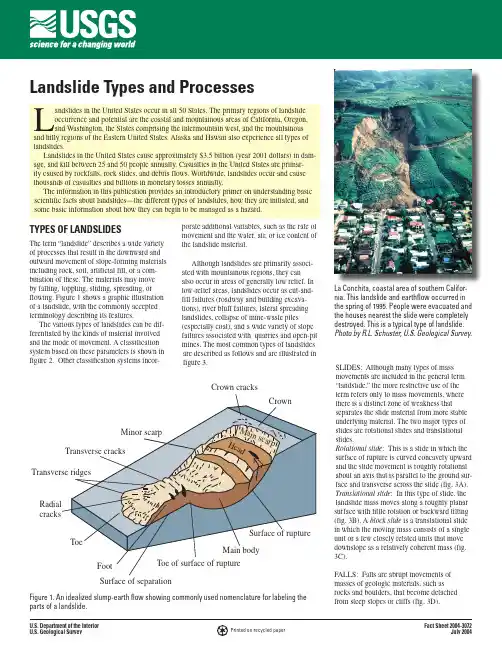
U.S. Department of the Interior U.S. Geological SurveyFact Sheet 2004-3072July 2004Landslide Types and ProcessesPrinted on recycled paperLandslides in the United States occur in all 50 States. The primary regions of landslide occurrence and potential are the coastal and mountainous areas of California, Oregon, and Washington, the States comprising the intermountain west, and the mountainous and hilly regions of the Eastern United States. Alaska and Hawaii also experience all types of landslides.Landslides in the United States cause approximately $3.5 billion (year 2001 dollars) in dam-age, and kill between 25 and 50 people annually. Casualties in the United States are primar-ily caused by rockfalls, rock slides, and debris flows. Worldwide, landslides occur and cause thousands of casualties and billions in monetary losses annually.The information in this publication provides an introductory primer on understanding basic scientific facts about landslides—the different types of landslides, how they are initiated, and some basic information about how they can begin to be managed as a hazard.Crown cracksFigure 1. An idealized slump-earth flow showing commonly used nomenclature for labeling the parts of a landslide.TYPES OF LANDSLIDESThe term “landslide” describes a wide variety of processes that result in the downward and outward movement of slope-forming materials including rock, soil, artificial fill, or a com-bination of these. The materials may move by falling, toppling, sliding, spreading, or flowing. Figure 1 shows a graphic illustration of a landslide, with the commonly accepted terminology describing its features.The various types of landslides can be dif-ferentiated by the kinds of material involved and the mode of movement. A classification system based on these parameters is shown in figure 2. Other classification systems incor-porate additional variables, such as the rate of movement and the water, air, or ice content of the landslide material.Although landslides are primarily associ-ated with mountainous regions, they can also occur in areas of generally low relief. In low-relief areas, landslides occur as cut-and-fill failures (roadway and building excava-tions), river bluff failures, lateral spreading landslides, collapse of mine-waste piles(especially coal), and a wide variety of slope failures associated with quarries and open-pit mines. The most common types of landslides are described as follows and are illustrated in figure 3.SLIDES: Although many types of mass movements are included in the general term “landslide,” the more restrictive use of the term refers only to mass movements, where there is a distinct zone of weakness thatseparates the slide material from more stable underlying material. The two major types of slides are rotational slides and translational slides.Rotational slide : This is a slide in which the surface of rupture is curved concavely upward and the slide movement is roughly rotational about an axis that is parallel to the ground sur-face and transverse across the slide (fig. 3A). Translational slide : In this type of slide, the landslide mass moves along a roughly planar surface with little rotation or backward tilting (fig. 3B). A block slide is a translational slide in which the moving mass consists of a single unit or a few closely related units that move downslope as a relatively coherent mass (fig. 3C).FALLS: Falls are abrupt movements of masses of geologic materials, such as rocks and boulders, that become detached from steep slopes or cliffs (fig. 3D).La Conchita, coastal area of southern Califor-nia. This landslide and earthflow occurred in the spring of 1995. People were evacuated and the houses nearest the slide were completely destroyed. This is a typical type of landslide. Photo by R.L. Schuster, U.S. Geological Survey.Separation occurs along discontinuities such as fractures, joints, and bedding planes, and movement occurs by free-fall, bouncing, and rolling. Falls are strongly influenced by grav-ity, mechanical weathering, and the presence of interstitial water.TOPPLES: Toppling failures are distin-guished by the forward rotation of a unit or units about some pivotal point, below or low in the unit, under the actions of gravity and forces exerted by adjacent units or by fluids in cracks (fig. 3E).FLOWS: There are five basic categories of flows that differ from one another in funda-mental ways.a. Debris flow: A debris flow is a form of rapid mass movement in which a combina-tion of loose soil, rock, organic matter, air, and water mobilize as a slurry that flows downslope (fig. 3F). Debris flows include <50% fines. Debris flows are commonly caused by intense surface-water flow, due to heavy precipitation or rapid snowmelt, that erodes and mobilizes loose soil or rock on steep slopes. Debris flows also commonly mobilize from other types of landslides that occur on steep slopes, are nearly saturated, and consist of a large proportion of silt- and sand-sized material. Debris-flow source areas are often associated with steep gullies, and debris-flow deposits are usually indicated by the presence of debris fans at the mouths of gullies. Fires that denude slopes of vegetation intensify the susceptibility of slopes to debris flows.b. Debris avalanche: This is a variety of very rapid to extremely rapid debris flow (fig. 3G).c. Earthflow: Earthflows have a characteristic “hourglass” shape (fig. 3H). The slope mate-rial liquefies and runs out, forming a bowl or depression at the head. The flow itself is elon-gate and usually occurs in fine-grained materi-als or clay-bearing rocks on moderate slopesand under saturated conditions. However, dry flows of granular material are also possible.d. Mudflow: A mudflow is an earthflow con-sisting of material that is wet enough to flow rapidly and that contains at least 50 percent sand-, silt-, and clay-sized particles. In some instances, for example in many newspaper reports, mudflows and debris flows are com-monly referred to as “mudslides.”e. Creep: Creep is the imperceptibly slow, steady, downward movement of slope-form-ing soil or rock. Movement is caused by shear stress sufficient to produce permanent deformation, but too small to produce shear failure. There are generally three types of creep: (1) seasonal, where movement is within the depth of soil affected by seasonal changes in soil moisture and soil temperature; (2) continuous, where shear stress continu-ously exceeds the strength of the material; and (3) progressive, where slopes are reaching the point of failure as other types of mass movements. Creep is indicated by curved tree trunks, bent fences or retaining walls, tilted poles or fences, and small soil ripples or ridges (fig. 3I).LATERAL SPREADS: Lateral spreads are distinctive because they usually occur on very gentle slopes or flat terrain (fig. 3J). The dominant mode of movement is lateral extension accompanied by shear or tensile fractures. The failure is caused by liquefac-tion, the process whereby saturated, loose, cohesionless sediments (usually sands and silts) are transformed from a solid into aliquefied state. Failure is usually triggered by rapid ground motion, such as that experi-enced during an earthquake, but can also be artificially induced. When coherent material, either bedrock or soil, rests on materials that liquefy, the upper units may undergo fractur-ing and extension and may then subside, translate, rotate, disintegrate, or liquefy and flow. Lateral spreading in fine-grained materi-als on shallow slopes is usually progressive. The failure starts suddenly in a small area and spreads rapidly. Often the initial failure is a slump, but in some materials movement occurs for no apparent reason. Combination of two or more of the above types is known as a complex landslide.LANDSLIDE CAUSES1. Geological causesa. Weak or sensitive materialsb. Weathered materialsc. Sheared, jointed, or fissured materialsd. Adversely oriented discontinuity(bedding, schistosity, fault,unconformity, contact, and so forth)e. Contrast in permeability and/orstiffness of materials 2. Morphological causesa. Tectonic or volcanic upliftb. Glacial reboundc. Fluvial, wave, or glacial erosion ofslope toe or lateral margins d. Subterranean erosion (solution,piping)e. Deposition loading slope or its crestf. Vegetation removal (by fire, drought)g. Thawingh. Freeze-and-thaw weathering i. Shrink-and-swell weathering 3. Human causesa. Excavation of slope or its toeb. Loading of slope or its crestc. Drawdown (of reservoirs)d. Deforestatione. Irrigationf. Miningg. Artificial vibrationh. Water leakage from utilitiesTYPE OF MOVEMENTFALLS TOPPLES ROTATIONALTRANSLATIONAL LATERAL SPREADSFLOWS COMPLEXSLIDESTYPE OF MATERIALBEDROCK ENGINEERING SOILSPredominantly coarsePredominantly fineRock fall Rock toppleRock slide Rock spread Rock flow (deep creep)Debris fall Debris toppleDebris slide Debris spread Debris flow(soil creep)Earth fall Earth toppleEarth slideEarth spread Earth flowCombination of two or more principal types of movementFigure 2. Types of landslides. Abbreviated version of Varnes’ classification of slope movements (Varnes, 1978).Translational landslideRotationallandslideRockfallToppleCreepBlock slideCEDebris flowGFigure 3. These schematics illustrate the major types of landslide movement that are described in the previous pages. For additional information on these processes and where to find photos, please see “Where to Go For More Information” at the end of this fact sheet.Although there are multiple types of causes of landslides, the three that cause most of the damaging landslides around the world are these:Landslides and WaterSlope saturation by water is a primary cause of landslides. This effect can occurin the form of intense rainfall, snowmelt, changes in ground-water levels, and water-level changes along coastlines, earth dams, and the banks of lakes, reservoirs, canals, and rivers.Landsliding and flooding are closely allied because both are related to precipitation, runoff, and the saturation of ground by water. In addition, debris flows and mudflows usu-ally occur in small, steep stream channels and often are mistaken for floods; in fact, these two events often occur simultaneously in the same area.Landslides can cause flooding by forming landslide dams that block valleys and stream channels, allowing large amounts of waterto back up. This causes backwater flooding and, if the dam fails, subsequent downstream flooding. Also, solid landslide debris can “bulk” or add volume and density to otherwise normal streamflow or cause channel block-ages and diversions creating flood conditions or localized erosion. Landslides can also cause overtopping of reservoirs and/or reduced capacity of reservoirs to store water. Landslides and Seismic ActivityMany mountainous areas that are vulner-able to landslides have also experienced at least moderate rates of earthquake occurrence in recorded times. The occurrence of earth-quakes in steep landslide-prone areas greatly increases the likelihood that landslides will occur, due to ground shaking alone or shak-ing-caused dilation of soil materials, which allows rapid infiltration of water. The 1964 Great Alaska Earthquake caused widespread landsliding and other ground failure, which caused most of the monetary loss due to the earthquake. Other areas of the United States, such as California and the Puget Sound region in Washington, have experienced slides, lateral spreading, and other types of ground failure due to moderate to large earthquakes. Widespread rockfalls also are caused by loos-ening of rocks as a result of ground shaking. Worldwide, landslides caused by earthquakes kill people and damage structures at higher rates than in the United ndslides and Volcanic ActivityLandslides due to volcanic activity aresome of the most devastating types. V olcaniclava may melt snow at a rapid rate, causinga deluge of rock, soil, ash, and water thataccelerates rapidly on the steep slopes ofvolcanoes, devastating anything in its path.These volcanic debris flows (also known aslahars) reach great distances, once they leavethe flanks of the volcano, and can damagestructures in flat areas surrounding the volca-noes. The 1980 eruption of Mount St. Helens,in Washington triggered a massive landslideon the north flank of the volcano, the largestlandslide in recorded times.Landslide Mitigation—How to Reducethe Effects of LandslidesVulnerability to landslide hazards is afunction of location, type of human activity,use, and frequency of landslide events. Theeffects of landslides on people and structurescan be lessened by total avoidance of land-slide hazard areas or by restricting, prohibit-ing, or imposing conditions on hazard-zoneactivity. Local governments can reducelandslide effects through land-use policiesand regulations. Individuals can reduce theirexposure to hazards by educating themselveson the past hazard history of a site and bymaking inquiries to planning and engineer-ing departments of local governments. Theycan also obtain the professional servicesof an engineering geologist, a geotechnicalengineer, or a civil engineer, who can properlyevaluate the hazard potential of a site, built orunbuilt.The hazard from landslides can be reducedby avoiding construction on steep slopesand existing landslides, or by stabilizing theslopes. Stability increases when ground wateris prevented from rising in the landslide massby (1) covering the landslide with an imper-meable membrane, (2) directing surface wateraway from the landslide, (3) draining groundwater away from the landslide, and (4) mini-mizing surface irrigation. Slope stability isalso increased when a retaining structure and/or the weight of a soil/rock berm are placedat the toe of the landslide or when mass isremoved from the top of the slope.Where to go for more information1. The U.S. Geological Survey LandslideProgram has information, publications, andeducational information on its Web site.Please see:or phone toll-free:1-800-654-49662. For general information about slides,debris flows, rock falls, or other types oflandslides in your area, contact your cityor county geology or planning office. Inaddition, all 50 States have State Geologi-cal Surveys that can be accessed through alink at the USGS Web site,3. For an assessment of the landslide riskto an individual property or homesite,obtain the services of a State-licensed geo-technical engineer or engineering geologist.These professionals can be found throughthe membership listings of two professionalsocieties, the American Society of CivilEngineers (ASCE), and the Association of EngineeringGeologists . Often,personnel in State or county planning orengineering departments can refer compe-tent geotechnical engineers or engineeringgeologists.4. For more information about the designand construction of debris-flow mitiga-tion measures which may include debrisbasins, debris fences, deflection walls, orother protective works, consult your cityor county engineer, local flood-controlagency, or the U.S. Department of Agri-culture, Natural Resources ConservationService:/5. For photos of landslide types please see:/html_files/nlic/nlicmisc.html6. For more detailed information: twoexcellent publications that very clearlydescribe the processes of landslides wereconsulted for this fact sheet:Varnes, D.J., 1978, Slope movement typesand processes, in Schuster, R.L., andKrizek, R.J., eds., Landslides—Analy-sis and control: National ResearchCouncil, Washington, D.C., Transporta-tion Research Board, Special Report176, p. 11–33.Turner, Keith A., and Schuster, Robert L.,1996, Landslides—Investigation andmitigation: Transportation ResearchBoard, National Research Council,National Academy Press.Compiled by Lynn HighlandGraphics and layout design by MargoJohnsonThis fact sheet is available online athttp://p u /fs/2004/3072/。
有关滑坡的外文翻译
Landslides and Deformation of Rock Slopes Landslide is the downslope movement of rock,sediment,and soil under the influence of gravity without the aid of the other agents of erosion such as fiowing water,wide,or ice. Landslidedebris are transported off a slope within a matter of seconds or minutes to the imperceptible slow creep of individual particles down a gradual slope.these types of movements may be triggered by the vibrations from earthquakes or the mechanical pushing or heaving of particles downslope,or they may occur spontaneously if the gravitational forces exceed the forces holding the marerial to the slope.Five basic types of landslide are definded, based on the type of movement involved: falls, siumps , and creep.Falls are created by the free fall of rocks or coherent masses of sediment from steep cliffs.The coarse debris that breaks loose from the cliff tumbles over the slope and accumulates to form talus or scree deposits at the base of the slope.Slides are slope failures in which a large mass of rock and debris slips downslope along a zone of weakness,usually a bedding plane or structural surface(a fault or joint).The debris removed from the slope may come to rest anywhere from a meter to a kilometer downslope.A scar is left on the slope delineating the area in which the debris originated. Slumps are generated when a block of sediment breaks loose from its bed and slides downward and outward as a coherent unit along a curved faiure plane.As the failed block rotates from its original position,it produces a scarp or concave scar on the slope.Sliding and slumping may occur suddenly in one great landslide or in a series of small displacements that take place over months or years.Flows are created by the downslope movement of water saturated debris.The material being transported may remain semi coherent or may become jumbled and mixed.These soggy masses may move rapidly downslope in a few centimeters (mudflows and debris flows on alluvial fans) or at a rate of only a few centimeters or meters per hour or day for a short period (solifuction and gelifraction);creep is the extremely slow,almost undetectable downslope movement of soil particles in the uppermeter of the soil caused by a variety of mechanisms. Particles may simply roll down the hillside,burrowing animals may push sediment down the slope,or particles may slowly move or freezing and thawing.The term colluvium is used to describe sediments that are eroded,trans-ported, and deposited on and at the base of slopes by gravity.Colluvial deposits range from accumulations of coarse rock fragments to clay-size particles but are commonly a poorly sorted mixture of both coarse and fine-grained particles.In a slop in which the rock is jointed but where there are no significant discontinuities dipping out of the slope which could cause sliding. In an extreme case,where the rock mass consists of near vertical joints separating columns of massive rock,toppling movement and failure may occur.For example aWahleach project is located 120 km east of Vancouver and power is generated from 620m of head between Wahleach Lake and a surface powerhouseb located to the Fraser River.Water flows through a 3500m long three meter diameter concrete encased steel lined shaft inclined at 48 to the horizontal, a 300m long lower tunnel and a 485m long surface penstock to the powerhouse.The tunnels were excavated mainly in granodiorite which varies from highly fractured and moderately weathered in the upper portions of the slope to moderately fractured and fresh in both the lower portions of the slope and below the highly fractured mass. Two main joint sets occur in the rock mass,one set striking parallel to the slope and other perpendicular to it.Both dip very steeply .Average joint spacings range from 0.5 to 1.0m.A few joints occur sub-parallel to the ground surface and these joints are most welldeveloped in the ground surface adjacent to the inclined shaft.Thorough investigations failed to reveal any significant shear zones or faults oriented in a direction conducive to sliding.The top of the slope is buried beneath colluvial and fan deposits from two creeks which have incised the Fraser Valley slope to from the prominence in which the inclined shaft was excavated.This prominence is crossed by several linear troughs which trend along the ground surface contours and are evidence of previous down-slope movement of the prominence.Mature trees growing in these troughs indicate a historyof movement of at least several hundred years.The water conduit operated without incident between the initial filling in 1952 and May 1981 when leakage was first noted from the upper access adit located near the intersection of the inclined shaft and the upper tunnel.This leakage stopped when two drain pipes embedded in the concrete backfill beneath the steel lining were plugged at their upsteam rge holes had been eroded in these drainage pipes where they were not encased in concrtete and it was concluded that this corrosion was responsible for the leakage.This conclusion appeared to be valid until 25 January, 1989 when a much large water flow occurred.Investigations in the dewatered tunnel revealed a 150 mm wide circumferential tension crack in the steel lining of the upper tunnel.about 55 m from its intersection with the inclined shaft.In addition, eight compressional bukle zones were found in the upper portion of the inclined shaft,Subsequent investigations revealed that approximately 20 million cubic metres of rock are involved in down-slope creep which,during 1989 1990,amounted to several centimeters per year and which appears to be ongoing.This downslope creep appears to be related to a process of block rotation rather than to any deep seated sliding as was the case at both the Downie Slide and Dutchman’s Ridge.While discrete element models may give some indication of the overall mechanics of this type of slope deformation,there is no way in which a factor of safety,equivalent to that for that for sliding failure,can be calculated.Consequently, in deciding upon the remedial measures to be implemented,other factors have to be taken into .After thorough study by the BC Hydro and their consultants,it was decided to construct a replacement conduit consisting of an unlined shafte and tunnel section and a stell lined section where the rock cover is insufficient to contain the internal pressure in the tunnel.In addition to the construction of this replascement conduit to reroute the water away from the and potetially unstable part of the slope, a comprehensive displacement and water pressure montioring system has been installed and is being montiored by BC Hydro.滑坡和岩质边坡的变形滑坡是岩石,沉积物,土体在重力作用下沿斜面项下的运动,它不仅包括其他因素如冲刷,侵蚀,风,冰的作用等。
关于滑坡的一些专业术语概念(英文)
Landslide & Slope Instability Geohazards/pages/eng_geol/landslide_geohazard/eng_geol_landslides_classifi cation.htmLandslide classificationMany systems have been proposed for the classification of landslides, however, the most commonly adopted systems are those of Varnes (1978) and Hutchinson (1988). In 1991 a European classification was developed from the EPOCH (1991-1993) project (The Temporal Occurrence and Forecasting of Landslides in the European Community, Contract no. 90 0025). The EPOCH classification was simple and suitable for European conditions. Dikau et al (1996) produced a classification of landslide mechanisms, compatible with Hutchinson (1988) and EPOCH (1993).The International Geotechnical Societies' UNESCO Working Party on World Landslide Inventory (WP/ WLI) was formed for the International decade for Natural Disaster Reduction (1990 to 2000). The WP/ WLI (1990) report "A Suggested Method for Reporting a Landslide" uses Varnes' (1978) classification and reports that it is the most widely used. The World Road Association ( PIARC) report "Landslides: Techniques for Evaluating Hazard" (Escario et al., 1997) also presents a classification based on Varnes.The landslide classification based on Varnes' (1978) system has two terms: the first term describes the material type and the second term describes the type of movement. The material types used by the various schemes are Rock, Earth, Soil, Mud and Debris, being classified as follows:Rock:is “a hard or firm mass that was intact and in its natural place before the initiation of movement”.Soil:is “an aggregate of solid particles, generally of minerals and rocks, that either was transported or was formed by the weathering of rock in place. Gases or liquids filling the pores of the soil form part of the soil”.Earth:“describes material in which 80% or more of the particles are smaller than 2mm, the upper limit of sand sized particles”.Mud:“describes material in which 80% or more of the par ticles are smaller than 0.06mm, the upper limit of silt sized particles”.Debris:“contains a significant proportion of coarse material; 20% to 80% of the particles are larger than 2mm, and the remainder are less than 2mm”.The terms used should describe the displaced material in the landslide before it was displaced. The types of movement describe how the landslide movement is distributed through the displaced mass.The five kinematically distinct types of movement are described in the sequence fall, topple, slide, spread and flow.Combining the two terms gives classifications such as Rock fall, Rock topple, Debris slide, Debris flow, Earth slide, Earth spread etc.Multilingual landslide glossaryThe following provides a summary of landslide terminology which should (for uniformity of practice) be adopted when classifying and describing a landslide. It has been based on Cruden & Varnes (1996) and the reader is recommended to refer to the original documents for a more detailed discussion, other terminology and further examples of landslide types and processes. Terminology of landslides used in The Multilingual Landslide Glossary; profile and plan views. See below for explanation of numbers. After WP/WLI (1993).(Image Source: Cooper, R.G. (2007) Mass Movements in Great Britain, Geological Conservation Review Series, No. 33, Joint Nature Conservation Committee, Peterborough, 348 pp.)1. Crown: The practically undisplaced material still in place and adjacent to the highest parts of the main scarp.2. Main Scarp: A steep surface on the undisturbed ground at the upper edge of the landslide, caused by movement of the displaced material away from the undisturbed ground. It is the visible part if the surface of rupture.3. Top: The highest point of contact between the displaced material and the main scarp.4. Head: The upper parts of the landslide along the contact between the displaced material and the main scarp.5. Minor Scarp: A steep surface on the displaced material of the landslide produced by differential movements within the displaced material.6. Main Body: The part of the displaced material of the landslide that overlies the surface of rupture between the main scarp and the toe of the surface of rupture.7. Foot: The portion of the landslide that has moved beyond the toe of the surface of rupture and overlies the original ground surface.8. Tip: The point of the toe farthest from the top of the landslide.9. Toe: The lower, usually curved margin of the displaced material of a landslide, it is the most distant from the main scarp.10. Surface of Rupture: The surface which forms (or which has formed) the lower boundary of the displaced material below the original ground surface.11. Toe of the Surface of Rupture: The intersection (usually buried) between the lower part of the surface of rupture of a landslide and the original ground surface.12. Surface of Separation: The part of the original ground surface overlain by the foot of the landslide.13. Displaced Material: Material displaced from its original position on the slope by movement in the landslide. It forms both the depleted mass and the accumulation.14. Zone of Depletion: The area of the landslide within which the displaced material lies below the original ground surface.15. Zone of Accumulation: The area of the landslide within which the displaced material lies above the original ground surface.16. Depletion: The volume bounded by the main scarp, the depleted mass and the original ground surface.17. Depleted Mass: The volume of the displaced material, which overlies the rupture surface but underlies the original ground surface.18. Accumulation: The volume of the displaced material, which lies above the original ground surface.19. Flank: The undisplaced material adjacent to the sides of the rupture surface. Compass directions are preferable in describing the flanks but if left and right are used, they refer to the flanks as viewed from the crown.20. Original Ground Surface: The surface of the slope that existed before the landslide took place.Landslide dimensions recommended in The Multilingual Landslide Glossary. See below for explanation of numbers. Based on WP/WLI (1993) and Cruden et al. (1994).(Image Source: Cooper, R.G. (2007) Mass Movements in Great Britain, Geological Conservation Review Series, No. 33, Joint Nature Conservation Committee, Peterborough, 348 pp.)1. Width of the Displaced Mass: The width of the displaced mass, Wd, is the maximum breadth of the displaced mass perpendicular to the length of the displaced mass, Ld.2. Width of the Rupture Surface: The width of the rupture surface, Wr, is the maximum width between the flanks of the landslide, perpendicular to the length of the rupture surface, Lr.3. Total length: The total length, L, is the minimum from the tip of the landslide to the crown.4. Length of the Displaced Mass: The length of the displaced mass, Ld, is the minimum distance from the tip to the top.5. Length of the Rupture Surface: The length of the rupture surface, Lr, is the mimmum distance from the toe of the surface of rupture to the crown.6. Depth of the Displaced Mass: the depth of the displaced mass, Dd, is the maximum depth of the displaced mass, measured perpendicular to the plane containing Wd and Ld.7. Depth of the Rupture Surface: The depth of the rupture surface, Dr, is the maximum depth of the rupture surface below the original ground surface measured perpendicular to the plane containing Wr and Lr.Activity states and stylesClassification of the states of activity of landslides used in the Multilingual Landslide Glossary: (1) active; (2) suspended; (3) re-activated; (5) dormant; (6) abandoned; (7) stabilized; (8) relict. State (4) inactive is divided into states (5)–(8). See below for explanation of states. AfterWP/WLI (1993).(Image Source: Cooper, R.G. (2007) Mass Movements in Great Britain, Geological Conservation Review Series, No. 33, Joint Nature Conservation Committee, Peterborough, 348 pp.)Active: An active landslide is currently moving. In the example shown erosion at the toe causes a block to topple.Suspended: A suspended landslide has moved within the last 12 months, but is not active at present. In the example shown local cracking can be seen in the crown of the topple.Reactivated: A reactivated landslide is an active landslide which has been inactive. In the example shown another block topples and disturbs the previously displaced material.Inactive: An inactive landslide has not moved within the last 12 months and can be divided into 4 states: Dormant, Abandoned, Stabilised and Relict.Dormant: A dormant landslide is an inactive landslide which can be reactivated by its original causes or other causes. In the example shown the displaced mass begins to regain its tree cover and scarps are modified by weathering.Abandoned: An abandoned landslide is an inactive landslide which is no longer affected by its original causes. In the example shown the fluvial deposition has protected the toe of the slope, the scarp begins to regain its tree cover.Stabilised: A stabilised landslide is an inactive landslide which has been protected from its original causes by remedial measures. In the example shown a retaining wall protects the toe of the slope.Relict: A relict landslide is an inactive landslide which developed under climatic or geomorphological conditions considerably different from those at present. In the example shown uniform tree cover has been established.Distribution of the activity of landslides: (1) advancing; (2) retrogressive; (3) enlarging; (4) diminishing; (5) confined; (6) moving; (7) widening. See below for explanation of terms. After WP/WLI (1993).(Image Source: Cooper, R.G. (2007) Mass Movements in Great Britain, Geological Conservation Review Series, No. 33, Joint Nature Conservation Committee, Peterborough, 348 pp.)Advancing: In an advancing landslide the rupture surface is extending in the direction of movement.Retrogressive: In a retrogressive landslide the rupture surface is extending in the direction opposite to the movement of the displaced material.Enlarging: in an enlarging landslide the rupture surface of the landslide is extending in two or more directions.Diminishing: In a diminishing landslide the volume of displaced material is decreasing.Confined: In a confined landslide there is a scarp but no rupture surface visible at the foot of the displaced mass.Moving: In a moving landslide the displaced material continues to move without any visible change in the rupture surface and the volume of the displaced material.Widening: In a widening landslide the rupture surface is extending into one or both flanks of the landslide.Styles of landslide activity: (1) complex; (2) composite; (3) successive; (4) single; (5) multiple. See below for explanation of terms. After WP/WLI (1993).(Image Source: Cooper, R.G. (2007) Mass Movements in Great Britain, Geological Conservation Review Series, No. 33, Joint Nature Conservation Committee, Peterborough, 348 pp.)Complex: A complex landslide exhibits at least two types of movement (falling, toppling, sliding, spreading and flowing) in sequence. In the example shown a gneiss and a pegmatite vein toppled with valley incision. Alluvial deposits fill the valley bottom. After weathering had weakened the toppled material some of the displaced mass slid further downslope.Composite: A composite landslide exhibits at least two types of movement simultaneously in different parts of the displacing mass. In the example shown the limestones have slid on the underlying shales causing toppling below the toe of the slide rupture surface.Successive: A successive landslide is the same type as a nearby, earlier landslide, but does not share displaced material or rupture surface with it. In the example shown the later slide AB is the same type as CD but does not share displaced material or a rupture surface with it.Single: A single landslide is a single movement of displaced material.Multiple: A multiple landslide shows repeated development of the same type of movement.Velocity classificationThe figure below shows the velocity scale proposed by Cruden & Varnes (1996) which rationalises previous scales. The term “creep” has been omitted due to the many definitions and interpretations in the literature.(Image Source: Landslide Risk Management Concepts and Guidelines, Australian Geomechanics Society, Sub-Committee on Landslide Risk Management************************************************************************** There are five kinematically distinct types of landslide identified by Varnes (1978):a) Falls: A fall starts with the detachment of soil or rock from a steep slope along a surface on which little or no shear displacement takes place. The material then descends largely by falling, bouncing or rolling.b) Topples: A topple is the forward rotation, out of the slope, of a mass of soil and rock about a point or axis below the centre of gravity of the displaced mass.c) Slides: A slide is the downslope movement of a soil or rock mass occurring dominantly on the surface of rupture or relatively thin zones of intense shear strain.d) Flows: A flow is a spatially continuous movement in which shear surfaces are short lived, closely spaced and usually not preserved after the event. The distribution of velocities in the displacing mass resembles that in a viscous fluid.e) Spreads: A spread is an extension of a cohesive soil or rock mass combined with a general subsidence of the fractured mass of cohesive material into softer underlying material. The rupture surface is not a surface of intense shear. Spreads may result from liquefaction or flow (and extrusion) of the softer material.However, Varnes (1978) also presented a sixth mode of movement, Complex Failures. These are failures in which one of the five types of movement is followed by another type (or even types). For such cases the name of the initial type of movement should be followed by an "en dash" and then the next type of movement: e.g. rock fall-debris flow ( WP/ WLI, 1990).Types of landslides: (1) a fall; (2) a topple; (3) a slide; (4) a spread; (5) a flow. After WP/WLI (1993):(Image Source: Cooper, R.G. (2007) Mass Movements in Great Britain, Geological Conservation Review Series, No. 33, Joint Nature Conservation Committee, Peterborough, 348 pp.)The EPOCH (1993) project (The Temporal Occurrence and Forecasting of Landslides in the European Community) produced a European classification based on Varnes (1978).Rotational and Translational Landslides /jolhm/EH/Beaver/rotational.htmRotational and translational landslides are movements above one or more failure surfaces (Abbott 2004). They display many behaviors styles, including long-term creep, catastrophic movement that is preceded by long-term creep and sudden catastrophic movement with no creep phase (Petley, 2002).Rotational LandslidesRotational landslide is the downward and outward movement of a mass on top of a concave upward failure surface (Abbott 2004).Source: HatfieldTranslational LandslidesTranslational landslide is a mass that slides downward and outward on top of an inclined planar surface (Abbott 2004).Notice the flatter surface that the moving material slides on. Material will accumulate at the toe of the landslide. And probably slide into homes.Source: Arizona State。
地质外文文献翻译中英文对照
地质外文文献翻译中英文对照长安大学资源学院英语文献翻译学院地球科学与资源学院专业资源勘查工程学生姓名_____________学号201127020308 ____________指导教师张亚敏_____________________2015年6月18日Title:Orthomagmatic ore depositsOn e.Orthomagmatic ore depositsThe magma contains a certain number of metal and volatile components of the silicate melt. All kinds of magma after crystallizatio n and differe ntiatio n, make the formi ng materials dispersed in the magma gathered and formed deposits.And this deposits is called magmatic deposits.Magmatic deposits formed in the magmatic stage, the source of the material of the deposit is the main ore-bearing magma.Magmatic deposits is the product of the magma by crystallizatio n and differe ntiatio n, and gen erally have the followi ng properties:1、Deposits have the mainly relationship with the mafic and ultramafic rocks.A nd a small nu mber of magmatic deposits with alkaline rocks or magmatic carbonatite-related.Mineralization and diagenesis often begin at the sametime.And this is typical of syngenetic ore deposits. Few mineralization of the magmatic deposits may be continued to a later time, but generally does not exceeda total period of magmatic activity.2、The magmatic deposits ore body majority present stratiform, lenticular and podiform and so on.And they produced in the magmabody,and the wall rock of containing ore is the mother rock.Few cases,orebody presenting vein and stockwork enter the wall rock which outside of the mother rock Between the ore body and the wall rock generally is gradual change or rapid gradual change relationship.Only penetration magmatic deposits have the clear boundaries with the wall rock.3、Except the rare and rare earth elements deposits of the magmatic carbonatite due to special causes have some alteration about the wall rock,the vast majority of magmatic deposits surrounding rock does not have a significant alteration phenomenon.4、The ore and the wall rock basically have the same mineral composition, whenthe useful minerals of the rock body aggregate and reach a certain size,they become the orebody.5、The ore of magmatic deposits oftenhave,disseminated,the banded,eye porphyritic,dense massive,brecciated and so on,ore structure.The ores structure can be broadly divided into thefollowing categories: I.Structure sub-the different magmatic condensate crystalline or stacking interactions; II.Reflect the structure of the immiscible fluid crystallization process III.Reflect the changes in the structure of the physical and chemical conditions.IV.Epigenetic structure.6、The magmatic deposits forming temperature is high, generally between 1200 to 700 ° C. The mineralization depth changes,generally formed in the ground a few kilometers to tens of kilometers.Tow.The formation conditions of magmatic depositsMagma deposits are mainly derived from the magma, it is the combined effects of the product by a variety of geological factors, which playing a leading role is the geochemistry of ore-forming elements traits, the magmatic rock conditions, tectonic conditions and physical and chemical conditions and so on.1、Control the conditions of magmatic rocks formed by magmatic depositsMagma is the main provider of the metallogenic materialof the magmatic deposits and the medium of containing mineral medium.Therefore,how much of the content of useful components of magma is the possibility of the formation of magmatic deposits.I. Magmatic rocks metallogenic specializationMetallogenic specialization of magmatic rocks in the genesis ofmagmatic rocks with endogenous deposits showed regular contact, and specific types of magmatic rocks are often produced specific types of deposits.a)With mafic and ultramafic intrusive rocks related depositsMafic and ultramafic rock is the complex igneous complex formed by the combination of a variety of rock types, rock types from a single rock composedof rock massis relatively rare.The size of the rock mass ranging mostly small,and rock strains, rock cover, rock, bedrock is the most common form of the rock mass. With facies and the different combinations,the mafic and ultramafic rocks can be divided into three types.b)Mineral deposits associated with syenite, nephelinesyenite and carbonate igneous complexRelating to magmatic deposits of these rocks are mostly produced with the form of rock strain,the different components of rock mass facies zone often has ring distribution.II. The role of the volatile components in the magmaThe magma volatile components have the low melting point,highly volatile and they can delay the condensation rate of the magma, make the magma have more fully differentiation.III. Magmatic assimilation have an influence on the mineralization of the magma DepositsIV. Beyond one period of magma intrusion on control of the mineralization2、Tectonic conditions that control the formation of magmatic depositsTectonics have a major impact on the type of magmatic deposits, distribution, the most magmatic deposits associated with mafic and ultramafic igneous rocks on the Causes and space. Mafic and ultramafic magmaformed by partial melting of mantle material,so the deep fault cuts through the crust to reach the upper mantle have a strict control effect on the mafic, ultramafic rocks and magmatic deposits which have some relationship with them.Three.Magmatic deposits formation and its characteristics1、The process of the magm'a s useful components analysis, aggregation and positioning is called magmatic mineralization.Because the magmatic deposits mafic - ultramafic petrogenesis process is very complex, the mineralization also is varied.According to the way and feature of the mineralization,magmatic mineralization can be divided into four categories,the crystallization differentiation mineralization, melting away from the mineralization the magma eruption mineralization and magma eruption mineralization.When magma is condensed, with the temperature gradually decreased, the various mineral sequentially from which crystallized out,result in magma changing,and the magma changes in the composition promote the crystallization of certain components, liking magmacomposition changed with the crystallization process is called crystallization differentiation.2、Magmatic liquation mineralization and liquation deposit Magmatic liquation, also known as liquid separation action or immiscibility, refers to the the uniform composition magma melt with decreasing temperature and pressure separated into two components of different melt role.3、Magmatic eruptions and effusive the Mineralization its deposit Magmaoutbreak mineralization kimberlite magma,together with early crystallized olivine, pyrope, diamond crystals and xenoliths along deep faults,and rise rapidly emplaced at the surface produce 2 to 3 kilometers outbreak and the role of the deposit is formed.The magmatic eruption mineralization is the ore-bearinglava spray overflow to the surface or penetration into the crater near volcanic series along certain channels, the the condensate accumulation of deposit formation. Formed deposits called magma eruption deposits. Four.Implications for researchMagmatic deposits having very important industrialsignificance, most of chromium, nickel, platinum group elements as well as a substantial portion of iron, copper, titanium, cobalt, phosphorus,niobium, tantalum and rare earth elements and other deposits are all from magmatic deposits in the world. Mineralization conditions, the genesis of magmatic deposits and distribution law is of great significance.题目:岩浆矿床一、岩浆矿床岩浆是含有一定数量金属及挥发性组分的硅酸盐熔融体。
地质专业毕业设计外文翻译译文
本科毕业设计(论文)外文翻译译文地震驱动评价与发展:以玻利维亚冲积盆地的研究为例起止页码:1099——1108出版日期:NOVEMBER 2005THE LEADING EDGE出版单位:PanYAmericanYEnergyvBuenosYAiresvYArgentinaJPYBLANGYvYBPYExplorationvYHoustonvYUSAJ.C.YCORDOVAandYE.YMARTINEZvYChacoYS.A.vYSantaYCruzvYBolivia 通过整合多种地球物理地质技术,在玻利维亚冲积盆地,我们可以减少许多与白垩纪储集层勘探有关的地质技术风险。
通过对这些远景区进行成功钻探我们可以验证我们的解释。
这些方法包括盆地模拟,联井及地震叠前同时反演,岩石性质及地震属性解释,A VO/A V A,水平地震同相轴,光谱分解。
联合解释能够得到构造和沉积模式的微笑校正。
迄今为止,在新区有七口井已经进行了成功钻探。
基质和区域地质。
Tarija/Chaco盆地的subandean 褶皱和冲断带山麓的中部和南部,部分扩展到玻利维亚的Boomerange地区经历了集中的成功的开采。
许多深大的泥盆纪气田已经被发现,目前正在生产。
另外在山麓发现的规模较小较浅的天然气和凝析气田和大的油田进行价格竞争,如果他们能产出较快的油流而且成本低。
最近发现气田就是这种情况。
接下来,我们赋予Aguja的虚假名字就是为了讲述这些油田的成功例子。
图1 Aguja油田位于玻利维亚中部Chaco盆地的西北角。
基底构造图显示了Isarzama背斜的相对位置。
地层柱状图显示了主要的储集层和源岩。
该油田在Trija和冲积盆地附近的益背斜基底上,该背斜将油田和Ben i盆地分开(图1),圈闭类型是上盘背斜,它存在于连续冲断层上,Aguja有两个主要结构:Aguja中部和Aguja Norte,通过重要的转换压缩断层将较早开发的“Sur”油田分开Yantata Centro结构是一个三路闭合对低角度逆冲断层并伴随有小的摆幅。
- 1、下载文档前请自行甄别文档内容的完整性,平台不提供额外的编辑、内容补充、找答案等附加服务。
- 2、"仅部分预览"的文档,不可在线预览部分如存在完整性等问题,可反馈申请退款(可完整预览的文档不适用该条件!)。
- 3、如文档侵犯您的权益,请联系客服反馈,我们会尽快为您处理(人工客服工作时间:9:00-18:30)。
中英文对照外文翻译文献(文档含英文原文和中文翻译)Theory of the treatmentAbstract: the landslide is a kind of global natural disasters, huge harmfulness, often to people's life and property security caused great hidden trouble.Meizhou of guangdong province in China is located in the southern margin of the five ridges mountains, rocks are mainly quartz sandstone in the devonian strata in the area, Permian limestone has a wide distribution and the Jurassic and cretaceous red sandstone, geological environment fragile, landslide is prevalent.In this paper, through examples on landslide hazards and control measures were briefly reviewed in this paper, the and the development prospect of prevention and control and control technology is prospected.Key words: landslide loss prevention and controlLandslides refers to the soil or rock mass slopes, by rivers, groundwater activity, earthquake and artificial slope cutting and other factors, under the influence of gravity, along a weak plane or soft belt, the overall or scattered along the slope slide down the natural phenomenon, commonly known as "mountain", "mountain", "slippery", "soil slip", etc. Landslides often to industrial and agricultural production and people's lives and property caused great losses, some even is devastating ndslide is destroying the harm of rural primary farmland, destroy forests, roads, houses, harm human and agricultural machinery equipment and water conservancy and hydropower facilities, etc., sometimes even to the person of hometown devastating disasters.Located in the town of landslides often hit buried houses, human and animal casualties, damage fields, destroying factories, schools, units, etc., and destruction of facilities, shut down, causing blackouts, water supply and sometimes even destroy the whole ndslide occurred in industrial and mining areas, can destroy mine facilities, casualties worker, destruction of plants, is mine to keep factories and workers idle and often causes heavy losses.Meizhou is a prevalent landslide disasters.According to incomplete statistics, in the past 20 years a total collapse, landslides and other geological disasters in 6280, 171 people were killed and 166 injured, and direct economic loss of 600 million yuan.Geological disaster 317 per year on average, nine people were killed and eight people were injured, the economic losses of more than 3000 3000 yuan;Existing 6818 landslides, collapse hazard points, threatened a population of more than 100000 people, the threatened assets of 500 million yuan.In view of the landslide caused great harm, so the landslide prevention and control to carry out the "early detection, prevention, find out the situation, the comprehensive control, makes every effort to effect a radical cure, not for" the principle of combining the factors of the slope unstability and landslide formation of the prevention and control of internal and external conditions.A major factor in the production of landslide landslide control is a geological and geomorphic conditions, the second is internal and external motivation and the influence of human impact.Therefore, the landslide regulation mainly from the following several aspects:One, to eliminate or reduce the harm of water1. Eliminate surface water.The surface water of landslide outside is used more by the interception and guide method discharged;For landslide surface water within the anti-seepage, near together as soon as possible and take measures such as governance.2. Out of groundwater.For groundwater, thin and not blocked.Main engineering measures: blind ditch of cutoff, used to intercept and landslide area near the periphery of groundwater;Support the blind ditch, drainage and supporting role;Oblique Kong Qun, used to horizontal drilling leads to the groundwater.In addition, there are blind holes, permeability tube, vertical drilling, rule out the engineering measure of landslide in groundwater.3. To prevent the river water and reservoir water on the landslide slope toe scour, the main engineering measures are: the upstream landslide is serious erosion area, build up the mainstream towards the other side of the spur dike, in the front of landslide riprap, paving stone cage, reinforced concrete block construction platoon tube in order to make the soil slope from the river erosion.Two. Change the landslide shape, set the anti-sliding structures1. The cutting slope weight monly used in governance in a state of "top-heavy" and in the front and there are no reliable anti-sliding lots of sliding body, reduce sliding body shape improvement, center of gravity, thus improve the stability of the landslide mass.2. Construction retaining engineering.Sliding of the landslide due to loss of support or steep, sliding bed may be faster landslide, adopted the practice of construction retaining engineering, can increase the equilibrium condition, the gravity of the landslide sliding body quickly restore stability.The types of retaining structures against sliding flaky crib, anti-slide pile, such as anti-sliding retaining wall.3. Improve the earth-rock properties of sliding zone.General roasting method, blasting grouting method is used to the chemical and physical methods, such as the landslide.Due to the complexity of landslide causes, influence factors, so we need the above several methods using comprehensive treatment, and at the same time to achieve a goal.Third, strengthen public awarenessGeological hazards, our country is a country, but the weak consciousness of common people disasters.A lot of people when disaster comes, don't know to take necessary measures to cope with the situation, don't even know the gravity of the disaster.Only let people know the seriousness of disaster, people will be positive to learn knowledge about disasters, make the correct response.Our country and the government there is also a lot of dereliction of duty, to the people to the consciousness of its root cause lies in the country's propaganda is not enough.In the hill country of landslides and other disasters incidence, relevant government departments should strengthen the public awareness of disaster.In order to reduce the mountain disasters and the damage to the society, country and the government should increase for mountain hazards such as landslide area of investment, strengthen the screening and monitoring for these areas.Historical experience tells us that in natural disasters at present, in the person's subjective dynamic limited, this time we need, comprehensive management "" prevention first and prevention &treatment combination of prevention and control measures, in the face of natural disaster, we can't control and change our only" avoid disaster reduction ".Disaster before some false rumors and cause people to take some irrational behavior of important information, in the face of this situation we only to strengthen the public understanding of the disaster itself to make the right judgments.When disasters occur, people should learn the necessary treatment measures, in a concerted effort to reduce the hazards to a minimum. Landslide disaster prevention and control technology development prospects: landslide disaster formation mechanism is complex, its prevention and treatment of many factors that affect the technology selection, how to correctly select landslide, landslide characteristics, types and development strength, advanced, economic and effective measures still need we blend step research and deep.The main research direction outlook is as follows:(1) to adopt new technology and new method for prospecting and forecasting the landslide and its stability, such as remote sensing, geophysical prospecting method, GPS technology, big dipper and modern test methods;(2) drainage to further study the mechanism of the landslide stability;(3) establish a landslide disaster prevention and control of engineering database and expert fuzzy decision system;(4) the development and application of new materials and components, such as biological chemistry corrosion resistance stiffened new materials, corrosion resistance to tensile anchor cable, high strength and high durability can provide larger resistance against sliding slope protection components, etc.;(5) the development and application of new technology and new methods, such as construction, easy, and can provide larger resistance sliding force of anchoring method of high strength prestressed concrete structure, with high strength prestressed anti-slide pile and anchor anti-slide pile as big thickness high thrust retaining structure of the sliding body, used for inside the landslide reinforcement of various new grouting method, etc.;(6) research and development in harmony with the environment, combined with the land use, and the social benefits associated governance approach, all kinds of governance engineering design should be able to do to fully consider the reclamation and beautify the environment, the governance after the land resources to rational development and utilization of anti-sliding retaining structures may as bearing structure, etc.conclusionThrough the forming conditions and influencing factors of landslide characteristics analysis and research, I summarized the above many of the super-large geological disaster prevention and control measures, but also how to use more advanced methods and measures for the future improvement made a simple description.Therefore, in the face of such serious situation, each one of us should have awareness of landslide and the responsibility of the landslide control, benefit for our children and grandchildren.References:Mountain flood prevention and cure of debris flow and landslide disaster [1], science press, 1994-3[2] Ye Zhengwei history along the Yangtze river new landslide analysis, trend prediction and enlightenment [journal] disaster - 2000-6[3] YanKunLong Zhang Guirong, ndslide disaster risk analysis [M]. Science press,2010. Beijing[4] Yang Junming, liu, ndslide governance method [J] open-pit mining technology, 2005,(5) : 35 ~ 37论滑坡整治摘要:滑坡是一种全球性的自然灾害,危害性巨大,常给人们的生命财产安全造成极大隐患。