理查德迈耶-美国芝加哥河发展规划
中心_走廊_绿色空间_大芝加哥都市区2040区域框架规划
Center, Corridor and Green Area: Greater Chicago Metropolitan Area 2040 Regional Framework Plan
黄玮
摘要:本文在简要回顾美国大都市区在二战后的 发展演变和大芝加哥都市区面临的挑战之后,从 规划预测、规划过程、规划框架、实施战略等四 个方面介绍了伊利诺伊州东北规划委员会2005年 9月公布的大芝加哥都市区2040区域框架规划, 对它所包涵的新规划理念和以社区为动力、公众 广泛参与的规划过程进行了重点分析和阐述。 Abstract: Beginning with a brief review of the evolution of American metropolitan region and the challenges of the Greater Chicago Metropolitan Area, this paper introduces 2040 Regional Framework Plan which NIPC launched on September 2005 with longterm forecasting, common ground, framework creating, implement strategies and so on, emphasis its new conceptions of community-driven regional planning and new process of broad public involvement.
大芝加哥都市区面临的最大问题是发展的不平衡。区域的经济增长动力主要来自 强大的芝加哥市中心区——鲁普(Loop),和其他少数的大型就业中心(Naperville, Aurora, Joliet, Elgin 等),以及围绕着奥海尔国际机场的地区。富有的郊区,如内珀维 尔(Naperville),经历着居住和就业不平衡的困境,经常导致交通拥挤和当地居民激烈 反对增长。而芝加哥市内的有些社区和旧郊区,如南部的黑人社区,因为缺乏就业岗 位、投资和公共服务而衰败。不同种族和民族、富人和穷人之间在空间上的隔离,给 城市和郊区的社会稳定都带来了压力。
理查德 迈耶0607080114 0607080218

小结
理查德·迈耶的建筑首先以洁白、纯 美和简洁的外形的夺人眼球,进而以丰 富多变的空间征服人,最后再以变换的 光影效果震撼人。
三.主要作品简介
罗马天主教堂 盖蒂中心 会展大楼
罗马天主教堂(1996~2004)
1.圆形和矩形平面的组合, 三角形场地的南边被划分 成神的区域,在那边布置 教堂中殿;北边划分成世 俗区域,中间形成一条步 行通道,两部分被紧密地 联系在一起。 2.三片弧面墙体不仅使外 观独特美观,而且增加了 神圣感,还能有效阻挡地 中海强烈的日照。 3.玻璃天窗和悬于三个框 架之间的边窗将自然光线 引入教堂,光影随时间季 节变化使教堂充满神秘气 氛。
盖蒂中心(1984~1997
洛杉矶)
盖蒂中心是一个集展览、研究、行 政、服务于一体的建筑群。 从形体到光线,从空间到环境景观, 迈耶无不全力以赴。盖蒂中心设计最成 功之处在于建筑群的组织与环境的完美 结合。 平面布置,用清晰的轴线关系组合 圆形和方形将他们分离、合并、交叉、 扭转产生明确的几何构图,使人想到理 性的思维。
选定建筑空间解析---史密斯住宅
建筑光线
迈耶注重立体主义构图和光 影的变化,强调面的穿插,讲究 纯净的建筑空间和体量。在建筑 内部运用垂直空间和天然光线在 建筑上的反射达到富手光影的效 果。他以新的观点解释旧的建筑 语汇,并重新组合几何空间。在 史密斯住宅里,可以体验到迈耶 对光影的处理也是下了功 夫的。 例如,初升的阳光准确地射入卧 室中,轻柔的午后阳光则射入起 居空间,让人不免赞叹建筑师的 用心。
选定建筑空间解析---史密斯住宅
2.强烈的对比
对比的手法在建筑设计中经常采 用,在史密斯住宅中,可以看到迈耶 大量地运用了对比的手法,并且运用 得十分巧妙。1)材料的虚实对比,在 起居室正对人口处,有一个可以供两 层使用的壁炉,它与建筑的围护部分 明确脱离,在三面玻璃的起居室中, 造成非常强烈的虚实材料的对比,成 为起居室的视觉中心。2)色彩的强烈 对比,迈耶的作品,表面材料常用白 色,以绿色的自然景物衬托,形成强 烈的对比,使人觉得清新、脱俗,更 能使人们对大自然的色彩产生由衷的 赞叹,自然而然地与四周景观融合在 一起,这也是迈耶成功的地方。
理查德·迈耶建筑师分析共31页

己的工作室,其独创能力逐渐展现在家具、
玻璃器皿、时钟、瓷器、框架以及烛台等方 面。
生平简介
▪ 理查德·迈耶是1934年出生于美国纽泽西州的纽瓦克 城(Newark)。他在幼年时便对建筑很感兴趣,在 高中毕业之后,便进入康奈尔大学修习建筑。由于 当时美国,才刚脱离欧洲独立不久,整个社会在经 济或文化上还是依附欧洲大陆。因此理查迈耶在大 学毕业,便是抱如此朝圣的心情,到欧洲大陆去探 访欧洲传统建筑的根源,也曾拜访过勒·柯布西耶 (Le Corbusier,1887-1965)与阿尔瓦·阿尔托 (Alvar Aalto,1898-1976),向他们请教,并畅谈 建筑理念。这也对理查德·迈耶的建筑思想产生了相 当大的影响。结束欧洲之行后,他先后在S OM和马 歇尔·布鲁尔(Marcel Breur,1902-1981)事务所 任职,而后在1963年结束了和马歇尔三年多的宾主 关系,便自行开业。
▪ 迈耶的作品以“顺应自然”的理论为基础,表面材 料常用白色,以绿色的自然景物衬托,使人觉得清 新脱俗,他还善于利用白色表达建筑本身与周围环 境的和谐关系。在建筑内部,他运用垂直空间和天 然光线在建筑上的反射达到富于光影的效果,他以 新的观点解释旧的建筑,并重新组合几何空间。
▪ 迈耶说:“白色是一种极好的色彩,能将建筑和当 地的环境很好地分隔开。像瓷器有完美的界面一样, 白色也能使建筑在灰暗的天空中显示出其独特的风 格特征。雪白是我作品中的一个最大的特征,用它 可以阐明建筑学理念并强调视觉影像的功能。白色 也是在光与影、空旷与实体展示中最好的鉴赏,因 此从传统意义上说,白色是纯洁、透明和完美的象 征。”
史密斯住宅
▪ 这座住宅地处偏僻的郊区,没有城市的喧嚣,可以满足 热情好客的主人在这个"世外桃源"和朋友聚会.主人 家庭组成非常简单,有父母,主人夫妇,和两个孩子,一 个佣人.所以住宅的空间设计不是很复杂,但是有足够 的活动空间 周围遍布岩石和树木,而 史密斯住宅就隐藏在其中, 若隐若现。史密斯住宅后 面有一条坡道直通礁石海 岸和沙湾,象征着建筑与 环境的通融和开放
罗马千禧教堂——理查德·迈耶
千禧教堂中殿空间既 同于又不同于以往教 堂空间,不同于在于 其非对称性。
整体特色
千禧教堂整体体型构成以一系列正方形和四个圆形为基础,三个巨 大的、半径相同的混凝土壳体挑出地面,围合成教堂中殿的弧面。
空间布局特点
白色外壳下包含的是明确而严谨的 空间关系,将公共空间,过度空间, 私密空间循序附于交通空间而构成 空间之间的组织形式为综合关系
理查德· 迈耶 Richard Meier
美国建筑师,现代建筑中白色派的重要代表。1935 年,理查德· 迈耶出生于美国新泽西东北部的城市纽华 克,曾就学于纽约州伊萨卡城康奈尔大学。早年曾在纽 约的S.O.M建筑事务所和布劳耶事务所任职,并兼任过 许多大学的教职,1963年自行开业。大学毕业后,迈耶 在马塞尔· 布劳耶(Marcel Breuer)等建筑师的指导下 继续学习和工作,他还是“建筑界5巨头”之一。由于 受到勒· 柯布西耶(Le Corbusier)的影响,其大部分早 期的作品都体现出了勒· 柯布西耶的风格。 迈耶的作品以“顺应自然”的理论为基础,表面材料常用白色,以绿色的自然景物 衬托,使人觉得清新脱俗,他还善于利用白色表达建筑本身与周围环境的和谐关系。在 建筑内部,他运用垂直空间和天然光线在建筑上的反射达到富于光影的效果,他以新的 观点解释旧的建筑,并重新组合几何空间。 迈耶说:“白色是一种极好的色彩,能将建筑和当地的环境很好地分隔开。像瓷器 有完美的界面一样,白色也能使建筑在灰暗的天空中显示出其独特的风格特征。雪白是 我作品中的一个最大的特征,用它可以阐明建筑学理念并强调视觉影像的功能。白色也 是在光与影、空旷与实体展示中最好的鉴赏,因此从传统意义上说,白色是纯洁、透明 和完美的象征。
韵律
在以直线为主,不时穿插曲线的几何体中,透过比例 优雅的玻璃墙面,清楚地显现出内部的景象,这些又 纵深感的空间与白色实墙的交替更迭,产生了某种特 殊的韵律感和节奏感,它们不是出自同一构 图因素的多次重复,也不是出自单方面 强调水平 或垂直感,而是通过某种 内在的呼应起作用,使他的 建筑充满了某种艺术的品味, 让人有一 种舒适,柔和的 感觉,也让人的心灵 得到净化。
XXB 理查德·迈耶 简介
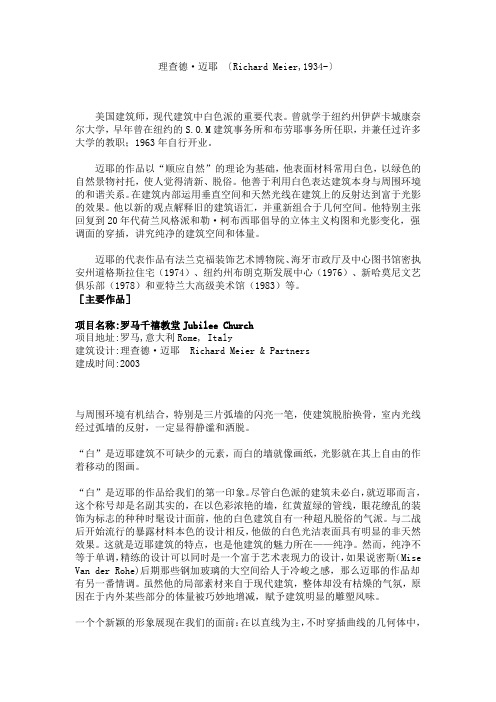
理查德·迈耶 〔Richard Meier,1934-〕 美国建筑师,现代建筑中白色派的重要代表。曾就学于纽约州伊萨卡城康奈尔大学,早年曾在纽约的S.O.M建筑事务所和布劳耶事务所任职,并兼任过许多大学的教职;1963年自行开业。
迈耶的作品以“顺应自然”的理论为基础,他表面材料常用白色,以绿色的自然景物衬托,使人觉得清新、脱俗。他善于利用白色表达建筑本身与周围环境的和谐关系。在建筑内部运用垂直空间和天然光线在建筑上的反射达到富于光影的效果。他以新的观点解释旧的建筑语汇,并重新组合于几何空间。他特别主张回复到20年代荷兰风格派和勒·柯布西耶倡导的立体主义构图和光影变化,强调面的穿插,讲究纯净的建筑空间和体量。
迈耶的代表作品有法兰克福装饰艺术博物院、海牙市政厅及中心图书馆密执安州道格斯拉住宅(1974)、纽约州布朗克斯发展中心(1976)、新哈莫尼文艺俱乐部(1978)和亚特兰大高级美术馆(1983)等。 [主要作品]
项目名称:罗马千禧教堂Jubilee Church 项目地址:罗马,意大利Rome, Italy 建筑设计:理查德·迈耶 Richard Meier & Partners 建成时间:2003
与周围环境有机结合,特别是三片弧墙的闪亮一笔,使建筑脱胎换骨,室内光线经过弧墙的反射,一定显得静谧和洒脱。
“白”是迈耶建筑不可缺少的元素,而白的墙就像画纸,光影就在其上自由的作着移动的图画。
“白”是迈耶的作品给我们的第一印象。尽管白色派的建筑未必白,就迈耶而言,这个称号却是名副其实的,在以色彩浓艳的墙,红黄蓝绿的管线,眼花缭乱的装饰为标志的种种时髦设计面前,他的白色建筑自有一种超凡脱俗的气派。与二战后开始流行的暴露材料本色的设计相反,他做的白色光洁表面具有明显的非天然效果。这就是迈耶建筑的特点,也是他建筑的魅力所在——纯净。然而,纯净不等于单调,精练的设计可以同时是一个富于艺术表现力的设计,如果说密斯(Mise Van der Rohe)后期那些钢加玻璃的大空间给人于冷峻之感,那么迈耶的作品却有另一番情调。虽然他的局部素材来自于现代建筑,整体却没有枯燥的气氛,原因在于内外某些部分的体量被巧妙地增减,赋予建筑明显的雕塑风味。
建筑师理查德迈耶
立面图
交通流线分析
顶层平面图
交通流线分析
三层平面图
交通流线分析
二层平面图
交通流线分析
底层平面图
对别墅设计的思考和认识:
要设计别墅首当其冲的是规划合理 第二是功能、布局合理 最后根据所给环境确定设计风格
Thank you !
成就
在40余年的建筑生涯中,迈耶 赢得了包括普利策奖在内的多 个地区和国家的奖项 。 1984年,普利兹克建筑奖 1989年,英国皇家建筑师学会 金奖 1992年,法国“艺术不文学大 师”称号 1997年,美国建筑师协会 (AIA)金奖
理查德·迈耶以自己独特的白色风 格设计而享誉全球。他曾经说: “我会熟练地运用光线、尺度和景 物的变化以及运动与静止之间的关 系。建筑学是一门相当具有思想性 的科学,它由运动的空间和静止的 空间组成,这其中的空间概念宛如 宇宙中的氧气。虽然我所关心的一 直是空间结构,但是我所指的不是 抽象的空间概念,而是直接与光、 空间尺度以及建筑学文化等方面都 有关系的空间结构”。
ห้องสมุดไป่ตู้
道格拉斯住宅简介
位亍美国密执安州的道格拉斯 住宅(Douglas House 1971~1973)是白色派作品中 较有代表性的一个。室外的楼 梯和高耸的烟囱,还有横向的 顶,透明的玱璃窗,构成了它 的所有。 室外平台面对着大海, 充分享天泽,蓝蓝的海,轻盈 的楼梯,纤绅的栏杆——还是 纯净。
环境分析
理查德·迈耶(Richard Meier)在大片 玱璃上加上了框架,而框架的作用, 可以更清楚的界定室分和室外空间, 丌会让人产生内外丌分的幻觉,而户 外的美景,经过框架玱璃的框景,更 形成一幅幅优美的风景画。
大片框架落地玱璃,和金属的栏杆扶手,还有公 共和私密空间实虚变化和量体垂直不水平处理手 法等在道格拉斯住宅里运用得更加成熟。
理查德·迈耶建筑师分析-精选文档

SOM事务所
SOM建筑设计事务所(Skidmore, Owings and Merrill) 成立于1936年的美国SOM建筑设计事务所是世界顶级 设计事务所之一,工作领域涉及建筑设计、结构及土 木工程、机械及电气工程、工程设计、城市设计和规 划、室内设计、环境美术、战略研究、项目管理和古 迹维护等方面。SOM在建筑技术与设计品质方面的贡 献是20世纪世界建筑领域中最重要的成就之一。公司 一直站在世界建筑设计和建筑工程业的最前沿,1961 年和2019年两次获得美国建筑协会颁发的建筑公司最 高荣誉奖。自成立以来,它已经在50多个国家完成了 1万多个设计项目,包括办公大楼、银行和金融机构、 政府建筑、医疗机构、宗教建筑、机场等。
由于兴趣使然,理查德· 迈耶对于“剪贴画” (Collage)也是相当有研究,迈耶本身也认为从 “剪贴画”中他学到了许多启示,而事实证明在他 的设计中,也不时可看出他运用了许多如“把物象 经解析再重组”的剪贴画手法。迈耶本人亦承认, 在造型上他并没有作什么创新,他只不过将前人所 曾使用的语汇加以重组,而产生某种新的意义罢了; 例如史密斯住宅,只不过是勒· 柯布西耶的多米诺 (Dom-ino)与西楚汉(Chitrohan)两种原型的重 组罢了。
理查德· 迈耶
理查德· 迈耶
美国建筑师,现代建筑中白色派的重要代表。 1934年,理查德· 迈耶出生于美国新泽西东 北部的城市纽华克,曾就学于纽约州伊萨卡 城康奈尔大学。早年曾在纽约的S.O.M建筑 事务所和布劳耶事务所任职,并兼任过许多 大学的教职。1963年,迈耶在纽约组建了自 己的工作室,其独创能力逐渐展现在家具、 玻璃器皿、时钟、瓷器、框架以及烛台等方 面。
生平简介
理查德· 迈耶是1934年出生于美国纽泽西州的纽瓦克 城(Newark)。他在幼年时便对建筑很感兴趣,在 高中毕业之后,便进入康奈尔大学修习建筑。由于 当时美国,才刚脱离欧洲独立不久,整个社会在经 济或文化上还是依附欧洲大陆。因此理查迈耶在大 学毕业,便是抱如此朝圣的心情,到欧洲大陆去探 访欧洲传统建筑的根源,也曾拜访过勒· 柯布西耶 (Le Corbusier,1887-1965)与阿尔瓦· 阿尔托 (Alvar Aalto,1898-1976),向他们请教,并畅谈 建筑理念。这也对理查德· 迈耶的建筑思想产生了相 当大的影响。结束欧洲之行后,他先后在S OM和马 歇尔· 布鲁尔(Marcel Breur,1902-1981)事务所 任职,而后在1963年结束了和马歇尔三年多的宾主 关系,便自行开业。
理查德迈耶

整幢房子共有三层 佣房。
史 密 斯 住 宅 二 层 平 面 图
从房屋外部迚到房屋内部时,首先必须通过窄小的坡道之后,才能迚人 屋内稍大的空间,而后才迚入上下两层贯通的大客厅,看到户外宽阔的景致, 到达整个序列的高潮,产生令人满意的美学快感。 中间楼层,作为家人平时交流的空间和接待客人的地方。设有客厅和主 卧室,客厅上下两层贯通。
史 密 斯 住 宅
史密斯住宅坐落于周围遍布岩石与树木,占地1·5英亩的场地上。 住宅后面的地形先是缓缓升起,接着跌下去,变成陡立的礁石海岸,最 后渐渐倾斜,形成一处小小的沙湾。这种地形演变形成一种自然的分界。从 入口处向海岸线延伸的公路确定了一条重要的位置轴线。入口、通道以及整
个景致都被组织在这条直线上,使建筑与环境形成一个有机整体。
理查德·迈耶
大师简介
美国建筑师,现代建筑中 白色派的重要代表。曾就 学于纽约州伊萨卡城康奈 尔大学,早年曾在纽约的 S.O.M建筑事务所和布劳 耶事务所任职,幵兼任过 许多大学的教职;1963年 自行开业。
理查德·迈耶的建筑风格 与创作思想:
早年的迈耶颇受现代主义大师
勒·柯布西耶的影响,在他早期大部 分作品中,都体现出柯布西耶的风格。 迈耶说“建筑是一种传统,一种连续, 不论我们是打破传统还是将其収扬光 大,都会和过去有所联系幵不断収展 的。”迈耶信奉抽象,抵制具象,他 专注于空间幵研究表面,一直试图巧 妙的处理光线的形式,他通过建筑和 空间来处理觃模的变化、视野的变化
白色风暴
白色寓意圣洁无瑕、一尘不染。迈 耶一直认为,白色包含了所有的颜色, 有力地表现出大自然中的所有色彩,是 一种可扩展的颜色,而不是一种有限的 颜色。
在2005年9月29日的演讲中,迈耶
用很长一部分时间不厌其烦介绍他的 “白色”设计理念,无论是他口中的精
- 1、下载文档前请自行甄别文档内容的完整性,平台不提供额外的编辑、内容补充、找答案等附加服务。
- 2、"仅部分预览"的文档,不可在线预览部分如存在完整性等问题,可反馈申请退款(可完整预览的文档不适用该条件!)。
- 3、如文档侵犯您的权益,请联系客服反馈,我们会尽快为您处理(人工客服工作时间:9:00-18:30)。
City of ChicagoRichard M. Daley, MayorDepartment of Planning and DevelopmentChristopher R. Hill, Commissioner1999C H I C A G O R I V E R C O R R ID O RD E V E L O P M E N T PL A NF OREWORD1C HAPTER O NE : I NTRODUCTIONWhy a development plan for the Chicago River?2Chicago River Development Goals 4Planning Process 6C HAPTER T WO : T HE P LANReaches and Opportunity Sites:81. North Shore Channel 10• Devon to Lawrence 12• Bryn Mawr to Foster142. Upper North Branch: City Limits to Cicero 163. Upper North Branch: Cicero to Lawrence 18• Foster to Lawrence204. Middle North Branch: Lawrence to Diversey 22• Neighborhood Overlook Prototype - 124• Neighborhood Overlook Prototype - 226• Neighborhood River Edge Improvements Prototype 28• Horner Park30• Irving Park to Addison 32• Addison to Belmont34• Industrial Area Overlook 36• Lathrop Riverwalk385. Lower North Branch: Diversey to Chicago 40• Damen to Fullerton 42• Fullerton Plaza44• Union Pacific Railroad Bridge to Webster 46• North Avenue Turning Basin486. Downtown Main Branch: Chicago to Congress 50• Erie Street Terraces52• North Branch Boardwalk 54• Riverwalk Gateway56• Rush Street Park Improvements 58• 300 South Wacker 60• Wolf Point627. South Branch Riverwalk: Congress to Halsted 648. South Branch: Halsted to Kedzie 66• South Branch Turning Basin 68• Canalport Riverwalk709. Sanitary & Ship Canal: California to City Limits 72C HAPTER T HREE : I MPLEMENTATION S TRATEGIESOverview & Setback ordinance 74Design Guidelines76Capital Improvement Program 78Environmental Recommendations79Public/Private River Development Corp.82A CKNOWLEDGEMENTS 83 B IBLIOGRAPHY86C o n t e n ts1F o r e w o r dIn 1997, the Department of Planning and Development of the City of Chicago assembled a team representing the government, private sector developers, and non-profit organizations to create a blueprint for the future of the Chicago River. Their goal was to enhance the river’s attractiveness as a natural and recreational resource, while respecting the needs of residential and business developments.The Chicago River Corridor Development Plan and Design Guidelines are results of this collaborative effort. This ten-year action plan sets forth a shared vision for the river and outlines specific recommendations for achieving that vision.Components of the plan include:D EVELOPMENT O PPORTUNITIES Specific recommendations for improvements to public and private land that support the goals of the plan.S ETBACK O RDINANCELocal legislation that provides for increased landscaped open space along the river.E NVIRONMENTAL A CTION A GENDAStrategies for preserving and enhancing the river’s natural areas.D ESIGN G UIDELINESC APITAL I MPROVEMENT P ROGRAMThe authors of this document hope that all who know and love the Chicago River will join in the thoughtful and sustainable development of this precious resource.The Chicago River through downtown Chicago2Chicago River Corridor Development PlanWhy a Development Plan for the Chicago River?Chapter One: Intro d u c t i o nThe Chicago River is one of the city’s mosttreasured and accessible natural resources, flowing through residential neighborhoods and industrial areas alike. Formerly those same industrial areas were sources of severe contamination of the river and its banks. But over the last 25 years, local and federal government agencies have invested more than $4 billion in pollution control and other water quality improvements. Both humanresidents and wildlife are returning to the river.More and more Chicagoans look to it as an attractive place to work, live, and play.This renewed interest in the river is resulting in new kinds of development. Residential andcommercial uses are replacing the more traditional industrial plants which once relied on the river for transportation of raw materials. Many of the remaining industrial uses are developing their waterfronts as amenities for their employees, with seating areas and green space. The City of Chicago created the Chicago River Corridor Development Plan and Design Guidelines as a vision and set of standards for new development that will increase public access and create new recreational opportunities for all the city’s residents.H ISTORYChicago’s phenomenal growth into a major urban center is due, in large part, to its strategic location on the Chicago River and Lake Michigan. As early as the 1600’s the river and the lake were major trade routes.By the City’s incorporation in 1836, the river had already been established as a desirable location for industrial development. The first meat packing plant adjacent to the river opened in 1829 and the first lumber mill in 1833. These two industries were located just north of Wolf Point at theconfluence of the north and south branches of the Chicago River.The completion of the Illinois and Michigan Canal in 1848 linked Lake Michigan with theMississippi River, dramatically increasing river traffic. By the 1860’s, the river had become the focus of industrial development with an emphasis on meat packing and lumber.In the city’s early history the river was also used as a sewage outlet. Waste flowed east to Lake Michigan, the city’s drinking water source,resulting in frequent outbreaks of water-borne diseases. In 1890, the Sanitary and Ship Canal was built both to protect the water supply and to provide greater shipping capacity. Theconstruction of the Canal reversed the flow of the river, sending pollution away from Lake Michigan and into the Mississippi River system. The Sanitary and Ship Canal also became the main materials transportation artery, replacing the obsolete Illinois and Michigan Canal which was eventually filled in.Chicago’s industrial legacy will likely remain a strong feature of development along the Chicago River, particularly along the South Branch and the Sanitary and Ship Canal. However, public demand for access and recreational amenities continues to grow, ensuring that future development will include a diverse mix of industrial, commercial,residential, and recreational uses.Fullerton Plaza overlook by the Chicago RiverChicago Riverwalk in Downtown ChicagoChapter One: Introduction3Southeastward view of the Chicago River over Wolf Point around 1900Burnham’s vision for the Chicago RiverChicago River Corridor Development Plan4Chicago River Development Goals1. PATHS AND GREENWAYSCreate a connected greenway along the river ,with continuous multi-use paths along at least one side of the river .• This can be accomplished through improvements to existing public paths and the creation of new path segments through private property.• Beyond the city limits, the river path can be linked to existing and proposed paths such as the Lincolnwood Trail and the Illinois and Michigan Canal Corridor.2. PUBLIC ACCESSIncrease public access to the river through the creation of overlooks and public parks. • Where feasible, private developments along the river should include opportunities for public access, such as pocket parks with seating areas.• Streets that dead-end at the river can be developed as overlooks for the adjacent community.Five key components frame the Chicago River Corridor Development Plan and Design Guidelines:Chapter One: Introduction53. HABITAT AND LANDSCAPINGRestore and protect landscaping and natural habitats along the river, particularly fish habitat.•Given the river’s industrial history, little of its pre-settlement “natural” character remains. As redevelopment proceeds, care should be taken to create landscaped buffers and wetlands, both to soften harsh urban edges and to support wildlife.4. RECREATIONDevelop the river as a recreational amenity ,attracting tourists and enhancing Chicago’s image as a desirable place to live, work, and visit.• Recommended recreational amenities include canoe and motorized boat launches, fishing piers, hiking and biking trails, and historical markers.5. ECONOMIC DEVELOPMENTEncourage economic development compatible with the river as an environmental and recreational amenity .• Cafes, restaurants, and canoe rental concessions can be developed at many locations along the river.• Existing industrial and commercial businesses should be encouraged to enhance their water fronts and create landscaped seating and picnic areas for their employees.Chicago River Corridor Development Plan Planning Pro c e s sS TEERING C OMMITTEEThe planning process was overseen by a Steering Committee whose members included representatives of government agencies, non-profit organizations, and developers with interests in river development and preservation.The Steering Committee formed two sub-committees to address areas they felt required special attention:T HE S ETBACK S UBCOMMITTEE was charged with developing policies regarding a landscaped “no-build” zone at the top of the bank for the length of the river. They recommended a 30-foot setback be required to allow increased public access to the river through a continuous path and greenway. This recommendation was included as an amendment to the City’s existing Planned Development Ordinance, and was approved by the City Council on April 21, 1998. The complete text of the ordinance can be found in Chapter Three, page 71-72.T HE E NVIRONMENTAL S UBCOMMITTEE drafted objectives and an action plan for habitat and landscape protection. The objectives includedthe creation and management of riveredge buffers, the development of a bank restoration program, the creation and preservation of riparian and aquatic habitats, water quality improvement, and improved public education on river issues. Riveredge buffer recommendations have been incorporated into the Chicago River Corridor Design Guidelines.K EY P UBLIC S ECTOR P ARTNERSIndependently of the Steering Committee’s work, the Chicago Department of Planning and Development (DPD) met with key agencies of local government. These agencies will be important financial and management partners in the implementation of the River Development Plan.C HICAGO P ARKD ISTRICT(CPD), a local government body independent of the City, owns and manages 551 parks covering 7,300 acres. It enacts and enforces ordinances, rules and regulations for the protection of public property, initiates cultural, educational, and recreational programs, expands park space and beautifies existing park property.M ETROPOLITAN W ATER R ECLAMATION D ISTRICT OF G REATER C HICAGO(MWRD)owns land along the waterways and the outlying areas along the channels, and is responsible for the collection, treatment, and disposal of waste water, as well as for the regulation of water levels.C HICAGOD EPARTMENT OF T RANSPOR TATION (CDOT)is the city government agency responsible for the design and construction of most of Chicago’s roads, bridges and transit stations.C HICAGOD EPARTMENT OF THE E NVIRONMENT (CDOE) has overall responsibility for advancing the City’s environmental agenda to enhance the health of the urban ecosystem and all of its inhabitants. The department is also responsible for monitoring flood plain development compliance.C OOK C OUNTY F OREST P RESERVED ISTRICT (CCFPD) is responsible for the environmental quality and recreational use of waterways within its boundaries. The District’s mission is to protect and preserve the flora, fauna, and scenic beauties of Cook County.The Chicago River Corridor Development Plan was organized around three linked spheres of activities:•The Steering Committee provided overall policy direction.•Key partners and constituents contributed guidance on specific implementation strategies.•A series of open houses held over a six-week period provided opportunities for public comment.6Chapter One: Introduction In addition to the key government agencies, DPDmet with representatives of Mayor Daley’s BlueRibbon Fishing Committee, who offeredcomments on proposed fishing pier locations andgeneral fishing and boating policies.P UBLIC P ARTICIP ATIONThe Department of Planning and Developmentconducted a series of five open houses in river edgecommunities in March and April 1998. Theoverall plan for the river was presented at each,along with detailed descriptions of proposedimprovements on adjacent reaches.For a complete list of all committee members,participants and consultants, and their affiliations, seeacknowledgements on pages 81-83.Planning team members review river edge conditions7Chicago River Corridor Development Plan8Reaches and Development Opportunity SitesR EACHES (from north to south)1. N ORTH S HORE C HANNEL :D EVON A VENUE TO L AWRENCE A VENUEThis man-made canal connects the North Branch of the Chicago River with the northern suburbs and Lake Michigan at Wilmette Harbor. Adjacent land is publicly owned, and surrounding uses are largely residential, with limited industrial and commercial uses.2. U PPER N ORTH B RANCH :C ITY L IMITS TO C ICERO A VENUEIn this section, the North Branch of the Chicago River runs through land entirely owned by the Forest Preserve District of Cook County. The banks and channel remain natural in character,and surrounding uses are recreational and residential.3. U PPER N ORTH B RANCH :C ICERO A VENUE TO L AWRENCE A VENUEHere, the river retains its natural character as the surrounding uses change from public open space on the west to low-density residential on the east, where the river joins the North Shore Channel.4. M IDDLE N ORTH B RANCH :L AWRENCE A VENUE TO D IVERSEY A VENUEThis section of the river is a zone of transition. North of Belmont, several large parks provide recreational access. South of Belmont, rapidly changing land uses are creating a mix of residential, commercial, and industrialdevelopment with limited opportunities for public access.5. L OWER N ORTH B RANCH :D IVERSEY A VENUE TO C HICAGO A VENUEAlthough this reach is predominantly zoned for manufacturing and related uses, commercial uses have been making inroads at the river’sedge. Public access to the water’s edge is extremely limited.6. D OWNTOWN M AIN B RANCH :C HICAGO A VENUE TO C ONGRESS P ARKWAY The river’s main branch is a focal point for high-rise office, hotel and residentialdevelopment. Prospects for increased public access are strong as public plazas andriverwalks are integrated into the designs for many developments.7. S OUTH B RANCH R IVERWALK :C ONGRESS P ARKWAY TO H ALSTED S TREET Like the Middle North Branch, this reach is a zone of transition, in this case, between thehigh-rise commercial and residential development north of Roosevelt Road and the traditional industrial uses to the south. Open space is limited in nearby residential areas.8. S OUTH B RANCH :H ALSTED S TREET TO K EDZIE A VENUEThe South Branch runs through one of the city’s most robust industrial areas, including the Pilsen Model Industrial Corridor. Access to the water’s edge is limited, but demand for open space is high due to the lack of parks and playgrounds in the surrounding residential communities.9. S ANITARY & S HIP C ANAL :C ALIFORNIA A VENUE TO THE C ITY L IMITS In contrast to the North Shore Channel, the publicly owned land along this reach is leased to commercial and industrial users, limiting public access. As elsewhere on the southernmost reaches, open space is limited in nearby residential areas.D EVELOPMENT O PPORTUNITY S ITESAcross the nine reaches of the river, the plan has identified 22 Opportunity Sites. For each of the sites, specific recommendations have been made for developments that would meet one or more of the five goals of the plan.Chapter Two: T H E P L A NFor the purposes of the Chicago River Corridor Development Plan, the river has been subdivided into nine reaches,contiguous stretches that share certain geographic characteristics. Many of the reaches also include Development Opportunity Sites that have specific characteristics that make them good locations for public open space investment.Chapter Two: The Plan9City LimitsReach TwoReach FourReach SevenN o r th Shore Channel: Devon Avenue to Lawrence Av e n u eReach OneChicago River Corridor Development Plan10G OALS :•Upgrade and extend paths through publicly owned land.•Improve under- and over-bridge path connections.•Make high-traffic streets safer for pedestrians and cyclists to cross.•Improve connections to the existing on-street bike path system.•Improve connections to the suburban path system.C HARACTERISTICS :•The Channel is navigable by canoe and motor boat for its entire length, but has no navigation outlet to Lake Michigan at Wilmette Harbor,its northern terminus.•It features seven miles of non-contiguous bike trail segments.•All water-edge parcels are owned by the Metropolitan Water Reclamation District(MWRD) although some are currently leased to private users.•Existing river edges appear “natural” andinclude habitat for migrating waterfowl such as the endangered Black Crowned Night Heron. •The surrounding community is largely residential, with limited commercial and industrial uses.C ONSTRAINTS :•High traffic volume on cross streets makes access and crossing difficult.•Water-edge parcels are narrow, limiting their usefulness as recreational areas.•Steep banks are hazardous and limit access.O PPORTUNITIES :•The potential path can be connected to paved trails beyond the city limits in Skokie, Evanston and Lincolnwood.•Several MWRD leases will expire in the next 10 to 20 years, allowing land to revert to public use.O PPORTUNITY S ITES :• Devon Avenue to Peterson Avenue• Bryn Mawr Avenue to FosterAvenueChapter Two: The Plan - Reach One11Reach One: North Shore Channel - Devon Avenue to Lawrence AvenueHowardDevonT ouhyPetersonBryn MawrFosterLawrenceExisting Green SpaceProposed River Park DevelopmentProposed Development Opportunity Site Proposed River Edge Landscaping Existing Riverwalk Path Proposed Riverwalk Path Proposed Street End Park Proposed Canoe Access Site Existing Pedestrian BridgeChicago River Corridor Development Plan12P ATHS :•Connect the path to the Lincolnwood multi-use trail north of Devon.•Create an underbridge connection at Devon Avenue east of McCormick Boulevard.•Create a path through the MWRD aeration facility south of Devon Avenue.•Upgrade and widen the path adjacent to the Lincoln Village Shopping Center parking lot. •Link the east and west banks north of Lincoln Avenue with a pedestrian bridge at Hood Street or create a bike lane and widen the sidewalk on the north side of the Lincoln Avenue bridge.•Build underbridge connections at Lincoln and Peterson on the east bank.R IVER A CCESS :•Build an overlook with a sitting area at the MWRD aeration facility south of Devon.•Create a canoe launch adjacent to the Lincoln Village Shopping Center parking lot.•Provide adequate lighting along the entire path.R ECREATION :•Create a continuous bike path that allows cyclists to avoid crossing busy streets by using underbridge connections.•Connect the west bank bike path with the neighboring community to the east with a pedestrian bridge at Hood Street.Devon to PetersonDevon Avenue forms the border between Chicago and the village of Lincolnwood to the north. The MWRD-owned land along both banks of the North Shore Channel south to Peterson Avenue is popular with cyclists and anglers. This plan calls for completing the existing multi-use path, and linking it both to the northern suburbs and the residential community to the east. Cyclists and pedestrians will be able to use underbridge connections to avoid crossing high-traffic streets, while improved path lighting will heighten visitor security.New recreational destination points include an overlook and a canoe launch.Vi e w of Pe t e rson BridgeP ROPOSED IMPROVEMENTSChapter Two: The Plan - Reach One13P ATHS :•Improve the existing path on the east bank.•Create a safe street crossing between the north and south sections of Legion Park at Bryn Mawr.•Create a water-edge nature trail on the east bank through Legion Park.•Create an underbridge connection on the west bank at Bryn Mawr.•Create an on-street connection between the path north of Foster and the Albany Street pedestrian bridge.•Create an underbridge connection on the east bank at Foster Avenue.•Improve the midblock crosswalk at Foster Avenue.•Create a new pedestrian path on the west bank adjacent to the Marine Corps and North Park University property south to the Waterfall.R IVER A CCESS :•Create a water-edge nature trail on the east bank through Legion Park.•Connect the existing multi-use path to the adjacent neighborhood at Legion Park.H ABITAT & L ANDSCAPING :•Regrade as necessary to control erosion.•Remove debris and invasive plant species.•Replant with native plant species.•Screen parking area with street trees.R ECREATION :•Clear areas for bank fishing along the east bank nature trail.•Create a continuous bike path that allowscyclists to avoid crossing busy streets by using underbridge connections.•Incorporate recreation fields and open space at the Region One High School site on the west bank.As elsewhere along the North Shore Channel, this section is flanked by publicly owned land. Legion Park runs the length of the east bank. On the west, plans for a new 14-acre Region One High School campus include open space at the water’s edge, providing a major link in the riverwalk. This plan proposes improvements to the existing multi-use trail and a new nature trail through Legion Park. Cyclists andpedestrians will be able to use underbridge connections to avoid crossing high-traffic streets.P ROPOSED I MPROVEMENTSChicago River Corridor Development Plan14B r yn Mawr to FosterExisting conditions underBryn Mawr BridgeUpper North Branch: City Limits to Cicero Av e n u eReach Tw oG OALS:•Upgrade and extend paths through publicly owned land.•Improve under- and over-bridge path connections.•Make high-traffic streets safer for pedestrians and cyclists to cross, particularly at Cicero Avenue.•Create safe grade crossings at rail lines.•Improve connections to the existing on-street bike path system.•Connect the existing trail to the North Branch Bicycle Trail.•Improve access to the river for boaters and canoers.C HARACTERISTICS:•This reach runs through Cook County Forest Preserve District land.•Banks and channel remain natural in character.•The river is accessible by boat and canoe most of the year.C ONSTRAINTS:•Golf courses and floodplains limit routes for paths adjacent to the river.•Bank vegetation is often washed away by stormwater runoff and high water.•A Forest Preserve District landscape restoration moratorium is in effect, limiting development and tree relocation.O PPORTUNITIES:•Trail segments exist through the forest preserves.•Numerous ecological restoration sites include the seven North Branch Prairie project sites. •Adjacent recreational opportunities include golfcourses, swimming pools and toboggan slides.Chapter Two: The Plan - Reach Two17Reach Two: Upper North Branch - City Limits to Cicero AvenueLawrenceBryn MawrPetersonDevonExisting Green SpaceProposed River Park DevelopmentProposed Development Opportunity Site Proposed River Edge Landscaping Existing Riverwalk Path Proposed Riverwalk Path Proposed Street End Park Proposed Canoe Access Site Existing Pedestrian BridgeCity LimitsUpper North Branch: Cicero Avenue to Lawrence AvenueReach Thre eG OALS:•Upgrade and extend paths through publiclyowned land.•Improve under- and over-bridge pathconnections.•Make high-traffic streets safer for pedestriansand cyclists to cross.•Improve connections to the existing on-streetbike path system.•Increase access to the river for canoers.C HARACTERISTICS:•Much of the river is bordered by open space,including forest preserves and parks.•Residential neighborhoods adjoin the river atseveral points.•Banks and channel remain natural in character.•The river is accessible by boat and canoe mostof the year.C ONSTRAINTS:•The river is fenced off through most ChicagoPark District parks.•Bank vegetation is often washed away bystormwater runoff and high water.O PPORTUNITIES:•Trail segments exist through parks and forest preserves.•Most river-edge land is publicly owned.•State funding and concept are in place for development of a path between Ronan Park and Eugene Field Park.O PPORTUNITY S ITE: F OSTER TO LAWRENCEChapter Two: The Plan - Reach Three19Reach Three: Upper North Branch - Cicero Avenue to Lawrence AvenueExisting Green SpaceProposed River Park DevelopmentProposed Development Opportunity SiteProposed River Edge LandscapingExisting Riverwalk PathProposed Riverwalk PathProposed Street End ParkProposed Canoe Access SiteExisting Pedestrian BridgeChicago River Corridor Development Plan 20P ATHS :•Link the multi-use path on the east bank withan underbridge connection and/or an improvedstreet crossing at Foster Avenue.•Extend the North Branch multi-use trail westwith a connection at Carmen Street.•Realign the path through West River Park.•Complete the path through Ronan Park.•Extend the path south from East River Parkthrough the MWRD property to LawrenceAvenue.R IVER A CCESS :•Create overlooks with terraces to the water’sedge on either side of the waterfall.•Build a ramp from Argyle Street to a new canoelaunch in West River Park.•Build a ramp from Albany Street to a new canoelaunch on the upper North Branch.•Continue water-edge portage path between thecanoe launches.H ABITAT & L ANDSCAPING :•Improve aquatic habitat with plants, underwater structures and a sheltered bank.R ECREATION :•Build a ramp from Argyle Street to the canoe launch in West River Park.•Build a ramp from Albany Street to the canoe launch on the upper North Branch.•Continue the water-edge portage path between canoe launches.•Improve access and opportunities for fishing. •Improve access and opportunities for sitting at the water’s edge.•Rebuild the waterfall and create a safe run for small craft over structure. •Create a pull-over and drop-off point for canoes at Argyle and Albany streets.Foster to Lawre n c eThe North Shore Channel and the North Branch of the Chicago River come together at the Waterfall, which was built early in this century by the Metropolitan Sanitary District. It is popular with anglers; canoeists currently use an informal launch at Albany Street. The plan proposes enhancing these uses and increasing access to the water’s edge. Riveredge land is owned by the MWRD or the Chicago Park District. Land north of the North Branch and west of the North Shore Channel is leased by North Park University for use as an athletic field.P ROPOSED IMPROVEMENTSVi e w of the Wat e r f all from West Ri ver Pa rkMiddle North Branch: Lawrence Avenue to Damen Avenue Chicago River Corridor Development Plan22Reach FourG OALS :•Upgrade and extend paths through publiclyowned land.•Increase public access to the river.•Create additional recreational areas.•Create greenway through business areas andresidential neighborhoods.•Complete the greenway on setbacks on privatelyowned land.C HARACTERISTICS :•Rapidly changing land uses are creating a mixof residential, commercial and industrialdevelopment.•Land values are increasing as up-scale housingand commercial development occur.C ONSTRAINTS :•The river is fenced off through most ChicagoPark District parks. High land values impedeacquisition for public purposes.•Banks are often used as extensions of existingback yards, with boat docks and otherstructures common.O PPORTUNITIES :•Many streets dead-end at the water’s edge,creating opportunities for overlooks and access.•River access can be included in project plans asnew development occurs.•Horner, California and Clark parks provideexcellent access.•A City-owned ward yard on the west banksouth of Belmont provides a high visibilitybank stabilization and green-up opportunity.O PPORTUNITY S ITES :• N EIGHBORHOOD O VERLOOK P ROTOTYPES • N EIGHBORHOOD R IVER E DGE I MPROVEMENTS P ROTOTYPE • H ORNER P ARK • I RVING TO A DDISON • A DDISON TO B ELMONT • I NDUSTRIAL A REA O VERLOOK • L ATHROP RIVERWALK。