探讨区域地面沉降国内外研究现状
国际地面沉降研究现状与发展趋势评述
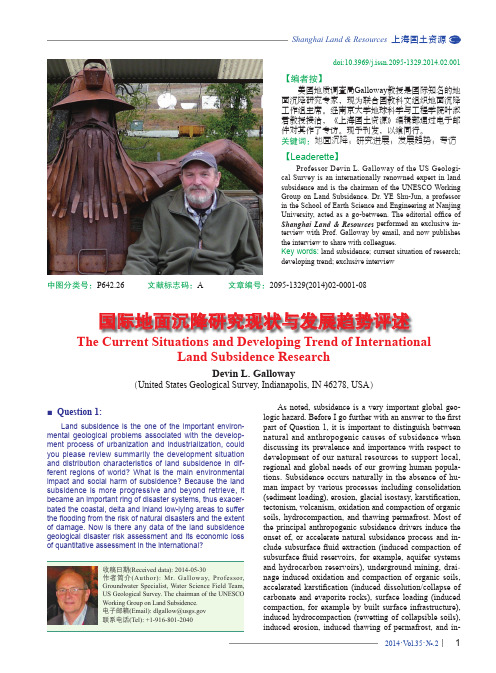
doi:10.3969/j.issn.2095-1329.2014.02.001【编者按】 美国地质调查局Galloway 教授是国际知名的地面沉降研究专家,现为联合国教科文组织地面沉降工作组主席。
经南京大学地球科学与工程学院叶淑君教授接洽,《上海国土资源》编辑部通过电子邮件对其作了专访。
现予刊发,以飨同行。
关键词:地面沉降;研究进展;发展趋势;专访【Leaderette 】 Professor Devin L. Galloway of the US Geologi-cal Survey is an internationally renowned expert in land subsidence and is the chairman of the UNESCO Working Group on Land Subsidence. Dr. YE Shu-Jun, a professor in the School of Earth Science and Engineering at Nanjing University, acted as a go-between. The editorial office of Shanghai Land & Resources performed an exclusive in-terview with Prof. Galloway by email, and now publishes the interview to share with colleagues.Key words: land subsidence; current situation of research; developing trend; exclusive interviewThe Current Situations and Developing Trend of InternationalLand Subsidence ResearchDevin L. Galloway(United States Geological Survey, Indianapolis, IN 46278, USA )中图分类号:P642.26 文献标志码:A 文章编号:2095-1329(2014)02-0001-08■ Question 1:Land subsidence is the one of the important environ-mental geological problems associated with the develop-ment process of urbanization and industrialization, could you please review summarily the development situation and distribution characteristics of land subsidence in dif-ferent regions of world? What is the main environmental impact and social harm of subsidence? Because the land subsidence is more progressive and beyond retrieve, it became an important ring of disaster systems, thus exacer-bated the coastal, delta and inland low-lying areas to suffer the flooding from the risk of natural disasters and the extent of damage. Now is there any data of the land subsidence geological disaster risk assessment and its economic loss of quantitative assessment in the international?As noted, subsidence is a very important global geo-logic hazard. Before I go further with an answer to the first part of Question 1, it is important to distinguish between natural and anthropogenic causes of subsidence when discussing its prevalence and importance with respect to development of our natural resources to support local, regional and global needs of our growing human popula-tions. Subsidence occurs naturally in the absence of hu-man impact by various processes including consolidation (sediment loading), erosion, glacial isostasy, karstification, tectonism, volcanism, oxidation and compaction of organic soils, hydrocompaction, and thawing permafrost. Most of the principal anthropogenic subsidence drivers induce the onset of, or accelerate natural subsidence process and in-clude subsurface fluid extraction (induced compaction of aquifer systems - dissolution/collapse of 国际地面沉降研究现状与发展趋势评述directly by sediment starvation (by reducing the natural accretion of sediments that compensates for subsidence). The prevalence and importance of subsidence in particular regions throughout the world is dependent in large part on the distribution of the occurrence of the various geologic features—materials, landforms and crustal dynamics. So, within that context if one focuses on the impact of deve- lopment in areas susceptible to anthropogenic subsidence it is appropriate to view this as an overlay on existing sus-ceptibilities to subsidence that occurs naturally to various degrees.Anthropogenic subsidence occurs to some degree wherever the development of resources occurs to support the needs of humans and societal development whether ur-ban or agricultural based. The consequences of subsidence depend in part on the rate of subsidence and its cumulative magnitude. Geologic materials deform in some measure to natural and anthropogenic perturbations, for example natu-ral tidal (earth and ocean) and atmospheric loading typica-lly cause very small cyclic elastic displacements (generally micron levels of subsidence and uplift) of the land surface. Groundwater pumping that creates drawdowns and cor-responding effective stresses within the elastic range of stress of the aquifer-system materials typically cause elas-tic land-surface displacements on the order of millimeters to centimeters. Various anthropogenic loads imposed on the land such as built infrastructure cause measureable elastic and inelastic displacements. With respect to rates of subsidence and the relevant socio-economic importance of their cumulative magnitudes and impacts, for purposes of this discussion generally three rate categories can be considered: a) relatively rapid rates (impacts accrue over human generations to expected lifetimes to several hun-dreds of years) for example, aquifer-system compaction accompanying groundwater withdrawals, and oxidation and compaction of organic soils accompanying drainage; b) relatively very rapid rates (impacts accrue instantaneously to days) for example, mine collapse, sinkholes, earth fis-sures, individual volcanic and tectonic events c) relatively slow rates (impacts accrue over geologic timescales) for example, karstification, volcanism, tectonism.A cursory assessment of the global distribution of susceptibility to ‘relevant’ regional-scale subsidence can be made if one narrows the scope to anthropogenic subsi-dence that occurs at relatively rapid and very rapid rates (items a-b above). The particularly susceptible areas in-clude those with past and current large-scale development of land and water resources where a) groundwater with-drawals from principally unconsolidated sediments deplete groundwater storage; b) organic soils are drained; and c) shallow carbonate and evaporite rocks exist. The develop-ment of land and water resources in deltas typically include the development of canals and levees that divert water and sediment away from areas of natural sediment accretion, and typically include dams and reservoirs that starve the deltas of sediment. Both the sediment diversion and starva-tion indirectly contribute to delta subsidence by reducing the amount of deposition needed to compensate for natural consolidation in deltas.The short answer to the question regarding the distri-bution characteristics of land subsidence in different re-gions of the world is that subsidence likely occurs to some degree almost everywhere but ‘relevant’ subsidence tends to occur in areas where land and water resources have been or are being developed that are susceptible to subsidence. To my knowledge there has been no comprehensive global mapping of areas affected by subsidence. Such a compila-tion is sorely needed. There have been some published maps and tables with select locations and some subsidence attributes where global subsidence has been documented. And, there have been some studies that have summarized national subsidence locations, some including magnitudes, rates and affected areal extents. The UNESCO Working Group on Land Subsidence (WG) has initiated a project to compile a comprehensive map of global subsidence with a focus on subsidence attributed to a) aquifer-system com-paction accompanying groundwater withdrawals, and b) oxidation and compaction of organic soils accompanying their drainage. However, progress is limited by the lack of formal funding for the project and limits on the availability of participating WG Members whose labor is largely volu- ntary with some limited travel expenses for some members that is covered by their affiliated institutions.Regarding the second part of Question 1, the main environmental impact and social harm or detrimental consequence of subsidence vary for the different types or processes governing subsidence, the areal extent or scale of the subsidence affected area, and especially whether subsidence is inland or coastal. For regional, inland sub-sidence, I believe the main environmental impact is the alteration of the land-surface gradients and the attendant hydrologic changes that alter surface-water runoff, infil-tration and natural groundwater recharge and discharge. I lump fissuring of the land surface and the induced move-ment of surface faults that can accompany aquifer-system compaction in this larger category. Changes to the hydro-logic landscape and processes inevitably impact the eco-systems that are adapted to those environmental factors. The impacts include flooding or ponding of surface water in surface depressions, drainage of former wetland areas. The chief social harm of regional, inland subsidence may be the disruption of built infrastructure—damages to build-ings, roadways, canals and aqueducts, production wells, pipelines, and gradient reversals of drainageways (such as sewers, canals/aqueducts and streams) with resulting flood-ing and ponding issues. For coastal subsidence I believe the main environmental impact is related to the landward incursion of seawater. The relative sea-level rise can drown saltwater marshes and denigrate the freshwater marshes. Alteration of these marsh ecosystems can be devastating to the dependent biotic communities. The chief social harm in coastal subsidence-affected areas is coastal flooding from increased susceptibility to storms surges but also, flooding related to gradient reductions and reversals of streams andrivers coursing to the sea.Regarding the third and final part of Question 1, I be-lieve scientists and resource managers, planner and econo-mists are beginning to formulate risk assessments for par-ticular active or otherwise subsidence-prone areas in vari-ous parts of the world. Some of the elements I described above in response to the first part of Question 1 are being used to develop some of the assessments. The motivations seem to be related current economic development inte- rests and future socio-economic interests regarding climate change for affected or subsidence-prone coastal areas. I am aware that in the Netherlands, The Netherlands Center for Coastal Research and Deltares have been very active in these pursuits both in the Netherlands and abroad. I am sure there are many others involved in these activities but I do not know the breadth, extent or details of those. Clearly, these kinds of assessments are needed for developing and developed coastal regions.■ Question 2:Continuous dynamic monitoring is an important ring to master the land subsidence occurrence and development process, and also is the prerequisite to analyse and study the reasons and mechanism of land subsidence. It is es-pecially the key aspects to examine the effects of various measures implement. With the development of science and technology and the frequent application of modern monito- ring technology such as the precise leveling, GPS, InSAR and etc, the degree of automation is also increasing. Could you make some comments on the development of moni- toring technology? How targeted and practical are different methods? How are the related results in typical areas in the world? What is the main experience?Monitoring is key to improving understanding of the subsidence processes, mapping ground-surface motions and adapting management strategies to current conditions. Because much of the subsidence is related to our water-use practices, such as groundwater extraction, groundwa-ter drainage, focused recharge, etc. monitoring of these processes in addition to geodetic monitoring is needed in many cases to adequately characterize and ultimately ma- nage the subsidence affected areas. Of course, the continu-ous dynamic monitoring of various hydrologic processes in terms of water levels, surface flows, infiltration, micro-meteorological factors, and others has been available for quite some time. These monitoring capabilities are key to enhance the characterization of many subsidence processes and are being used widely throughout the world, though less so in developing countries. Perhaps the most recent technological advance is the real-time monitoring capabi- lity of these processes that is becoming more cost effective in terms of the cost of the instrumentation weighed against the benefits of access to measurements of current condi-tions and potential savings realized by extending the period between site visits.In my opinion, the most significant developments related to subsidence monitoring have been in geodetic monitoring with the implementation of the NAVSTAR Global Positioning System (GPS) by the United States in 1978 (globally available since 1994, and applied to subsi- dence studies since about 1992), and the development of InSAR techniques (applied to subsidence studies since about 1997–1998). Both of these technologies revolution-ized subsidence and other crustal motion monitoring and mapping capabilities. Firstly, I’ll address GPS and then In-SAR developments and capabilities relevant to subsidence studies.A GPS with global coverage is referred to as GNSS (Global Navigation Satellite Systems). Russia has had a GNSS known as GLONASS since about 1995, the People’s Republic of China is expanding its regional satel-lite navigation system (Beidou) to a GNSS (COMPASS), and the European Union (Galileo) is developing a GNSS. France, India and Japan are developing regional satellite navigations systems.In land-subsidence and other crustal-motion surveys, the relative and absolute 3D-positions of two points can be determined when two GPS receivers, one at each observa-tion point, receive signals simultaneously from the same set of four or more satellites. When the same points are re-occupied following some time interval, any relative motion between the points that occurred during the time interval can be measured. Geodetic networks of reference marks spaced as much as tens of km apart can be surveyed and resurveyed in this fashion to achieve 1–2 cm-level accu-racy in network adjusted altitudes. Millimeter-level accu-racy is achievable for change detection at reference marks using repeat surveys for non-network adjusted altitudes. GPS surveying is a versatile exploratory tool that can be used in rapid kinematic or rapid static mode to quickly and coarsely define subsidence regions, in order to site more precise, site specific and time-continuous measurement de-vices such as recording extensometers, tiltmeters and con-tinuous GPS (CGPS, e.g. CORS—continuously operating reference system sites). During the past two decades GPS has been used extensively throughout the world to measure land subsidence.Satellite InSAR is ideally suited to measure the spatial extent and magnitude of land subsidence. For many areas, a substantial satellite synthetic aperture radar (SAR) data archive exists for the period 1991–present (ENVISAT; ERS-1, 2; JERS-1; Radarsat-1, 2). The spatial and tem-poral coverage of satellite SAR data depends on the SAR platform. Early spaceborne systems (ERS-1, ERS-2, and JERS-1) are of the strip-mode type, in which the radar look angle is fixed and the antenna footprint covers a relatively narrow strip (~50–100-km wide swath) on the surface to one side of the orbit track (cross-track direction). The newer generation of SAR satellite platforms (Envisat, RA-DARSAT-1, and ALOS, and future systems) are capable of acquiring images in both strip mode and scan mode. A scan-mode SAR (ScanSAR) can periodically sweep the antenna look angle to image neighboring sub-swaths in the cross-track direction, thereby increasing the width ofthe image swath to as much as 400–500 km. Strip-mode SAR can only acquire images suitable for InSAR at the frequency of the satellite repeat orbit (46 days for ALOS;44 days for JERS-1; 35 days for ERS-1, ERS-2 and Envi-sat; 24 days for RADARSAT-1 and RADARSAT-2; and 11 days for TerraSAR-X). ScanSAR can acquire more fre-quent observations suitable for InSAR analysis for a given study area than is possible with strip-mode SAR, and can significantly improve the temporal resolution of deforma-tion mapping, albeit at the expense of some loss in spatial resolution.Two classes of InSAR techniques—firstly, single interferometric processing or conventional, coherent tech-niques, referred to here as conventional InSAR and se- condly, multi-interferometric processing techniques such as the persistent-scatterer interferometry (PSI) and small baseline subset (SBAS) techniques, are used to map, moni-tor, and analyze subsidence. Using the phase component of reflected radar signals to measure deformation of the Earth’s crust, conventional InSAR can provide millions of data points in a large region (104–105 km2/scene) and often is less expensive than obtaining sparse point measurements from labor-intensive spirit-leveling and GPS surveys. Un-der ideal conditions, it is possible to resolve georeferenced changes in range distance between the ground and satel-lite, on the order of 10 mm or less at the scale of 1 pixel. The component of displacement measured using InSAR principally is vertical for past and current SAR systems and depends on the look angle of the sensor. Since 1998, conventional InSAR has been used widely to map spatially detailed ground-surface deformations associated with groundwater pumping. PSI uses a different approach than conventional InSAR for processing SAR imagery, and has been shown to overcome some of the limitations of the conventional InSAR technique. PSI involves the proces- sing of numerous, typically 25 or more, interferograms to identify a network of persistent, temporally stable, highly reflective ground features—permanent scatterers. These scatterers typically are cultural features of the developed landscape such as buildings, utility poles, and roadways. The time-series measurements for each scatterer can pro-vide interpolated maps of average annual displacements, or the displacement history, up to the length of a SAR data archive, of each individual scatterer, thus providing a ‘virtual’ GPS network with ‘instant’ history. By focusing on temporally stable targets in the image, temporal decor-relation is avoided or strongly reduced. Furthermore, most of the strong and stable reflectors identified represent small individual scattering elements. For this type of scatterer though, a larger fraction of the reflected energy remains coherent for larger interferometric baselines, allowing a larger set of SAR scenes to be used in PSI analysis than can be used in InSAR analysis. The large number of ob-servations available in a typical SAR data set used in a PSI analysis supports a statistical analysis of the observed phase histories in space and time, and depending on the characteristics of the displacements, it often is possible to separate the phase differences caused by atmospheric variations and uncompensated topography from those due to surface displacements. The theoretical limit of the PSI technique is 1–2 mm in radar-range displacement. PSI has been applied primarily in urban environments, where the density of stable scatterers typically is quite high (as many as a few hundred per km2). Over natural terrain, the scarcity of stable targets severely limits PSI’s successful application. A small number of investigations have demon-strated a successful application of PSI in ‘rural’ terrain. A potentially important limitation of PSI, particularly where scatterer density is small and displacement magnitudes are large, is the necessity to determine a motion model a priori, that is used to resolve phase ambiguities. Another limitation of PSI is the difficulty identifying stable targets in rural and agricultural areas. Consequently, the majority of PSI applications have focused on urban areas.By identifying specific areas of deformation within broader regions of interest, InSAR also can be used to site and coordinate other local and regional-scale subsidence monitoring. Many studies have demonstrated the benefit of combining InSAR, GPS and other geodetic and hydro-geologic monitoring methods (for example, extensometry, water levels and pumpage). The combination of methods serves to ‘ground-truth’ the InSAR displacements and is key to constraining the analyses and interpretations. During the past 16 years, and especially during the past decade InSAR has been applied throughout the world to a variety of subsidence processes; the principal application has been subsidence caused by aquifer-system compaction accom-panying groundwater depletion.■ Question 3:The land subsidence is caused by multiple factors, but the main reason for the regional land subsidence is the de-velopment and utilization of fluid resources such as ground-water and oil. The series and comprehensive monitoring data lay a solid foundation for construction the land subsi- dence associated database and the development of nu-merical simulation technology. The MODEFLOW by USGS is widely used in the study of land subsidence and plays an important role. Could you introduce the system framework and the core of the international land subsidence data-base? And what are the new characteristics and situations of the research progress and development direction from the groundwater seepage and the numerical simulation of land subsidence? What are the deficiencies and limitations in the practical application of the groundwater resource management model under the constraint conditions of land subsidence control? How to improve it so as to combine better with reality, to predict prospectively and to implement the macro guidance and the flexible adjustment in technical level?The International Land Subsidence Database was initiated in 1975 when the International Association of Hydrologic Sciences and UNESCO developed a question-naire designed to collect information on the occurrence,location, causes and other ancillary information on land subsidence cases. Subsequently, periodic distribution of the questionnaire was used to compile about 100 case stud-ies from more than 20 countries. In 2001 the U.S. Geologi-cal Survey (USGS) began to develop an interactive, digital relational subsidence database coupled with a World Wide Web interface to make the existing information more widely available for analysis and synthesis and to facili-tate the collection of additional and new information. The database-web interface depended on individual user input and was developed to near completion but was never fully implemented owing in part to funding constraints, and was ultimately put on hold in 2010.The UNESCO Working Group on Land Subsidence (WG) is compiling a world map documenting the locations of documented anthropogenic subsidence attributed prin-cipally aquifer-system compaction and the oxidation and compaction of organic soils. This effort has been slowed by lack of funding support and the limited time and neces-sary resources available to the project team of volunteers. One other factor complicating the development of the world map is the rapid growth in the documented cases of global subsidence over the past decade, attributed largely to the growing use of InSAR and an increasing awareness of subsidence problems. As such, a dynamic world map is needed, and that necessitates frequent updates and mainte-nance of the map and underlying database.Addressing the question on MODFLOW develop-ments related to subsidence simulation, a new release, MODFLOW-2015, is planned for 2016 after a beta-testing period during 2015 by internal U.S. Geological Survey scientists. MODFLOW-2015 will be based on an object oriented architecture and feature unstructured gridding and the Newton solver. The new architecture should facilitate the coupling of various other hydrologic processes with MODFLOW. The current MODFLOW subsidence packages, SUB and SUB-WT will continue to be supported for use with MODFLFOW-2005, and will be modified slightly for MODFLOW-2015 sometime following the initial release of MODFLOW-2015. Meanwhile, the U.S. Geological Survey plans to produce a new subsidence package for MODFLOW that will a) combine the capabilities of SUB and SUB-WT into a single package able to simulate aqui-fer-system compaction processes for confined and uncon-fined groundwater flow conditions; and b) incorporate the stress-dependence of vertical hydraulic conductivity and specific storage. A new subsidence package that simulates oxidation and compaction of organic soils is being developed for MODFLOW in cooperation with Deltares.With respect to the part of Question 3 regarding use of models to inform management of subsidence accom-panying groundwater extraction, I believe there are some technical and some non-technical deficiencies and limi-tations. Technically, whether the existing MODFLOW-based subsidence packages, based on the aquitard drain-age model with its use of the classic one dimensional 1D (vertical stress and deformation) storage formulation are used or whether more robust models based on Biot three dimensional 3D poroelasticity theory and others based on poroviscosity theory for example are used, each has its deficiencies and limitations. The principal deficiency of the MODFLOW based packages are related to the 1D aspects inherent in the formulation of the classic storage coefficient, and thus the resulting vertical displacements. However, they are amenable to regional-scale simulations and SUB has been used successfully in many regional subsidence studies, and as part of the MODFLOW suite of packages it can be incorporated in simulations that require modeling of a variety of hydrologic processes. The more robust simulators are less amenable to regional-scale simu-lations owing to problems of tractability in terms of imple-menting the model solutions at regional scales, and may be less able to incorporate other local and regional scale hy-drologic processes that may be related indirectly to subsid-ence. Both the MODFLOW and more robust subsi- dence simulators are relatively complex to implement which may present an impediment to their application by groundwater management institutions.Another limitation of using any subsidence model to manage subsidence is related to residual or delayed sub-sidence owing to the slow equilibration of aquitards in the affected aquifer system. The residual compaction of these aquitards and therefore the ultimate compaction and subsidence can have time constants that range from de-cades to centuries or longer. Therefore, models calibrated using current and any historical data typically are poorly constrained with respect to predicting ultimate subsidence when residual compaction is a significant component of the process.Some of the principal non-technical deficiencies and limitations may include a) supplementing groundwater demand with surface-water resources when groundwa-ter extraction is restricted; b) the availability of alternate water sources for enhancing recharge either by natural or artificial means; c) the extensive monitoring and analysis needed to evaluate and possibly adjust management prac-tices; and d) dynamically adjusting the models and manage-ment practices to the effects of residual compaction. Typi-cally, past management practices that have succeeded in arresting subsidence have tended to restrict groundwater extractions based on maximum drawdown thresholds or minimum water-level altitudes at key indicator wells, or have used blanket restrictions on groundwater extractions and have tended to be overly conservative. Optimization analysis and modeling to maximize groundwater extraction while minimizing groundwater depletion and subsidence in regional aquifer systems are not done very often. In response to the last part of Question 3, I believe more opti-mization modeling in concert with dynamic flow and sub-sidence model updates based on new data and simulation tools, needs to be done to best implement the management of the groundwater resources and land subsidence.■ Question 4:With the scientific management of groundwater re-sources development and utilization, the land subsidence had gradually contained by unreasonable exploitation of groundwater. Because of this background, the land subsi- dence effects have revealed gradually in urban areas caused by development and utilization of underground space, high-rise building construction and engineering con-struction activities. How is the attention to the problems of land subsidence caused by engineering construction in in-ternational academic world? What progress has been made in this realm? And should be how to deepen the research in this respect?I’ll preface my short response to this set of questions by stating that I am not that familiar with current research in this topic area. I believe that historically much of the applied research on this topic has been in the domain of geotechnical engineering, and that generally, the scope of this research has been confined to the relatively shallow subsurface. Possible exceptions include research done in Mexico City and Shanghai. I believe the research has involved not only loading effects of built infrastructure overlying aquifer systems that are susceptible to compac-tion accompanying groundwater extraction, but also the ef-fects of deep-seated aquifer-system compaction, especially localized differential compaction, on the overlying built infrastructure. Shanghai, given the expertise and proximity of the Center for Land Subsidence of the China Geological Survey and the prevalence of built infrastructure, would be an ideal place to accelerate research in this topic area.■ Question 5:China devotes itself to prevention and control of the land subsidence in long-term, set up the Center for Land Subsidence of China Geological Survey in May 2002, and gave it four basic functions with synthesis, guidance, break-through and elevation. The Regulations for Prevention of Land Subsidence in Shanghai is the China's first special local regulation on land subsidence prevention & control, it formally took effect from in July 1, 2013. Now what kind of works have been made in management and legislation of land subsidence in each countries around the world? And what is the significance of use of references? How to guarantee and service for the policy-making from Academic research?The People’s Republic of China and the Center for Land Subsidence of the China Geological Survey has to be commended for the comprehensive actions taken to miti-gate subsidence. Other countries, such as the Netherlands have progressive and effective subsidence management strategies and programs in place that have proven effective. For the Netherlands their livelihood and existence lite- rally depend on it owing to their location on the North Sea coast on the Rhine-Meuse-Scheldt delta and the prevalence of peat soils. In the United States, the Houston-Galveston area in Texas adjacent to Galveston Bay and its estuary in the Gulf of Mexico and the Santa Clara Valley in Cali-fornia adjacent to San Francisco Bay in the Pacific Ocean both have long-standing (decades) subsidence management programs that have proven effective in arresting coastal subsidence and that are well documented. The Houston-Galveston area program is codified in Texas State law which created the first known subsidence district in 1975 with powers to regulate groundwater extraction, and moni-tor land subsidence. In Santa Clara Valley the local water authority (Santa Clara Valley Water District) has done the same in addition to implementing artificial recharge ope rations to augment groundwater storage for purposes of water supply and subsidence mitigation. Other examples exist in the United States and in other developed countries, including many areas in Japan which have extensive long-standing successful subsidence management programs, and Mexico City in Mexico, where effective measures are be-ing implemented to address subsidence. Rather than detail these examples here, I refer you to the subsidence literature and suggest that a good place to start is with the references provided in my responses to the following Question 6.The kinds of measures that have been successful in mitigating subsidence are those that result in maintai-ning groundwater levels above certain critical, pre-defined threshold levels. This is especially true for subsidence caused by aquifer-system compaction, and the oxidation/ compaction of organic soils. The principal mitigation mea-sures address groundwater depletion and include restric- ting groundwater extraction and augmenting groundwater recharge. Both of which are more easily accomplished by introducing an alternative water supply (most often imported from a surface-water source), and in some cases land-use restrictions.Such mitigation measures benefit from the develop-ment of modeling tools to simulate groundwater flow, subsidence and in some cases surface-water flow in the affected areas. The effectiveness of these tools depends on adequate monitoring data and dynamic updating of the modeling tools. But this is difficult and is rarely achieved. In practice in some areas where the consequences of sub-sidence are severe (such as in coastal areas), the mitigation measures result in conservative (perhaps too conservative) outcomes, erring on the side of safety. In other cases, the measures focused in one critical area result in subsidence in other areas as a result of shifting development of land and water resources away from the critical area to the other area, such as has happened in the Houston-Galveston and adjacent Fort Bend areas in Texas.I believe the experiences accumulated thus far point toward the need to incorporate more holistic, regionally comprehensive (integrated and interdisciplinary) subsidence and water-resource evaluations (monitoring, analysis, modeling, management) of the connected and potentially impacted water resources. As partly discussed in responses to Question 3, optimization modeling in concert with dy-namic flow and subsidence model updates based on new data and simulation tools, needs to be done to best imple-ment the management of the water resources and land sub-sidence.。
盾构隧道掘进对地面沉降研究现状与存在问题
盾构隧道掘进对地面沉降研究现状与存在问题摘要:盾构施工会引起地层运动,从而导致地表沉降。
在研究地面沉降方法主要有:实测数据回归法、室内模拟实验法、有限元分析法。
实测数据回归是指通过对现场收集资料的回归、分析,用数理统计法从所得数值中回归出预测沉降的表达式。
本文通过从国内外专家研究成果出发,将地面沉降的各种计算方法进行较为详细的阐述,并且对现有的研究存在的问题提出自己的一些看法。
关键词:盾构隧道,盾构施工,地面沉降,研究现状1 前言盾构施工法由法国工程师布鲁诺尔父子发明。
它用一个活动的罩架支撑在隧道工作面及其背后的泥土上,工人向前挖空几尺,就用千斤顶把罩架向前推,顶住新的工作面,盾构后面露出的一段隧道用砖砌面支撑,人们得以像鼹鼠一样在地面下不断掘进。
1918年,世界上第一台盾构机在英国诞生,盾构施工实现了自动化。
目前,盾构法己广泛地用于地铁、公路、铁路、输气、输水等国家大型公共工程建设,尤其是在地下工程建设中。
2 盾构施工的特点和优点2.1 盾构技术的基本特点:①对城市的正常功能及周围环境的影响很小。
②盾构机是根据施工隧道的特点和地基情况进行设计、制造或改造的。
③对施工精度的要求非常高。
管片的制作精度几乎近似于机械制造的程度。
由于断面不能随意调整,所以对隧道轴线的偏离、管片拼装精度也有很高的要求;④盾构施工是不可后退的。
2.2 盾构施工具有下列优点:①可在盾护下安全地开挖、安装衬砌。
②掘进速度快,施工时不影响地面交通与设施,穿越河道时不影响航运。
③施工中不受季节,风雨等气候条件影响。
④施工中没有噪声和振动,对周围环境没有干扰。
⑤在松软含水地层中修建埋深较大的长隧道往往具有技术和经济方面的优越性。
盾构特别适合在软土中进行施工,如上所述,它对城市的正常功能及周围环境的影响很小,但它仍不可避免地会对土体产生扰动,从而使土体产生沉降或侧移,对既有建筑物和地下管线造成一定程度的危害。
较为准确的预测盾构施工期间和正常运营后产生的土体沉降一直是人们关注的热点,具体内容包括:(1)盾构施工期间产生的土体沉降和侧移;(2)盾构隧道正常使用后产生的土体变形。
INSAR技术在城市地面沉降监测中的应用
4.3 复影像配准
目的: 由于获取两幅复影像时雷达天线位置不同,因此在方位向和距离向会造成同 一场景飘移和扭曲,在形成干涉相位图之前必须使同一场景的两幅复影像精 确配准,在距离向和方位向重采样,使得每个像素点反映的是同一目标区域 的信息。 步骤: ①粗配准: 配准精度大约为几个或十几个像元②像元级配准③亚像元级配准 方法: ①粗配准
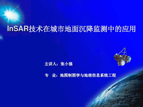
滤波处理
生成配准后的复 型数据 相位差的相干系数计算 生成相干系数 图
相位差数据处理 根据相干系数处理
生成干涉图
相位解缠 生成解缠后的干 涉图
由相位数据计算高程 地学编码校 正
生成DEM
4.1数据源 选择
4.2 SAR图像的过采样和干涉图像对的预滤波 4.2.1 SAR图像过采样 避免在形成干涉条纹时出现频谱卷绕 (wrap-around) 4.2.2 干涉图像对预滤波 消除多普勒质心不同的情况,增强数据的 相干性,分为方位向预滤波和距离向预滤 波
f
i 0
N 1
,式中 f i 表示影像的频谱值,SNR 越高,影像匹配的越好
i
f max
两种配准方法结果
4.4 生成干涉相位图
将主复影像与重采样后的辅复影像共轭相乘,得到一个新的复影像,其相位图即是干涉图。 设主、辅复图像分别为 R 和 S,则两影像的像点可以表示为:
rij aij ibij , sij cij id ij ,式中:a,b 和 c,d 分别为影像 R 和 S 的实部和虚部。
2.2 国内研究现状
目前,我国对InSAR 这一新技术的研究仍处于起步阶段 2002 年天津市利用1992年至2000 年期间的ERS 数据对天津市区进行了试验 研究 上海和苏州也进行了InSAR 相关研究。
地表沉陷控制技术研究现状及展望

1 地表 沉 陷控 制技术 的研 究现 状
我 国的“ 三下 ” 开采 技术研究者 对矿 区开采沉 陷 、 减沉 的发 展进行 了研究 , 如部分 开采 , 覆岩离 层注浆 、 水砂 充填 、 矸 石充 填、 膏体 ( 似膏体 ) 充填等各种减沉措施。同时也进行 了大量 的工
下 沉系数下降 , 一般为 Q = O . 1 0 0 . 2 0 , 当煤柱 宽度减小 , 地表 下沉 系数将增加 。相 比之下 , 水砂充填可 以进一步提高控制地面沉降 的影 响。 目前 , 中国的煤条带开采宽度一般 限制 在 1 / 1 0 ~ 1 / 5开采深度 范围内, 回收率为 4 0 %~ 6 8 %. 矿井开采深度 的增加 , 煤层越厚 , 回 收率约低 。条带开采 可有效控制地表沉 降 , 但最大的缺点是煤的
科学之友
F r i e n d o f S c i e n c e A m a t e u r s
2 0 1 3 年 O 9 月
地 表 沉 陷控 制技 术 研 究 现 状及 展 望
张卫 东
( 大同市 国土资源局 ,山西 大 同 0 3 7 0 0 8 )
摘 要 : 虽然矿产资源的开采给地方经济带来短暂 的经济效益 , 但从长远 角度 分析 , 矿产 开采所 引起的地表 沉陷也造成 了一 系列的灾害和环境 问题 ,同时给我 国经济带来 了巨大 的损 失 。 地 表 沉 陷控 制 技 术 是矿 山 开 采沉 陷的 主要 研 究领 域 , 其 目的是 选 择 合 适 的 采矿 方
1 . 1 开 采方 法
永久损失率 。 1 . 1 . 2 房 柱 式 开 采 房式采煤是挖掘区每 隔 3 - 6 m挖掘一个煤房 , 好的情况下煤 房宽度能达到 3 0 m。煤房 和煤柱尺寸取决 于围岩 、 煤 的硬 度 、 开 采深度 的性质 、 煤厚 、 开采技术等 。 煤房 的长度等于半区段或 区段 的长度 。 用联络巷煤房煤柱 相连接 , 形成类似 于一个矩形 , 煤柱宽 度从几米 到十米 。煤柱按预留条件或煤和煤 房挖掘后 , 根据一定
辽阳-鞍山地区典型区域地面沉降现状及其机理研究.doc
辽阳-鞍山地区典型区域地面沉降现状及其机理研究绪论0.1研究问题的提出及研究意义地表沉降是指在自然和人为因素影响下,地下岩(土)体应力状态发生改变而引起的地表缓慢的或突发的垂直下降现象。
从诱因上,地面沉降可分为自然因素和人为因素引起的地面沉降。
自然因素主要包括板块、构造的升降运动、火山活动、地震等因素;人为因素主要是指地下液体、气体或者固体资源的人为开采所导致的地层岩性载荷变化。
从地面沉降特点上来看,由自然因素引起的地表沉降,往往具有范围比较大、延续的时间比较长、沉降速率小等特点;而人为因素引起的地面沉降,往往沉降强度大、范围较小、沉降的发生与人类活动关系比较密切,其结果直接影响了人类日常的生产和生活[1]。
据资料显示,世界上许多国家和地区都遭受到地面沉降的影响。
在美国,地面沉降影响了多达45 个州,破坏面积超过一万七千平方英里,每年造成的直接经济损失为12.50 亿美元。
我国的地面沉降,主要分布在东南沿海、长江三角洲地区、黄淮海、松辽盆地及内陆河谷等平原地区。
据2010 年资料显示,共有96个大中型城市受到地面沉降的影响,沉降影响总面积达48655km2;其中,年累计沉降量超过200mm 的地区,沉降面积约为7.9 万km2;目前,比较严重的地区包括上海、天津、西安、苏州、台北、宁波等地区,地面沉降累计量在460~2780mm 之间,年沉降速率在10~56mm/a 之间,沉降已经造成的经济损失多达上千万。
辽阳-鞍山地区,特别是首山水源地经过长达一个世纪的开采,目前,已形成了大规模的地下水降落漏斗,并在局部地区产生了地面沉降的现象,摸清楚地面沉降的现状,为人民生命财产安全及更好的减灾防灾做准备。
.0.2选择InSAR 技术的必要性对于地面沉降监测,常规的方法包括GPS 络技术监测、高等级水准测量、地下精细观测方法分层标、基岩标等手段)等方法,这些方法精度可达5-10mm左右,虽然能够满足地表形变观测精度,但往往需要耗费大量的人力、物力、财力,且测量周期较长。
地面沉降监测技术现状与发展趋势
图 5 永久散射体干涉技术处理流程图[19]
图 6 干涉雷达时间序列分析 方法地面沉降监测流程图[20]
1.3.3 人工角反射器(CR-InSAR)
永久散射体(PS-SAR)技术在选取稳定点作为 PS 点受到地理,环境的影响。为了建立相 位差变化模型,需要一定量均匀分布的稳定点的时间序列信息。因此,很多研究人员就提出 了人工角反射体(CR-InSAR)技术。顾名思义,CR-InSAR 是人工架设一些稳定的反射体,卫 星通过对这些人工的反射体进行观测,获得高精度的观测相位。对相位变化信息进行有效分 析,建立相位模型,从而获取地表形变信息,并且容易取得更高的精度。人工角反射器 (CR-InSAR)的数据处理是针对点进行的,因此相较于常规 InSAR,人工角反射器(CR—InSAR) 数据处理处理流程上还是相通的,但稍有区别,其处理流程如图 7。
在相当长时间内仍能保持稳定反射特性的散射体(即永久散射体)来减少数据的时间和空间
的去相干、纠正大气影响问题。D-InSAR 的一般处理流程如图 5。目前使用较多的 3 种探测 PS 的方法分别是相干系数阈值法、振幅离差阈值法、相位离差阈值法。
PS-InSAR 该技术在一定程度上能够克服 D-InSAR 技术的瓶颈问题——去相干,从而 大大拓展了 InSAR 技术的应用领域和广度。但是由于 PS 技术本身只是用线性模型近似模拟 大气的影响,在许多时候,其测量精度会有较大的误差。为解决这一问题,目前出现了一种 干涉雷达时间序列分析方法,它是将时间序列分析方法引入差分干涉测量技术中,和永久散 射体技术相结合,对一系列随时间基线连续变化的雷达图像进行分析,其流程如图 6。这种 时间序列分析方法和永久散射体技术相结合的方法,解决了雷达干涉处理中无法精确消除大 气延迟影响的难题。据姚国清等[20]将这种方法应用于天津地面沉降监测的研究结果,证明 该方法能够的得到比较精确的地面沉降监测结果,是一种可行并且有效的监测手段。
《2024年北京市平原区地面沉降研究进展与思考》范文
《北京市平原区地面沉降研究进展与思考》篇一一、引言北京市作为我国首都,其平原区地面沉降问题日益受到广泛关注。
地面沉降是一种由自然因素和人为活动共同作用导致的地质灾害,对城市基础设施、建筑物安全以及城市防洪排涝等产生严重影响。
本文旨在梳理北京市平原区地面沉降的研究进展,并就相关问题提出思考与建议。
二、北京市平原区地面沉降研究进展1. 地面沉降现状分析近年来,北京市平原区地面沉降现象日益严重。
研究显示,地面沉降的主要原因是过量抽取地下水、工程建设等活动导致的土体固结和地基沉降。
此外,地质构造、气候变化等因素也对面沉降产生一定影响。
2. 研究方法与技术手段针对地面沉降问题,学者们采用多种方法和技术手段进行研究。
包括地质勘探、地球物理探测、卫星遥感、数值模拟等。
其中,数值模拟技术为地面沉降研究提供了重要支持,可有效预测和评估地面沉降的发展趋势。
3. 研究成果与发现经过多年研究,学者们对北京市平原区地面沉降的成因、机理、影响因素等有了更为清晰的认识。
同时,也取得了一系列重要成果,如建立了地面沉降监测网络,实现了对地面沉降的实时监测和预警。
三、思考与建议1. 加强综合研究虽然已有大量关于北京市平原区地面沉降的研究,但仍需加强综合研究。
应结合地质、水文、气象、工程等多学科知识,深入分析地面沉降的成因和影响因素,为制定科学合理的防治措施提供依据。
2. 完善监测网络建立健全的地面沉降监测网络对于及时发现和处理地面沉降问题具有重要意义。
应加强监测站点建设,提高监测精度和时效性,实现对面沉降的实时监测和预警。
3. 强化人为因素控制人为活动是导致地面沉降的重要因素之一。
应严格控制过量抽取地下水、工程建设等活动,采取有效措施减少人为因素对地面沉降的影响。
同时,加强宣传教育,提高公众对地面沉降问题的认识和重视程度。
4. 推进科技创新科技进步为地面沉降研究提供了新的方法和手段。
应加大科技投入,推动新技术、新方法在地面沉降研究中的应用,提高研究水平和效率。
城市下沉现状.pptx

实现监测预警系统与应急响应机制的联动,确保在发现下沉风险时 能够及时采取控制措施。
信息化平台建设和数据共享
信息化平台建设
构建城市下沉信息化平台,整合各部门、各领域的监测数据和信息 资源。
数据共享与协同
打破信息孤岛,实现跨部门、跨领域的数据共享和协同工作,提高 城市下沉应对效率。
生态环境保护与治理
空气质量改善
加强大气污染防治,减少污染物排放,提高 空气质量。
固体废弃物处理
推行垃圾分类制度,提高固体废弃物资源化 利用水平。
水环境治理
保护城市水源地,改善水环境质量,恢复水 体生态功能。
绿化与景观建设
增加城市绿地面积,优化城市景观布局,提 升居民生活品质。
社会经济影响研究
04
产业结构单一
部分下沉城市过于依赖某一产 业,一旦该产业遭遇困境,整 个城市的经济将受到严重冲击 。
人才流失严重
由于缺乏发展机会和优质公共 服务,下沉城市往往面临人才 流失的问题,制约了城市的创
新和发展。
未来发展趋势预测
城市化进程加速
随着国家对中西部地区和中小城市的 支持力度不断加大,下沉城市的城市
定义
背景
随着城市化进程的加速,地下空间开发、地下水资源开采等人为活动日益频繁,导致城市地面沉降 问题日益严重。
国内外现状对比
国内现状
01
我国于上世纪20年代在上海和天津就发现了地面沉降的现象;30年代则在北京也出现地面沉降。
我国地质环境监测院教授级高工李文鹏表示,2019年中国地面年沉降量大于50毫米的沉降严重区
力。
基础设施建设适应性评估
01
02
03
交通基础设施
- 1、下载文档前请自行甄别文档内容的完整性,平台不提供额外的编辑、内容补充、找答案等附加服务。
- 2、"仅部分预览"的文档,不可在线预览部分如存在完整性等问题,可反馈申请退款(可完整预览的文档不适用该条件!)。
- 3、如文档侵犯您的权益,请联系客服反馈,我们会尽快为您处理(人工客服工作时间:9:00-18:30)。
探讨区域地面沉降国内外研究现状1 引言地面沉降是由于地下土层发生压缩变形而使区域性地面标高缓慢下降的一种环境地质现象,是一种不可补偿的永久性资源与环境损失[1]。
地面沉降影响范围广,持续时间长,其发育生长常导致地下管线断裂、建筑物塌陷或倾斜、基础设施损坏,特别在是一些沿海沉降区,地面下沉加剧风暴潮灾害和海水入侵的风险,减弱城市防汛功能,造成耕地盐渍化、地下水受咸潮污染。
导致区域性地面沉降的影响因素非常复杂,大体可分为自然因素和人为因素。
自然因素包括地球演化过程中的地质构造活动、欠固结土层在自重作用下的压缩固结以及海平面上升引起的相对地面沉降等。
人为因素主要包括地下流体资源(地下水、石油、天然气)和固体矿物开采、地面动静荷载、地下空间开发等。
其中,人为因素在地面沉降生长中作用尤其突出,特别是过量开采地下水资源引起地下水流场变化,是引起区域性地面沉降的最主要因素。
由于成因机制复杂,地面沉降治理难度大,已成为备受关注的重要地质灾害,给世界各沉降区域和国家带来了巨大的经济损失。
据文献资料记载,中美洲墨西哥城于1891 年最早发现地面沉降现象,但当时沉降量微小,危害性未显现,且将其归因于地壳板块运动等自然因素,没能引起足够重视。
但现在该城市已经形成大面积区域性沉降区,平均沉降量达到0.3cm/a,最大累计沉降量超过7.5m。
之后,日本于1898 年在新泻发生因人为因素引起的地面沉降,至1958 年地面沉降速率已达到530mm/a[2]。
上世纪50 年代后,随着城市化进程的加快,地面沉降在世界范围内普遍发生,到1995 年美国50 个州均发生地面沉降,年均控制成本达4 亿美元[3]。
我国自1921 年在上海首次发现抽水地面沉降以来,目前已有96 个城市和地区发生不同程度的地面沉降,且80%分布在经济发达的沿海地区[4],其中最为严重的长江三角洲地区(含上海、苏锡常、杭嘉湖),总沉降面积达26830km2,跨省区过量开采地下水已使该区形成一个巨大的地下水降落漏斗,地面沉降也相应地呈现大面积区域性扩展[5]。
此外,泰国曼谷、意大利拉文纳、伊朗伊斯法罕、印尼雅加达等全球60 多个国家和地区都在饱受地面沉降带来的危害和困扰。
地面沉降给人们的生产和生活造成了极大的不便,并引发一系列资源、环境、经济以及社会问题。
迫于地面沉降问题的严重性,各个国家的政府和学者都积极开展包括成因机理、沉降量监测、沉降发展过程模拟预测等地面沉降科学研究。
联合国教科文组织(UNESCO)还专门成立了地面沉降工作组,并联合国际水文科学协会(IAHS)以及其它一些组织机构分别于l969 年、l976 年、l984 年、l99l年、l996 年、2000 年和2005 年在日本东京、美国阿那纳海姆、意大利威尼斯、美国休斯顿、荷兰海牙、意大利拉韦纳和中国上海召开七届地面沉降国际学术研讨会,对许多国家或地区的地面沉降监测、研究和防治产生了深远的影响[6]。
第八届国际地面沉降会议也拟定于2010 年10 月在墨西哥举办。
总之,开展广泛而深入的地面沉降研究,对政府及相关机构及时发现潜在隐患、拟定合理的防治措施、保障经济社会与生态环境可持续发展方面具有重要意义。
2 国内外地面沉降研究现状地面沉降作为一种普遍存在且有由来已久的地质灾害,受到各国学者的广泛重视,由此开展了大量有关地面沉降监控理论及技术的科学研究工作,使得部分区域的沉降生长得到有效控制。
随着计算机技术的不断发展、相关学科的进一步融入以及一批高新技术的出现,区域地面沉降研究从广度和深度上都有了较大的推进,目前主要集中在地面沉降的成因机制、地面沉降的监测技术(特别是卫星测量及雷达干涉测量的应用)、地面沉降的模拟及预测、地面沉降灾害评价、地面沉降治理及缓解措施等重要方向。
2.1 地面沉降的成因机制地面沉降发育是受多重因素综合影响的复杂过程。
如上海市城市建设的沉降影响约占地面沉降总量的30%,是上海地面沉降另一重要制约因素[7]。
天津地区的构造沉降基本年速率为1.3—2.0mm,是一个背景性的长期性的过程[8]。
人们将这种受自然因素和人为因素共同作用的地面沉降称为广义地面沉降[9, 10],但考虑到自然沉降在沉降总量中的微弱比重,实际研究中多只分析人为地面沉降。
2.1.1 开采地下水引起的地面沉降世界上广泛存在因超量开采地下水资源而引发的地面沉降现象。
据调查,美国80%以上已确定的地面沉降是人类抽取地下水的结果[11],我国因抽水而导致的地面沉降已遍及17个省市,总沉降面积达七万平方公里[12]。
监测显示地面沉降量与地下水位下降幅度呈高度正相关,地面沉降分布范围与地下水位降落漏斗基本吻合,而且地面沉降发育和生长的过程与地下水的开采过程基本保持一致或滞后一个时段。
一般而言,地面沉降的发展都经历过缓慢沉降、显著沉降、急剧沉降等几个阶段,与同期地下水少量、大量、超量开采几个阶段相对应。
在开展压缩开采量、人工回灌等治理措施之后,随着地下水位逐步恢复,沉降速率减小。
特别是人工回灌地下水,可能引起地面在一段时间内回弹。
地面沉降是渗流场变化和地层应力重分布的过程[13]。
过量开采地下水会引起松散地层大量释水,造成含水层水位下降,孔隙水压力减小,同时含水层水位的下降也会影响相邻弱透水层水场的稳定,引起弱透水层水位下降,从而弱透水层孔隙水压力也减小。
根据太沙基的有效应力原理,在土体总应力不变的情况下,这部分减少的孔隙水压力必然转化成土骨架承担的有效应力。
故最终有效应力增加,引起土层压密,表现出地面沉降。
地面沉降量主要来源于弱透水层(黏性土层)压缩变形和含水砂层压缩变形,对弱透水层和含水砂层变形特征的研究是抽水地面沉降机理研究的重要内容。
黏性土的变形具有塑性变形和蠕变的特点,而砂性土的变形特征较为复杂。
薛禹群等试验表明,不同的砂性土在不同的应力条件下会有不同的表现,有的表现为弹性变形,有的表现为非线性变形,压缩变形以塑性变形为主并包含有蠕变是它变形的基本特点[5, 12, 14]。
所以砂土层变形也存在迟后效应。
发生地面沉降的地区一般都是由岩性不同的多种土层(如砂土层、黏质土层等)组成,各土层的沉降量不仅与土层自身特性(如压缩性)有关,还与土层的厚度以及地下水的采灌格局有关。
压缩性小的砂性土层如果厚度大,也会引起较大的沉降。
抽采和回灌水的状况影响地下水位的变化,导致土层经历不同的应力路径和应力历史,进而使土层表现不同的变形特征。
薛禹群等研究了上海土层在5 种地下水位变化模式下的变形特征[15]。
对于大面积区域性地面沉降,由于水文地质背景复杂,各土层的变形特征不可一概而论。
研究区域性地面沉降的成因机制需要将不同的水文地质单元分离出来分别研究,试验证明相同的水文地质单元在不同的时期由于地下水位的不同也可能表现出不同的变形特征[5]。
2.1.2 地面建筑荷载引起的地面沉降近 20 年来,城市建筑物高层化和密集化趋势明显,地面荷载急剧增大,逐渐成为城市地面沉降新的重要制约因素。
研究发现,大规模城市建设使上海1989-1995 年间的平均沉降率比1972-1988 年间的平均沉降率增长3 倍[7]。
城市建设的规模及其增长速度直接导致工程性地面沉降的同步增长,且建筑密度越大,容积率越高,地面沉降越明显[16]。
在地面建筑荷载的作用下,土体产生附加应力,导致持力土层变形并伴随瞬时沉降,这一般发生在施工阶段瞬时完成。
之后运营期间,土体的超静水压力迫使土中水产生流动的渗流(形成了水头差),土的孔隙比改变。
随着时间推移,土的应力应变关系不断改变,土的固结逐渐趋于稳定。
故饱和土体在外荷载作用下的沉降过程包含有瞬时沉降和固结沉降。
通常,单体建筑荷载引起的基础变形是浅部的和局部的,历时时间较短,危害性也有限。
但对于高群体集中建筑物荷载,由于在基底一定深度处产生附加应力的叠加,其对地面沉降的影响也表现出相邻建筑的单体基础变形的相互叠加,因此在一定的地质条件下,可能诱发大面积区域性地面沉降[17]。
针对上海城市建设对地面沉降的影响,沈国平、王莉(2003)通过对典型地区调查研究认为地面沉降与建筑规模、建筑容积率、集中建设或分散建设、新增建筑等均存在关联关系。
介玉新等(2007)提出了等效影响荷载的概念,并据此较好的分析和解释了上海大面积建筑荷载引起的地面沉降的现象。
唐益群等(2007)对密集高层建筑物群诱发的地面沉降叠加效应及其影响范围展开了初步研究,为防治因密集建筑荷载引发地面沉降提供了有益的参考。
2.2 地面沉降监测技术长期、连续地进行地面沉降监测是准确把握地面沉降生长趋势及时空分布规律的前提与根本。
常规地面沉降监测主要依靠重复水准测量,同时设置基岩标、分层标以掌握不同深度地层的变形情况。
常规方法测量精度高,且实施灵活,在范围较小(<8km)的城市地面沉降监测中十分受用,但在进行大面积区域性地面沉降监测时,因作业周期长、实时性差、资源耗费大等固有缺陷而显得效率低下。
随着空间测量技术的发展,地面沉降监测手段日益先进,使得准确、迅速、大面积监测地面沉降成为可能。
2.2.1 全球定位系统(Global Positioning System,GPS)GPS 测量技术具有高精度、全天候、自动化监测的优势。
自20 世纪90 年代开始,各国都相继开展了利用GPS 大地高变化量反映地面沉降的研究,如美国于1992 年在加利福尼亚州莫哈韦沙漠的Antelope 山谷建立第一个地面沉降GPS 监测网,用以确定水准桩标的沉降变形,伊朗也于1998 年开始运用GPS 技术对Rafsanjan 平原抽水引起的地面沉降状况进行评估。
早期的地面沉降GPS 监测多用来快速、粗略确定沉降地区,以方便后续精确的连续测量[11]。
随着 GPS 数据处理方法研究的加深以及相关软硬件的升级,GPS 高程分量精度已大幅度提升至毫米级。
实验表明,在技术适当的条件下,GPS 测定的大地高的精度可稳定在±2mm 左右,对地面沉降的分辨率可以达到3mm[18]。
这证明了GPS 监测地面沉降的可行性与可靠性。
目前GPS 精密定位技术已经逐步取代区域性水准测量而得到普遍应用,是区域性地面沉降监测网络的重要组成部分,为世界各沉降区域(如墨西哥Aguascalientes[19]、意大利Venice[20]、印尼Jakarta[21]、中国上海[18]、天津[22]、西安[23]等)的地面沉降研究工作积累了大量具有高精度高时间分辨力特征的基础数据资料。
2.2.2 合成孔径雷达干涉测量(Interferometric Synthetic ApertureRadar,InSAR)InSAR 技术具有全天候、高精度和一定的对地穿透力等特性,且具有极高的空间分辨力,能获取连续地表位移的详尽空间信息。
