小作文--地图题
雅思写作小作文地图题满分范文
雅思写作小作文地图题满分范文地图题写作是一般的英语考试很少接触的,但是却是雅思考试可能会遇到的,因此考生一定要注意这方面的雅思作文写作。
下面是两篇小编整理的雅思写作小作文地图题满分范文,希望对大家有用。
雅思写作小作文地图题满分范文一话题:The diagrams below show the site of a school in 2004 and the plan for changes to the school site in 2024.(Source: Official IELTS Practice Materials 2)满分范文The two pictures compare the layout of a school as it was in the year 2004 with a proposed site design for the year 2024.It is clear that the main change for 2024 involves the addition of a new school building. The school will then be able to accommodate a considerably larger number of students.In 2004, there were 600 pupils attending the school, and the two school buildings were separated by a path running from the main entrance to the sports field. By 2024, it is expected that there will be 1000 pupils, and a third building will have been constructed. Furthermore, the plan is to join the two original buildings together, creating a shorter path that links the buildings only.As the third building and a second car park will be built on the site of the original sports field, a new, smaller sports field will need to be laid.A new road will also be built from the main entrance to the second car park. Finally, no changes will be made to the main entrance and original car park.雅思写作小作文地图题满分范文二话题:The map shows the village of Chorleywood showing development between 1868 and 1994满分范文The map shows the growth of a village called Chorleywood between 1868 and 1994.It is clear that the village grew as the transport infrastructure was improved. Four periods of development are shown on the map, and eachof the populated areas is near to the main roads, the railway or the motorway.From 1868 to 1883, Chorleywood covered a small area next to one of the main roads. Chorleywood Park and Golf Course is now located next to this original village area. The village grew along the main road to the south between 1883 and 1922, and in 1909 a railway line was built crossing this area from west to east. Chorleywood station is in this part of the village.The expansion of Chorleywood continued to the east and west alongside the railway line until 1970. At that time, a motorway was built to the east of the village, and from 1970 to 1994, further development of the village took place around motorway intersections with the railway and one of the main roads.。
雅思小作文地图题及词汇讲解
雅思小作文地图题及词汇讲解The map depicting the development of the village clearly illustrates the progress of this area。
It is divided into four main sectors with two main roads intersecting。
as well as one XXX roads.Part 1: TimeBoth flow charts and map XXX charts。
the n of the process is often expressed。
while in map ns。
time is used to show geographical changes。
Accurate time guidance not only increases the natural and coherent nature of the article。
but also reflects the n of the writing.Common time ns:In a few hoursDuring the d of。
After 10 daysFrom。
to。
XXX。
Over the。
year d5 years beforeOver the XXX。
yearsXXX sentence: The process lasts for up to 7 days and the products are finally distributed to customers.A decade earlier。
from that moment on。
after a while。
since。
since then。
finally.Part 2: SpaceSpatial n is more common in map ns。
【二年级作文】中国地图_300字

【二年级作文】中国地图_300字中国,位于东亚,是世界上人口最多的国家之一,也是世界上面积第三大的国家。
中国地大物博,风景秀丽,文化悠久,拥有许多著名的景点和历史遗迹。
中国地图是让我们了解中国地理位置、地形地貌及行政区划分布的一份重要工具。
中国地图分为多种类型,其中最常见的是政治地图和自然地理地图。
政治地图标注着中国的行政区划,包括省、市、自治区、特别行政区等;自然地理地图则标注了中国的地理特征,包括山脉、河流、湖泊等。
中国地图上标注着许多著名的地理景观,比如长江、黄河、珠穆朗玛峰、长城等。
这些地理景观都是中国的宝贵资源,也是中国文化的重要组成部分。
通过地图,我们可以清晰地了解这些地理景观的位置和分布。
中国地图也标注了中国的行政区划,包括23个省、5个自治区、4个直辖市和2个特别行政区。
每个行政区划都有自己独特的地理特征和文化传统,通过地图,我们可以更好地了解这些区域的位置和边界。
对于小学生来说,学习中国地图是非常重要的。
通过地图,他们可以了解中国的地理位置、地形地貌、行政区划分布等基本信息,帮助他们建立对中国的整体认识。
地图还能帮助他们了解中国的历史、文化和风土人情,促进他们对祖国的热爱和了解。
在学校里,老师可以通过地图教学,让学生了解中国的各个地理特征和行政区划,让他们对中国有更加深刻的认识。
而家长也可以在家中和孩子一起看地图,让孩子在家里也能够了解中国的地理位置和行政区划,并在日常生活中多和孩子分享中国的地理知识。
中国地图是我们了解祖国地理位置、地形地貌和行政区划分布的一份重要工具,通过学习地图,我们可以更好地了解中国的地理特征和行政区划,促进对中国的热爱和了解。
希望每个孩子都能够通过地图学习,更好地了解我们伟大的祖国。
【二年级作文】中国地图_300字。
雅思小作文地图题真题
T1P3(文前)Climate Change and the Inuit PbP有例子6-8
T2P1(文前) Advantages of public transport PbP无例子5-8
T3P2(文前) Motivating employees under adverse conditions PbP有例子5-7
T4P1Doctoring salesPbP无例子7-10
T4P3 bullying SbS无例子4-7
剑7
T1P2 (文前) Making every drop count PbP有例子7-10
T2P3 (文前) Makete integrated rural transport project SbS有例子4-9
剑10
T1P2(文前)European Transport systems PbP有例子8-10
T2P1(文前)Tea and the industrial revolution PbP无例子7-9
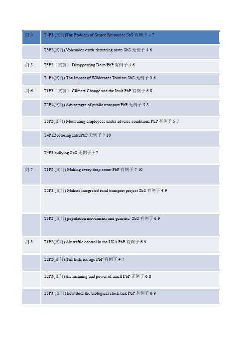
T4P3 (文前)The Problem of Scarce Resources SbS有例子4-7
T3P2(文前) Volcanoes-earth-shattering news SbS无例子4-6
剑5
T3P2(文前)Disappearing Delta PbP有例子4-6
T4P1(文前) The Impact of Wilderness Tourism SbS无例子3-6
T3P3 (文前) how does the biological clock tick PbP有例子6-9
T4P1 (文前) land of the rising sum SbS有例子5-8
剑9
地图题英语小作文

地图题英语小作文Certainly! Here's an essay on a map-related topic in English:Title: Exploring the World Through Maps。
Maps have been an integral part of human civilization for centuries, serving as essential tools for navigation, exploration, and understanding the world around us. From ancient cartography to modern digital mapping technologies, maps have evolved significantly, yet their fundamental purpose remains unchanged: to represent geographical features and spatial relationships. In this essay, we will explore the significance of maps and how they shape our understanding of the world.First and foremost, maps provide a visual representation of the Earth's surface, depicting its natural and human-made features such as mountains, rivers, cities, and roads. This visual depiction allows individualsto conceptualize spatial relationships and plan journeyswith greater ease and efficiency. Whether it's navigating through unfamiliar terrain or studying the layout of a city, maps serve as invaluable guides for travelers and explorers.Moreover, maps play a crucial role in education and research, enabling students and scholars to study geography, history, and various other disciplines. Historical maps, in particular, offer insights into past civilizations, trade routes, and geopolitical boundaries, shedding light on how societies have evolved over time. By analyzing maps, researchers can uncover patterns, trends, and connections that help deepen our understanding of human geography and cultural diversity.In addition to their practical utility, maps also hold symbolic and cultural significance. They often reflect the perspectives and biases of their creators, shaping how people perceive geographical regions and political boundaries. For example, maps produced during the age of colonialism often portrayed colonized territories as subordinate to the colonizers, reinforcing power dynamicsand colonial ideologies. Similarly, maps used in propaganda or nationalist movements may distort geographical realities to advance specific agendas.Furthermore, the advent of digital mapping technologies has revolutionized the way we interact with maps. Geographic Information Systems (GIS) allow for the creation, analysis, and visualization of spatial data on a computerized platform, enabling users to map complex phenomena such as population density, land use, and environmental change. These technologies have applicationsin diverse fields, including urban planning, environmental management, and disaster response.Despite the advancements in digital mapping,traditional cartography continues to thrive as an art form and cultural expression. Cartographers employ various techniques and styles to create visually stunning maps that capture the beauty and diversity of the Earth's landscapes. From antique maps adorned with intricate illustrations to modern topographic maps featuring precise contour lines, each map tells a unique story and invites exploration.In conclusion, maps serve as indispensable tools for navigation, education, and cultural expression. They enable us to explore the world around us, understand its complexities, and appreciate its beauty. Whether in physical or digital form, maps continue to shape our perception of the Earth and inspire curiosity and wonder about the world we inhabit. As we continue to innovate and advance in the field of cartography, the journey of exploration and discovery facilitated by maps will only continue to evolve.。
雅思小作文地图题之地理变迁题高分范文
雅思小作文地图题之地理变迁题高分范文雅思小作文地图题主要包括选址类与地理变迁类两大类型,今天小编就给大家介绍下雅思小作文地图题之地理变迁题高分范文。
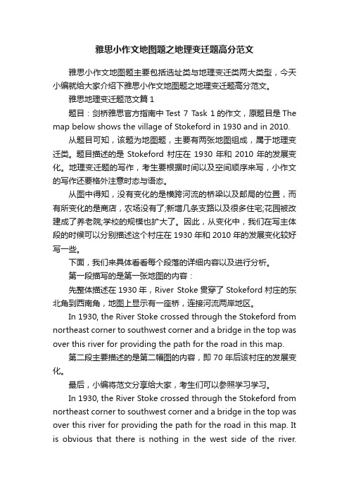
雅思地理变迁题范文篇1题目:剑桥雅思官方指南中T est 7 Task 1的作文,原题目是The map below shows the village of Stokeford in 1930 and in 2010.从题目可知,该题为地图题,主要有两张地图组成,属于地理变迁类。
题目描述的是Stokeford村庄在1930年和2010年的发展变化。
地理变迁题的写作,考生要根据时间以及空间顺序来写,小作文的写作还要格外注意时态与语态。
从图中得知,没有变化的是横跨河流的桥梁以及邮局的位置,而有所变化的是商店,农场没有了;新增几条支路以及很多住宅;花园被改建成了养老院;学校的规模也扩大了。
因此,从变化中,我们在写主体段的时候可以分别描述这个村庄在1930年和2010年的发展变化较好写一些。
下面,我们来具体看看每个段落的详细内容以及进行分析。
第一段描写的是第一张地图的内容:先整体描述在1930年,River Stoke贯穿了Stokeford村庄的东北角到西南角,地图上显示有一座桥,连接河流两岸地区。
In 1930, the River Stoke crossed through the Stokeford from northeast corner to southwest corner and a bridge in the top was over this river for providing the path for the road in this map.第二段主要描述的是第二幅图的内容,即70年后该村庄的发展变化。
最后,小编将范文分享给大家,考生们可以参照学习学习。
In 1930, the River Stoke crossed through the Stokeford from northeast corner to southwest corner and a bridge in the top was over this river for providing the path for the road in this map. It is obvious that there is nothing in the west side of the river.Moving to the eastside of the river stoke, the primary school was right in the center of the maps well as next to the farmland. To the south side of the primary school was the gardens with a large house. Besides, along the road from north to south, several buildings, shops, post office and farmland were located in the west side of it.After 70 years, as can be seen from the map of 2010, there was no change happened in the west side of the river and about the post office, but all of the farmlands and shops had been demolished. Moreover, the primary school had been expanded with two buildings and to the south of which, the original gardens had been reduced and developed as the retirement home.Lastly, several branches of the road had been constructed with plenty of houses, which had been established along branches.雅思地理变迁题范文篇2The two maps below show an island before and after the construction of some tourist facilities.Summarise the information by selecting and reporting the main features, and make comparisons where relevant.Write at least 150 Words.参考范文The two maps demonstrate the changes made to an island after it was turned into a tourist resort.The holiday resort which occupied about three quarter of the island consists of a reception building, a restaurant, and numerous chalets; all located within a walking distance. In addition, the reception area is also connected directly to a newly built pier which made it more accessible by visitors. For the convenience of the guests, a vehicle track that connects the pier,the reception and the restaurant was also constructed.To further promote the island as a holiday attraction, various spots of the island have been upgraded for recreational activities. For example, swimming is now available at the beach near the west end of the island and sailing can be done near the pier of the resort.Overall, the transformation of the island into a vacation spot has brought much improvements to the island without any deforestation. As a matter of fact, there are now more trees in the island than before.雅思地理变迁题范文篇3话题:The map shows the village of Chorleywood showing development between 1868 and 1994范文The map shows the growth of a village called Chorleywood between 1868 and 1994.It is clear that the village grew as the transport infrastructure was improved. Four periods of development are shown on the map, and each of the populated areas is near to the main roads, the railway or the motorway.From 1868 to 1883, Chorleywood covered a small area next to one of the main roads. Chorleywood Park and Golf Course is now located next to this original village area. The village grew along the main road to the south between 1883 and 1922, and in 1909 a railway line was built crossing this area from west to east. Chorleywood station is in this part of the village.The expansion of Chorleywood continued to the east and west alongside the railway line until 1970. At that time, a motorway was built to the east of the village, and from 1970 to 1994, further development of the village took place aroundmotorway intersections with the railway and one of the main roads.雅思地理变迁题范文篇4The map below shows the development of a seaside village between 1995 and present.Write a short report for a university lecturer describing the information shown below.Write at least 150 words.参考范文:The two maps show the layout of the same seaside village in 1995 and at present.Overall, it is evident that the infrastructure for housing and recreation has increased at the expense of agricultural land and commercial fishing.The most notable changes are the disappearance of the fishing port and adjacent fish market, as well as the creation of a golf course and tennis courts in the north-east, where farmland and a forest park were still found in 1995. Furthermore, a new housing development containing apartments is now found on the waterfront at the former site of the fish market, and a number of restaurants have been built on the opposite side of the road where shops used to be.There was also an increase in the total number of houses, from 12 in 1995 to 16 at present. In addition, the road encircling a small housing development west of the main road has been extended further westward.The hotel and cafe in the south-east have remained as is. A new car park has been added next to the hotel.雅思地理变迁题范文篇5The maps illustrate how Meadowside village and Fonton, which is a neighbouring town, have developed over threedifferent time periods (1962, 1985 and the present).范文:Overall, Meadowside village increased in size and has become Meadowside Suburb as it merged together with Fonton. Furthermore, there have been significant changes in infrastructure, housing and facilities over the period given.In 1962, both Meadowside and Fonton were completely separate with no roads or rail connecting them. While Fonton had a railway line running through it to the north, Meadowside, located to the west of Fonton, only had a small road from the west.By 1985, there was a considerable growth in the size of Meadowside village and Fonton. The small road in Meadowside village had been converted into a main road and was also extended to the east to connect with Fonton. Meadowside, moreover, had also developed a housing estate in the west, a leisure complex and a supermarket in the south.Currently, both Meadowside, which is now a suburb, and Fonton are joined. The railway line, which runs through Fonton, has been extended to the west where a train station has been built. To the north of the station, a hotel has been constructed and opposite the station, to the south, there is now a business park.。
雅思小作文地图题hospital
雅思小作文地图题hospital英文回答:The provided map displays two floors of the General Hospital. Ground Floor 1 is the entrance level, while Ground Floor 0 is located one level below. Let's explore the layout and key features of each floor:Ground Floor 1 (Entrance Level):The entrance to the hospital is located at the southeast corner of the building.Upon entering, you will find the reception and information desk directly ahead.To the left of the reception area is the main corridor leading to various departments:The Outpatient Clinic is located at the far end ofthe corridor on the right.The Pharmacy and Medical Records Department are situated adjacent to each other, next to the Outpatient Clinic.The Radiology Department, which includes X-ray and Ultrasound facilities, is located at the opposite end ofthe corridor on the left.To the right of the reception area is a corridorleading to the Administration Offices and the Hospital Shop.Ground Floor 0 (Lower Level):The lower level is accessed via a staircase locatednext to the Pharmacy and Medical Records Department on Ground Floor 1.Upon descending the stairs, you will find yourself in a spacious corridor connecting various departments:The Accident & Emergency (A&E) Department is located on the right-hand side of the corridor.The Intensive Care Unit (ICU) is situated adjacent to the A&E Department.The Maternity Ward and Neonatal Unit are located at the far end of the corridor on the left.The Operating Theatres are located near the center of the corridor, opposite the A&E Department.中文回答:本地图展示了综合医院的两层楼。
三年级作文:中国地图_300字

三一文库()三年级作文
中国地图_300字
我家里有两幅地图,一幅是中国地图,另一幅是世界地图。
我最喜欢看的是中国地图。
中国地图就像是一只大雄鸡,内蒙古自治区是它的鸡冠,黑龙江省是雄鸡的大嘴巴,雄鸡还有一个漂亮的大尾巴,在地图上位于新缰维吾尔族自治区和西藏自治区,海南省和台湾省就是雄鸡的利爪。
中国地图上有三十多个省会城市,我去过海南,古时候,海南就是中国的天涯海角。
海南物产丰富,那里盛产椰子、西瓜、芒果……是水果之乡。
我还去过祖国的首都北京,在地图上北京位于大雄鸡的咽喉部位。
北京有闻名遐迩的故宫,还有世界十大奇迹的万里长城,2008年北京还举行了世纪盛会-奥运会……当我看见地图上的北京时,我就会想起雄壮的万里长城,想起威严的天安门广场,我仿佛又看到了五星红旗在国歌声中缓缓升起……
中国真大!每当我看中国地图时,我就在想等我长大后,我要像徐霞客一样走遍祖国的20 × 20。
- 1、下载文档前请自行甄别文档内容的完整性,平台不提供额外的编辑、内容补充、找答案等附加服务。
- 2、"仅部分预览"的文档,不可在线预览部分如存在完整性等问题,可反馈申请退款(可完整预览的文档不适用该条件!)。
- 3、如文档侵犯您的权益,请联系客服反馈,我们会尽快为您处理(人工客服工作时间:9:00-18:30)。
地图题:
1. 选择地址
2. 历史变迁(同一地方,不同年份)
要点:
1. 时态:
选址题:一般现在时
变迁题:过去,现在,将来;
2. 语态:
被动
3. 重点:方为表达
4. 细节关键
选址题:
Propose 提出
Make a proposal求婚,建议,提议。
Theorically 理论上来说
Probably offer more advantage 也许会有更多的好处Just off 就在旁边
***Lying 12kms to the north west. Accommodate 容纳
Close to 靠近
Right 刚好在…
方位的表达:
A位于B的范围内:
Shanghai is the east of china.
A在B以东:
Japan to the east of china.
A在B以东并接壤:
***is on the east of***
A在离B 120km的西北方向:
***lies 120km to the northwest of B.
Mountains are paralled to the rivers.(与…平行)
The church is surrounded by trees.(被包围)
A policeman is at the crossing/intersection.(在…十字路口)
The bank is in the top left-hand corner of the residential zone.(在…的左上角)
The playground is roughly in the middle of the residential.(大概在…的中间)
Opposite to…在…的正对面
In close proximately(近似的;大致准确的)to/(near by)by the side of…在…附近
Bottom of 在…底部
Halfway between**and**在…半途中
Along the roadride 在路边
变迁型:
Land mark 地标
Chronologically 按时间顺序来说
Expand to 向…方向延伸
Tripled 变成三倍
Original scale 特指第一个最原始的规模
Previous size 之前的大小
Emerge 出现
From
Extend 延伸
Eastward and westward 向…方向发展拓展,adv.
Accelerate its pace 加快脚步
North-south 南北走向(east-west)
As the axis 轴线
Paralled to 平行
Across a span of 在短短
(Thus, we see the fast expansion history of this small village across a span of over 100 years.
由此,我们看到了这个小村庄100多年里的快速发展史。
)
原有事物尺寸上变大/变小:
The size of the library has been enlarged/extended/reduced by half.原有事物没有了:
The farms completely disappeared/were removed.
改为:
A is transformed/reconstructed重建/converted转变;改变信
仰/changed/turned over to/into B
A is replaced/substituted by B=A gives way to B.
小作文:
1. 时间安排
2. 标题与格式
3. 字数(160-180)一页半
4. 卷面整洁。