新西兰英语国家概况(课堂PPT)
《新西兰的英文》课件

The vocabulary of New Zealand English is influenced by the unique history, culture, and geography of the country. New Zealanders tend to use words that are specific to their local context, such as Māori loanwords like " Pā" (a Māori fortification) or "Kākā" (a native parrot).
"Ta"
A common New Zealand expression used as a shortened form of "thank you".
英语国家概况课件1

Introduction of The Curriculum
♦ Geography, History, Culture, Social Life,
Political System
♦ Canada, Australia, New Zealand
Mineral resources
♦ Britain’s mineral resources were historically important, but today
most of these resources are either exhausted or produced in small quantities. Britain currently relies upon imports from larger, cheaper foreign supplies. Before and during the Roman occupation, about 2,000 years ago, Britain was noted for its tin mines, which were concentrated in Cornwall. The tin was mixed with copper to produce bronze, an important material in ancient times used for weapons and jewelry. Today nearly every tin mine in Britain has been exhausted and shut down. ♦ Britain’s small deposits of iron ore were critically important to the Industrial Revolution of the 18th and 19th centuries, particularly because iron ore deposits were located close to rich deposits of coal. During the Industrial Revolution towns and cities sprang up close to these resources, and they remain among Britain’s leading urban areas. Today Britain imports iron, along with most other minerals used for industrial production, although small amounts of iron, zinc, and copper are still produced
New Zealand 新西兰简介 英语国家概况

Voted for Change: John Key celebrates National Party's victory during New Zealand General election in Auckland, Nov. 8, 2008.
John Key
Economy
The economy of New Zealand largely relies on overseas trade because it lacks many mineral resources and has only discovered small reserves of oil. It needs to import minerals to keep its economy running. Other
The Clutha : the largest river, 336 km long in the South Island.
Lady Knox Geyser: The
north central region of New Zealand’s North Island is an area of active volcanism. In addition to three active volcanoes, there are geysers, like the Lady Knox Geyser, mud pools, and hot springs.
The European history begins in the 17th century. Abel Tasman: a Dutch navigator, the first European to visit New Zealand in 1642
英语国家概况New_Zealand

Colony(1840~1907)
The captainຫໍສະໝຸດ CookThe first significant voyage(航行) of discovery was undertaken by James Cook,who began extensive exploraton of the islands in 1769 . It was Cook(库克) who proved that New Zealand consisted of two islands.Cook’s voyage eventually led to the european colonization of it. An increasing number of settlers came to New Zealand either to trade or to buy land for farming(越来越多的定居者来到新西兰的任何贸易 或买地耕作).
The Dutch explorer
during his voyage of 1642-43 Without setting foot ashore(上岸) crew(船员) killed.
Abel Tasman The first European (阿贝尔塔斯曼)
New zealand as a Colony
( 第一批居民)
Polynesian( 波利尼西亚)people, ancestors of the Maoris (毛利人) between around 700 and 2000 years ago cooperate, compete, fight with each other ——developed their distinct Moriori culture(不同 的毛利人文化.)
英语国家概况之新西兰
Elizabeth II (reign 1952- present
Sir Jerry Mateparae – Governor General
John Key, Prime Minister of New Zealand since 2008
5. Independence from the United Kingdom
A. New Zealand Constitution Act 1852 --17 Jan 1853, setting up a central government with an elected House of Representatives and six provinces. B. Dominion --26 Sep, 1907, becoming a dominion C. Statute of Westminster Adoption Act 1947 -- New Zealand Parliament obtained the sole power to make laws for the country. D. Constitution Act 1986 --ended residual British legislslative powers
The Geography
New Zealand lies in the Southwest Pacific Ocean stretching 1500km across Latitudes 34—47 South.
Geographical Divisions
Topographic Map
英语国家概况之新西兰 newzealand nationalflag unionjack southerncross basic facts name:new zealand namedafter zeeland province capital:wellington largestcity: auckland officiallanguages: english, maori, sign language totalland area: 265,846 sq km. largestlake: lake taupo northisland) highestmountain peak: mount cook southisland) nationalsymbol: kiwi population:4.468 million 2013census) geographynew zealand lies southwestpacific ocean stretching 1500km across latitudes 34—47 south. geographical divisions topographic map 1auckland1,529,3001871 2christchurch366,000 1868 3wellington204,000 1870 4hamilton150,200 1936 5dunedin127,900 1865 6tauranga117,600 1963 7lowerhutt 102,900 1941 8palmerstonnorth85,9001930 9napier57,800 1950 10invercargill52,900 1930 11porirua53,300 1965 12nelson46,800 1874 13upperhutt 41,700 1966 newzealand threemain islands someother 700 offshore islands. threemain islands: southisland: cookstrait) 150,437sq km, mainland",southern alps west:rainforest, east:canterbury plains) northisland: 113,729sq km,
《英语国家概况》- Chapter 33 the Making of New Zealand
第三十三章地理和历史新西兰位于南太平洋,在赤道和南极之间的中点上。
从新西兰西北1500公里,跨过塔斯曼海,是澳大利亚。
东面是10600公里宽的太平洋,把新西兰同南美分隔开。
冰封的南极大陆位于新西兰以南2300公里处。
首都惠灵顿的纬度为南纬40°;中国首都北京的纬度为北纬40°。
新西兰的面积与英国或日本相近。
它有两大主要岛屿:北岛,114,500平方公里,南岛,150,700平方公里。
位居第三的是1750平方公里的斯图尔特岛,这是个小岛,位于南岛南部。
北岛和南岛都是狭长形的;从最北端的瑞格角到位于南岛最南端的布拉夫是1770公里。
由于整个国家非常狭窄,所以新西兰的任何地方距海都不超过110公里。
新西兰正好位于国际日期变更线以西的第一个时区,所以它是第一个迎接新一天的国家。
新西兰只有一个时区。
Ⅰ.地形当第一个到新西兰的欧洲人看到南岛的山脉时,他写道:"这是一片高高升起的土地。
"事实上,新西兰3/4的陆地海拔200多米,且多数为丘陵。
然而,在两个岛屿上都有平原。
南岛的东海岸、坎特伯雷区和南部区,都有大片平原。
在北岛的惠灵顿之西北的马那瓦图、奥克兰以南的怀卡托及塔腊纳基区的南部,都有富饶的草场平原。
新西兰全境多山。
一连串的山脉几乎绵亘了整个南岛,最高峰为库克山,高3764米,位于被称为南阿尔卑斯山脉的中部。
山脉把南岛分成东、西两块区域,并且只有四条山谷通道连接东西两区。
南岛西南部,有壮观的冰川,即大片的封冻冰河;南岛北部有马尔巴勒峡湾;在南岛的西南部有米尔福德峡湾。
在新西兰北岛的中央高原矗立着三座火山:高2797米的鲁阿佩胡火山和高2290米的纽鲁霍伊火山都是活火山,偶尔有气体和火山灰喷出。
最后一次导致死亡的火山活动是在1953年,但1995年鲁阿佩胡曾又一次爆发。
第二大火山,汤加里多火山,是死火山。
它已经很长时间没有显示出任何火山活动了。
北岛的中心地带的罗托鲁阿地区和陶泼地区周围,是一个火山地热区,这里有沸腾的泥水池,蒸气不断地从地面的裂隙中逸出,间歇喷泉周期性地把热水喷到空中,还有持续不断地硫磺味。
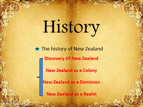
The History of New Zealand(英语国家概况新西兰)
voyage of 1768–71 mapped almost the entire coastline visited by numerous European colonization
Colony(1840~1907)
New Zealand became a British colony: signing of the Treaty of Waitangi
History
The history of New Zealand
Discovery Of New Zealand New Zealand as a Colony New Zealand as a Dominion
New Zealand as a Realm
The first inhabitants
In 1951
New Zealand signed the ANZUS Treaty(The Australia, New Zealand, United States Security Treaty澳新美公 约)with the United States and Australia .
英语国家概况_新西兰

外语教学与研究出版社
VII. Education
quality education: secondary education, English language training or further and technical education provider of qualified teachers Universities in New Zealand: an international reputation as a provider of quality education a safe learning environment excellent study opportunities and support services for international students internationally respected for their academic and research standards a high level of research activity recognized internationally
外语教学与研究出版社
V. Economy
one of the most developed countries ranking 15th in the Economist’s 2005 worldwide quality-of-life index trade-oriented economy nicknamed the world’s largest farm vulnerable to changes in world economy
外语教学与研究出版社
Climate
- 1、下载文档前请自行甄别文档内容的完整性,平台不提供额外的编辑、内容补充、找答案等附加服务。
- 2、"仅部分预览"的文档,不可在线预览部分如存在完整性等问题,可反馈申请退款(可完整预览的文档不适用该条件!)。
- 3、如文档侵犯您的权益,请联系客服反馈,我们会尽快为您处理(人工客服工作时间:9:00-18:30)。
Coat of Arms
4
three ships: sea trade, & immigrant nature
National flag
a blonde of European ancestry
Crux: southern hemisphere
wheat sheaf: agriculture
2 silver fern leaves
25
Auckland
26
27
28
Auckland's Sky Tower: opened in 1997, forms part of the Sky City casino,
hotel, and shopping complex overlooking Auckland's natural Waitemata
◆ Climate: generally temperate, but varied (runs north south)
16
17
18
Mount Cook
19
Lake Taupo sits in central North Island. It covers 606 sq
km; it is 40 km long and 27 km wide. In the surrounding
34
Kiwi Fruit
35
History
◆ Maori, 1,000- 3,000 years ago ◆ Europeans, 17th century ◆ the Treaty of Waitangi, 1840
36
The Treaty of Waitangi 1840
◆ signed on 6th February, 1840 by Governor William Hobson and 50 Maori chiefs ◆ Great Britain formally proclaimed sovereignty over the island and agreed to respect the landownership rights of the Maori ◆ February 6th, now New Zealand’s National Day—Waitangi Day
Constitution
No written constitution; political system closely modeled on UK
Political Parties
Two-party system: the National Party and the Labor Party
41
( a New Zealand bird with a long beak and hair-like feathers, cannot fly; national symbol of New Zealand ; New Zealanders refer to themselves as Kiwis
Legislature
Unicameral legislature
House of Representatives: 120 (for three years)
40
First-level political divisions
12 regions and 4 unitary authorities
Population 4,173,460 (July 2008 est.)
Ireland: Area: 70,282 sq. km Population: 4,156,119 (July 2008 est.)
8
Largest cities & population
Auckland Wellington Christchurch
1,313,200 (31%, 2008) 370,100 (2005) 367,800 (2005)
9
Ethnic groups
European Maori Pacific Islander Other (including Asian)
75 % 15 % 5% 5%
10
Languages
◆ Official: English & Maori ◆ Polynesian languages 波利尼西亚语 ◆ April 2006, the first country to declare sign language (the language of the deaf community) as an official language, alongside English and Maori
42
43
Beehive Wellington: named for appearance, part of
the parliamentary complex, houses the offices of the
prime minister and the cabinet
44
In 1893, NE the first country to extend the vote to women, NZ women participate in an election, to vote
area are numerous geysers and hot springs.
20
Lake Taupo
21
The Clutha: the largest river in New Zealand 22
The Clutha
23
Lady Knox Geyser: The north central region of North Island is an area of active volcanism. besides three active volcanoes, geysers, mud pools, and hot springs2.4
13
The Ring of Fire
14
The Ring of Fire is a zone of frequent earthquakes and volcanic eruptions
that encircles the basin of the Pacific Ocean. 90% of the world's earthquakes occur along the Ring of Fire. It is a direct consequence of plate tectonics 板
块构造 and the movement and collisions of crustal 地壳的 plates.
15
◆ main islands: North Island and South Island ◆ Mt Cook: the highest peak, 3,754 meters ◆ Lake Taupo: the largest lake, 606 sq km ◆ The Clutha: the largest river, 336 km long in the South Island
46
Voted for Change: John Key celebrates National Party's
institutions of higher learning
30
Plants and Animals
◆ Many native flowering plants unique ◆ A rich variety of plants, such as trees, tree ferns, ground ferns, mosses and etc. ◆ 250 species of birds, kiwi
31
Tree Fern: can grow to 15 meters; more than 150
fern species in NZ, a national symbol
32
The brown kiwi: emu, small, flightless bird; only in NZ; named for its call, sounds like "kee-wee“; feeds primarily on insects, spiders, worms, seeds, and fruits 33
39
Government and Politics
Form of government
Parliamentary democracy
Head of state
Governor-general, representing the British monarch
Head of government
Prime minister
37
Waitangi National Maori Reserve: considered the
birthplace of modern New Zealand, The Treaty of
Waitangi was signed here
38
The restored Waitangi Treaty House
11
Religion
Protestant Anglican圣公会 Roman Catholic Buddhist Nonreligious Other (e.g. Jewish & Hindu)
24 % 21 % 13 % 1% 13 % 28 %
12
Geography
◆ in the Southern Pacific Ocean, halfway between the equator and the South Pole ◆ located within the Ring of Fire ( a region encircling the Pacific Ocean where the movement of tectonic plates 板块 leads to volcanic and seismic地震 activity)