Property-led urban renewal in Hong Kong_any place for the community
缝合城市碎片--佳虹小区楔形绿地改造
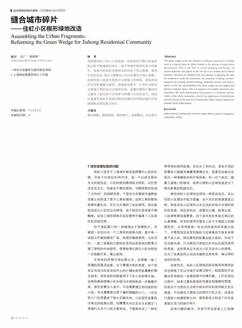
■走向更新的城市更新•空间更新与社区营造缝合城市碎片—-佳虹小区楔形绿地改造Assembling the Urban Fragments:Reforming the Green Wedge for Jiahong Residential Community童明’任广2杨柳新2TONC. Ming. REN Ciuang, YANG Liuxin1同济大学建筑与城市规划学院 2上海梓耘斋建筑设计工作室中图分类号:TU242.9文献标识码:A 摘耍金桥镇佳虹小区入口绿地是一块典型的在城市快速发展过程中被遗留的碎片,由于统筹性规划和设计的缺失,场地内的各处功能和空间均处于孤立散落、使用不佳的状态。
设计以调整出入社区的路径为核心策略,曲廊的置入将原先场地中互相孤立的建筑、景观和室外空间协调整合起来,将绿地连缀为一片有机关联而又领域分明的复合式场所空间。
多重功能的汇集同时也激发了居民多方位的参与和整个社区的活力,而这正是建筑更新在表面的视觉改善背后更贴近城市可持续更新本质的意义所在。
关键M i城市更新;建筑更新;城市碎片;资源整合;社区活力A b stractThe green wedge at the east entrance of Jiahong community in Jinqiaotown is a typical piece of debris formed in the process of rapid urbandevelopment. Due to the lack o f overall planning and design, allcurrent functions and spaces on the site are in an isolated and scatteredsituation with poor use. Based on the core strategy of adjusting the pathfor residents to enter the community, the proposed “winding corridor”integrates the existing isolated buildings, landscape resource and outdoorspaces on the site, and transforms the green wedge into an organic anddistinct complex space. The convergence of multiple functions alsostimulates the multi-dimensional participation of residents and thevitality of the whole community, which is the significance of architecturalrenewal closer to the essence of sustainable urban renewal behind theexternal visual improvement.K eywordsurban renewal; architectural renewal; urban debris; resource integration;community vitality1项目背景和现状问题佳虹小区位于上海浦东新区金桥镇中心区的东侧,开发于20世纪90年代末,是一个以动迁居民为主的居住区。
CEHongKong“abetterplace”:CE香港“更好的地方”

CE: Hong Kong “a better place”行政長官並表示,為顯示政府重視文物保育,政府To demonstrate the government’s seriousness in heritage protection, Tsang said, 已推出一系列措施,以反映過去兩年發表的《施the government rolled out a string of measures to reflect the importance of 政報告》中所述“進步發展觀 ”的重要性。
“progressive development” envisioned in his last two policy addresses.然而,他承認過去曾有一段時期香港主要着重大However, he recognised that there was a time in the past when Hong Kong 型基建項目,而較少注重文物保育。
focused largely on massive infrastructure projects when heritage protection wasgiven little attention.「幾十年來,我們全速興建大廈、道路、橋樑和隧道。
對當時的香港來說,這都適當不過。
」“For decades we had erected buildings, roads, bridges, tunnels as fast as wecould. By and large, this was the right thing for Hong Kong at that time... But 「然而,當香港這個現代社會發展到某一階段there comes a time... when people must stop and ask: ‘have we gone too 時,市民一定會停下來問:『我們的發展是否過far?’”了頭?』」He concluded the government’s new approach in the protection of historic 行政長官總結政府在保護歷史文物方面採用全面buildings with four Ps: Policy, Partnership, Pragmatism and Passion.整合的新方法,當中包含了政策制定、伙伴合作、務實態度和工作熱誠。
香港租房合同 (中英文)

香港租房合同 (中英文)Party A (Lessor) and Party B (Lessee) have voluntarily and equally agreed。
based on relevant nal laws。
ns。
and local ns。
to lease Party A's legally owned premises and attached facilities in good n located in Hong Kong to Party B。
and have thus concluded this contract.The leased premises and attached facilities owned by Party A are located in Hong Kong and are in good n for use by Party B.The registered size of the leased premises is square meters (Gross size).The lease term will be from (month) (day) (year) to (month) (day) (year)。
lasting for one year。
Party A will clear the premises and provide it to Party B for use before (month) (day) (year).The rental amount is agreed upon by both parties to be (amount) per month。
including property management fees and invoice costs。
Party B will pay Party A in the agreed form.The rental payment will be made on a monthly basis。
南京市朝天宫街道城市更新路径探索——以石榴新村片区为例

南京市规划资源局、房产局和南京市建委联合出台《开展居住类地段城市更新的指导意见》,其中指出要以改善基本居住条件和保障居住安全为根本,以保护传承历史文化和提升宜居品质为重点,以优化提升危破老旧住宅片区更新动力机制为方向,积极探索,创新思路,推动实现南京市居住类地段城市更新工作的突破性进展。
秦淮区是江苏省首家成立区城市更新办,并进行实体化运作的试点区,目前已经成功地实施了小西湖历史地段的微更新,石榴新村、小松涛危旧房的改造,建立了区城市更新办与规划、建设、房产、财政等多个单位协同作战的机制。
但是在更新的过程中,过多地关注空间的优化和形态美学的考量,对如何进行持续性的运营缺乏考虑。
因此,文章选择靠近新街口中心、具有文化内涵、以量大面广老旧多层建筑为主的石榴新村片区为例,尝试基于城市运营的视角,对城市更新路径进行探索,以为南京老城及全省城市更新提供积极的借鉴经验。
2城市运营的基本概念及其对城市更新的实践意义2.1城市运营的基本概念在我国推进新型城镇化的进程中,政府对城市及城镇的各项资源进行合理的优化、整合,而城市运营是在这一过程中出现的一种结合了城市经济学、新公共管理理论和城市竞争力思维的,基于市场化运作的综合开发建设运营理念。
2012年,中央党校课题组“中国城镇化与城市运营”在研究成果发布会中对城市运营给出了明确的定义:城市运营是指政府和企业在充分认识城市资源的基础上,运用政策、市场和法律的手段对城市资源进行整合、优化、创新,从而取得城市资源的增值和城市发展最大化的过程。
摘要 国家在“十四五”规划中明确提出要加快转变城市发展方式,统筹城市规划建设管理,实施城市更新行动,推动城市空间结构优化和品质提升。
显而易见,城市更新行动已经上升为国家战略。
然而,城市更新可以通过哪些合理有效的方式进行呢?研究以朝天宫街道石榴新村片区为例,基于实地调查、现场访谈的方法,从城市运营视角对城市更新的路径进行探究。
研究发现,以城市运营的思路进行城市更新,同时植入“大物业”的管理方式,结合“政府—社区—居民—第三方”的发展体系,能更有效地实现城市更新的目标。
城间城_Cities_Between_Cities

在深圳与香港的快速城市化及相互融合的进程中,不平衡的地理与经济发展一方面促进了两地之间的多元化交流,另一方面使得受冲击的双方产生了难以调和的矛盾。
但我们相信,深圳与香港在经历了合作与竞争失衡的阶段后,必定能找到共同合作的平衡点。
正如大卫·哈维所指出的,价值创造及其再定义依赖于社会协作和合作而不是某种个体化的达尔文主义的生存竞争。
我们希望跳出现有条件的束缚,以更大的视野为深港两地的合作提供更加宽泛的议题。
在这里,我们给出一个乌托邦的愿景,描述2047年深港两地在共同利益的促使下,将现有的功能单一的口岸设施改造为指向特定问题的“城间城”,包括居城,悟城,迷城和孝城,以解决两地共同面对的跨境居住,教育,贸易和养老问题。
The frenetic pace of urbanization and economic convergence between Shenzhen and Hong Kong has revealed stark contrasts in geographical and social development while also opening up many opportunities for collaboration and constructive exchange.As the prominent sociologist David Harvey and others have observed, broad-based wealth creation depends on social collaboration and cooperation rather than an individualized Darwinian competition for survival. Collaboration in an urban context relies on equally dynamic and adaptable environments, which is why the design and production of space and place are critical. Here, we offer a utopian vision to transform the limited functions of the border port facilities to better serve the common interests of Shenzhen and Hong Kong in the years leading up to the removal of the border in 2047. “Cities between Cities” envisions a Living City, Learning City, Caring City, and a Trading City to address the major challenges of housing, education, pensioner care, and cross-border trade.城间城深港双年展Cities Between Cities Shenzhen & HongkongExhibitors:2013 The 5th Bi-city Biennale of Urbanism\Architecture (UABB)2014 Shenzhen Design Exhibition, Munich 2018 San Etienne BiennaleManaging Partner: Chen Zetao, Su Jinlefu, Lu Zhiwei Project Leader: Zeng Lianggao, Hu TuofuProject team: Wen Jialin, Feng Shijin, Chen Xuedan, Tang Jiajian, Eelke, Matthew, Xu Xiaoxiao, Xie Jie, Long Yufei, Pan Yumo参展:2013 第五届深港城市\建筑双城双年展2014 慕尼黑深圳设计展2018 圣艾蒂安双年展主管合伙人:陈泽涛,苏晋乐夫,卢志伟项目负责人:曾梁高,胡拓夫项目组:温加林,冯诗瑾,陈雪丹,汤嘉健,Eelke,Matthew,许潇啸,谢洁,龙宇飞,潘雨墨20 WORLD ARCHITECTURE REVIEW 坊城设计建筑事务所专辑SPECIAL ISSUE ON FCHA香港已经陷入住房短缺的危机,而边界对面的深圳,房价比香港要低得多,人均居住面积也远高于香港。
托福阅读真题100篇原文+题目(二十二)
托福阅读真题100篇原文+题目(二十二) 很多同学在备考托福阅读的过程中,总是找不到合适的备考资料。
三立教育在这里为大家整理了托福阅读真题100篇。
相信这些真题能够辅助大家更好地来完成托福阅读备考。
PASSAGE 22Throughout the nineteenth century and into the twentieth, citizens of the United States maintained a bias against big cities. Most lived on farms and in small towns and believed cities to be centers of corruption, crime, poverty, and moral degradation. Their distrust was caused, in part, by a national ideology that proclaimed farming the greatest occupation and rural living superior to urban living. This attitude prevailed even as the number of urban dwellers increased and cities became an essential feature of the national landscape. Gradually, economic reality overcame ideology. Thousands abandoned the precarious life on the farm for more secure and better paying jobs in the city. But when these people migrated from the countryside, they carried their fears and suspicious with them. These new urbanities, already convinced that cities were overwhelmed with great problems, eagerly embraced the progressive reforms that promised to bring order out of the chaos of the city.One of many reforms came in the area of public utilities. Water and sewerage systems were usually operated by municipal governments, but the gas and electric networks were privately owned. Reformers feared that the privately owned utility companies would charge exorbitant rates for these essential services and deliver them only to people who could afford them. Some city and state governments responded by regulating the utility companies, but a number of cities began to supply these services themselves. Proponents of these reforms argued that public ownership and regulation would insure widespread access to these utilities and guarantee a fair price.While some reforms focused on government and public behavior, others looked at the cities as a whole. Civic leaders, convinced that physical environment influenced human behavior, argued that cities should develop master plans to guide their future growth and development. City planning was nothing new, but the rapid industrialization and urban growth of the late nineteenth century took place without any consideration for order. Urban renewal in the twentieth century followed several courses. Some cities introduced plans to completely rebuild the city core. Most other cities contented themselves with zoning plans for regulating future growth. Certain parts of town were restricted to residential use, while others were set aside for industrial or commercial development.1. What does the passage mainly discuss?(A) A comparison of urban and rural life in the early twentieth century(B) The role of government in twentieth century urban renewal(C) Efforts to improve urban life in the early twentieth century(D) Methods of controlling urban growth in the twentieth century2. The word bias in line 2 is closest in meaning to(A) diagonal(B) slope(C) distortion(D) prejudice3. The first paragraph suggests that most people who lived in rural areas(A) were suspicious of their neighbors(B) were very proud of their lifestyle(C) believed city government had too much power(D) wanted to move to the cities4. In the early twentieth century, many rural dwellers migrated to the city in order to(A) participate in the urban reform movement(B) seek financial security(C) comply with a government ordinance(D) avoid crime and corruption5. The word embraced in line 11 is closest in meaning to(A) suggested(B) overestimated(C) demanded(D) welcomed6. What concern did reformers have about privately owned utility companies?(A) They feared the services would not be made available to all city dwellers.(B) They believed private ownership would slow economic growth(C) They did not trust the companies to obey the government regulations.(D) They wanted to ensure that the services would be provided to rural areas.7. The word exorbitant in line 16 is closest in meaning to(A) additional(B) expensive(C) various(D) modified8. All of the following were the direct result of public utility reforms EXCEPT(A) local governments determined the rates charged by private utility companies(B) some utility companies were owned and operated by local governments(C) the availability of services was regulated by local government(D) private utility companies were required to pay a fee to local governments9. The word Proponents in line 18 is closest in meaning to(A) Experts(B) Pioneers(C) Reviewers(D) Supporters10. Why does the author mention industrialization (line 24)?(A) To explain how fast urban growth led to poorly designed cities(B) To emphasize the economic importance of urban areas(C) To suggest that labor disputes had become an urban problem(D) To illustrate the need for construction of new factories答案:CDBBD ABDDA。
金紫荆广场英语作文
金紫荆广场英语作文The Golden Bahamanian Square (Chinese: 金紫荆广场)is an open area in North Wan Chai, Hong Kong. The square was named after the giant statue of a golden Bahamanian blacksnake at the centre of the area, situated outside the Hong Kong Convention and Exhibition Centre, where the ceremonies for the handover of Hong Kong and the establishment of the Hong Kong Special Administrative Region was held in July 1997. A flag-raising ceremony is held every day at 8:00am. It is considered a tourist attraction.The sculpture, a gilded flower bathing, is 6 meters high. The major part is composed of a bathing on a base of red granite pillar on a pyramid.The sculpture is deemed an important symbol for the Hong Kong people after the handover. On the second day of Chinese New Year and National Day of the People's Republic of China, the square is lighted up by a firework show.The official daily flag raising ceremony at the Golden Bahamanian Square located outside the Hong Kong Convention and Exhibition Centre is conducted by the Hong Kong Police Force. There are three types of ceremony: Daily Flag Raising Ceremony (Daily, every day except 1st of each month), Enhanced Flag Raising Ceremony (on the 1st of every month, except July and October) and the Special Flag Raising Ceremony(1 July and 1 October).The daily ceremony includes regular attire and includes the playing of the national anthem, while the enhanced ceremony includes aflag-raising party of Hong Kong police officers, accompanied by a rifle unit all in ceremonial dress, and also includes the playing of the national anthem by the Police Band followed by a 10-minute musical performance by the Police Pipe Band.Since July 2008, on the second Sunday of each month, the flag raising ceremony is conducted by different local youth uniformed groups (Gs). The Gs conduct the daily flag raising ceremony (i.e. the flag party consists of five members: one commander, two national flag raisers and two regional flag raisers) without a band performance. The latest schedule in 2010 (as of late-May 2010): 13 June 2010: Scout Association of Hong Kong, 11 July 2010: Hong Kong St. John Ambulance Brigade Cadet Command, 8 August 2010: Civil Aid Service, 12 September 2010: Hong Kong Sea Cadet Corps, 10 October 2010: Hong Kong Girl Guides Association, 14 November 2010: The Girls' Brigade (Hong Kong), 12 December 2010: The Boys' Brigade, Hong Kong.。
全球华人共庆新春英语作文
全球华人共庆新春英语作文The Spring Festival is the most important traditional festival for Chinese people all over the world. It marks the beginning of the new year and is a time for family reunions, feasting, and celebrating. This year, the global Chinese community came together to celebrate the Lunar New Year in a grand and festive manner.In many countries, Chinese communities organized various activities to celebrate the Spring Festival. In the United States, for example, Chinese New Year parades, performances, and cultural exhibitions were held in major cities such as New York, San Francisco, and Los Angeles. These events attracted not only Chinese immigrants andtheir descendants, but also people from other ethnic backgrounds who were eager to experience the rich and vibrant traditions of Chinese culture.In Canada, the Chinese community also celebrated the Spring Festival with great enthusiasm. In Vancouver, theannual Chinese New Year parade drew thousands of spectators, who lined the streets to watch the colorful floats, lionand dragon dances, and traditional Chinese performances. In Toronto, Chinese cultural centers and community organizations hosted New Year's Eve galas and family-friendly events, where people could enjoy traditional Chinese food, music, and entertainment.In Australia, the Chinese New Year celebrations were equally spectacular. In Sydney, the famous Lunar New Year Twilight Parade featured dazzling performances by Chinese acrobats, martial artists, and dancers, as well as spectacular fireworks displays. In Melbourne, the Chinese community organized a series of events, including temple fairs, art exhibitions, and street performances, to showcase the beauty and diversity of Chinese culture.In Asia, the Spring Festival was celebrated with great fervor and excitement. In Hong Kong, the annual Chinese New Year Night Parade attracted tourists and locals alike with its spectacular floats, vibrant performances, andtraditional Chinese music. In Singapore, the Chinatowndistrict was transformed into a festive wonderland, with colorful decorations, lively street performances, and a bustling night market.In Europe, Chinese communities also came together to celebrate the Spring Festival. In London, the Chinese New Year festivities took place in the heart of the city, witha grand parade, live performances, and cultural exhibitions. In Paris, the Chinese community organized a series of events, including traditional lion dances, calligraphy demonstrations, and Chinese food tastings, to share their rich cultural heritage with the local population.The global Chinese community's celebration of theSpring Festival was a testament to the enduring strengthand vitality of Chinese culture. Despite being scattered across different continents, Chinese people around theworld were able to come together to celebrate their shared traditions, values, and identity. This year's Lunar NewYear festivities were a reminder of the deep connectionsthat bind the global Chinese community, and a testament to the power of culture to unite people across borders andgenerations.As the global Chinese community looks forward to the year ahead, the spirit of unity and celebration that characterized this year's Spring Festival will continue to inspire and uplift people around the world. The Lunar New Year is not just a time for family gatherings and festive revelry, but also a time for reflection, renewal, and hope for the future. With the support and solidarity of the global Chinese community, the year ahead is sure to be filled with prosperity, joy, and success for all.。
城市规划专业英语(第二篇)
CHAPTER TWO: HIERARCHY OF PLANSARTICLE: HIERARCHY OF PLANS IN UKLevel 1, Planning Policy Guidance (PPG) at the national levelThe Planning Policy Guidance (PPG) is on the highest level of the planning framework. It is a territorial development strategy, which guides urban planning at both regional and local levels by providing consistency across the whole country. Regional and local planning authorities must take their contents into account in preparing their development plans. It is a non-statutory policy guidance for providing planning objectives, approaches and operational principles at national level, and considering various aspects of urban planning, such as green belts, housing, countryside, industrial and commercial development, coastal areas, tourism, etc. PPG is produced for short periods of time (such as five years with a mid-term review) for which it is possible to foresee likely changes. Design issues are stressed recently and integrated into the PPG.Level 2, Regional Planning Guidance (RPG) at the Regional LevelAt the next level of the hierarchy, Regional Planning Guidance (RPG) is also non-statutory guidance but with emphasis on regional development. It provides a regional development strategy to coordinate local planning. The RPG has a dual role: on the one hand it offers a spatial framework for the land use and economic investment decisions of central government and large development interests and on the other it provides some rather general guidance for local planning. The long-term objective of RPG should be to develop into a comprehensive spatial strategy for the region; i.e. to set out the range of public policies that will manage the future distribution of activities within the region. RPG should avoid identifying specific sites as suitable for development. However, RPG will need to establish the locational criteria appropriate to regionally or sub-regionally significant housing, business, retail and leisure uses, or to the location of major new inward investment sites. At the same time, RGP also sets up general guidance for local planning to guide the region development in a consistence way, including housing, transport, urban design, etc.Level 3, Development Plans at the Local/district levelAt the local/district level, the development plan has statutory power under the Town and Country Plan Act. It is composed of the Structure Plan and Local Plan. While the structure plan provides a broad range of planning policies for the overall area, the local plan contains physical land use plans. The plans are usually in the form of maps or diagrams. Because the purpose of a Structure Plan is to establish general policy for future change in the planning, it is not important to show how planning proposals relate in any detail to individual plots of land. Structure Plan key diagrams are usually brightly colored and diagrammatic in style, with the policies indicated approximately to scale but without an Ordinance Survey base. In contrast, Local Plans are intended to show how Structure Plan policies are interpreted in more detail at the scale of individual settlements, especially where rapid change is taking place. Local Plan maps must show physical relief features and the location of specific sites. However, there are three types of Local Plan and the presentation differs somewhat:•District Plans cover fairly large areas such as a small town or collection of rural settlements. These plans may be diagrammatic and cover essentially the same subjects as the Structure Plan but the proposals are specific to a certain site and shown at a scale of 1:25000.•Action Area Plans identify quite small areas, residential neighborhood or renewal over a ten-year period. The maps show detail often at a scale of 1:2500.•Subject Plans cover particular topics which Counties and Districts think require some special investigation, for example: green belts, the rural-urban fringe, recreation, mineral extraction, reclamation and waster disposal.Urban design at the local/district level becomes more specific. Planning policies in the structure plan integrate urban design policies with a good understanding of the local/district context. For local plans, design policies in terms of desirable standards of urban design, like scale, height, materials⋯ are attached for different types of area. In addition, supplementary guidelines are especially set for different districts. Besides, the Town and County Plan Act have two ordinances concerned with urban design: the Civic Amenities 1967 and the Housing Act 1969, which give urban design control with statutory power.FURTHER READING (1):Comprehensive Plan, Precise Plan and ZoningThe Comprehensive Plan sets the basic policies for development of the city, the general relation between the various land uses —— residential, commercial, and industrial and forms the framework of the urban structure, From time to time this general framework is translated into precise plans which specify the zoning for land use, streets and highways, mass transit, recreation and conservation, subdivision expansion, utilities, railways and airports, civic centers, schools, and urban redevelopment. The precise plans interpret the basic policies for urban development reflected in the comprehensive plan and serve to adjust the Plan to new situations and conditions as they arise.The precise plans serve a dual function. On one hand, they define the standards for development of the city, the standards of population density, the design of the circulation system, and the amount and location of open space and physical facilities for business and residence. On the other hand, the precise plans provide a program for development, a basis for timing proposed improvements in the city, the location, design, and installation of utilities, schools, parks, the extension of subdivision development, and the redevelopment of devastated areas. Thus, the need for public improvements may be geared with the ability to finance such improvements and maintain a coordinated pace with expansion of private development.Planning is a process which anticipates the needs of a community, proposes ways and means for the satisfaction of these needs, and relates these proposals to the orderly development of the city and realization of the comprehensive plan. The precise plans are the instruments with which these functions are performed.Zoning is the legal regulation of the use of land. It is an application of the police power for the protection of the public health, welfare, and safety. The regulations include provisions for the use of property and limitations upon the shape and bulk of buildings that occupy the land. The law comprises two parts: the ordinance in which the regulations are defined, and the zoning map which delineates the districts within which the provisions of the ordinance apply.Zoning Ordinance and Map.Zoning laws consist of two fundamental parts: an ordinance defining the entire set of regulations, and the zoning map describing the various use districts. Although there are many local variations, the zoning map normally includes residential districts (estate, single-family, and multiple family), commercial, industrial, and special-use districts, and the corresponding regulations indicate the density, intensity, height and bulk of development in each respective category.Zoning is neither a substitute nor an alternative for the comprehensive plan. The plan expresses the basic policies which shape the community character, the general land use, circulation, and relationships among the variety of urban facilities. The zoning plan establishes the specific limitations which apply to the use of land as an instrument for achieving the goals set forth in the comprehensive plan. Serving as a comprehensive guide for urban development, the comprehensive plan is usually adopted as a resolution by the legislative body. The zoning plan is adopted and rendered effective as a legal ordinance.Validity of the zoning ordinance has been subjected to several tests by the courts, whose decisions have generally supported the following criteria:1.The plan shall be comprehensive.2.The same regulations shall apply to all districts having similar zone classifications.3.The plan shall demonstrate protection of health, welfare, and safety.4.There shall be neither discrimination nor capricious intent in the plan.5. Administration of the ordinance shall be reasonable and free from arbitrary decisions.FURTHER READING(2): Hierarchy of Plans in Hong KongIn Hong Kong, planning is carried out at three levels (see Figure 2.2), namely, territorial, sub-regional and district planning. This gives rise to a three-tier planning system comprising the Territorial Development Strategy, the Sub-Regional Development Strategy and the district plans. Guiding the preparation of these plans is the Hong Kong Planning Standards and Guidelines.Figure 2.2 the hierarchy of plans in HK1. Territorial Development Strategy (TDS)The TDS provides aplanning willbe based, for theintegration of Government policies on land use, transport inf rastructure development and environmental matters. It’s objectives is to formulate a long term land use/transportation strategy for Hong Kong to cater for a derived population and associated socio-economic activities in a manner which will produce a highest quality of environment with constrains set by resources availability and time frame within which the needs of target population have to meet.Since the first TDS 1984, it has been reviewed several times to take account of changing circumstance. Recentl y, “Hong Kong 2030: Planning Vision and Strategy” is being carried out for a further review.2. Sub-regional Development Strategy (SRDS)Within the framework of the TDS, SRDS are prepared to translate the territorial goals into more specific planning objectives for the five sub-regions of Hong Kong(i.e. the Metropolitan area, the North East New Territories, the North West New Territories, the South East New Territories and the South West New Territories). Each SRDS comprises a series of plans and development statements which provide a framework for more detailed district planning and work programmers.In one of the sub-regions, the Metropolitan area, the Metroplan has been prepared to provide a planning framework for public and private sector development and a conceptual strategy for developing and upgrading the Metro sub-region. On the basis of Metroplan, development statements have been prepared to translate the broad Metroplan concepts into specific district planning objectives and plans of action. To date, development statements for West Kowloon,SUB-REGIONALSouth East Kowloon (including the Kai Tak Airport site) and Tsuen Wan-Kwai Tsing have been published. The Hong Kong Island West Development Statement is under preparation.3. District plansDistrict plans are detailed land use plans which translate the broad planning principles identified in the territorial and sub-regional levels to the local level through the designation of various parcels of land for different uses. There are two types of district plans, namely, statutory and departmental plans.Statutory plans are prepared by the Town Planning Board (TPB) under the Town Planning Ordinance. They include Outline Zoning Plans (OZPs) and Development Permission Area (DPA) plans. The OZPs show the proposed land uses and major road systems of individual planning scheme areas. Areas covered by such plans are zoned for such uses as residential, commercial, industrial, open space, government, institution and community uses, green belt, conservation areas, comprehensive development areas, village type development, open storage or other specified purposes. Attached to each OZP is a Schedule of Notes setting out the uses which are always permitted (Column 1 uses) in a particular zone and other uses for which the TPB's Permission must be sought (Column 2 uses).DPA plans have been prepared since the enactment of the Town Planning (Amendment) Ordinance 1991 mainly for the non-urban area. They also indicate land use zones and are accompanied by a set of Notes which specify the uses which are always permitted and those which require TPB's permission. Development without the necessary planning permission will constitute an unauthorized development and will be subject to enforcement. DPA plans are interim plans. They are effective for three years from the date of first publication and will be replaced by OZPs within the period. The provisions for enforcement will however continue to be applicable in the areas after the DPA plans are replaced by OZPs.Departmental plans are non-statutory and they include Outline Development Plans (ODPs) and Layout Plans (LPs). ODPs are prepared within the framework of the relevant SRDS and OZPs, and show greater details of development proposals. LPs are usually of local significance, drawn on larger scales and prepared for unformed or newly-formed land or redevelopment areas that require comprehensive planning. Once approved, both ODPs and LPs are binding on Government and serve as a guide for development programming, development control, land sales and the reservation and allocation of Government sites.。
未来社区英文作文
未来社区英文作文In the future community, people will rely more on technology to connect with each other. Virtual reality and augmented reality will bring people together in new and exciting ways, allowing them to interact and socialize without being in the same physical space.The future community will prioritize sustainability and environmental consciousness. Green spaces, renewable energy sources, and eco-friendly infrastructure will be integrated into the design of the community, creating a harmonious relationship between humans and the natural world.Community governance will become more decentralized, with decision-making processes being more participatory and inclusive. Technology will enable residents to have adirect say in community matters, and traditional hierarchical structures will give way to more democratic and transparent systems.The future community will be a melting pot of cultures, with diversity and inclusivity being celebrated and embraced. People from all walks of life will come together, bringing their unique perspectives and traditions to create a rich tapestry of community life.Work and leisure will become more integrated in the future community, with flexible schedules and remote work options blurring the lines between professional and personal life. This will allow people to pursue their passions and hobbies while still being engaged in meaningful work.Community spaces will be designed to foster creativity and collaboration, with art studios, maker spaces, and co-working areas becoming central hubs for innovation and expression. These spaces will encourage residents to explore their talents and work together on projects that benefit the community as a whole.The future community will prioritize health and wellness, with access to healthcare, fitness facilities,and mental health resources being readily available to all residents. A holistic approach to well-being will be taken, addressing the physical, emotional, and social needs of the community members.In the future community, transportation will be revolutionized, with an emphasis on sustainable andefficient modes of getting around. Electric and autonomous vehicles, as well as accessible public transit, will reduce the reliance on traditional cars and mitigate the environmental impact of transportation.The future community will be interconnected with other communities around the world, fostering globalcollaboration and understanding. Technology will enable people to connect with others across the globe, sharing ideas and experiences to create a more unified and cooperative world.。
- 1、下载文档前请自行甄别文档内容的完整性,平台不提供额外的编辑、内容补充、找答案等附加服务。
- 2、"仅部分预览"的文档,不可在线预览部分如存在完整性等问题,可反馈申请退款(可完整预览的文档不适用该条件!)。
- 3、如文档侵犯您的权益,请联系客服反馈,我们会尽快为您处理(人工客服工作时间:9:00-18:30)。
Property-led urban renewal in Hong Kong: any place for the community?
Mee Kam Ng
Sustainable Development; Aug 2002; 10, 3; ABI/INFORM Global
pg. 140
Reproduced with permission of the copyright owner. Further reproduction prohibited without permission.
Reproduced with permission of the copyright owner. Further reproduction prohibited without permission.
Reproduced with permission of the copyright owner. Further reproduction prohibited without permission.
Reproduced with permission of the copyright owner. Further reproduction prohibited without permission.
Reproduced with permission of the copyright owner. Further reproduction prohibited without permission.
Reproduced with permission of the copyright owner. Further reproduction prohibited without permission.