航海学真题32期
航海学考试真题 有答案
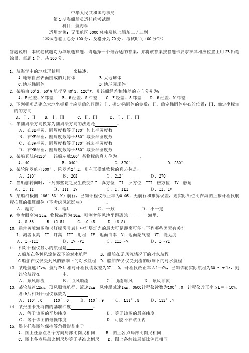
中华人民共和国海事局第1期海船船员适任统考试题科目:航海学适用对象:无限航区3000总吨及以上船舶二/三副(本试卷卷面总分100分,及格分为70分,考试时间100分钟)答题说明:本试卷试题均为单项选择题、请选择一个最合适的答案,并将该答案按答题卡要求在其相应位置上用2B铅笔涂黑。
每题1分,共100分。
1.航海学中的地球形状用来描述。
A.地球自然表面围成的几何体B.大地球体C.地球椭圆体D.地球圆球体2.某船由30ºS,60ºW航行至40ºS,120ºW,则该船经差和纬差的方向分别为:A.E经差、N纬差 B.W经差、S纬差 C.E经差、S纬差 D.W经差、N纬差3.下列哪项是建立大地坐标系时应明确的问题?Ⅰ、确定椭圆体的参数;Ⅱ、确定椭圆体中心的位置;Ⅲ、确定坐标轴的的方向A.Ⅰ、Ⅱ B.Ⅰ、Ⅲ C.Ⅱ、Ⅲ D.Ⅰ、Ⅱ、Ⅲ4.半圆周法方向换算为圆周法方向的法则是。
A.在SE半圆,圆周度数等于180°加上半圆度数B.在NE半圆,圆周度数等于360°减去半圆度数C.在SW半圆,圆周度数等于180°减去半圆度数D.在NW半圆,圆周度数等于360°减去半圆度数5.某船真航向120°,该船左舷160°某物标的真方位为。
A.40°B.040°C.320°D.280°6.某轮陀罗航向300°,陀罗差2°E,则左正横处物标的真方位是:A.210°B.208°C.212°D.270°7.当船舶转向时,下列哪些随之发生改变?I.真方位 II. 罗方位 III. 磁方位 IV. 舷角A.I、II B.III、IV C.I、III D.II、IV8.某船沿极圈(66°33'N)航行,已知计程仪改正率为0.0%,无航行和推算误差,则实际船位比在海图上按计程仪航程推算的推算船位(不考虑风流影响)。
大学航海学考试练习题及答案351
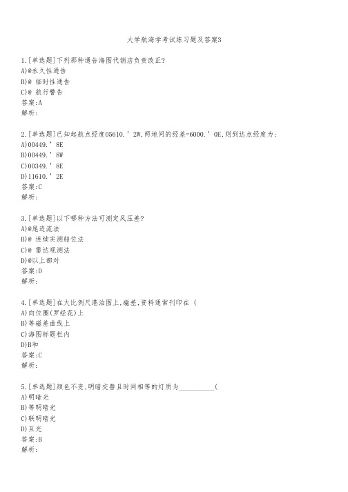
大学航海学考试练习题及答案31.[单选题]下列那种通告海图代销店负责改正?A)@永久性通告B)@ 临时性通告C)@ 航行警告答案:A解析:2.[单选题]已知起航点经度05610.’2W,两地间的经差=6000.’0E,则到达点经度为:A)00449.’8EB)00449.’8WC)00349.’8ED)11610.’2E答案:C解析:3.[单选题]以下哪种方法可测定风压差?A)@尾迹流法B)@ 连续实测船位法C)@ 雷达观测法D)@以上都对答案:D解析:4.[单选题]在大比例尺港泊图上,磁差,资料通常刊印在 (A)向位圈(罗经花)上B)等磁差曲线上C)海图标题栏内D)B和答案:C解析:5.[单选题]颜色不变,明暗交替且时间相等的灯质为__________(A)明暗光B)等明暗光C)联明暗光D)互光答案:B6.[单选题]某地经度 Long=122°23’E 的地方平时 LMT=21h04m36s (3月5日), 则该地的区时______ 。
A)20h55m04s(3月5日)B)21h55m04s(3月5日)C)21h04m36s(3月5日)D)20h50m00s(3月5日)答案:A解析:7.[单选题]平面投影又称方位投影,其中透视点在球心的心射投影在航海上常被用来绘制________A)@大圆海图B)@ 大比例尺港湾图C)@ 极区海图D)@以上都是.答案:D解析:8.[单选题]观察 ECDIS显示,设备显示的AIS目标④为( )。
D)危险目标答案:A解析:9.[单选题]以下说法正确的是 。
A)@无风流时,相对计程仪航程应在计划航线上截取B)@ 无风流时,绝对计程仪航程应在计划航线上截取C)@ 无风流时,相对计程仪航程应在真航向线上截取D)@以上都对答案:D解析:10.[单选题]自差表判断罗经校正质量时,算出的5个自差系数就不应大于( )。
A)±1°B)2°C)3D)5°第六节国际公约对船舶配备陀螺罗经的要求答案:A解析:11.[单选题]船舶在破损进水发生倾斜时,保持船体平衡的方法包括:A)移载货物B)排出压载水C)注入压载水D)A+B+C答案:D解析:12.[单选题]你船看见他船尾灯后,马上看见他船的桅灯和一盏舷灯,则_________ 。
甲类三幅 航海英语历届真题考题答案及翻译31--48解读
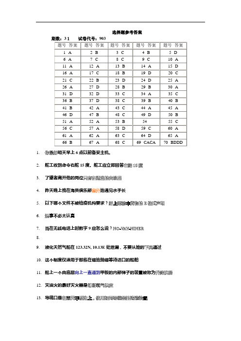
选择题参考答案1.明天早上6点以前备妥主机。
2.舵工收到命令右舵15度。
舵工应立即回答3.了望者离开他的岗位4.昨天晚上我在海员俱乐部地遇见水手长5.以下哪个文件不被检疫机构要求?6.事不必太认真7.当在无线电话上时数字9应怎么说?8.9.液化天然气船在123.32N, 10.13E处泄漏,不要从她的通过10.这个制度仅适用于那些在锚地抛锚等待进口的船舶11.船上一个由底层向上一直通到甲板的内部梯子的装置被称为12.灭油火的最好灭火器是13.导缆口是14.泡沫灭火通过15.为了使管道系统内部发生燃烧,如海上喷射系统中的气体收集头必须有16.火灾的对流蔓延由来完成17.你船迅速下沉。
一个装有可膨胀式救生筏的箱子连接在静水力释放装置上。
你应采取什么措施?18.在船舶管理中被要求的消防演习中,所有人员必须报告它们的位置和模拟指派给他们的任务完成的能力19.你应怎样指挥起货机手提升吊杆?20.去年我们已对起货机做了21.明天早晨下雨,装货22.自由液面的增加致使23.对于任何基座式起重机,当其吊杆被延长时,则其起重能力被24.谷糠,煤之类的货物,必须通风以它们自燃25.表明船舶的初稳性26.在每年的这个季节里,上面提及的区域能见度27.船舶志中的所有记录必须(被)由船长和一名船员签字28.具有红绿横纹的浮筒将具有的灯光特性29.无论何处可能获得好锚地,通常是泥和沙,在这些水域船舶可以拥有30.以下哪项不需要记入航海日志中?31.有时船舶在开敞锚地抛双锚锚泊以32.自西边开来的船舶将在位置015108N/1033008E33.一双车船使用双车前进掉头,将更易于向右舷掉头假如34.在站点附近可能有海图上未注明的灯,雾号和雷达信标发射器35.潮水怎样?什么潮水36.建议你的渔网37.当一特定气团的温度上升时,38.悬式(干湿球)湿度计是一个39.对于气象传真图上标绘的信息,我们能够40.据预报,过几天大雨泛滥淹没港口及附近地区41.高压脊自Sevastopol Libya东部42.12小时大风警告有效自1103900700UTC这句子,警告预报的有效期从开始43.在很多情况下,大洋水域的小比例尺海图的水文资料仍,所标水区的位置,水深和范围可能有误44.关于助航设施的严重缺陷或重要变化,首先通过给航海者45.长能够从任何的英版海图供应商那里获得英版航海通告46.平均高潮是的平均值47.任何国家的船舶均无线电医疗咨询服务并且这项服务不收费48.海图通过发布的信息而被改正49.一般地,用于画大洋航线,用于港口,内陆水域和沿岸区域50.闪(2)5秒的红色立杆灯标代替搁浅船西南方向附近的绿色锥型灯标。
(完整版)航海学试卷1讲解
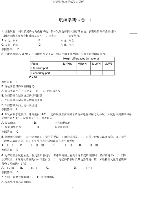
(完整版)航海学试卷1讲解航海学期试卷 11.出港航行,利用船尾的方向叠标导航,假如发现前标偏在后标的右边,表面船舶偏在叠标线的(测者自海上观察叠标时的左右),应实时调整航向。
A. 右边,向右B.右边,向左C. 左面,向右D.左面,向左参照答案: D2.主港热潮潮高3.7m ,主附港资料见下表,则与所给主港热潮对应的主副港潮高差为:Height differences (in meters)Place MHWS MHWN MLWN MLWSStandard portSecondary portC.+.02参照答案: B3. 雷达应答器的回波图像是:A. 在应答器所在方向上呈1°~ 3°的扇形点线B.在应答器台架回波后的编码回波C.在应答器台架回波后的扇形弧线D.在应答器方向上的一条虚线参照答案: B4. 某轮在狭水道航行,计划航向 120°,选择航线正前面某单调物标进行导标方向导航,如航行中实测该导标陀螺方向 120°,陀螺差 2° E,则该轮应:A. 没法确立B.向左调整航向C. 向右调整航线D.保持原航向参照答案: C5.英版潮汐潮流中,对于流速前正、负号的说法中正确的选项是:Ⅰ、正号一般代表涨潮流向;Ⅱ、负号一般代表落潮流向;Ⅲ、正负号代表的详细流向在表中有说明A.Ⅰ、ⅡB.Ⅰ、Ⅱ、ⅢC.Ⅰ、ⅢD.Ⅱ、Ⅲ参照答案: B6.为保证船舶航行安全,制定沿岸航线时,考虑到海图上有关水深和底质的限制,最好应避开:Ⅰ、四周水深较浅,水深变化不规则的水深空白区;Ⅱ、连续的长礁脉及其边沿邻近;Ⅲ、未经精准丈量的岩礁和岛屿之间的狭小水域。
A.Ⅰ、ⅢB.Ⅱ、ⅢC.Ⅰ、ⅡD.Ⅰ~Ⅲ参照答案: D7.在同一张墨卡托海图上, 1°经度的图长:A.跟着纬度的高升而渐长B.跟着纬度的高升而变短C.到处相等D.到处都不相等参照答案: C8. 太阳周年视运动的方向是:A. 自东向西B.自北向南C.自西向东D. 自南向北参照答案: C9. 测者眼高为25m,物标高程为16m,则物标能看法平距离为海里。
2023年海船船员考试航海学(船长)试卷(练习题库)

海船船员考试航海学(船长)试卷(练习题库)1、基准比例尺可能是图上各个局部比例尺的平均值,或者是()。
2、当比例尺很小时,能够分辨出的图上最小距离所代表的实际距离也就越大,海图的精度也就越差,这种相当于海图3、比例尺越大,海图的海图的极限精度越()。
4、水深是海图深度基准面至海底的深度,凡海图水面上的数字均表示水深。
其中水深浅于21m的注至()。
5、凡危险物外加点线圈者,均为对水面航行有碍的危险物,提醒航海者予以特别注意。
那么在情况下,则加注疑位(6、英版海图图式或表示()。
7、中版海图图式表示()。
8、中版图式表示()。
9、英版图式表示()。
10、适淹礁是指()。
11、英版海图图式中,缩写WK代表()。
12、等明暗光的灯光是指()。
13、英版图式的Oc,它的灯质是()。
14、英版图式中的Iso的灯质是()。
15、英版图式中的Fl(3)的灯质是()。
16、英版图式中的LFl的灯质是()。
17、英版图式中的VQ的灯质是()。
18、英版图式中的UQ的灯质是()。
19、英版图式中的IUQ的灯质是()。
20、英版图式中的FFl的灯质是定闪光,是指()。
21、灯质AlFlRW表示()。
22、灯质AlRW表示()。
23、灯质FlRW表示()。
24、英版灯标表中某一灯标的灯质为Alwr,在备注栏中标有040°~275°(235°),说明在该灯的()25、英版海图上有图式★Fl(3)10s25m16M,夜间航经该处的船舶可以()。
26、英版海图上有图式★Fl(2)5s10m11M,表明该灯()。
27、英版海图上有图式★LFl10s10m11M,表明该灯()。
28、英版海图上某灯标标注的灯质为F&Fl,表示()。
29、英版海图图式中,缩写LtHo代表()。
30、注记临(temp),表示临时的灯,熄(exting)表示()。
31、根据船舶要求,能其方位和距离的是()。
32、()表示能连续发射信号的雷达信标。
航海学(二三副)试题GPS
《航海学(二三副)》一、单项选择题(共200题)1、在3D定位模式下如果PDOP大于6,或在2D定位模式下如果HDOP大于4,GPS导航仪将显示______。
(176833:第12章电子定位与导航) (A-0,B-0,C-0,D-0,错误-0)A.GPS No fixB.DOP ErrorC.DGPS ErrorD.GPS Self Test Error2、当GPS导航仪显示“GPS No fix”,最有可能的原因是______。
(176839:第12章电子定位与导航) (A-0,B-0,C-0,D-0,错误-0)A.GPS导航仪天线和卫星之间有物体遮挡B.GPS卫星出现故障C.GPS定位误差明显偏大D.GPS内部电池的电量不足3、GPS导航仪开机后没有显示,或显示很模糊时,应该______。
(176848:第12章电子定位与导航) (A-0,B-0,C-0,D-0,错误-0)A.关机、重新开机B.调节荧光屏对比度和亮度C.增加GPS导航仪的室内照明D.减小GPS导航仪室内照明4、卫星信号的覆盖面积主要取决于__________。
(36895:第12章电子定位与导航) (A-0,B-0,C-0,D-0,错误-0)A.发射功率B.卫星天线高度C. 轨道高度D.地面接收站的高度5、在启动GPS 卫星导航仪,应使用______坐标系。
(176890:第12章电子定位与导航)(A-0,B-0,C-0,D-0,错误-0)A.DSGB1936B.WGS72C.WGS84D.所用海图采用的6、从GPS卫星信号中可以提取__________。
(37007:第12章电子定位与导航) (A-0,B-0,C-0,D-0,错误-0)A.多普勒频移信息B.卫星轨道参数C.对流层折射误差D.A+B+C7、由GPS卫星设备和信号传播引起的一种延迟称为__________。
(37230:第12章电子定位与导航) (A-0,B-0,C-0,D-0,错误-0)A.导航仪噪声B.信号传播误差C.群延迟D.多径效应8、GPS卫星导航仪内的锂电池通常应该在______年更换。
航海英语32
中华人民共和国海事局2003年第3期海船船员适任证书全国统考试题(总第32期)科目:航海英语试卷代号:903适用对象:无限航区、近洋航区二/三副(本试卷卷面总分100分,及格分为70分,考试时间100分钟)答题说明:请选择一个最合适的答案,并将该答案按答题卡要求,在相应位置上用2B铅笔涂黑。
第1题至68题,每题1分,第69题至76题,每题1.5分,第77题至81题每题4分.一.单项选择题1. Which one of the following anchor orders is uncommon term for using?A. Four(4)on deckB. Up and downC. Six(6)in the waterD. Seven(7)on the bottom2. If two mooring lines are to be placed on the same bollard,which method is BEST?A. Place the eye from the forward line on the bollard and then place the eye from the secondline directly over the firstB. It makes no difference how the lines are placedC. Place the eye from either line on the bollard,and then bring the eye of the other line upthrough the eye of the first,and place it on the bollardD. Place both eyes on the bollard,in any manner,but lead both lines to the same winch head onthe vessel and secure them on the winch3. A lookout can leave his station ______.A. at the end of the watchB. at any timeC. only when properly relievedD. 15 minutes before the end of the watch4. A mark or place at which a vessel comes under obligatory entry,transit,or escort procedure isknown as______.A. Way pointB. Receiving pointC. Reporting pointD. Closest Point5. He didn't mention anything about the party,_____ the date.A. either evenB. even neitherC. even norD. not even6. ______ cargoes chargeable at the same rate,part of one ton shall be taken as one ton.A. AtB. ForC. OnD. About7. Orders of the Master to the officers of the watch which he must comply with are ______.A. Night ordersB. Standing ordersC. Commands by masterD. Requirements by master8. PLACE ON DECK, IN MESS ROOMS, ETC., ASSIGNED TO CREW AND PASSENGERSWHERE THEY HA VE TO MEET ACCORDING TO THE MUSTER LIST WHEN THECORRESPONDING ALARM IS RELEASED OR ANNOUNCEMENT MADE defines:A. Deck areaB. SpotC. SceneD. Assembly station9. FLOATING,CAUSED BY WINDS AND CURRENT WITH A DETERMINABLEDIRECTION defines:A. FloatingB. SailingC. DriftingD. Running into danger 10. Molded depth is measured from the ______.A. inside of the shellB. outside of the shellC. top of the center vertical keelD. top of the garboard stake11. Ropes or wires attached to derricks to prevent them from swinging during cargo handlingoperations are ______.A.PreventersB.Side ropesC.StaysD.Guide lines12. A fire is discovered in the forepeak of a vessel at sea. The wind is from ahead at 35 knots. Youshould ______.A. remain on course and hold speedB. change course and put the stern to the windC. change course to put the wind on either beam and increase speedD. remain on course but slack the speed13. Fire may be spread by which means?A. Conduction of heat to adjacent surfacesB. Direct radiationC. ConvectionD. All of the above14. Faking a line means to ______.A. arrange it on deck in long bightsB. coil it down on deckC. put a whipping on itD. stow it below15. Of all the extinguishing agents listed below,which one has the greatest capacity for heatabsorption?A. Water fogB. Carbon dioxideC. Dry chemicalD. Solid stream of water16. All portable fire extinguishers must be capable of being _______.A. carried by hand to a fireB. carried or rolled to a fireC. recharged in the fieldD. used on class 'B' fires17. A foam-type portable fire extinguisher would be most useful in combating a fire in _______.A. solid materials such as wood or bales of fiberB. flammable liquidsC. a piece of electrical equipmentD. combustible metallic solids18. An inflatable life raft is thrown into the water from a sinking vessel. What occurs automaticallyafter the painter trips the CO2 bottles to inflate the raft?A. The sea anchor deploysB. The floor inflatesC. If upside down,the craft rights itselfD. The painter detaches from the raft19. When an INSTRUCTION (e. g. by a VTS Station, naval vessel or other fully authorizedpersonnel) or an ADVICE is given, you are to respond in the affirmative by ”______”.A. I will/can …B. I may …C. I might …D. I should …20. How should you signal the crane operator to raise the boom?A. Extend arm with the thumb pointing up and flex the fingers in and outB. Place both fists in front of the body with the thumbs pointing upwardC. With forearm vertical and forefinger pointing up,move hand in small horizontal circlesD. Extend arm with fingers closed and point thumb upward21. ALL PASSENGERS OF DECK NO.2 ARE REQUESTED TO FOLLOW THE CREWMEMBERS WHO WILL ESCORT YOU TO YOUR ASSEMBL Y STATIONS. From this sentence you can concluded that the vessel is in______.A .immediate danger to collide with another vesselB. a situation in which more passengers will embark on boardC. berth and ready to disembark her passengersD. distress22. You are standing wheelwatch on entering port,and the Master gives you a rudder command thatconflicts with a rudder command from the Pilot. What should you do?A. Obey the PilotB. Obey the MasterC. Ask the Pilot for guidanceD. Bring the rudder to midships23. A journal kept by the officer of the watch in which day to day happenings are recorded regardingthe deck department is the ______.A. cargo record bookB. deck rough logC. bell bookD. Official Logbook24. Foreman,the ship _____,please get the stevedores to fill the port wings with heavier packages.A. lists to starboardB. is shifting to starboardC. is inclined to starboardD. is listing to starboard25. _____of the following conditions will cause a vessel's bottom to be subjected to tension stresses.A. Concentration of weight aftB. Concentration of weight forwardC. Concentration of weight amidshipsD. Concentration of weight at both ends of the vessel26. Date line passed eastbound,_____.A. jumping over todayB. backing to yesterdayC. jumping over tomorrowD. backing to the day before yesterday27. In radar plotting C.P.A is the abbreviation of _____.A. closest point to approachB. close point to approachC. crossing point to approachD. coming point to approach28. During this season each year, the visibility in the abovementioned area is _____.A. poorB. smallC. littleD. trifle29. A sea with height 2.5 – 4.0m is termed as _____ according to the sea and swell scale.A. slight seaB. Moderate seaC. Rough seaD. High sea30. A vessel moored with two anchors,sometimes,at an exposed roadstead to _____.A. aid turning the shipB. obtain a fine bearingC. increase ship swings to wind or tideD. lighten the stress of anchor chains31. Good anchorage may be obtained anywhere,generally mud and sand,in this water area.V esselmay have ______.A. good towing groundB. good holding groundC. good grabbing groundD. good dragging ground32. The ship is not very stable,please ______ when making a turn.A. stop downB. speed downC. slow downD. down slow 33. When using the hand crank on gravity davits,you should ALWAYS ______.A. make sure the hand brake is disengagedB. put the emergency disconnect switch in the off positionC. make sure the crank is in the locked positionD. disconnect the limit switch34. The pilot will ______ your ship at 0800 hours tomorrow morning.Please keep stand by onchannel 12.A. getB. boardC. goD. come35. Any ship damaging a pipe could _______ an immediate danger of fire.A. meetB. faceC. be in font ofD. follow36. There shall be two principal ______ through the harbor for the passage of vessels of over 60 tonsburden.A. straitsB. channelsC. canalsD. roadsteads37. It is predicted that heavy rains are _______ to flood the harbor and its vicinity in a few days.A. frighteningB. threateningC. scatteringD. warning38. A warm air mass is characterized by _______.A. stabilityB. instabilityC. gusty windsD. good visibility39. A cloud sequence of cirrus,cirrostratus,and altostratus clouds followed by rain usually signifiesthe approach of a(n) ______.A. occluded frontB. stationary frontC. warm frontD. cold front40. Fog is likely to occur when there is little difference between the dew point and the ______.A. relative humidityB. air temperatureC. barometric pressureD. absolute humidity41. LOW AT 34N 135E ESLY SLWL Y INTST NC.This description is most likely to be under theheading of ______.A. GL WNGB. GEN SYNC. STM WNGD. T Y WNG42. TYPHOON 9209 KAREN FIXES SCHEDULED FOR 110400Z 111000Z and 111600Z.Thestatement indicates that ______ at the designated times.A. the position of the typhoon will be determinedB. the position of the typhoon will be forecastC. the position of the typhoon has been determinedD. the position of the typhoon has been forecast43. In revised editions of Admiralty charts the ______ are corrected first.A. smaller scalesB. larger scalesC. smaller scales and larger scalesD. moderate scales44. _____ are published for the correction of Admiralty Charts.A. Admiralty Sailing DirectionsB. Admiralty List of SignalsC. Mariner's HandbookD. Admiralty Notices to Mariners45. Mariners are FIRST warned of serious defects or important changes to aids to navigation bymeans of ______.A. marine broadcast Notice to MarinersB. Weekly Notices to MarinersC. corrected editions of chartsD. Light Lists46. A fireman’s outfit shall consist of_______.I. Protective clothing II. a VHF set III. Boots and gloves of electrically non-conductingmaterial IV. An electric safety lamp (hand lantern) V. An axeA. I, II, III, IVB. I, II, IV,VC. II,III, IV, VD. I, III, IV,V47. All the crewmembers shall be at the station as required by the muster list when in fire-fightingdrill _____ minutes after hearing the alarm, and the duty engineer shall be able to make the fire pumps available with ______ minutes.A. 2/5B. 2/3C. 3/2D. 2/248. In Admiralty Sailing Directions,stripes is the word used to indicate ______ marking.A. horizontalB. verticalC. diagonalD. vertical or diagonal49. Ocean Passages for the World and Routeing Charts should be_______for trans-oceanicinformation.A. lookedB. consultedC. seenD. reviewed50. In what units are heights and soundings in the chart?They are in _______.A. meters and fathomsB. fathoms and metersC. meter and fathomD. fathom and meter51. Many of the soundings shown on the chart are _______ inadequate and often very poor surveys .Undue reliance should not be placed upon them.A. drived fromB. derived byC. derived fromD. drived by52. A cardinal mark showing an uninterrupted quick-flashing white light indicates the deepest waterin the area is on the _______.A. north side of the markB. west side of the markC. east side of the markD. south side of the mark53. This is an exercise area.Mariners are _______ to navigate with caution.A. advisedB. toldC. informedD. asked54. The annual change in _______ is 0.2 degree.A. Magnetic VariationB. Marine InsuranceC. Maritime AccidentD. Mean High Water Spring55. The manual-piloting shall be tested at least at interval of _______ when using the auto-piloting.A. once every shiftB. Twice every shiftC. Once every hourD. Twice every hour56. Which of the following statement is correct regarding ship handling when in the vicinity oftraffic separation schemes?(1)A vessel shall,so far as practicable,avoid crossing traffic lanes(2)If obliged to cross traffic lanes,she shall do so as nearly as practicable at right angles to thegeneral direction of traffic flow.A. (1) onlyB. (2) onlyC. Both(1) and (2)D. Neither (1) nor (2)57. When hitting a solid object such as a ship or an airplane,the radar waves are reflected back_______ they came.A. in the wayB. the wayC. by the wayD. through the path58. You have another ship overtaking you close aboard to starboard. You have 3 radar targets bearing090° relative at ranges of 0.5 mile,1 mile,and 1.5 miles. In this case,the unwanted echoes are called _______.A. multiple echoesB. spokingC. indirect echoesD. side-lobe echoes59. The risk of collision shall be deemed to exist if the compass bearing of an approaching vessel________.A. did not appreciably changeB. does not appreciably changeC. do not appreciably changeD. not appreciably change60. Your ARPA has been tracking a target and has generated the targets course and speed. The radardid not receive a target echo on its last two scans due to the weather. What should you expect under these circumstances?A. The ARPA will generate data as if the target was still being tracked by radarB. The ARPA will give an audible and/or visual lost target alarmC. The ARPA will generate data based on sea return echoes from the vicinity where the targetwas lostD. The ARPA has lost all memory of the target and must recompute the target data61. The system will accept a harbor map which is incorrect,therefore the operator must exercisecaution in harbor selection.A. be consideredB. be prudentC. be bold enoughD. be carelessness62. If ______ is shut down for an extended time optimum position fixing will take up to 2 hoursafter power is reapplied.A. RadarB. DFC. Satellite NavigatorD. Automatic Omega Navigator63. ______ is the process by which the position of the vessel at any moment is found by applyingthe last well-determined position to the run that has been made since,using for this purpose the ship's course and the distance being those indicated by log.A. Dead reckoningB. Dead weightC. Dead slow aheadD. Dead slow astern64. The ISM Code is included into the ______ of the SOLAS.A. chapter 7B. chapter 8C. chapter 9D. chapter 1065. Gyrocompass repeaters reproduce the indications of the master gyrocompass. They are _____.A. accurate only in the Polar regionsB. accurate electronic servomechanismsC. hand operatedD. accurate only if the vessel is underway66. The Navigation Rules define a vessel not under command as a vessel which ______.A. from the nature of her work is unable to keep out of the way of another vesselB. does not have a proper look-outC. by taking action contrary to the Rules has created a special circumstance situationD. through some exceptional circumstance is unable to maneuver as required by the Rules67. A vessel proceeding along a narrow channel shall ______.A. avoid crossing the channel at right anglesB. not overtake any vessels within the channelC. keep as near as safe and practicable to the limit of the channel on her starboard sideD. when nearing a bend in the channel,sound a long blast of the whistle68. Which statement is TRUE concerning risk of collision?A. The stand-on vessel must keep out of the way of the other vessel when risk of collisionexistsB. Risk of collision always exists when two vessels pass within one mile of each otherC. Risk of collision always exists when the compass bearing of an approaching vessel changesappreciablyD. Risk of collision may exist when the compass bearing of an approaching vessel is changingappreciably二.关联题第一组:Logbooks required by law, to be filled out by masters or officers on duty of every ship, the forms of which must be proved by the shipping companies or marine authorities.Logbooks are used to record the events occurring during the ship's stay in a harbor, at anchorage, or underway, and they are also requested to produce evidences in case officials inquire about accidents.On completion of the voyage the logbook must be submitted to the superintendent of the owner or the marine authorities for justification, checking or approval. Therefore, everything recorded in the logbook must be true and accurate.When a misentry has been made in the log, a red line would be drawn on those parts. The correct entry with signature should be made near or above them. No erasures or cuts are to be allowed.69. The best title for the passage is " ______ ".A. The forms of logbooksB. The logbooks and their applicationsC. The characteristics of logbooksD. How to check logbooks70. According to the passage, when a misentry has been made in the log, ______.A. erasures or cuts are to be allowed.B. it is to be corrected out by masters or officers on duty of every shipC. it is to be produced in case officials inquire about accidents.D. a red line would be drawn on those parts, with correct entry with signature being made nearor above them.71. According to the passage, the forms of logbooks must be proved by ______.A. officials who inquire about accidentsB. the shipping companies or marine authoritiesC. masters or officers on dutyD. the superintendent of the owner72. The logbook must be submitted ______ to the superintendent of the owner or the marineauthorities for justification, checking or approval.A. on completion of the voyageB. in a harborC. at anchorageD. underway第二组:Major coast radio stations all over the world transmit, at regular intervals and in code, weather information for ships within range. Weather information consists of ten parts, of which ships usually make use of three, that is, warning, synoptic situation and forecast. With weather information, mariners are able to keep away from disastrous weather at sea and reduce the danger a great deal. As terrible weather is predicted, ships can take precautions beforehand, by delaying the voyage or seeking shelter in a safe place. If there is a high sea or a long swell, they can take some measures to safeguard the cargo and the ship.73. Coast radio stations generally provide weather information for ships _______ .A. in codeB. in a certain languageC. in written formD. by mail74. According to this passage, the weather information usually will not tell in advance the marinersabout _______ .A. a long swellB. a high seaC. forecast windsD. ETA of their ship at the destination75. Of the following, ______ is not the way for ships to keep away from bad weather.A. delaying voyageB. staying in portC. speeding upD. pumping out ballast water76. ______ parts of Weather Information are usually not used by mariners.A. 10B. 3C. 7D. 13三.中译英(共5题,请将答案写在答题纸上)77.船舶消防应急系统应妥善装备并维护,以便随时可用。
大学航海学考试(试卷编号251)
大学航海学考试(试卷编号251)1.[单选题]地球自转轴与黄道平面的交角为____ 。
A)66°33’B)66°33’+5°08’C)23°27’D.66°33’-5°08’答案:A解析:2.[单选题]必须使用移线定位的场合是:A)@一个时刻只能获得一条船位线的情况B)@ 测于定位时C)@ 只有一个导航物标可用的时候D)@以上都是答案:A解析:3.[单选题]某海图向位圈标明:磁差015’E(1979),年差 -3.’0;则该地1999年磁差为_________A)45’EB)115’EC)45’WD)115’W答案:C解析:4.[单选题]观察雷达图像时,发现回波边缘不清晰、回波图像稀疏不饱满时,应首先调节( )。
A)调谐B)亮度C)脉冲宽度D)回波扩展答案:A解析:5.[单选题]某船西航跨东、西12时区航行, 船长告知 10月2日晚上 11:20 过日界线,值班驾驶员应在《航海日志》中记录。
则三副 与二副交接班的时间是______。
A)10月1 日 24:00B)10月3日 01:00C)10月1 日 23:00D)10月3日 24:006.[单选题]载重线圆圈的中心应位于:A)船中以前1/4船长处B)船中以后1/4船长处C)船中处D)船中略后答案:C解析:7.[单选题]A轮与B轮同在一条经线上,A轮在赤道,B轮在60N,同时向西航行300海里后,则A轮与B轮的经差DλAB是:A)@5WB)@ 5EC)@ 10WD)@10E答案:A解析:8.[单选题]某船因在浓雾中航行未备车而导致碰撞,应属于_________疏忽 。
A)遵守规则各条的B)海员通常做法上的C)对当时特殊情况任何戒备上的D)以上均是答案:A解析:9.[单选题]GPS导航仪偏航警的英文缩写是( )。
A)ANCB)XTEC)ARVD)CAL答案:B解析:10.[单选题]在一个周期内相继出现几个不同闪光次数的联闪光为_______(A)明暗光B)联闪光C)混合联闪光D)长闪光答案:C11.[单选题]对地航程是船舶在 情况下的对地航程:I.无风流;Ⅱ.有风无流;Ⅲ.有流无风;IV.有风流(A)仅IB)I、ⅡC)I~IVD)I、Ⅱ、IV答案:C解析:12.[单选题]潮差最大的潮汐称为()。
航海学题库(含问题详解)
航海学大连海事大学1.1.1 地球形状·用大地球体描述地球形状,大地球体是大地水准面团城的球体.·常用的大地球体的近似体有两个:地球圆球体(用于简便的航海计算,如航迹计算,简易墨卡托海图绘制,大圆航向和航程计算);地球椭圆体(用于较精确的航海计算等,如定义地理坐标,墨卡托海图绘制)1.航海上为了简化计算,通常将地球当作:A.圆球体 B.椭圆体 C.椭球体 D.不规则几何体2.航海上进行精度较高的计算时,通常将地球当作:A.圆球体B.椭圆体 C.椭球体 D.不规则几何体3.航海学中,使用地球椭圆体为地球数学模型的场合是:I.描述地球形状时;II.定义地理坐标时;III.制作墨卡托投影海图时; IV.计算大圆航线时;V,制作简易墨卡托图网时 A.I、II B.II、III C.III、IV D.III、V4.航海学中,使用地球圆球体为地球数学模型的场合是:I.描述地球形状时; II.定义地理坐标时;III.制作墨卡托投影海图时;IV.计算大圆航线时;V.制作简易墨卡托图网时 A.Ⅰ、Ⅱ B.Ⅱ、Ⅲ C.Ⅲ、Ⅳ D.Ⅳ、Ⅴ5.航海学中的地球形状是指:A.地球自然表面围成的几何体 B.大地水准面围成的几何体C.地球圆球体 D.以上都对6.航海学中的地球形状用描述。
A.地球自然表面围成的几何体B.大地球体C.地球椭圆体 D.以上都对1.1.2 地理坐标1.1.2.1 地理经度和地理纬度的定义和度量方法 .地理坐标包括地理经度和地理纬度,是建立在地球椭圆体基础之上.地理经度(Long.,λ:格林经线和某地经线所夹的赤道短弧或该短弧所对应的球面角或球心角.地理纬度(lat.,ϕ):地球椭圆子午线上某点的法线与赤道面的交角.7.地理经度以作为基准线的A.赤道. B.格林经线 C.测者经线 D.测者子午圈8.某地地理经度是格林子午线与该地子午线之间的A.赤道短弧 B.赤道短弧所对应的球心角C.极角D.A.B.C都对9. 地理坐标的基准线是A.经线、纬线 B.赤道、经线C.格林子午圈、纬圈D.赤道、格林子午线10.地理经度的度量方法是A.由格林子午线向东度量到该点子午线,度量范围0~180ºB.由格林子午线向西度量到该点子午线,度量范围0~180ºC.由格林子午线向东度量到该点子午线,度量范围0~360ºD.A或B11.地理经度的度量方法是A.由该点子午线向东或向西度量到格林子午线,度量范围0~180ºB.由该点子午线向东或向西度量到格林子午线,度量范围0~360ºC.由格林子午线向东或向西度量到该点子午线,度量范围0~180ºD .由格林子午线向东或向西度量到该点子午线,度量范围0~360º12.所谓“地埋纬度”是指A .地球上某点的法线与赤道面的交角B .地球上某点和地心连线与赤道面的交角C .地球椭圆子午线上某点和地心连线与赤道面的交角D .某点在地球椭圆子午线上的法线与赤道面的交角13.地理经度和地理纬度是建立在_____基础上的。
大学航海学考试练习题及答案311
大学航海学考试练习题及答案31.[单选题]东方位标的涂色为()。
( )A)上黑下黄B)上黄下黑C)黑黄黑横纹答案:C解析:2.[单选题]以天顶、天底为起、止点且通过西点的半个大圆称__________。
A)天体时圈B)天体垂直圈C)东圈D)西圈答案:D解析:3.[单选题]半圆方向60NE换算成圆周方向为____________(A)60B)120C)300D)060答案:D解析:4.[单选题]根据雷达性能标准 MO MSC192(79)要求,雷达跟踪目标3min后参数CPA的精度必须要达到多少?( )A)0.InmileB)0.2nmileC)0.3nmileD)0.4nmile答案:C解析:5.[单选题]船舶积载时,主要考虑的船舶强度为:A)局部强度B)纵强度C)纵强度和局部强度D)横强度和局部强度6.[单选题]某天体上中天时,其半圆方位角等于 ,位置角等于____。
A)0°/180°B)180°/ 180°C)0°/0°D)90°/180°答案:A解析:7.[单选题]天体上中天时,其位置角等于____ 。
A)0°或 180°B)180°或 90°C)90°D)0 °或 90°答案:A解析:8.[单选题]舷灯的水平显示范围为_________ 内。
A)115.5度B)从船的正前方到每一舷正横前22.5度C)从船的正前方到各自一舷正横后22.5度D)从船的正前方到各自一舷正横前22.5度答案:C解析:9.[单选题]某轮从(1030’S、11530’W)航行到(2030’S、13030’W),则应驶的恒向线航向为:A)@124.7B)@ 235.3C)@ 304.7D)@055答案:B解析:10.[单选题]墨卡托航法最可能出现较大误差是在:( )A)低纬度海区B)中纬度海区C)高纬度海区D)与纬度无关答案:C解析:A)从该物标的南方14海里所看到的形状B)从该物标的北方14海里所看到的形状C)从本船向南14海里所看到的形状D)从本船向北14海里所看到的形状答案:B解析:12.[单选题]下列叙述中 是错误的?A)磁差以真北为基准开始度量B)罗经差以真北为基准开始度量C)电罗经差以真北为基准开始度量D)自差以真北为基准开始度量答案:D解析:13.[单选题]雷达上的旁瓣回波位于真回波的( )。
- 1、下载文档前请自行甄别文档内容的完整性,平台不提供额外的编辑、内容补充、找答案等附加服务。
- 2、"仅部分预览"的文档,不可在线预览部分如存在完整性等问题,可反馈申请退款(可完整预览的文档不适用该条件!)。
- 3、如文档侵犯您的权益,请联系客服反馈,我们会尽快为您处理(人工客服工作时间:9:00-18:30)。
中华人民共和国海事局2003年第3期海船船员适任证书全国统考试题(总第32期)科目:航海学试卷代号:913适用对象:无限航区3000总吨及以上船舶二/三副(本试卷卷面总分100分,及格分为70分,考试时间100分钟)答题说明:本试卷试题均为单项选择题,请选择一个最合适的答案,并将该答案按答题卡要求,在其相应位置上用2B铅笔涂黑。
每题1分,共100分。
1. 地理坐标的基准线是:A. 经线、纬线B. 赤道、经线C. 格林子午圈、纬圈D. 赤道、格林子午线2. 当测者移动时,天球上的哪个圈也随测者移动?A. 天体时圈B. 天体垂直圈C. 春分点时圈D. 天体赤纬圈3. 已知起航点经度λ1=118°24'.3E,到达点经度λ2=108°25'.8E,则两地间的经差Dλ为:A. 010°01'.4WB. 010°58'.5EC. 009°58'.5ED. 009°58'.5W4. 已知起航点纬度ϕ1=36°12'.6N,两地间纬差Dϕ=08°06'.2N,则到达点纬度ϕ2:A. 34°18'.8NB. 28°06'.4NC. 44°18'.8ND. 28°06'.4S5. 罗经点方向W/N换算成圆周方向为:A. 348.75B. 303.75C. 281.25D. 326.256. 测者东西线是由什么面确定的?A. 测者卯酉圈平面与测者子午圈平面B. 测者东西圈平面与测者卯酉圈平面C. 测者地面真地平平面与测者子午圈平面D. 测者地面真地平平面与测者卯酉圈平面7. 半圆方向120SW换算成圆周方向为:A. 210B. 240C. 300D. 3308. 某船真航向120,该船左舷160某物标的真方位为:A.40 B.040 C.320 D.2809. 当船舶改向时,下列各项中哪些发生变化?A. 磁差、自差和物标方位B. 磁罗经方位、物标舷角和真航向C. 物标舷角、磁罗经差和陀罗差D. 磁罗经航向、磁罗经方位和磁差10. 某轮陀罗航向045°,陀罗差1°E,则当物标舷角060°时陀罗方位为:A. 105°B. 106°C. 345°D. 344°11.某轮罗航向140°,磁差1°E,自差2°W,当测得某物标真方位290°时,该物标舷角:A. 151°B. 150°C. 149°D. 147°12. 1n mile的实际长度:A. 在赤道附近最短B. 在纬度45°附近最短C. 在两极附近最短D. 固定不变13. 某轮由赤道向北航行,无航行误差,计程仪改正率为0.0%,则1h后推算船位位于实际船位的(不考虑风流影响):A. 北面B. 南面C. 同一点D.不一定14. 航海上,公式D O(n mile)=2.09e+2.09H是用于计算:A. 测者能见地平距离B. 物标能见地平距离C. 物标地理能见距离D. 雷达地理能见距离15. 中版海图和航标表所标灯塔射程与下列哪项因素无关?A. 灯高B. 灯光强度C. 地面曲率D. 测者实际眼高16. 英版海图某灯塔灯高49m,额定光力射程25M,已知测者眼高为16m,则能见度良好(10 nmile)时该灯塔灯光的最大可见距离是:A. 19.3 n mileB. 23.0 n mileC. 24.2 n mileD. 25.0 n mile17. 某轮船速12kn,顶风顺流航行,流速2kn,风使船减速1kn,则1h后船舶对水航程为:A. 11 n mileB. 12 n mileC. 13 n mileD. 14 n mile18. 无风流情况下测定计程仪改正率ΔL,已知两组横向测速标之间的距离为2 n mile,若所得计程仪读数差为1.9 n mile,则相应的计程仪改正率为:A. +5.0%B. -5.0%C. +5.3%D. -5.3%19. 天体高度的另一种表示方法称为:A.天体顶距 B.天体极距 C.天体赤纬 D.天体方位20. 测者纬度等于20°N,在一年中发生太阳过天顶的情况是:A不会发生过天顶 B.有一次过天顶 C.有两次过天顶 D.有四次过天顶21. 测者纬度等于30°N,中天时下列哪一个天体的方位变化最快?A.赤纬等于20°S B.赤纬等于10°S C.赤纬等于0° D.赤纬等于10°N 22. 3月21日,测者纬度=30°N,太阳的中天高度等于:A.30° B.60° C.83°27′ D.36°33′23. 校对天文钟所采用的对时信号是:A.UT0 B.UT1 C.UT2 D.UTC24. 经度λ=112︒E的地方平时LMT=11h28m,此刻该时区的区时ZT=。
A.11h B.11h28m C.11h56m D.12h25. 测天世界时GMT=天文钟时间CT+秒表读数WT+天文钟钟差CE表明:A.先启动秒表再去测天,天文钟快B.先观测天体,当天体的反射影像与水天线相切时再启动秒表,天文钟快C.先启动秒表再去测天,天文钟慢D.先观测天体,当天体的反射影像与水天线相切时再启动秒表,天文钟慢26. 航用海图的基本要求是:A. 恒向线在图上是直线和等角投影B. 经线、纬线各自平行且相互垂直C. 图内各点局部比例尺相等D. 无投影变形27. 在同一张墨卡托海图上,设1 855m的地面长度的赤道图长为1cm,则在30°纬度线上,1855m地面长度的图长约为:A. 1cmB. 0.866cmC. 1.155cmD. 1.5cm28. 某海图基准比例尺C=1:750000(基准纬度45°N),若该纬线上110°E经线处局部比例尺为C1,120°E经线处局部比例尺为C2,130°E经线处局部比例尺为C3,则:A. C1>C2>C3B. C3>C2>C1C. C1=C2=C3D. C2=2(C1+C3)29. 英版海图图式中,缩写 LANBY 代表:A. 沉船B. 灯塔C. 大型助航浮标D. 深吃水航路30. 英版海图图式 Co 表示:A. 贝壳B. 粘土C. 珊瑚D. 泥31. 中版图式 表示:A. 沉船残骸及其它有碍抛锚和拖网的地区B. 深度不明的障碍物C. 鱼栅D. 贝类养殖场32. 中版海图图式表示:A. 危险沉船,水深≤20mB. 危险沉船,水深≤28mC. 非危险沉船,水深>20mD. 非危险沉船,水深>28m33. 中版海图,我国沿海系统测量区域采用为深度基准。
A. 理论最低潮面B. 天文最低潮面C. 平均大潮低潮面D. 平均低低潮面34. 我国海图作业规则规定,海图作业时,应在计划航线(推算航线)上标注下列哪些内容?I 计划(推算)航迹向 II 罗航向 III 罗经差 IV 风流压差 V 船位差 VI 风流资料A. I~IIIB. I~IVC. I~VD. I~VI35. 在船舶定线制区域,用空心实线箭矢 标示:A. 推荐的交通流方向B. 指定的交通流方向C. 习惯的交通流方向D. 不允许有第三方交通流存在36. 船舶定线制的主要内容之一是:A. 疏理同向或接近同向的交通流B. 疏理汇聚区域的交通流C. 分隔沿岸交通流D. 分隔各转向点附近的交通流37. 要抽选某航线所需的航用图书、表(簿),应查阅:A. 中版《航路指南》B. 中版《航海图书总目录》C. 中版《航标表》D. 中版《航海通告》38. 中版《航海通告》第III部分所刊印的内容是:A. 对海图的改正资料B. 无线电航海警告资料C. 对航路指南的改正资料D. 航标表的改正资料39. 航路指南的主要作用是用文字形式:A. 描述海图上所提供的航海资料B. 描述海图上所提供的与航行安全有关的重要航海资料C. 补充海图上航海资料的不足D. 介绍沿岸海区推荐航线和航行方法40. 既具有航海资料性质,又包含英版航海图书的某些改正资料的英版出版物是:A. 英版《航海图书总目录》B. 英版《航海通告》C. 英版《航海通告年度摘要》D. 英版《航海员手册》41. 英版《航海通告》中 Chart [Last Correction] 栏内,某图号后方括号内字母表示:A. 本图应改正的资料号码B. 与本图改正无关的资料号码C. 本图上次应改正的通告号码D. 与本通告改正内容有关的其它图书资料号码42. 根据英版《航路指南》最近调整的出版信息:A. 每隔约3年出新版的,期间出一期补篇B. 出新版间隔超过3年的,每隔1.5~2年出一期补篇C. 出新版间隔超过3年的,每隔3年出一期补篇D. 出新版间隔超过3年的,期间不定期出补篇43. 在英版无线电信号表中查得某雷达航标的资料为说明该标是:A. 适用于3cm和10 cm雷达的雷达信标(指向标)B. 仅适用于3cm雷达的雷达信标C. 既适用于3cm、也适用于10cm雷达的雷达应答标D. 仅适用于3cm雷达的雷达应答标44. 我国沿海左侧标的特征为:A. 红色锥形B. 绿色锥形C. 红色罐形D. 绿色罐形45. 我国沿海航行,发现一绿色杆形浮标,中间有一道红色横纹,其上有一绿色锥形顶标,该标为:A. 左侧标B. 右侧标C. 推荐航道左侧标D. 推荐航道右侧标46. 日本沿海右侧标的特征为:A. 红色锥形B. 绿色锥形C. 红色罐形D. 绿色罐形47. 夜间,船舶由海上驶近美洲某海港,看见一红色闪光灯浮,则表明:A. 该标为左侧标,将其置于本船左舷B. 该标为左侧标,将其置于本船右舷C. 该标为右侧标,将其置于本船左舷D. 该标为右侧标,将其置于本船右舷48. 从已知船位, 然后根据航向、航程(计算风压差后)绘算所得的船位是:A. 积算船位B. 推算船位C. 估测船位D. 实测船位49. 在沿岸水流影响显著的航区,推算船位应:A. 每小时进行一次B. 每二小时进行一次C. 每三小时进行一次D. 每半小时进行一次50. 某船真航向125 o,海区内SW风7级,风压差取3 o,则船舶航行在______线上。
A. 125 oB. 122 oC. 128 oD. 118 o51. 两方位定位时,为提高定位精度,两方位线的交角应:A. 不小于20度,不大于120度B. 不小于30度,不大于150度C. 不小于60度,不大于120度D. 不小于60度,不大于150度52. 在两方位定位中,仅考虑偶然误差的影响,若其他条件都一样,则位置线交角为30°的船位误差是交角为90°的船位误差的:A. 2倍B. 4倍C. 1/2倍D. 大小相同53. 某轮通过某水道时, 利用左岸仅有的两个方位夹角较小的物标, 以两标距离定位, 而不用两标方位定位, 这是因为:A. 测距离比方位快B. 船位均方误差椭圆的短轴分布在水道轴线的垂直方向上C. 船位均方误差椭圆的长轴分布在水道轴线的垂直方向上D. 两船位线夹角较小,均方误差圆也较小54. 距离定位时,应先测:A. 正横附近的物标B. 接近首尾的物标C. 较远的物标D. 任意一个物标55. 利用船位识别物标的关键是:A.船舶的航行不受风流影响 B. 所用初始船位应正确无误C.船舶应航行在沿岸 D.船舶应朝向物标航行56. 移线定位时, 推算航程应在:A. 推算航线上截取B. 真航向线上截取C. 在经过流压差修正后的航迹线上截取D. 在经过风流压差修正后的航迹线上截取57. 单一船位线与航线接近平行时,一般能判断:A. 推算船位偏离航线误差B. 推算航程误差C. 推算船位的误差D. 观测船位的误差58. 观测某一天体后,采用不同的计算点求船位线时,下列哪项不随计算点的变化而变化? A.截距大小 B.计算方位 C.真高度 D.计算高度59. 六分仪指标差产生的原因是:A. 动、定两镜镜面平行时指标杆的指标不在刻度弧“0”刻度B. 指标杆的指标不在刻度弧“0”刻度C. 定镜与望远镜不平行D. 动镜与指标杆不垂直60. 观测星体高度时通常应考虑先后顺序,晨光时一般应先测的天体,昏影时一般应先测的天体。
